Author Archive

Official SpaceX FORMOSAT-5 mission patch.
Update: Successful launch, first stage booster return, satellite in orbit!
Today’s SpaceX’s Falcon 9 launch is set to deliver FORMOSAT-5, an Earth observation satellite for Taiwan’s National Space Organization (NSPO), to a low-Earth orbit (LEO).
Following stage separation, Falcon 9’s first stage will attempt to land on the “Just Read the Instructions” droneship that will be stationed in the Pacific Ocean
The 42-minute launch window opens on Thursday, August 24 at 11:51 a.m. PDT or 18:51 UTC. The booster will depart from Launch Complex 4 East (SLC-4E) at Vandenberg Air Force Base in California.
The SpaceX webcast of the launch will go live about 10 minutes before liftoff at:

The U.S. Air Force’s X-37B Orbital Test Vehicle 4 is seen after landing at NASA ‘s Kennedy Space Center Shuttle Landing Facility in Florida on May 7, 2017.
Credit: U.S. Air Force courtesy photo
X-37B mission
Assuredly, keeping a watchful eye on this SpaceX booster mission is the US Air Force and X-37B space plane officials.
Technicians are busily preparing the robotic X-37B Orbital Test Vehicle for the program’s fifth flight – OTV-5. This drone carries classified cargo and is reportedly scheduled to launch September 7 atop a SpaceX Falcon 9 from Kennedy Space Center, Florida.
This OTV-5 mission signals first time use of the SpaceX booster. Previous space plane missions have been boosted into Earth orbit by United Launch Alliance’s Atlas-5 launchers.
Go to this informative video from C4ISRNET:
http://www.c4isrnet.com/video/2017/08/23/spaceplane-readies-for-september-flight/

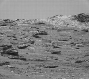
Curiosity Front Hazcam Left B image taken on Sol 1793, August 22, 2017.
Credit: NASA/JPL-Caltech
Now in Sol 1793, NASA’s Curiosity Mars rover experienced limited arm activities and a less lengthy weekend drive than planned, reports Abigail Fraeman, a planetary geologist at NASA/JPL in Pasadena, California.

Curiosity Mastcam Left image taken on Sol 1792, August 21, 2017.
Credit: NASA/JPL-Caltech/MSSS
Colder than expected
“Unfortunately, some of the arm activities and the drive we planned over the weekend didn’t execute because Mars was slightly colder than we expected,” Fraeman notes, “and we didn’t heat the actuators in the arm for quite long enough.”
Now planned is to recoup the contact science observations scientists had planned on sandy ripples in front of the robot.
Planned route
On tap is using Curiosity’s Mars Hand Lens Imager (MAHLI) to image targets “The Shivers,” “Trumpet,” and “Hosmer.”
Also slated is use of the Alpha Particle X-Ray Spectrometer (APXS) to observe Trumpet.
“Following the contact science activities, we’ll go for a drive that continues along the strategically planned route towards the area Curiosity will ascend Vera Rubin Ridge,” Fraeman adds.

Curiosity Mastcam Left image taken on Sol 1792, August 21, 2017.
Credit: NASA/JPL-Caltech/MSSS
Solar eclipses on Mars
Not to be outdone by yesterday’s solar eclipse, “solar eclipses happen on Mars too, although the Martian moons Phobos and Deimos are too small to completely cover the Sun like on Earth,” Fraeman explains.

Curiosity Mastcam Left image taken on Sol 1792, August 21, 2017.
Credit: NASA/JPL-Caltech/MSSS
“Curiosity has had the opportunity to observe several of these awesome celestial events throughout the mission, including one back in 2013 when even the rover couldn’t help but take a pause in the middle of a drive to look skyward,” Fraeman points out.

Here on Earth, Curiosity science team member Fred Calef’s unique pinhole viewer shows crescent shadows during yesterday’s eclipse.
Credit: Fred Calef
“Fortunately, with special solar filters already built into the rover’s cameras, Curiosity didn’t need to worry about ordering eclipse glasses last minute” in order to capture spectacular images.

Unidentified “box boy” is ready for eclipse action at one of the total solar eclipse viewing sites in Casper, Wyoming. This observer donned a cardboard box with eye-protective plastic to view the partial eclipse before totality.
Credit: Barbara David
CASPER, Wyoming – To paraphrase the legendary fighter, then Cassius Clay chiding his opponent, Sonny Liston, it was a celestial punch that was a true knockout – “a total eclipse of the Sunny!”
“It’s all about what the eclipse means to you, what it means to you and to you only,” and how personally it affects you, said John Goss, president of the Astronomical League that sponsored Astrocon 2017 here, in part a celebration of the total eclipse of the Sun.

During total eclipse, participants use their hands to observe crescent shapes on the ground.
Credit: Leonard David
Yes, I survived the Great American Eclipse of 2017, soaking up the solar eclipse in Casper, Wyoming.
For my new Space.com story, go to:
‘Mr. Eclipse’ Explains Why the 2017 Total Solar Eclipse Is Special
By Leonard David, Space.com’s Space Insider Columnist
August 22, 2017 07:30am ET
https://www.space.com/37898-total-eclipse-in-casper-wyoming-fred-espenak.html

Curiosity Mastcam Left image taken on Sol 1789. August 18, 2017.
Credit: NASA/JPL-Caltech/MSSS
NASA’s Curiosity Mars rover is performing Sol 1790 science duties – ready to carry out a list of tasks.
The robot did not cover a planned drive of 50 feet (15 meters), instead chalking up about 36 feet (11 meters).
But the rover moved far enough down the road to get in good position to acquire a full high-resolution mosaic of Vera Rubin Ridge (VRR) over the weekend, reports Mark Salvatore, a planetary geologist at the University of Michigan in Dearborn.

Curiosity Front Hazcam Right B image acquired on Sol 1790, August 19, 2017.
Credit: NASA/JPL-Caltech
Nice sandy location
“In addition, Curiosity parked herself in a nice sandy location where we can continue to investigate sand ripples on our way towards the ridge,” Salvatore adds. The science team has planned a full weekend of scientific investigations and data collection.
On the schedule, Curiosity’s Chemistry and Camera (ChemCam) will kick off this weekend’s science plan by investigating the chemistry of two of the few rocky targets in front of the rover: “Zephyr Ledges,” the multi-toned flaky patch of rocky material surrounded by sand ripples, and “Wallace Ledge,” which is a more massive piece of rock a bit further from the rover.

Curiosity Mastcam Left image taken on Sol 1788, August 17. 2017.
Credit: NASA/JPL-Caltech/MSSS
Two rocky targets
Following these chemistry measurements, the robot’s Mastcam will be used to document these two rocky targets, including a multispectral observation of “Zephyr Ledges” and the surrounding sands, Salvatore explains.
“Multispectral observations collect images at more wavelengths than our eyes are accustomed to viewing, which allows us to detect ‘color’ variations that help us to decipher the composition of these different materials,” Salvatore says.
ChemCam will also collect a high-resolution image mosaic of VRR from this location before Sol 1790’s first block of scientific investigations is completed. The second science block of Sol 1790 will be dedicated exclusively to collecting a twelve image mosaic of VRR using Mastcam.
Curiosity Mastcam Right image taken on Sol 1788, August 17, 2017.
Credit: NASA/JPL-Caltech/MSSS
Essential mosaics
Salvatore points out that these mosaics are essential to understand the structure of the ridge as can be seen from this perspective. “Once we are up on VRR itself, we will be unable to see these subsurface layers in the same context.”
Late in the afternoon on Sol 1790, Curiosity will unfurl its robotic arm and begin a chemistry analysis of a sand ripple named “The Shivers” using the Alpha Particle X-Ray Spectrometer (APXS) instrument.
“This measurement will last several hours, as the X-rays and alpha particles are generated by the slow radioactive decay of curium within the instrument. The longer the APXS is put in contact with a sample of interest, the more precise the chemical measurement will be,” Salvatore explains.
Ripple effects
Following the measurement of The Shivers, the robot’s APXS will then be moved to another sand ripple target known as “Trumpet,” where it will remain overnight to collect several additional hours of chemical analyses.
“As has been commonly seen in Gale crater, sand ripples exhibit differences in both color and grain size, even over very short distances,” reports Salvatore. “These variations provide really valuable information about wind patterns, the size of particles that can be moved by the wind, and whether there is any difference in composition between sediments of different grain sizes. Both “The Shivers” and “Trumpet” exhibit such differences in color and grain size, which is why they are targets of investigation for this weekend’s science plan.”

Curiosity Mars Descent Imager (MARDI) image acquired on Sol 1788, August 17, 2017.
Credit: NASA/JPL-Caltech/MSSS
Local environment
Salvatore explains that on Sol 1791, Curiosity will focus on monitoring the local environment in Gale crater. Standard measurements of the local weather and radiation environment will be made, as well as passive sky observations using ChemCam.
“Mastcam will be employed to image the distant rim of Gale crater, as a means of determining how dusty the martian atmosphere is on this day. These measurements are extremely valuable for several reasons, including understanding whether the martian atmosphere will hinder our ability to study the surface both from the ground and from orbit,” Salvatore adds.
Planned drive ahead
On Sol 1792, the scripted plan calls for Curiosity to head off on a planned drive of over 130 feet (40 meters) drive to the east-southeast along the planned VRR ascent route.
After the drive, Curiosity is slated to acquire Navcam and Mascam images of the rover’s immediate surroundings for the science team to use in their planning efforts on Monday morning. As always, the Mars Descent Imager (MARDI) will also acquire an image from below the rover.

Credit: NASA/JPL-Caltech/University of Arizona
Shallow sand bars
“Thinking back to the two rocky targets being investigated on the first day of this weekend plan, “Zephyr Ledges” and “Wallace Ledge,” I can’t help but think of how perfect these names are at this stage of the mission,” Salvatore recalls. “On Earth, these two names correspond to shallow sand bars off the east coast of Maine, in the shallow ocean near more prominent islands that rise above the water.”
Lastly, as Curiosity starts to make preparations to ascend Vera Rubin Ridge, “you can imagine the shallow sand sea that Curiosity is currently exploring and looking up towards the more prominent ridge just to the south,” Salvatore adds. “Take away the mighty Atlantic Ocean, and I wouldn’t be surprised if the hike from one of these shallow sand bars up to a nearby island doesn’t feel similar to Curiosity’s upcoming ascent from the lower Murray formation up into Vera Rubin Ridge,” he concludes.
New road map
Meanwhile, a new Curiosity traverse map through Sol 1789 has been issued.
The map shows the route driven by NASA’s Mars rover Curiosity through the 1789 Martian day, or sol, of the rover’s mission on Mars, as of August 18, 2017.
Numbering of the dots along the line indicate the sol number of each drive. North is up. The scale bar is 1 kilometer (~0.62 mile).
From Sol 1788 to Sol 1789, Curiosity had driven a straight line distance of about 61.76 feet (18.83 meters), bringing the rover’s total odometry for the mission since landing in August 2012 to 10.66 miles (17.16 kilometers).
The base image from the map is from the High Resolution Imaging Science Experiment Camera (HiRISE) onboard NASA’s Mars Reconnaissance Orbiter.

Curiosity Front Hazcam Left B image taken on Sol 1788, August 17, 2017.
Credit: NASA/JPL-Caltech
NASA’s Curiosity Mars rover is now busy at work during Sol 1789.
Christopher Edwards, a planetary geologist from Northern Arizona University in Flagstaff, Arizona reports: “After completing a successful drive back to the strategic route to continue up the Vera Rubin Ridge, we arrived at a workspace filled with sand and a lone rock outcrop dubbed “Dumplings Island.”

Curiosity Navcam Left B image taken on Sol 1788, August 17, 2017.
Image Credit: NASA/JPL-Caltech
This rock outcrop was the focus of most of planned activities, including high resolution microscopic imaging with the Mars Hand Lens Imager (MAHLI) to characterize the outcrop’s particle size and small scale textures.
Compositional data point
Edwards adds that MAHLI, Alpha Particle X-Ray Spectrometer (APXS) and Chemistry and Camera (ChemCam) observations are geared to understand the composition of the Dumplings Island outcrop, “providing another important compositional data point as Curiosity traverses the Vera Rubin Ridge stratigraphy.”

Curiosity Navcam Right B image taken on Sol 1788, August 17, 2017.
Credit: NASA/JPL-Caltech
The rover has passed its “Slip Risk Assessment Process (SRAP)” with flying colors, Edwards notes, which was needed to carry out Curiosity’s robotic arm-based activities in a current plan.
Wheel slippage
After finishing the drive to its current location, the Mars machinery ended up on a relatively flat spot with its wheels in good contact with the sandy surface that likely overlies bedrock.
“As such, the likelihood of rover wheel slippage due to arm activities was judged to be very low,” Edwards adds.

Curiosity Mastcam Right image taken on Sol 1787, August 16, 2017.
Credit: NASA/JPL-Caltech/MSSS
Wiggle room – not much
Given the strong desire to continue to drive up the Vera Rubin Ridge, there was a trade off between extending the duration of science activities and extending the planned drive, Edwards explains. “As the plan was already quite busy, no additional science duration was able to be allocated and the rover only got a few more minutes of drive time. In all, there wasn’t much wiggle room in today’s plan! Not much additional imaging, other than that required to characterize the compositional targets, made it in to the plan either,” he reports.

Curiosity Mars Hand Lens Imager (MAHLI) image from Sol 1788, August 17, 2017. MAHLI is located on the turret at the end of the rover’s robotic arm.
Credit: NASA/JPL-Caltech/MSSS
Strategic route
The path for the coming sols should follow a pre-defined strategic route closely, due to the fact that there’s a lower slope gap in the steep cliffs of the Vera Rubin Ridge.
That being the case, it makes for a safe path to the top.
Concludes Edwards: “It should be an exciting next few days of planning with some great views once Curiosity makes it to the top of the ridge and can look out over the path that’s been driven in the past 5 years of Mars surface operations.”

A recovered Saturn V booster element is showcased by Jeff Bezos who financed an ocean recovery of Apollo-era hardware.
Credit: The Museum of Flight, Seattle, Washington
Jeff Bezos, the billionaire mogul behind Amazon.com and the head of his Blue Origin rocket group, is passionate about space exploration as well as its historical roots.
Bezos recently told his story regarding dredging up Apollo remembrances – hardware resting three-miles deep in Atlantic Ocean waters.
For more information on Bezos and his salvaging of the past, go to my new Space.com story at:
Apollo’s Deep-Sea Fisherman: Jeff Bezos Recounts Saturn V Salvage Expedition
https://www.space.com/37830-jeff-bezos-apollo-rocket-engines-recovery.html

The Expedition 52 crew poses for a unique portrait. Pictured clockwise from top right are, Flight Engineers Paolo Nespoli, Jack Fischer, Peggy Whitson, Sergey Ryazanskiy, Randy Bresnik and Commander Fyodor Yurchikhin.
Credit: NASA
Continuously occupied since early November 2000, the International Space Station (ISS) is being viewed as an archaeological site.
The orbiting complex is eyed by The International Space Station Archaeological Project (ISSAP) as the first large-scale space archaeology project.

International Space Station.
Credit: NASA
Boldly going where no archaeologists have gone before are scholars Justin Walsh of Chapman University in Orange, California and Alice Gorman of Flinders University in Adelaide, Australia.
Microsociety/miniworld
“We are studying the crew of the International Space Station as a microsociety in a miniworld. Our project will have positive effects on the development of long-duration space missions, and it will extend the discipline of archaeology into a new context,” the ISS Archaeology site explains.
The space station serves as evidence for human adaptation to a completely new environment. The ISS undertaking has involved five space agencies, 25 nations, countless private contractors, and several hundred visitors from 18 countries, from scientists, military officers to a few tourists.
Questions to be addressed
Underpinning the project are seeking answers to questions outside the scope of standard histories. These include:
- How do crewmembers interact with each other and with equipment and spaces originating in other cultures?
- How does material culture reflect gender, race, class, and hierarchy on the ISS?
- How do spaces and objects frame interactions of conflict or cooperation?
- How have crewmembers altered the space station to suit their needs or desires?
- What are the effects of microgravity on the development of society and culture?

Astronauts Paolo Nespoli and Randy Bresnik are at work in their new home in space where they will live until mid-December.
Credit: NASA
New understanding
“No other site has the potential to illuminate how material culture shapes human experiences of the space environment across this timescale,” the group’s website explains. “We will offer a new understanding of human activity in space, with applications for the development of future missions. The project will also develop new methods for the discipline of archaeology that will enable future study of other remote, unusual, and/or dangerous contexts.”
Resources
Dig into the ISS Archaeological Project by going to:
Note:
On September 21, Justin Walsh will present the lecture “To Boldly Go Where No Archaeologist Has Gone Before: The Archaeology of a Human Habitation Site in Space.” This open to the public, Archaeological Institute of America/Tampa Bay Society lecture, will be held at the University of South Florida. For more information, go to: https://www.archaeological.org/societies/tampabay

Curiosity Navcam Left B image acquired on Sol 1787, August 16, 2017.
Credit: NASA/JPL-Caltech
Now in Sol 1787, NASA’s Curiosity Mars rover is commissioned to do less driving, more science.
That’s the word from Michael Battalio, an atmospheric scientist from Texas A&M University in College Station, Texas.

Curiosity Navcam Left B image acquired on Sol 1787, August 16, 2017.
Credit: NASA/JPL-Caltech
Driving issue
At the start of rover operations in the last day, it was discovered that a recent drive faulted prematurely after about 50 feet (15 meters), “which was roughly half the expected distance,” Battalio notes. “The drive halted because one of the middle wheels experienced a large up and down motion as if going over a large rock.”
Due to the short distance since the last contact science and the uncertain nature of the stability of the terrain at Curiosity’s position, Battalio adds that rover arm activities were ruled out due to the possibility of Curiosity shifting during arm motion.
“Thus, a possible touch and go plan was scaled back to only a drive away from the faulted position,” Battalio explains. This opened up a lot of science time, particularly for the Mars environment scientists.

Curiosity Navcam Left B image taken on Sol 1785, August 14, 2017. “Hupper” target from the Sol 1786 plan is the outcrop of rock near center of image.
Credit: NASA/JPL-Caltech
Horizon, cloud movies
The new scripted plan is a late afternoon supra-horizon movie (SHM) and a zenith cloud movie. The SHM is pointed just above the horizon due north so is sun-safe all day, but the zenith movie must be captured late or early in the day to allow for Navcam imaging to be sun safe, as the camera is pointed nearly vertically, Battalio notes.
“Sandwiched between the cloud movies,” Battalio adds, “Navcam will take a 30-minute dust devil movie to try to catch dust devils in motion. In the early morning of Sol 1788, there will be a morning imaging suite with second SHM and zenith movies from Navcam, and Mastcam will take a tau and LOS measurement.”
Tau is the optical depth vertically while LOS (line-of-sight) determines the amount of dust towards the direction of the crater rim.

Curiosity Mastcam Right image taken on Sol 1786, August 15, 2017.
Credit: NASA/JPL-Caltech/MSSS
ChemCam – now marked healthy
Now marked “healthy” is Curiosity’s Chemistry and Camera (ChemCam) after experiencing an anomaly over the weekend plan. But “in an abundance of caution,” Battalio says that geologists will only request one ChemCam observation of “Deadman Ledge,” which is an area of exposed Murray bedrock at the base of Vera Rubin Ridge.
The bulk of science will be performed by Curiosity’s Mastcam that will image “Folly Ledge,” an area of exposed fractures, “Cubby Hole,” an area of sand disturbed by the drive, a mosaic of the “Hupper” target from the Sol 1786 plan, and a documentation image of the ChemCam target.
Lastly, Battalio notes that rover planners also requested a Navcam image part way through the drive to look at what rock might have triggered Curiosity’s drive fault.

Loaded to the brim with samples, a robotic Mars Ascent Vehicle rockets off the planet under the watchful eye of an accompanying mini-rover.
Credit: NASA/JPL
How best to robotically tow back to Earth soil and rock samples of Mars is now in vigorous discussion.
The enterprise calls to mind part of the lyrics from a Stevie Wonder classic: “Here I am baby. Oh, you’ve got the future in your hand. Signed, sealed, delivered, I’m yours.”
NASA’s Mars 2020 rover mission is a spacecraft being cast as the first stage in hauling home specimens of the Red Planet.

Tests are underway at NASA’s Jet Propulsion Laboratory to demonstrate a direct to Earth Mars return sample capsule and a high-speed desert impact.
Credit: NASA/JPL
Seal the deal
To seal the deal, NASA has created a Returned Sample Science Board. A half-day workshop on where this effort now stands took place last month.
For detailed information, go to my new Space.com article:
Mars Sample Return: Scientists Debate How to Bring Red Planet Rocks to Earth
https://www.space.com/37815-nasa-mars-sample-return-plans.html

Curiosity Mastcam Left image acquired on Sol 1785, August 14, 2017.
Credit: NASA/JPL-Caltech/MSSS
NASA’s Curiosity Mars rover is now in Sol 1787, driving over last weekend over MSL drove over 105 feet (32 meters) to a sandy area with a few bedrock blocks.
However, the robot’s Chemistry and Camera (ChemCam) has suffered an anomaly, reports Ken Herkenhoff, a planetary geologist and the United States Geological Survey (USGS) in Flagstaff, Arizona. Trouble-shooting is underway.

Curiosity Front Hazcam Right B image acquired on Sol 1786, August 15, 2017.
Credit: NASA/JPL-Caltech
Marked sick
The instrument “was marked sick” after the acquisition of the first Remote Micro Imager (RMI) telescope mosaic of Vera Rubin Ridge, Herkenhoff adds.

Curiosity ChemCam Remote Micro-Imager photo of Vera Rubin Ridge taken on Sol 1783, August 12, 2017.
Credit: NASA/JPL-Caltech/LANL
“The instrument is in a safe state and turned off, but no other ChemCam observations were successful last weekend. The instrument team will need at least one sol to recover,” so no ChemCam activities were being planned.
Herkenhoff explains that the team concluded that it is not essential to acquire RMI data from the previous or current position, and agreed that they should stick with the touch-and-go rover activities that were strategically planned.

Curiosity Rear Hazcam Right B image acquired on Sol 1786, August 15, 2017.
Credit: NASA/JPL-Caltech
Target list
On the target list for Curiosity is “Emery Cove” for a short Alpha Particle X-Ray Spectrometer (APXS) integration and a trio of Mars Hand Lens Imager (MAHLI) photos.
After Curiosity’s robotic arm is stowed, Herkenhoff says that rover’s Right Mastcam will take a picture of a rock named “Hupper” that appears to show cross-bedding and acquire two mosaics of “Shooting Rock” to test techniques for improving the image resolution while the RMI is unavailable.
“The two mosaics will be identical,” Herkenhoff points out, “except for a small pointing offset between them which should allow them to be combined into a ‘super-resolution’ mosaic.”

Curiosity Navcam Left B image taken on Sol 1786, August 15, 2017.
Credit: NASA/JPL-Caltech
Dust devil search
Also on tap is use of Curiosity’s Navcam to search for dust devils before a drive, planned to be about 92 feet (28 meters) long. In addition to the usual post-drive imaging, Navcam will take a couple half-frames of the top of Vera Rubin Ridge to enable accurate targeting for an upcoming plan.

Credit: NASA/JPL-Caltech/University of Arizona
Lastly, the robot’s Mastcam will measure the amount of dust in the atmosphere, and the Mars Descent Imager (MARDI) will take a standard twilight image before the rover recharges overnight, Herkenhoff concludes.
New road map
A new Curiosity traverse map through Sol 1786 shows the rover’s position as of August 15, 2017.
Numbering of the dots along the line indicate the sol number of each drive. North is up. The scale bar is 1 kilometer (~0.62 mile).
From Sol 1785 to Sol 1786, Curiosity had driven a straight line distance of about 52.02 feet (15.86 meters), bringing the rover’s total odometry for the mission to 10.63 miles (17.10 kilometers).
The base image from the map is from the High Resolution Imaging Science Experiment Camera (HiRISE) in NASA’s Mars Reconnaissance Orbiter.

