Author Archive

Blue Origin’s crew capsule – a suborbital six-seater craft.
Credit: Blue Origin
Question: “As you may know, a number of private companies are experimenting with individual space travel. If you could afford it, how likely would you be to travel to space?”
Taking a new public pulse regarding this question is a Sept. 7-11 Morning Consult/POLITICO poll.
Explains Edward Graham, a reporter at Morning Consult covering tech policy: Forty-one percent of registered voters said they were likely to travel to space if they could afford it. A 48-percent plurality said they were not too likely or not at all likely to do so, even if they had the means.
Eleven percent didn’t know or had no opinion, according to the national sample of 1,975 voters. The survey has a margin of error of plus or minus 2 percentage points.

Sir Richard Branson, founder of Virgin Galactic takes flight. Will public space travel?
Credit: Virgin Galactic
Underwhelming prospect
Graham points out that Elon Musk’s Space Exploration Technologies Corp., Jeff Bezos’ Blue Origin and Richard Branson’s Virgin Galactic are pursuing expensive private space travel efforts.

Public pulse on space travel – sample page from new poll.
Credit: Morning Consult/POLITICO poll.
“Some Americans seem underwhelmed by the possibility of affordable private-sector space travel,” Graham explains, “even as the industry sets its sights on loftier goals than shepherding wealthy clients into outer space.”
Of those poll respondents with yearly incomes of $100,000 or more, 40 percent said they were likely to travel to space if they could afford it, Graham reports. “Fifty-five percent of respondents in that income bracket said they were unlikely or not too likely to make the journey, even if it was within their budget.”
Resources
For Graham’s full story on the poll findings, go to:
For the poll questions that were asked, including the public space travel query, go to:
https://morningconsult.com/wp-content/uploads/2017/09/National-Tracking-Poll-170904.pdf

Credit: NASA
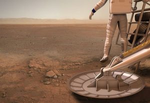
They are dubbed “vibrotactile boots.”
New work at Draper Labs in Cambridge, Massachusetts makes use of sensors at the front of the boot to detect obstacles and alert the user through a combination of visual signals and vibrations applied to the feet.
Alison Gibson of Draper says her “booted” system of knowing the position of your legs on Mars can be challenging while wearing a bulky pressurized suit. Also, altered gravity high-stepping across Mars certainly doesn’t help.
Footnote: task at hand
According to Andrea Webb of Draper, “the system allows astronauts to focus on the task at hand instead of watching the ground,” she said in a press statement.
Solid footing on Mars can be a real challenge, where reduced gravity and the constraints of a bulky pressured suit limit sensory feedback.

Credit: Dan Durda
Also, the protective helmet further limits an astronaut’s peripheral vision, forcing space explorers to lean forward and look down to see tripping hazards. In this environment, a punctured suit or damaged life support system can be fatal.
New approach
Point is, Draper researchers studied this problem and developed a new approach for how astronauts see and feel the terrain around them. By equipping a special boot with built-in sensors and tiny haptic motors that vibrate, the research team aims to give astronauts the information they need to stay safe.
“The boots have built-in sensors and vibration motors, all connected to a small microcontroller that processes the sensor data and determines which cue to send to the user,” says Alison Gibson, a Draper Fellow and former graduate student in MIT’s Department of Aeronautics and Astronautics.
Credit: Bob Sauls – XP4D/Explore Mars, Inc. (used with permission)
Vibratory feedback
Gibson further advises that the front of each boot contains an ultrasonic range-finder, a proximity sensor and a six degree-of-freedom Inertial Measurement Unit. The vibratory feedback delivered to the feet is supplemented with an augmented reality visual display that also indicates the location and proximity of approaching obstacles.
Draper and MIT research in this area could have applications in the design of navigation systems for the visually impaired, and serve as an added safety measure for first responders and firefighters as they navigate smoke-filled rooms, according to the Draper press statement.

Curiosity image of wheel – coated with Mars mud?
Credit: NASA/JPL
There is increasing discussion and debate concerning the exploration of Mars and how best to search for past/present life on the Red Planet.
One element of the deliberation is what constitutes a “Special Region” on Mars.

This series of images spans a period of 15 weeks shows a pair of fresh, middle-latitude craters on Mars. The bright material is water ice that was uncovered by the meteorite impact. Sublimation of the ice during the Martian summer leaves behind a dust layer that gradually thickens to the point where it obscures the ice. The impact responsible for these craters had not yet occurred by June 4, 2008, but had occurred by Aug. 10, 2008.
Credit: NASA/JPL-Caltech/University of Arizona
A Special Region is a region classified by the Committee on Space Research (COSPAR) where terrestrial organisms might readily propagate, or thought to have a high potential for existence of Martian life forms. This is understood to apply to a region on the Red Planet where liquid water occurs, or can occasionally happen, centered on our current understanding of requirements for life.
Impact craters
“I think many of the recent Martian meteorite impact craters imaged by Mars Reconnaissance Orbiter showing white ice in the interior of freshly exposed craters and their ejecta blanket should give us pause as to what ‘Special Regions’ on Mars are,” says Barry E. DiGregorio, director for the International Committee Against Mars Sample Return (ICAMSR). “In fact, every time I look into the night sky and see Mars,” he adds, “I think I am looking at a ‘Special Region.’”

The bright material conspicuous in this image was excavated from below the surface and deposited nearby by a 2008 impact that dug a crater about 8 meters (26 feet) in diameter. The extent of the bright patch was large enough for the Compact Reconnaissance Imaging Spectrometer for Mars, an instrument on NASA’s Mars Reconnaissance Orbiter, to obtain information confirming the material to be water ice.
Credit: NASA/JPL-Caltech/University of Arizona
DiGregorio suggests that no one at NASA can be sure that a rover or lander has not been inadvertently sent to a Special Region where wet zones persist.
“That’s because we apparently can’t detect the nearness of small amounts of evaporating water ice moving through the top soil or regolith,” DiGregorio notes.

Credit: NASA/JPL
Wheel proof – wet soil?
To enhance his case, DiGregorio points to images relayed from NASA’s Curiosity Mars rover. The images were acquired via the robot’s Mastcam camera on Sol’s 528-532.
“As you can see, the ‘soil’ adhering to the wheels is mud-like and wet – similar to a wet clay. So here you have an incident where Curiosity drove right over the top of a Special Region zone and it went unreported – until now,” DiGregorio concludes.
Clingons!

Murray Buttes and Mars explorer.
Artwork credit: Sean Doran
Resources
The pages of the Astrobiology journal have served as the epicenter of new, on-going dialogue regarding future exploration of Mars and the search for life on that distant world.
Go to:
Searching for Life on Mars Before It Is Too Late
http://online.liebertpub.com/doi/full/10.1089/ast.2017.1703
Four Fallacies and an Oversight: Searching for Martian Life
http://online.liebertpub.com/doi/pdfplus/10.1089/ast.2017.1749

The Red Planet as seen by Europe’s Mars Express.
Credit: ESA/D. O’Donnell – CC BY-SA IGO
A recent article in the journal Astrobiology has caused a dust-up about Mars.
Titled “Searching for Life on Mars Before It Is Too Late” the article makes the case that planetary protection policies as we conceive them today “will no longer be valid as human arrival will inevitably increase the introduction of terrestrial and organic contaminants and that could jeopardize the identification of indigenous Mars life.”
Lead author of the forum article is Alberto G. Fairén, a visiting scientist at Cornell University.
Change of strategy
The forum article, in short form, proposed a twofold change of strategy regarding exploration of the Red Planet:

New planetary prowler – the NASA Mars 2020 rover – scouring the Red Planet for select samples for eventual return to Earth.
Credit: NASA/JPL
First – allow immediate access to the Special Regions for vehicles with the cleanliness level of Curiosity, Mars2020, or Europe’s ExoMars.
Second – existing laboratory robotic technology must be made flight ready in the search for biochemical evidence of life, and in particular, the development of robotic nucleic acid sequencing instrumentations for future in situ detection and/or sample return.
Fallacies
In response, a new fast-track forum article in Astrobiology – “Four Fallacies and an Oversight: Searching for Martian Life” — has been authored by John Rummel of the SETI Institute and Catharine “Cassie” Conley, head of NASA’s Office of Planetary Protection.
Those fallacies as flagged by Rummel and Conley are:
- The contention that evidence of martian life would best be found in Special Regions is not well supported
- Evidence and cost estimations based on real mission systems suggest that cleaning robotic missions to currently required levels is in fact not a significant impediment to accessing candidate Special Regions
- The claim that martian life could convincingly be identified by nucleic acid sequence comparison, if it were obtained from a Special Region contaminated with Earth life, is invalidated by recent evidence of highly divergent life on Earth
- The idea that exploration with dirty robots is urgent because human exploration is imminent seems to ignore the possibility that contamination from poorly prepared robotic missions could spread as easily as contamination associated with human missions.

Mars expedition probes the promise that Mars was a home address for past, possibly life today.
Credit: NASA
Explore Mars properly
Additionally, Rummel and Conley write that an oversight in the earlier forum article is that it failed to acknowledge the possibility that introduced Earth organisms could cause damage both to martian resources we hope will be available to future human explorers and—considering that many Earth organisms are facultative pathogens (e.g., Clostridium tetani)—potentially to the explorers themselves.
“There is still time to explore Mars properly,” the Mars experts in the new article conclude.
Careful contamination control
“Without careful contamination control, however, robotic life-detection instruments could obtain a false positive or equivocal detection of life on Mars,” they write. In fact, they add that the Sample Analysis at Mars (SAM) instrument on the NASA Curiosity Mars rover has already detected Earth contamination at levels that swamp out possible signals from Mars.
“If an astronaut exploring Mars is likely to run into martian organisms, that fact should be well understood before landing there. Inadvertent exposure might affect astronaut health and their permission to return to Earth. Exposure to unknown Earth organisms could be a source of confusion in that circumstance,” Rummel and Conley state.
Resources
To access both of these important Astrobiology papers, go to:
https://www.leonarddavid.com/searching-for-life-on-marsbefore-it-is-too-late/
and
“Four Fallacies and an Oversight: Searching for Martian Life” at:
http://online.liebertpub.com/doi/pdfplus/10.1089/ast.2017.1749

Credit: HI-SEAS
An 8-month Mars analog isolation mission is wrapping up today at the Hawaii Space Exploration Analog and Simulation (HI-SEAS) facility at the Mauna Loa volcano, Big Island, Hawaii.
The six-person crew that began the simulated mission in January is comprised of four men and two women.

Credit: HI-SEAS
The purpose of the mock Mars mission — backed by NASA — is to directly address the “Risk of Performance Decrements Due to Inadequate Cooperation, Coordination, Communication, and Psychosocial Adaptation within a Team.”
According to a HI-SEAS statement: “We need to identify psychological and psychosocial factors, measures and combinations thereof that can be used to compose highly effective crews for autonomous, long duration and/or distance exploration missions.”
Go to this informative video by University of Hawai‘i News on HI-SEAS, published on Sep 15, 2017. Go to:
Credit: HI-SEAS

China’s Tianzhou-1 resupply craft has completed docking and refueling tasks with uncrewed Tiangong-2 space lab.
Credit: CCTV
China’s Tianzhou-1 resupply craft has backed away from the uncrewed Tiangong-2 space lab. The Sunday departure at 4:15 p.m. (Beijing time) had the cargo ship move to an orbit of roughly 250 miles (400 kilometers) above Earth.
The Chinese Xinhua news agency reports that Tianzhou-1 will continue to carry out experiments before nose-diving into Earth’s atmosphere. Pre de-orbit, the supply ship will gather experience for building and operating the country’s larger space station in the 2020s.
In-orbit refueling
Tianzhou-1 was launched on April 20 from south China’s Hainan Province.
The craft completed automated docking with the orbiting Tiangong-2 space lab on April 22.
The two docked spacecraft completed the first in-orbit refueling on April 27, a second refueling on June 15 and a final one, yesterday on September 16.

Credit: NASA/JPL-Caltech
With the NASA/ESA Cassini spacecraft nose-diving into Saturn on September 15, there are a number of moving messages from those attached to the now-gone spacecraft.
Among them, Carolyn Porco, Cassini Imaging Team leader and director of the Cassini Imaging Central Laboratory for Operations (CICLOPS) at the Space Science Institute in Boulder, Colorado. “We came. We Saw. It’s done.”
Dying essence
Porco noted on the scientist’s “Captain’s Log” via her Facebook page: “A kiloton explosion, spread out against the sky in a pyrrhic display of light and fire, a dazzling flash to signal the dying essence of a lone emissary from another world. As if the myths of old had foretold the future, the great patriarch will consume his child. At that point, that golden machine, so dutiful and strong, will enter the realm of history, and the toils and triumphs of this long march will be done,” she writes.
Porco underscores those that were appointed long ago to undertake the journey.
“It has been a taxing three decades, requiring a level of dedication that I could not have predicted, and breathless times when we sprinted for the duration of a marathon. But in return, we were blessed to spend our lives working and playing in that promised land beyond the Sun,” she adds.

Cassini navigation team watch data come in from the spacecraft during its final plunge into Saturn, Friday, Sept. 15, 2017 at NASA’s Jet Propulsion Laboratory in Pasadena, California.
Credit: NASA/Joel Kowsky

Cassini team members embrace after the spacecraft was deliberately plunged into Saturn, Friday, Sept. 15, 2017 at NASA’s Jet Propulsion Laboratory in Pasadena, California.
Credit: NASA/Joel Kowsky
Historic epoch
Cassini’s imaging team served as the “documentarians” of Cassini’s historic epoch and returned a stirring visual record of the spacecraft’s travels around Saturn and the glories that were found there. “This is our gift to the citizens of planet Earth,” Porco notes.
“It is doubtful we will soon see a mission as richly suited as Cassini return to this ringed world and shoulder a task as colossal as we have borne over the last 27 years,” Porco concludes: “To have served on this mission has been to live the rewarding life of an explorer of our time, a surveyor of distant worlds. We wrote our names across the sky. We could not have asked for more.”

Curiosity Front Hazcam Right B image acquired on Sol 1816, September 15, 2017.
Credit: NASA/JPL-Caltech
Just sliding into Sol 1818, NASA’s Curiosity Mars rover heads for a “soliday” on Sunday to get researchers back in synch with “Mars time” in Gale Crater.
That’s the update from Kenneth Herkenhoff a planetary geologist at the U.S. Geological Survey in Flagstaff, Arizona.
The focus of recent science planning was observations of the robot’s current workspace, including an experiment to acquire Alpha Particle X-Ray Spectrometer (APXS) and Mars Hand Lens Imager (MAHLI) data on a bedrock target before getting a brush off.
Brushable targets
MAHLI images of three potential Dust Removal Tool (DRT) targets were received and used to determine which of these small exposures could be brushed. One had small pebbles in the DRT ellipse, so could not be brushed, Herkenhoff adds, but both of the other targets (“Christmas Cove” and “Mitten Ledge”) are brushable.

NASA’s Mars rover Curiosity acquired this image using its Mars Hand Lens Imager (MAHLI) on Sol 1816, September 15, 2017. MAHLI located on the turret at the end of the rover’s robotic arm.
Credit: NASA/JPL-Caltech/MSSS
“So the APXS will measure the chemistry of Christmas Cove before it is brushed off, then will be placed on the brushed spot to measure chemical differences,” Herkenhoff notes. MAHLI will image both targets before and after brushing, he explains, then acquire a full suite of images on a layered block dubbed “Whittum.”
Laser strikes
Also on Sol 1818, Curiosity’s Chemistry & Camera (ChemCam) will shoot its laser at another layered bedrock block named “Medomak.”
The rover’s Mastcam is to image Medomak, the Sun, and the crater rim to measure dust opacity in the atmosphere. A nighttime operation of APXS is placing the instrument on Mitten Ledge for a long integration.
Passive spectra
Curiosity’s Sol 1819 duties that are planned involve a Navcam search for dust devils before ChemCam acquires passive spectra of Christmas Cove and Mitten Ledge.

NASA’s Mars rover Curiosity acquired this image using its Mars Hand Lens Imager (MAHLI) on Sol 1816, September 15, 2017. MAHLI located on the turret at the end of the rover’s robotic arm.
Credit: NASA/JPL-Caltech/MSSS
“Mastcam will then acquire multispectral observations of Christmas Cove and more distant “Jaquish Ledge” before the rover drives away,” Herkenhoff says.
After the drive, in addition to the standard imaging, the Dynamic Albedo of Neutrons (DAN) will execute two active integrations.
Winter on Mars
“Because the Martian winter is approaching, we are planning more heating, which reduces the power available for other activities,” Herkenhoff points out. Therefore, it has been difficult to fit all action items of the rover into the plan today, making for a challenging day.

Curiosity laser shots cross layered bedrock block named “Medomak.”
Curiosity ChemCam Remote Micro-Imager photo acquired on Sol 1818, September 17, 2017
Credit: NASA/JPL-Caltech/LANL
“We had to shorten or delete some scientific observations, which was painful, but I’m happy with all of the science we were able to plan today,” Herkenhoff concludes.

Credit: National Institute for Public Policy
Foreign Space Capabilities: Implications for U.S. National Security is a new monograph authored by Steve Lambakis and available from the National Institute for Public Policy, dated September 2017.
The monograph explains: “U.S. defense leaders must strive to guarantee U.S. freedom of action and provide a strong deterrent to aggressive behavior in space that prevents efforts by other nations to control orbits. These are the core interests of the United States in space.”

Credit: National Institute for Public Policy
“However much U.S. leaders and many of the American people and U.S. allies would never want to fight a war that extends into space, the United States must be prepared to defend its operations in that domain and, if necessary, fight through the loss of access to space capabilities. Space is an obvious place for the adversary to look to upset the advantage currently carried by the United States. This is why the nation’s leaders must act to defend and deter in space.”
Chapters focus on Expanding Exploitation of Space; Foreign Space and Counter-Space Developments; Protecting and Exercising U.S. Space Power; Implications for U.S. Defense Policy; and concludes with recommendations.
This report is available at:
http://www.nipp.org/wp-content/uploads/2017/09/Foreign-Space-Capabilities-pub-2017.pdf

Curiosity Navcam Right B image taken on Sol 1814, September 13, 2017.
Credit: NASA/JPL-Caltech
NASA’s Curiosity Mars rover is currently in Sol 1816, scouting about on Vera Rubin Ridge.
Planning for the rover’s science duties “was a bit like reading a great mystery novel,” reports Abigail Fraeman, a planetary geologist at NASA/JPL in Pasadena, California. “There were several twists and turns along the way, but we eventually reached an exciting ending that will reveal ‘Whodunit?’…or more accurately, what geologic forces had done to shape this landscape billions of years ago.”

Curiosity Front Hazcam Right B photo acquired on Sol 1815, September 13, 2017.
Credit: NASA/JPL-Caltech
Raised broken rocks
A recent drive of the robot was successful, placed it in front of one of many meter-scale factures that criss-cross this area.
“These fractures are visible in high-resolution orbital images, and on the ground are surrounded by raised broken rocks that appear to be slightly more resistant to erosion than their surroundings,” Fraeman adds. “We are interested in understanding how these fractures formed, if they were conduits for ancient water, and why the rocks on their edges are raised.”

Curiosity Mastcam Left photo taken on Sol 1814, September 13, 2017.
Credit: NASA/JPL-Caltech/MSSS
Should I stay, should I go?
Curiosity researchers made a quick decision that rocks being observed were interesting enough to warrant staying for another couple of days to collect good contact science targets, rather than the single touch-and-go as had originally been planned, Fraeman notes.
The decision to stay had the geology theme group working to figure out what targets would be ideal for collecting Mars Hand Lens Imager (MAHLI) and Alpha Particle X-Ray Spectrometer (APXS) data.

Curiosity Mastcam Left photo acquired on Sol 1814, September 13, 2017.
Credit: NASA/JPL-Caltech/MSSS
“This entailed a lot of back and forth between the scientists and rover planners to understand which targets were reachable in the somewhat broken up workspace in front of us,” Fraeman points out, “and which were simply too far away or fragmented to access.”
Standoff images
After some work, team members found a great raised rock to examine with APXS and MAHLI, given the target name of “Schoppee.”

Curiosity ChemCam Remote Micro-Imager photo taken on Sol 1814, September 13, 2017.
Credit: NASA/JPL-Caltech/LANL
The plan called for taking 25 centimeter MAHLI standoff images of several other locations near the raised rim of the fracture to provide additional information about targets that can be studied in the weekend plan.
3D model
“Forgoing the drive also allowed us to have time for some morning remote sensing before the contact science,” Fraeman says. During that time, on tap are Chemistry and Camera (ChemCam) observations of targets “Elwell,” “Bragdon,” and “Graffam,” as well as corresponding Mastcam documentation imaging.

Curiosity Rear Hazcam Left B image acquired on Sol 1815, September 13, 2017.
Credit: NASA/JPL-Caltech
Additional remote sensing is also on the checklist, including a ChemCam Remote Micro-Imager (RMI) Z-stack observation (used to make a 3D model) of fine laminations in the target “Phoney Island,” a corresponding Mastcam observation, and many environmental measurements in afternoon and early morning hours, Fraeman concludes.

Credit: NASA/JPL-Caltech/University of Arizona
New roadmap
A new traverse map has been issued by JPL, showing the ground track of the robot since landing in August 2012.
The new map shows the route driven by Curiosity through the 1814 Martian day, or sol, of the rover’s mission on Mars, as of September 13, 2017.
Numbering of the dots along the line indicate the sol number of each drive. North is up. The scale bar is 1 kilometer (~0.62 mile).
From Sol 1812 to Sol 1814, Curiosity had driven a straight line distance of about 30.77 feet (9.38 meters), bringing the rover’s total odometry for the mission to 10.80 miles (17.38 kilometers).
The base image from the map is from the High Resolution Imaging Science Experiment Camera (HiRISE) in NASA’s Mars Reconnaissance Orbiter.

