Author Archive

Curiosity Navcam Right B image taken on Sol 1858, October 28, 2017.
Credit: NASA/JPL-Caltech
The Curiosity Mars rover is now in Sol 1858, busily engaged in performing a “working weekend,” reports Mark Salvatore, a planetary geologist at the University of Michigan in Dearborn.
“Following a series of setbacks this week, Curiosity is on track to have a productive, albeit stationary, weekend,” Salvatore explains.
Series of headaches
Last week’s communication issue and possible difficulties in delivering the “Ogunquit Beach” sample to the Sample Analysis at Mars (SAM) instrument, Salvatore adds, “have given the science team a series of headaches as we try to make progress along Vera Rubin Ridge.”

Curiosity Rear Hazcam Left B image acquired on Sol 1857, October 27, 2017.
Credit: NASA/JPL-Caltech
Regarding the sample, the NASA robot’s Mastcam images last week showed that the sample may not have made it into the SAM instrument, reported Rachel Kronyak, a planetary geologist at the University of Tennessee in Knoxville last week. As a precautionary measure, it was decided to forego the analysis due to a chance that the SAM sample cup is empty.
In addition, the team discovered an error with the left Mastcam data transfer that has marked the instrument temporarily “sick” and is preventing researchers from acquiring new data from it until after the weekend plan. “Nonetheless, the team is optimistic moving into the weekend, and has planned a really nice suite of observations,” Salvatore notes.
One more time
Curiosity is slated to try one more time to deliver the Ogunquit Beach sample to the SAM instrument, and SAM will hopefully perform an evolved gas analysis (EGA) on the sample overnight on the first evening of the weekend plan.

Curiosity Front Hazcam Left B image taken on Sol 1858, October 28, 2017.
Credit: NASA/JPL-Caltech
Curiosity is to spend the majority of Saturday sleeping and recharging, as the EGA analyses requires significant power to perform.
Toward the end of Saturday, Curiosity will image and brush a patch of flat bedrock in front of the rover named “Sibasa” and will analyze this patch of bedrock with the Alpha Particle X-Ray Spectrometer (APXS) instrument to accurately characterize the chemistry of this region. This will be an overnight measurement.
Local surroundings
On Sunday, Curiosity will spend two hours investigating the local surroundings with Mastcam images as well as ChemCam laser-induced breakdown spectroscopy (LIBS) measurements, Salvatore reports.
ChemCam is slated to analyze four separate targets: “Schmidtsdrif,” “Sibasa,” “Lisbon,” and “Estecourt.”

Curiosity ChemCam Remote Micro-Imager image acquired on Sol 1856, October 26, 2017.
Credit: NASA/JPL-Caltech/LANL
Salvatore points out that Schmidtsdrif is a potentially hematite-rich target that is similar to iron-rich targets identified earlier by Curiosity. Sibasa is the brushed and imaged target that was also analyzed using the APXS instrument. Lisbon is a patch of dark soil near the rover. Estecourt is a raised block of material that is also similar to a previous sol’s target, and these analyses will hopefully allow for comparisons between targets.
“Mastcam imaging will not only document these ChemCam targets, but will also be used to acquire additional images further away from the rover to inspect the nature of the Vera Rubin Ridge from this location, and to help us plan for future traverses,” Salvatore notes. As the left Mastcam instrument is currently unavailable, all imaging will be done with Mastcam’s right “eye.”
Science ahead
With all of the headaches that arose last week, “the science team and rover planners have managed to again arrange for some wonderful science to be done with the resources that are currently available,” Salvatore says.

Curiosity Mastcam Right photo taken on Sol 1856, October 26, 2017.
Credit: NASA/JPL-Caltech/MSSS
On Monday, rover researchers may have accomplished a successful EGA analysis on Ogunquit Beach, will have used the APXS instrument to characterize Sibasa, and will have a plethora of new Mastcam and ChemCam observations to understand this section of the Vera Rubin Ridge.
“Hopefully all of your weekends,” Salvatore concludes, “will be more relaxing than Curiosity’s!”

Earth’s Moon as seen from the International Space Station taken by ESA British astronaut, Tim Peake.
Credit: NASA/ESA
The Lunar Exploration Analysis Group (LEAG) has issued a “Consensus Meeting Findings” document that outlines multi-year milestones to put U.S. astronauts back on the Moon, encourages private sector lunar efforts, utilizes the Moon’s resources and develops a lunar economy.
Those milestones are required to show progress toward “return[ing] American astronauts to the Moon,” the LEAG document adds, “not only to leave behind footprints and flags, but to build the foundation we need to send Americans to Mars and beyond” by developing a robust lunar economy.

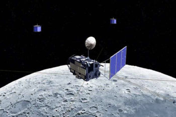
Early concept of Deep Space Gateway
Credit: NASA
Deep space thoughts
LEAG states that “any development of the proposed Deep Space Habitat/Gateway should be specifically designed to support long-term human and robotic presence on the lunar surface. If the decision is made to proceed with the proposed Deep Space Habitat/Gateway, decisions such as the orbit, design, and capabilities of the proposed infrastructure, as well as commercial and international opportunities, should be driven by the strategic direction to return U.S. astronauts to the lunar surface.”
The Moon “remains the cornerstone of planetary science and is an absolutely pivotal destination for science missions impacting our understanding of the entire Solar System,” the LEAG document explains.

The Earth straddling the limb of the Moon, as seen from above Compton crater.
Credit: NASA/GSFC/Arizona State University
Milestones ahead
The LEAG document flags “the paramount strategic objective” of human lunar return that is advocated by the newly re-activated National Space Council, headed by U.S. Vice President, Mike Pence.
LEAG’s document suggests the following milestones to enable the Nation’s “new strategic direction.”
1-2 Years
— Demonstrate NASA’s ability to deliver cargo- and crew-capable infrastructure via NASA’s Space Launch System (SLS) to cislunar space.
— Commercial sector demonstrates lunar access capability.
— NASA procures payload opportunities on commercial and international missions (i.e., procures commercial lunar missions services and funds selected science/exploration instruments to ride on them).
— NASA calls for Public-Private Partnerships (PPPs) and international partnerships for the establishment of infrastructure to enable surface access and navigation.
— Procurement of independent economic studies of the impact of using the Moon’s resources — also called In-situ Resource Utilization (ISRU) — on sustaining a permanent human presence on the Moon and growing the Lunar Economy.

NASA’s Resource Prospector that could be the first robot to navigate in the polar regions of the Moon.
Credit: NASA Ames Research Center
3-5 years
— Commercial sector demonstrates lunar surface access and return to Earth capability.
— ISRU technology validation on the lunar surface.
— Deployment of robotic prospecting explorers to the Moon.
— Develop experiments to use existing samples to promote and develop ISRU technologies.
5-10 years
— Development of ISRU pilot plants and fuel depots.
— Continued missions to the lunar surface for exploration and science.
— Human lunar landings.
Private sector and markets

Credit: Foster+Partners
The LEAG community encourages NASA to include the private sector in developing the architecture requested by the National Space Council for establishing a presence on the lunar surface.
“This could start with LEAG (including its Commercial Advisory Board, or CAB) involvement in NASA studies regarding establishing a robust near-term surface access program for robots and humans, establishing a lunar power and communications-navigation infrastructure, as well as demonstrating the abundance and usefulness of lunar resources (and creating a market for these),” the document explains.
Building bridges
Jointly chartered by the Science Mission Directorate (SMD) and the Human Exploration and Operations Mission Directorate (HEOMD), LEAG blends members of both communities, building bridges and synergies between science, exploration, and commerce whenever and however possible.
LEAG has a standing Commercial Advisory Board to offer programmatic insights into the capabilities provided by industry.
As a community-based, volunteer-driven, interdisciplinary forum, LEAG membership is open to all members of the lunar exploration community and consists of lunar and planetary scientists, life scientists, engineers, technologists, human system specialists, mission designers, managers, policymakers, and other aerospace professionals from government, academia, and the commercial sector.
The LEAG Consensus Meeting Findings stem from an October 10-12 meeting held at the Universities Space Research Association (USRA) in Columbia, Maryland.

Concept of view from a deep space habitat
Credit: ESA
The idea of a Deep Space Gateway has garnered high-level interest within the European Space Agency (ESA).
A recent ESA call for academic or industrial research ideas has been issued to discern benefits from such a deep space crewed spaceship in lunar vicinity – one that also enables access to the Moon’s surface.
Broad categories
Research areas for the Deep Space Gateway may fall into broad categories: Life Sciences, Physical Sciences, Solar System Science, Earth Sciences, and Astronomy and Astrophysics, as well as technology and other areas of a more applied nature.
The Deep Space Gateway is envisioned to host crewed missions and operate without crew in between. This facility is planned to be built and operated during the 2020’s as humanities next step beyond low Earth orbit and out into the Solar System.
Staging post
The notional Deep Space Gateway could serve as a staging post for exploration missions to the lunar surface and eventually to other deep space destinations, including Mars. It is also seen as a platform in a location where the human and technological challenges of long duration human missions in deep space can be investigated and addressed.
“The platform is being prepared through international cooperation, led by the partner agencies of the International Space Station,” an ESA document explains, also involving NASA, The Japan Aerospace Exploration Agency (JAXA) and the Canadian Space Agency (CSA).
“The technical definition of the Deep Space Gateway is driven by the technical needs of preparing deep space human exploration. It could also support opportunistic scientific research,” ESA adds.
Potential orbits
A number of potential orbits have been reviewed for the Deep Space Gateway, to determine their suitability for missions on terms of the operations of a habitat, access and return for crew and access to the lunar surface.

Credit: ESA
Additionally, the Deep Space Gateway should have the ability to move between orbits as needed for different missions.
Of orbits that have been reviewed, Near Rectilinear Halo Orbits and Earth-Moon L2 Halo orbits were found to be technically favorable.
Lunar vicinity science
Scientific areas that could benefit from human operations in lunar vicinity include:
- Lunar surface science using tele-presence
- Collecting and returning planetary material
- Understanding the Effects of Deep Space Radiation and Fractional Gravity
- Observation post for monitoring Earth’s climate
- A platform for astronomical observations
- Fundamental physics
- Heliophysics
Early concept of Deep Space Gateway
Credit: NASA
Cruise phase investigations
In addition, a number of “opportunistic investigation areas” have been identified for the cruise phase to the Moon, such as:
— Monitor lunar exosphere evolution of the whole Moon through a monthly cycle;
— Quantify impact flashes through the lunar night (clouds get in the way on Earth);
— Monitor human physiology and biomedical changes as the habitat or vehicle moves from within to outside the Earth’s magnetic field (assuming humans are present);
— Install cosmic dust/micrometeorite collectors;
— Target the habitat trajectory to facilitate a lunar eclipse of the Sun to study coronae/Sun composition that is undistorted by Earth’s atmosphere;
— Monitor Earth exosphere (geocorona) in the far ultraviolet which extends half way to the Moon and try to estimate the radiation pressure and its accurate extension which might change with solar activity.
A workshop on research opportunities for the Deep Space Gateway will be held in early December at the European Space Research & Technology Center (ESTEC), Noordwijk.

Curiosity Front Hazcam Left B image taken on Sol 1853 October 23, 2017
Credit: NASA/JPL-Caltech
“Space is hard,” reports Scott Guzewich, an atmospheric scientist at NASA’s Goddard Space Flight Center in Greenbelt, Maryland.
Scientists had prepared a packed science plan for NASA’s Curiosity Mars rover, now wrapping up Sol 1855 duties. On the master plan, along with taking a sure-to-be spectacular panorama of the Gale Crater floor, the rover was to use its Sample Analysis at Mars (SAM) Instrument Suite to study a “doggy-bagged” sample of martian sand from a location called “Ogunquit Beach.”
That sample has been onboard the robot for months, Guzewich adds.
Technical issues
However, technical issues with NASA’s Deep Space Network of satellite dishes around the world prevented rover controllers from sending Curiosity its marching orders. “But, those activities will hopefully be retried in the next few days,” Guzewich says.

Curiosity Mastcam Left image acquired on Sol 1853, October 23, 2017.
Credit: NASA/JPL-Caltech/MSSS
Since last December, the Curiosity engineering and scientific team has been busily diagnosing and then creating work-around plans to fix a problem with the robot’s drill. “That effort has made excellent progress,” Guzewich notes, “and we hope to be able to drill Mars rocks again in the not-too-distant future!”
Inlet imaging
Associated with getting the drill working is designing new methods to deliver samples of rocks to the rover’s built-in laboratories: the Chemistry & Mineralogy X-Ray Diffraction/X-Ray Fluorescence Instrument and SAM.

Curiosity Mastcam Left image acquired on Sol 1853, October 23, 2017.
Credit: NASA/JPL-Caltech/MSSS
Meanwhile, Curiosity’s Mastcam has recently imaged the inlets for SAM on the rover.
As of Sol 1850, Curiosity has chalked up 10.95 miles (17.63 kilometers) of driving since landing in the area in August 2012.

Artist’s concept of the Tiangong-1 in Earth orbit.
Credit: CMSA
China’s Tiangong-1 space lab is headed for an uncontrolled and destructive nose-dive into Earth’s atmosphere early next year.
Exactly when and where on Earth the multi-ton discarded craft will make its plunge cannot now be predicted. What is known is that the vehicle will reenter somewhere between 42° North and 42° South latitude.
Tiangong-1 (“Heavenly Palace”) was rocketed into Earth orbit in late September 2011. It was used for six successive rendezvous and dockings with spacecraft, Shenzhou-8 (uncrewed), Shenzhou-9 (piloted) and Shenzhou-10 (piloted) as part of China’s human space exploration activities. The vehicle weighed 18,740 pounds (8,500 kilograms) at launch.
Back in March of 2016, the space lab ceased functioning and to date the spacecraft has maintained its structural integrity. In length, the vehicle is 34 feet (10.5 meters) and sports a diameter of 11 feet (3.4 meters). The lab has two solar panels (approximately 23 feet (7 meters) by 10 feet (3 meters).

Credit: T.S. Kelso
Dropping in altitude
A check of orbital data shows that Tiangong-1 has been slowly dropping from its roughly 360 kilometer altitude at the beginning of 2017 to roughly 310 kilometers at present, explains T.S. Kelso, a senior research astrodynamicist at the Center for Space Standards & Innovation (CSSI), a research arm of Analytical Graphics.
Using two-line element (TLE) data, a format for distributing orbital element data of spacecraft, “we would expect to see reentry occur somewhere around the last week of March 2018,” Kelso told Inside Outer Space.
Notification
Earlier this year, the United Nations Office for Outer Space Affairs (UNOOSA) reissued a notification by China on the future uncontrolled re-entry of the country’s Tiangong-1 space lab.
“The probability of endangering and causing damage to aviation and ground activities is very low,” the notification states.
The notice advises that China attaches great importance to the re-entry of Tiangong-1 and will take the following measures in terms of monitoring its fall and providing public information:
— China will enhance monitoring and forecasting and make strict arrangements to track and closely keep an eye on Tiangong-1 and will publish a timely forecast of its re-entry
— China will make use of the international joint monitoring information under the framework of the Inter-Agency Space Debris Coordination Committee in order to be better informed about the descent of Tiangong-1.
— China will improve the information reporting mechanism. Dynamic orbital status and other information relating to Tiangong-1 will be posted on the website of the China Manned Space Agency (www.cmse.gov.cn) in both Chinese and English. In addition, timely information about important milestones and events during the orbital decay phases will be released through the news media.
— As to the final forecast of the time and region of re-entry, China will issue the relevant information and early warning in a timely manner and bring it to the attention of the United Nations Office for Outer Space Affairs and the Secretary-General of the United Nations by means of “note verbale” through diplomatic channels.

Credit: CORDS/The Aerospace Corporation
Leftovers
According to the Aerospace Corporation’s Center for Orbital and Reentry Debris Studies (CORDS), based on Tiangong-1’s inclination, the lab will reenter somewhere between 43° North and 43° South latitudes.
A prediction performed by The Aerospace Corporation on October 18, 2017 shows Tiangong-1 reentering in late January 2018 ± 1 month.
As for lingering leftovers, the CORDS website states that “it is highly unlikely that debris from this reentry will strike any person or significantly damage any property,” adding: “potentially, there may be a highly toxic and corrosive substance called hydrazine on board the spacecraft that could survive reentry. For your safety, do not touch any debris you may find on the ground nor inhale vapors it may emit.”
The Aerospace Corporation will perform a person and property risk calculation for the Tiangong-1 reentry a few weeks prior to the event.

Credit: CORDS/The Aerospace Corporation
Reentry viewing
According to CORDS, it may be possible to see Tiangong-1 reentering depending on the viewer’s location, the time of day, and visibility during reentry which will not be known until a few days prior to the event. A more detailed predicted reentry region will be provided a few days prior to the reentry time frame. Visibly incandescent objects from this reentry will likely last tens of seconds (up to a minute or more) in contrast with the vast majority of natural meteors which last mere seconds.
CORDS also notes that, depending on the time of day and cloud visibility, the reentry may appear as multiple bright streaks moving across the sky in the same direction. Due to the relatively large size of the object, it is expected that there will be many pieces reentering together, some of which may survive reentry and land on the Earth’s surface.
Resources
Check out this video taken by the European Space Agency (ESA) from an observation aircraft showing the ESA Automated Transfer Vehicle (ATV-1) spacecraft reentering over the Pacific Ocean after completing its ISS resupply mission. Go to:
For an older story of mine, back in June 2016, China’s “Heavenly Palace” – Headed for a Hellish Demise?, go to:
https://www.leonarddavid.com/chinas-heavenly-palace-headed-for-a-hellish-demise/

Signing of Outer Space Treaty.
Credit: United Nations
The United Nations Office for Outer Space Affairs (UNOOSA) and the international community are celebrating fifty years since the Outer Space Treaty entered into force on October 10, 1967.
The Outer Space Treaty — officially entitled the Treaty of Principles Governing the Activities of States in the Exploration and Use of Outer Space, including the Moon and Other Celestial Bodies — is the foundation of international space law.
Twenty-four countries ratified the Treaty in 1967, and now 105 countries are party to the Treaty.

Credit: ESA/NASA
Space diplomacy
Among its articles
- The Outer Space Treaty makes countries liable for damage caused by objects they launch into space and countries that are party of the treaty have to take responsibility for their activities in space.
- It also prohibits nations from placing weapons of mass destruction in outer space.
- The exploration and use of outer space is for all humankind, it states in the treaty, and no country can lay claim to the Moon or any other celestial body.

Space cowboys? International lawyers are trying to agree on what legislation will be needed to control the exploration of mineral resources in space to avoid a new ‘Wild West’.
Credit: James Vaughan
Historical origins
Explains UNOOSA Director Simonetta Di Pippo:
“As we look back on 50 years of the Outer Space Treaty, we remember its historical origins, celebrate the international cooperation and achievements it has facilitated, as well as to look ahead to an exciting future of space activities from exploring our solar system to developing better technology for improving lives on Earth. The Treaty is a commitment from the international community to preserve space peacefully, for all of us, and the generations to come.”
Resources
A number of postings have taken a long look at the Outer Space Treaty.
To brush-up on the basics and critical calls to reshape the Treaty, go to this assortment of resources:
1)
Information about the Outer Space Treaty, as well as the other space law treaties and principles, is available at:
http://www.unoosa.org/oosa/en/ourwork/spacelaw/treaties.html.
2)
The Outer Space Treaty’s Midlife Funk by Kyle Evanoff, research associate in international economics and U.S. foreign policy at the Council on Foreign Relations.
https://www.cfr.org/blog/outer-space-treatys-midlife-funk
3)
Build on the outer space treaty by Joan Johnson-Freese, professor of national-security affairs and chair of science, space and technology at the Naval War College, Newport, Rhode Island.
4)
The Outer Space Treaty at 50: An enduring basis for cooperative security by Paul Meyer, an adjunct professor of international studies at Simon Fraser University and a Senior Fellow with The Simons Foundation in Vancouver, Canada.
http://www.thespacereview.com/article/3335/1
5)
Reopening the American Frontier: Exploring How the Outer Space Treaty Will Impact American Commerce and Settlement in Space, a hearing convened by the Subcommittee on Space, Science, and Competitiveness.
6)
The Outer Space Treaty: Assessing its Relevance at the 50-Year Mark by James A. Vedda, Center for Space Policy and Strategy, The Aerospace Corporation.
http://aerospace.wpengine.netdna-cdn.com/wp-content/uploads/2017/06/OuterSpaceTreaty.pdf

Credit: NASA
The U.S. Government Accountability Office (GAO) has issued a new space report, looking at NASA’s development of three programs to put astronauts into space and beyond low Earth orbit, eventually to Mars: the Orion crew vehicle, Space Launch System, and Exploration Ground Systems.
GAO notes that all 3 programs must work together.
Oversight challenges
The approach that NASA is using to integrate its three human spaceflight programs into one system ready for launch offers some benefits, “but it also introduces oversight challenges,” the report stresses.
To manage and integrate the three programs—the Space Launch System (SLS) vehicle; the Orion crew capsule; and supporting ground systems (EGS)—NASA’s Exploration Systems Development (ESD) organization is using a more streamlined approach than has been used with other programs, and officials GAO spoke with believe that this approach provides cost savings and greater efficiency.

NASA’s Space Launch System.
Credit: NASA
However, GAO found two key challenges to the approach:
- The approach makes it difficult to assess progress against cost and schedule baselines. SLS and EGS are baselined only to the first test flight. In May 2014, GAO recommended that NASA baseline the programs’ cost and schedule beyond the first test flight. NASA has not implemented these recommendations nor does it plan to; hence, it is contractually obligating billions of dollars for capabilities for the second flight and beyond without establishing baselines necessary to measure program performance.
- The approach has dual-hatted positions, with individuals in two programmatic engineering and safety roles also performing oversight of those areas. As the image below shows, this presents an environment of competing interests.
Cost, Schedule Pressures
“We found challenges in NASA’s approach to integrating these programs,” GAO reports. For example, the technical authorities for engineering and safety also have program roles that include managing resources. When technical authorities must also deal with cost and schedule pressures, it can potentially impair their independence, the report continues.
“The Columbia Accident Investigation Board found in 2003 that this type of tenuous balance between programmatic and technical pressures was a contributing factor to that Space Shuttle accident,” the GAO report adds.

Credit: NASA
Pathway to Mars
NASA is at the beginning of the path leading to human exploration of Mars, explains the GAO report. The first phase along that path, the integration of SLS, Orion, and EGS, is likely to set the stage “for the success or failure of the rest of the endeavor.”
Establishing a cost and schedule baseline for NASA’s second mission is an important initial step in understanding and gaining support for the costs of SLS, Orion, and EGS, not just for that one mission but for the Mars plan overall. NASA’s ongoing refusal to establish this baseline is short-sighted, GAO points out, because Exploration Mission -2 (EM-2) is part of a larger conversation about the affordability of a crewed mission to Mars.
“While later stages of the Mars mission are well in the future, getting to that point in time will require a funding commitment from the Congress and other stakeholders. Much of their willingness to make that commitment is likely to be based on the ability to assess the extent to which NASA has met prior goals within predicted cost and schedule targets,” the GAO report points out.
Resources
To access this GAO report — Integration Approach Presents Challenges to Oversight and Independence (GAO-18-28: Published: Oct 19, 2017), and NASA’s responses, go to:
http://www.gao.gov/products/GAO-18-28
Also, give a listen to this podcast that highlights the findings of the GAO report:

Curiosity Mastcam Left image acquired on Sol 1850, October 20, 2017.
Credit: NASA/JPL-Caltech/MSSS
Now in Sol 1852, NASA’s Curiosity Mars rover is continuing its scientific sleuthing in a target-rich setting on the Red Planet.
Reports Ken Herkenhoff, a planetary geologist at the USGS in Flagstaff, Arizona, the robot drove over 65 feet (20 meters) on Sol 1850, wheeling into an area with lots of bedrock exposed.
“We had several nice targets to choose from, but were limited in what we could plan because we want to prepare for a SAM evolved gas analysis (EGA) of sand from “Ogunquit Beach,” which requires significant power,” Herkenhoff notes.
SAM stands for Sample Analysis at Mars (SAM) Instrument Suite.

Curiosity Mastcam Right image taken on Sol 1850, October 19, 2017.
Credit: NASA/JPL-Caltech/MSSS
Mars time
Scientists planned two sols to become synced back up with “Mars time” on Monday, so the rover will not be driving this weekend.
“Despite the power constraints,” Herkenhoff adds, “we were able to plan a lot of activities today.”
Sol 1852 will start with using the robot’s Navcam to search for clouds and dust devils, followed by Mastcam mosaics of the expected path ahead (southward).

The path ahead as observed by Curiosity’s Navcam Left B camera on Sol 1850, October 20, 2017.
Credit: NASA/JPL-Caltech
Then Curiosity’s Chemistry and Camera (ChemCam) and Right Mastcam will observe bedrock target “Balfour” and a block named “Ripon.”
Laser cleaning
Also on tap is use of the rover’s Mars Hand Lens Imager (MAHLI) to acquire a full suite of images of Balfour before the Alpha Particle X-Ray Spectrometer (APXS) is placed on the target for an overnight integration.
“We considered brushing Balfour before examining it with MAHLI and APXS, but to save time/power we decided not to. The ChemCam laser often cleans dust off of the surface of rock targets, so we’re hoping that will suffice on Balfour,” Herkenhoff explains.

Curiosity Mars Hand Lens Imager (MAHLI) photo acquired on Sol 1850, October 19, 2017. MAHLI is located on the turret at the end of the rover’s robotic arm.
Credit: NASA/JPL-Caltech/MSSS
Sample drop-off
On Sol 1853, the long-awaited drop-off of the Ogunquit Beach sample to SAM is planned.
“This activity was delayed by the drill anomaly and the testing that followed, so we are excited to be planning it today,” Herkenhoff concludes. If all goes well, the SAM EGA will take place this coming Monday.

A permanent human settlement on the Moon via Hawaii is being blueprinted.
Held earlier this month, an International MoonBase Summit (IMS) brought together representatives from academia, government and the private sector to help lay the groundwork for a base on the lunar surface.
“Because of its geography, geology and culture, Hawaii is the perfect place to build a MoonBase prototype,” explains Henk Rogers, an entrepreneur based in Hawaii and the organizer of the IMS.
Key issues
Working groups at the Summit, held October 1-5 on Hawaii island, focused on addressing key issues in the areas of:
- commercialization and business dynamics for economic success
- organizational structure and public-private partnership models
- design and architectural principles
- cultural and philosophical guidelines for planetary settlement
- geological/geographic considerations for location of the International MoonBase (IMB) and its terrestrial analog
- surface systems to build and operate the IMB
- public engagement and educational opportunities
Summit decisions
Meeting participants included Apollo 11 moonwalker, Buzz Aldrin. He encouraged the development of the International MoonBase as a valuable gateway to Mars during his keynote address.

Inside look at one idea the European Space Agency is exploring in its formulation of a “Moon Village” that incorporates 3D printing.
Credit: ESA/ Foster + Partners
Three key decisions resulting from the summit are:
- The International MoonBase will be located close to one of the moon’s poles to enable access to the abundant lunar resources that exist there;
- The terrestrial analog for the International MoonBase will be located on Hawaii island to take advantage of the island’s many features that mimic the lunar surface;
- The Mahina Lani Simulator is envisioned to be funded by an innovative, self-sustaining model.
A Master Plan, scheduled to be drafted in the spring of 2018, will also include a large number of issues that will be the subject of trade studies in the months ahead.
Furthermore, a 3-D model of the International MoonBase is in development that will provide the public with a high-fidelity look at the layout of the base.
For more information, go to:

The Marius Hills Skylight, as observed by the Japanese SELENE/Kaguya research team.
Image Credit: NASA/Goddard/Arizona State University
A comfy room on the Moon to protect explorers may be a large open lava tube in the Marius Hills region.
That’s the deep dive finding of a new study using radar data collected by a Japanese lunar orbiter — the SELENE spacecraft – and used to detect underlying lava tubes. SELENE was launched in September 2007, and was purposely crashed on the Moon in June 2009.
Japan’s SELENE Moon explorer.
Credit: JAXA
Radar data
A study of the SELENE radar data indicates, near the Marius Hills Skylight, an entrance to the tube, scientists found a distinctive echo pattern: a decrease in echo power followed by a large second echo peak, which researchers believe is evidence of a tube. The two echoes correspond to radar reflections from the moon’s surface and the floor and ceiling of the open tube.
The work has been published in Geophysical Research Letters.
Gravity data
Teaming up with the Japanese researchers, Purdue University experts tapped into data gleaned by NASA’s twin orbiters of the GRAIL mission that collected high-quality data on the Moon’s gravitational field.
Launched as GRAIL A and GRAIL B in September 2011, the probes, renamed Ebb and Flow, operated in a nearly circular orbit near the poles of the moon at an altitude of about 34 miles (55 kilometers) until their mission ended in December 2012, also purposely trashed on the Moon.

NASA’s twin GRAIL probes.
Credit: NASA
Jay Melosh, a GRAIL co-investigator at Purdue University, explains in a press statement: “Our group at Purdue used the gravity data over that area to infer that the opening was part of a larger system. By using this complimentary technique of radar, they were able to figure out how deep and high the cavities are.”
Spacious housing

The city of Philadelphia is shown inside a theoretical lunar lava tube.
Credit: Purdue University/David Blair
The upshot from the subsurface look-sees: Marius Hills is spacious enough to house one of the United States’ largest cities, if the gravity results are correct.
The existence of lava tubes on the Moon has been speculated in the past. But in combining radar and gravity data the result provides the clearest picture of what they look like and how big these features could be.
For information on “Detection of intact lava tubes at Marius Hills on the Moon by SELENE (Kaguya) Lunar Radar Sounder” go to:
http://onlinelibrary.wiley.com/doi/10.1002/2017GL074998/full

