Author Archive
Credit: Rocket Lab
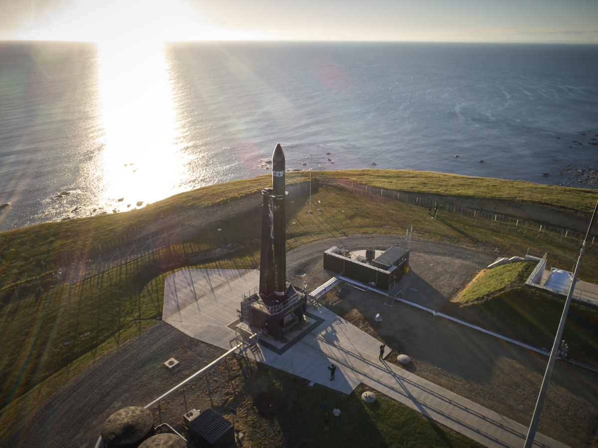
Rocket Lab has confirmed plans to expand its launch capability by developing a U.S. launch site – Launch Complex 2.
Four U.S. space ports are under review to launch the group’s Electron rocket.
— Cape Canaveral
— Wallops Flight Facility
— Pacific Spaceport Complex – Alaska
— Vandenberg Air Force Base
A decision on the confirmed site is expected to be made in August.
Simple, seamless
“We believe the launch process should be simple, seamless and tailored to our customers’ missions – from idea to orbit. Every aspect of the Electron orbital launch program is designed with this in mind and Launch Complex 2 is the next step in this strategy,” said Rocket Lab founder and chief executive Peter Beck in a company press statement.

Putting some zeal into New Zealand – Rocket Lab’s Electron booster lifts off on maiden flight.
Credit: Rocket Lab
Rocket Lab is considering East and West coast options to explore a wide range of inclinations matched against current and anticipated manifest demand.
Pad infrastructure
Launch Complex 2 will be designed to support monthly orbital launches. Once the final site is confirmed, construction will begin immediately, with the first mission from Launch Complex 2 slated for second quarter of 2019. Rocket Lab will construct its own pad infrastructure tailored to the Electron launch vehicle.
Credit: Rocket Lab
Rocket Lab’s Launch Complex 1 is situated on the Māhia Peninsula in New Zealand. Launch Complex 1 is licensed to launch up to every 72 hours.
Track record
The first Electron flight took place on May 25, 2017 but failed to reach orbit.
An Electron booster successfully lofted small satellites into orbit on January 21, 2018 local time. An attempt by Rocket Lab to launch its first commercial flight of five small satellites has been repeatedly delayed due to technical issues. No upcoming launch date has been issued by the group.
Rocket Lab is an American aerospace manufacturer with a wholly owned New Zealand subsidiary.

The Israeli lunar spacecraft weighs only 1,322 pounds, or 600 kilograms.
Credit: Eliran Avital
The nonprofit SpaceIL and Israel Aerospace Industries (IAI) announced today that a robotic lunar landing mission is slated to launch from Cape Canaveral, Florida this December.
If all goes as planned, the craft would attempt a touchdown on the Moon on February 13, 2019.
A final launch date will be announced closer to the event, according to a press statement.
Secondary payload
Following eight years of collaboration between SpaceIL and IAI, the lunar landing would make Israel the fourth country after Russia, the United States and China to reach the Moon.

Lunar lander is 1.5 meters, or over 4.9 feet high, 2 meters or 6 and a half feet in diameter, and the fuel it will carry will comprise some 75 percent of its total weight.
Credit: SpaceIL
The spacecraft will be launched as a secondary payload on a SpaceX Falcon 9 rocket from Cape Canaveral, Florida, and its journey to the Moon will take roughly two months.
The Israeli lunar spacecraft will be the smallest to land on the Moon, weighing only 1,322 pounds, or 600 kilograms.
The journey
Following launch, the moonbound craft will begin orbiting Earth in elliptical orbits. Upon receipt of a command from the control room, the spacecraft will enter a higher altitude elliptical orbit around Earth, which will reach a point near the Moon.
At this point, the lander will ignite its engines to enter a phase of orbiting the Moon prior to attempting a lunar landing. This process will be executed autonomously by the spacecraft’s navigation control system.
The entire journey, from launch to landing, will last approximately two months.

The nonprofit SpaceIL and Israel Aerospace Industries (IAI) announced today that a robotic lunar landing mission is slated to launch from Cape Canaveral, Florida this December.
Credit: SpaceIL
Continuing the mission
SpaceIL was the only Israeli contestant in the international Google Lunar XPRIZE competition. That competition ended officially with no winner on March 31, with Google announcing that it would no longer sponsor the competition.
SpaceIL is continuing with its mission to the Moon despite the contest’s expiration without a winner.
Approximately $88 million has been invested in the spacecraft’s development and construction, mostly from private donors.
For more information, visit:
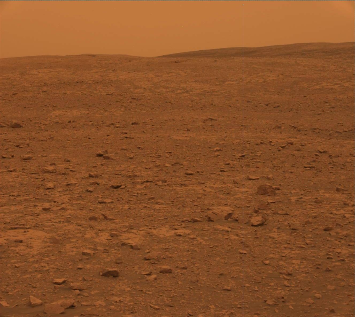
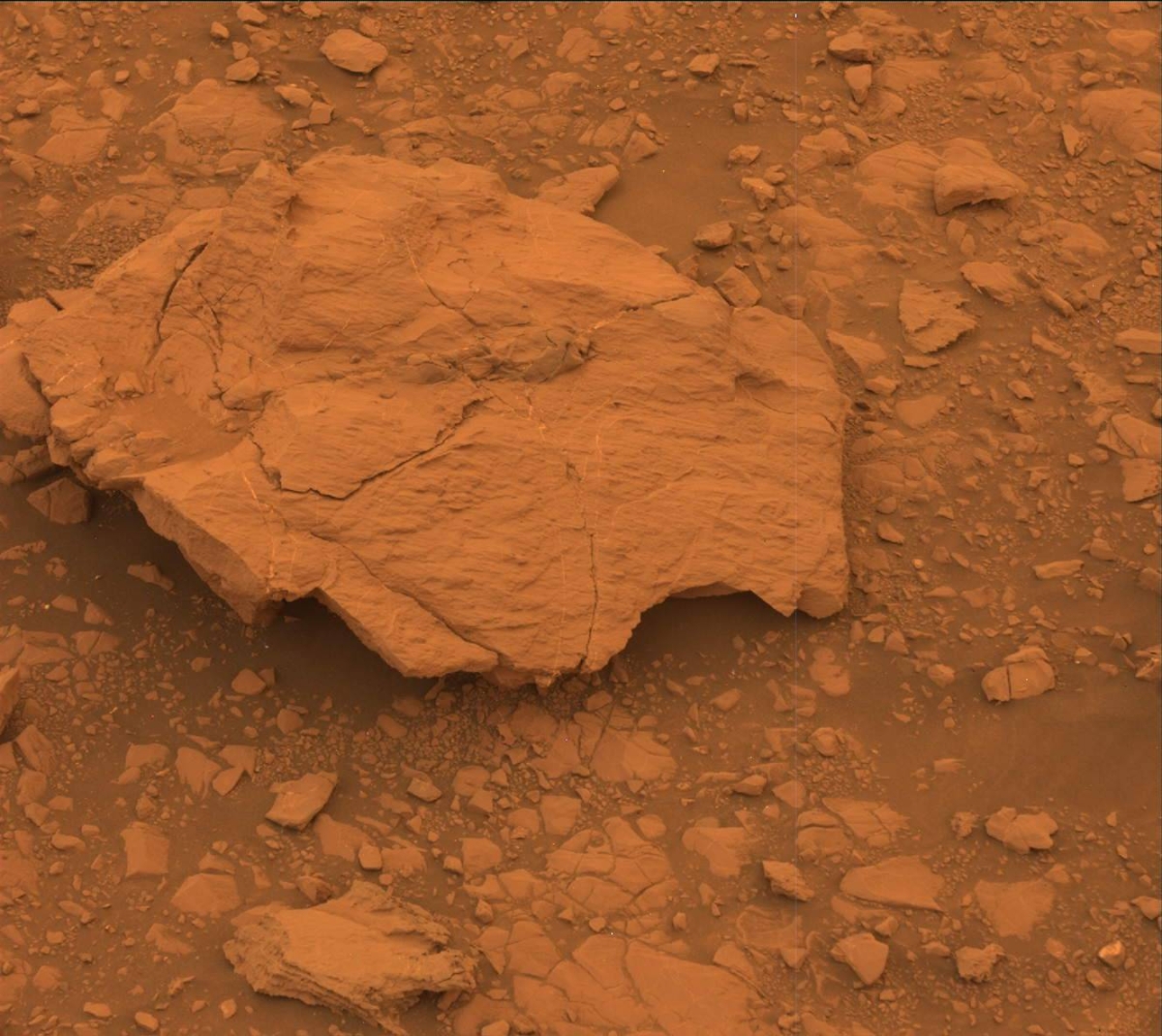
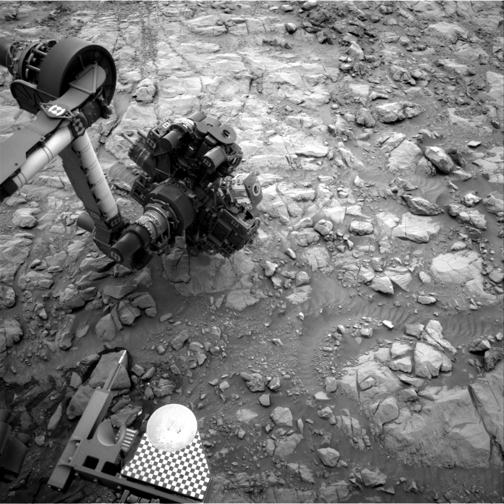
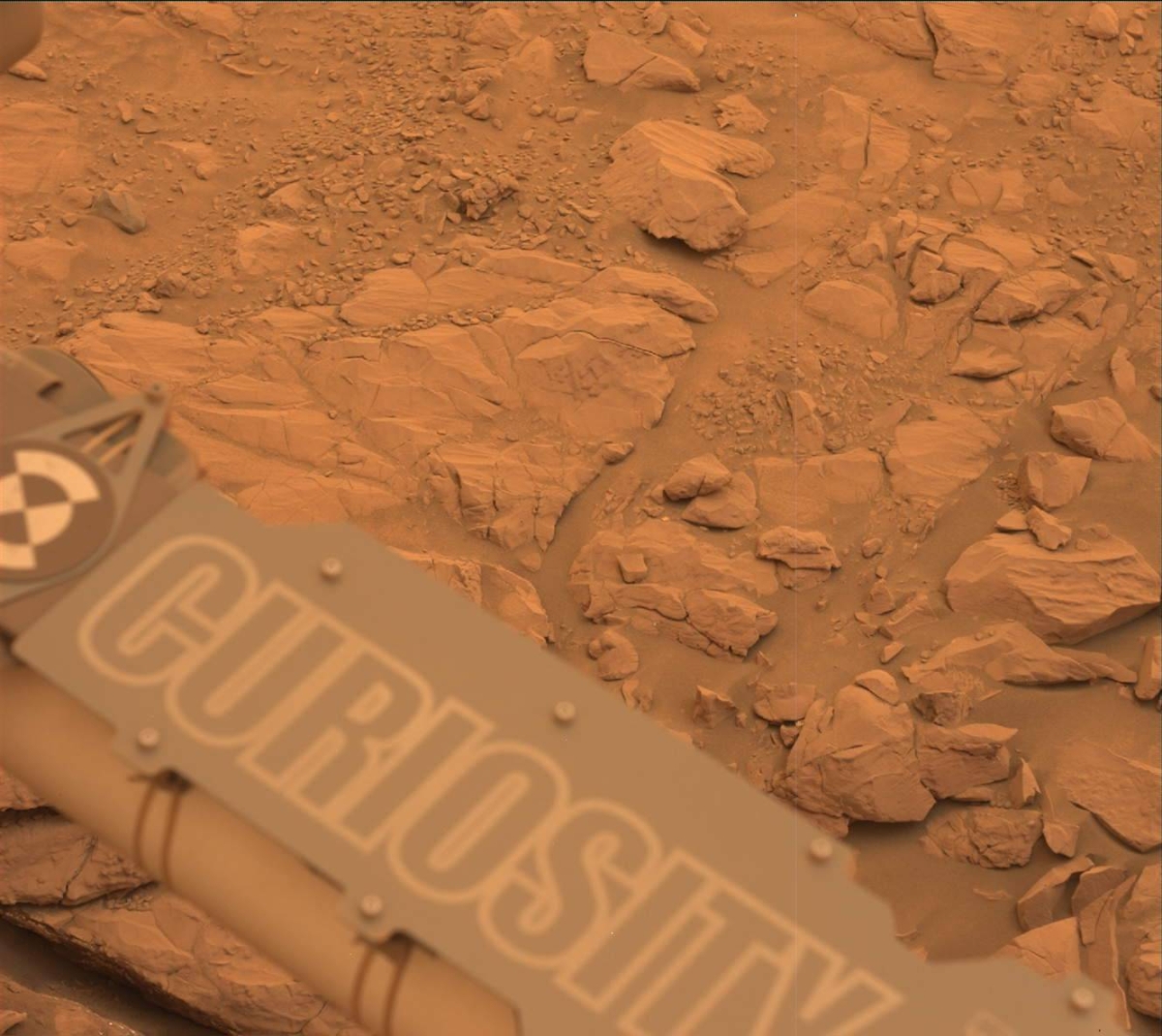
The image shows the Mastcam view as of Sol 2104, in which the nearby terrain is clearly visible, but nothing beyond the foreground and the entire scene looks a murky red-brown color due to the dust storm.
Curiosity Mastcam Left image acquired on Sol 2104, July 8, 2018.
Credit: NASA/JPL-Caltech/MSSS
NASA’s Curiosity Mars rover has just begun Sol 2107 science duties.
The robot is heading back to the “Great Red Spot,” reports Roger Wiens, a geochemist at Los Alamos National Laboratory in New Mexico.
“Unhampered by the storm, Curiosity is heading back toward a site visited on Sol 2005 for what we hope will be the next drill target,” Wiens adds.
Curiosity Mastcam Left photo taken on Sol 2104, July 8, 2018.
Credit: NASA/JPL-Caltech/MSSS
Hematite-rich site
Jupiter is known for its “Great Red Spot”, which is a swirling storm thousands of kilometers in diameter.
Wiens notes that the rover drive destination could perhaps be called the “Great Red Spot on Mars” as it seems to indicate the presence of a reddish mineral, hematite, as seen from orbit and in rover spectra.
“Of course this spot is not at all as prominent from orbit as Jupiter’s Great Red Spot,” Wiens points out, “but the orbital spectra do predict this location to have one of the highest surface hematite abundances in this part of Gale crater.”
Curiosity Mastcam Left photo acquired on Sol 2104, July 8, 2018.
Credit: NASA/JPL-Caltech/MSSS
Slight anomaly
The robot’s Chemistry and Camera (ChemCam) was marked healthy over the weekend after repetition of a known event last week.
Curiosity’s Rover Environmental Monitoring Station (REMS) lost a small amount of science data over the weekend in a slight anomaly, but the instrument remains healthy, Wiens adds.
A new one-sol plan is being uplinked to the rover.
Drill targets
Activities will include a drive to cover most of the roughly 164 feet (50 meters) remaining to a planned drill target. There are three targets in the pre-drive workspace.
Curiosity’s robotic arm will deploy the Mars Hand Lens Imager (MAHLI) and the Alpha Particle X-Ray Spectrometer (APXS) to target “Chippewa.”
APXS will get two 15-minute integrations; MAHLI will image from 25 and 5 centimeter distances.
ChemCam will target “Animikie” nearby. Mastcam will document that target plus “Barnum”, a piece of bedrock in between the other two.
Mosaic
Navcam will continue checking the atmospheric opacity and Mastcam will collect a four-image mosaic of “Taconite_crater.”
The rover’s Radiation Assessment Detector (RAD), Dynamic Albedo of Neutrons (DAN) and REMS will continue taking environmental data, Wiens explains.
A “soliday” — effectively a leap day in which Earth has an extra day relative to Mars – is occurring. “Our next sol of uplink will be on Wednesday,” Wiens concludes.
Credit: NASA/JPL-Caltech/Univ. of Arizona
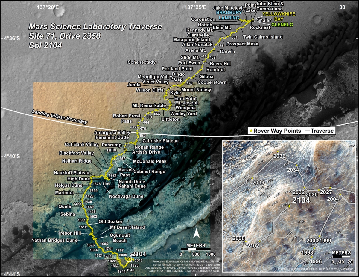
Rover reaches 12 miles
A Curiosity traverse map through Sol 2104 has been issued.
The map shows the route driven by NASA’s Mars rover Curiosity through the 2104 Martian day, or sol, of the rover’s mission on Mars (July 09, 2018).
Numbering of the dots along the line indicate the sol number of each drive. North is up. The scale bar is 1 kilometer (~0.62 mile).
From Sol 2102 to Sol 2104, Curiosity had driven a straight line distance of about 174.46 feet (53.18 meters), bringing the rover’s total odometry for the mission to 12.00 miles (19.32 kilometers).
Curiosity landed on Mars in August 2012.
The base image from the map is from the High Resolution Imaging Science Experiment Camera (HiRISE) in NASA’s Mars Reconnaissance Orbiter.

In-orbit explosions can be related to the mixing of residual fuel that remain in tanks or fuel lines once a rocket stage or satellite is discarded in Earth orbit. The resulting explosion can destroy the object and spread its mass across numerous fragments with a wide spectrum of masses and imparted speeds.
Credit: ESA
The European Space Agency (ESA) has issued an annual report on the status of the space environment.
The report focuses on the time evolution of cataloged and asserted objects in terms of number, mass, and area as well as addressing the global adherence to space debris mitigation measures.
Summary statements
A number of summary statements can be made derived from the presented data in the report, such as:
— The amount of objects, their combined mass, and there combined area has been steadily rising since the beginning of the space age, leading to the appearance of involuntary collisions between operational payloads and space debris.
— The amount of mission related objects released into the space environment is steadily declining, but still significant for rocket bodies.
— Launch traffic into the low Earth orbit protected regions is on the rise, fuelled by the proliferation of small payloads, i.e. below 10.0 kg in mass, during the last few years in terms of number, but not contributing significantly to the mass.
— Between 30 and 60% of all payload mass recently reaching end-of-life in the LEO protected region does so in orbits which adhere to the space debris mitigation measures.
— Around 70% of all rocket body mass recently reaching end-of-life does so in orbits which adhere to the space debris mitigation measures on protecting LEO. A significant amount of this is due to controlled re-entries after launch, a practice which is increasing and was above 20% in 2017.
— Around 90% of all payloads recently reaching end-of-life in the GEO protected region attempt to comply with the space debris mitigation measures. Around 80 % do so successfully.

Earth orbit is a junkyard of human-made space clutter.
Credit: Space Junk 3D, LLC. Melrae Pictures
Transparent overview
The content of the report aims to provide a transparent overview of global space activities, as well as estimate the impact of these activities on the space environment.
Furthermore, the report attempts to quantify the effect of internationally endorsed mitigation measures aimed at sustainability of the environment.
To read the entire document — ESA’s Annual Space Environment Report – go to:
https://www.sdo.esoc.esa.int/environment_report/Space_Environment_Report_latest.pdf

Credit: China Manned Space Agency
China’s state-run Xinhua news agency reports that the country is accelerating its timetable for a space station.
Citing Yang Liwei, director of the China Manned Space Engineering Office and the country’s first astronaut, the station’s core section is expected to be launched in 2020. Two experiment modules of the space station will be sent into space in 2021 and 2022. Three or four manned missions and several cargo spacecraft are planned in 2021 and 2022.

Credit: CMSA
After construction of the main parts of the space station, a capsule holding a large optical telescope will be sent into the same orbit to fly with the station, Yang said.
Flight rate
During construction of the station, the number of manned space missions will rise to about five a year, according to the July 8 Xinhua news story.
That flight rate beats the once every two or three years when China began sending astronauts into space more than a decade ago.
The quickening pace also means astronaut recruitment will be expanded, as reported by Xinhua.

Credit: CMSE
Handbook available
A version 1.0 handbook on the China Space Station (CSS) and its resources for international cooperation was issued May 28 by the UN Office for Outer Space Affairs and China Manned Space Agency.
For more details, go to this earlier Inside Outer Space story:
https://www.leonarddavid.com/china-space-station-handbook-details-operations/
To read the handbook, go to:
http://www.unoosa.org/documents/doc/psa/hsti/CSS_1stAO/CSS_1stAO_Handbook_2018.pdf
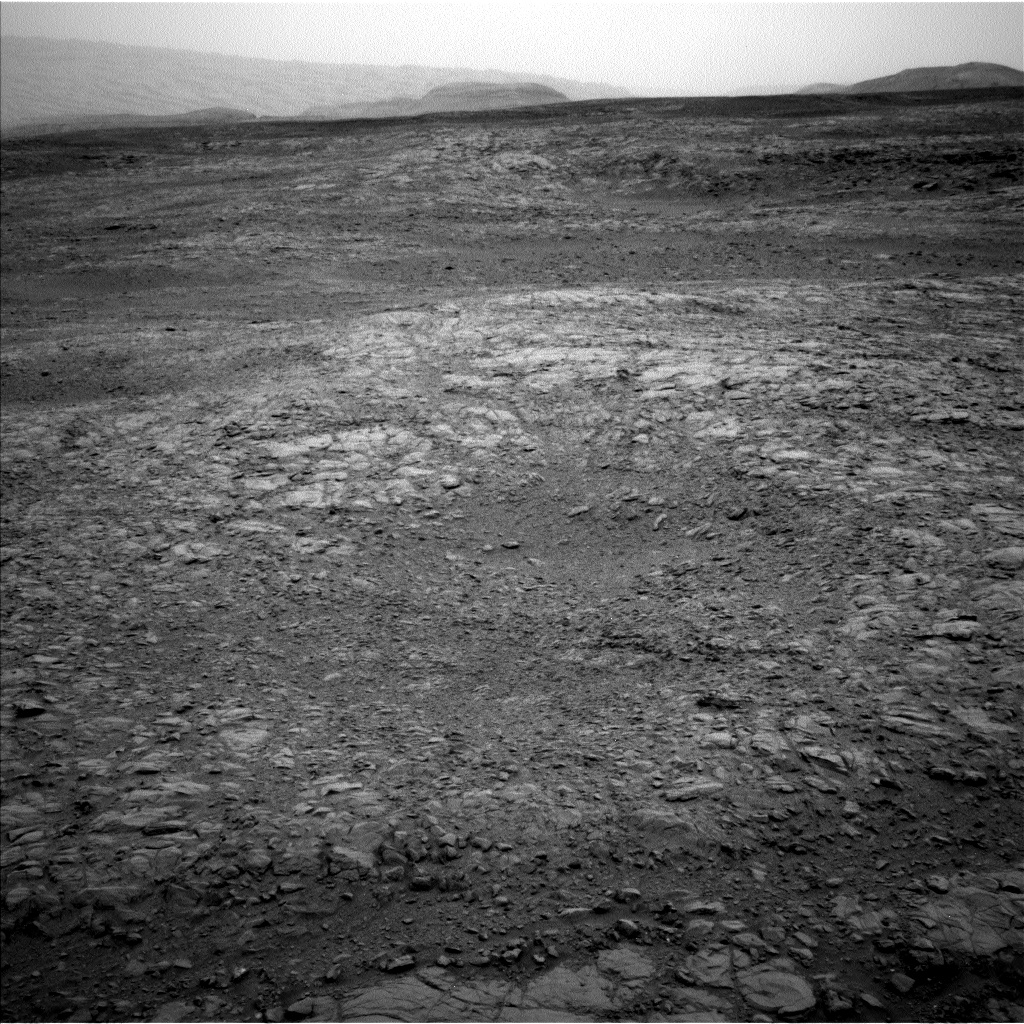
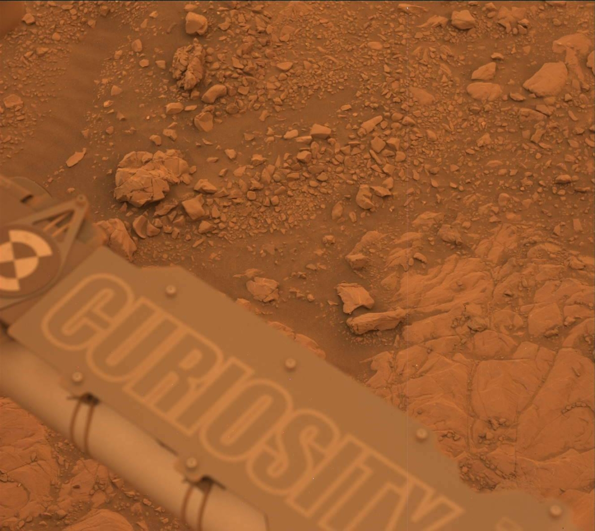
Curiosity Navcam Left B image taken on Sol 2102, July 5, 2018.
Credit: NASA/JPL-Caltech
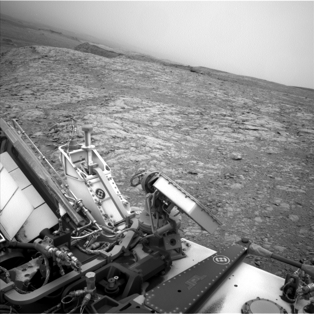
NASA’s Curiosity Mars rover is performing Sol 2104 duties.
Scott Guzewich, an atmospheric scientist at NASA’s Goddard Space Flight Center in Greenbelt, Maryland reports that a primary goal for recent planning was for the robot to approach its next drill location on the Vera Rubin Ridge.
To do so, Curiosity is paralleling the north side of the ridge during a new drive while documenting the geochemistry of the bedrock the rover is currently parked on.
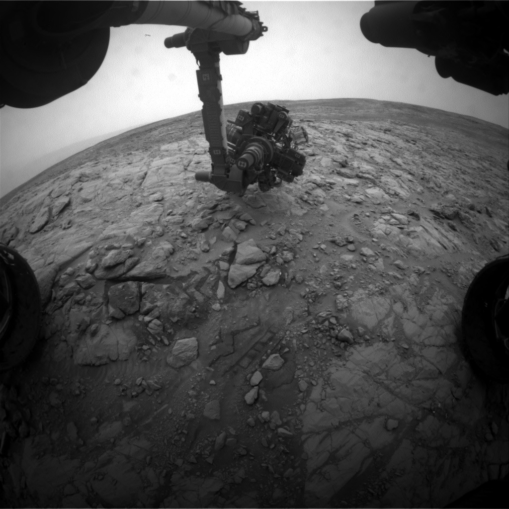
Curiosity Front Hazcam Right B image acquired on Sol 2102, July 5, 2018.
Credit: NASA/JPL-Caltech
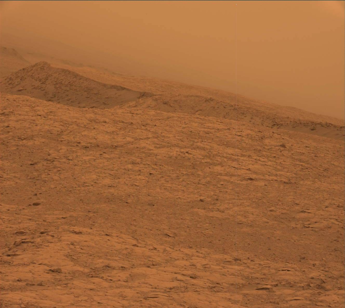
Dust storm update
Curiosity is also to continue studying the ongoing planet-encircling dust storm.
A warning from the rover’s Chemistry and Camera (ChemCam) initially prevented ground controllers from employing ChemCam for data gathering, but it was cleared up later and will be ready for Monday’s planning.
“We therefore took advantage of the unexpected availability of science time to include some routine Mastcam calibration activities and additional observations of the dust storm,” Guzewich notes.
Curiosity Mastcam Right photo taken on Sol 2100, July 3, 2018.
Credit: NASA/JPL-Caltech/MSSS
Reached its “peak”?
The amount of dust over Gale Crater, Guzewich adds, has been slowly declining over the last two weeks and it’s possible the dust storm has reached its “peak.”
“Whereas on Earth we have thousands of surface weather stations and a constellation of spacecraft observing the weather, on Mars we are comparatively blind to global conditions. But based on what data we do have, we may now be entering — or soon entering — the period where the massive amount of dust in the atmosphere will slowly settle out, and Mars’ shrouded surface may once again be clearly visible from space,” Guzewich explains.
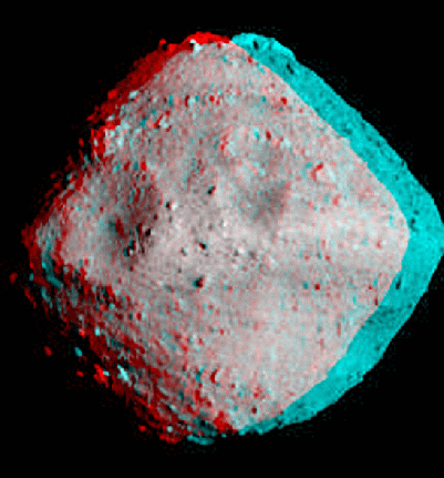
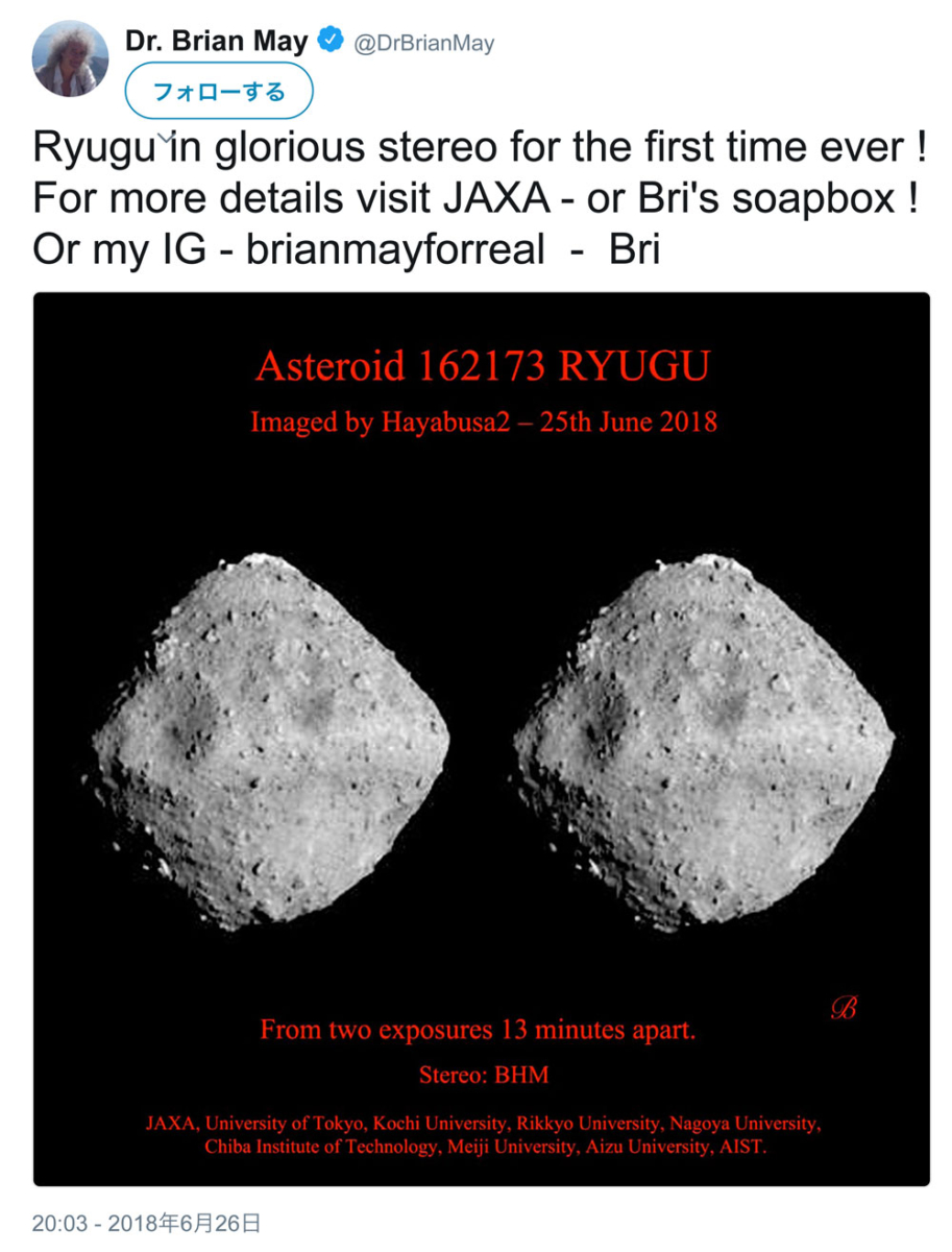
Image to be used with red/blue stereo glasses.
Credits: Yoshiro Yamada, credit for the original stereoscopic image is Brian May and credit for the images of Ryugu is JAXA, University of Tokyo, Kochi University, Rikkyo University, Nagoya University, Chiba Institute of Technology, Meiji University, Aizu University.
The Japan Aerospace Exploration Agency’s (JAXA) Hayabusa2 has been busy reconnoitering its target asteroid, Ryugu.
Brian May, the lead guitarist from the British rock band, Queen, has created a stereoscopic image of Ryugu from photographs captured with the Optical Navigation Camera onboard Hayabusa2, so that the asteroid can be viewed in three dimensions.
Planetary defense
Brian May is an astronomer, with a doctoral degree in astrophysics from Imperial College London. He has a strong interest in planetary defense or space guard, which considers the potential threat to the Earth from meteorites.
May is a core member of “Asteroid Day”, that began about three years ago to increase awareness of asteroids and action that can be taken to protect the Earth.
In particular, the two asteroids explored by Japan’s Hayabusa and Hayabusa2 missions, Itokawa and Ryugu, both have orbits that approach the Earth, and data from these missions is also being used to better understand planetary defense.
Brian May has previously created images to sterescopically view celestial bodies, and approached the Hayabusa2 Project to propose a stereoscopic image of Ryugu.
Go to this video for May’s explanation of the stereo imaging of the asteroid at:
http://www.hayabusa2.jaxa.jp/topics/20180704je/img/BrianMayStereoRyugu_Sound4.mp4
1302 days after leaving Earth, Hayabusa2 has finally arrived at Ryugu! Look how our view of this new world has already changed. https://t.co/veo3WGJtoa pic.twitter.com/K6Fx2kuwtR
— HAYABUSA2@JAXA (@haya2e_jaxa) June 29, 2018

Artist’s illustration of asteroid ISRU showing astronauts at an asteroid as well as other mining and transportation vehicles operating in space.
Credit: TransAstra Corporation & Anthony Longman
An international team has taken a hard look at the potential existence and utilization of “minimoons.”
The minimoon source population, the set of objects from which minimoons are drawn, are Earth’s co-orbital asteroids.
Within a few years, they suggest, the Large Synoptic Survey Telescope (LSST) will either begin to regularly detect temporarily-captured orbiters (TCOs) — colloquially known as minimoons — or force a re-analysis of the creation and dynamical evolution of small asteroids in the inner solar system.
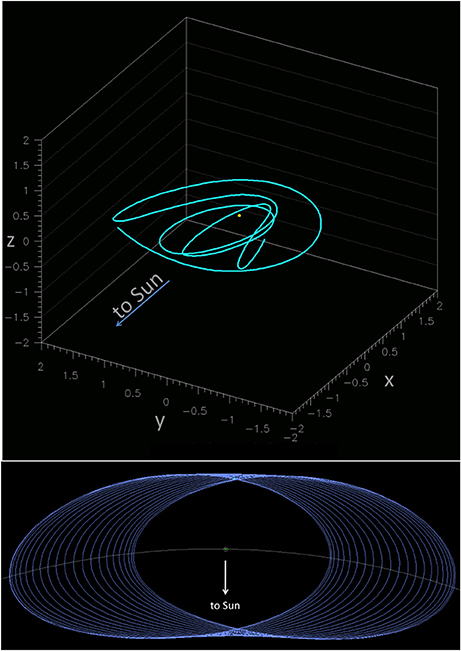
Minimoons (temporarily captured objects, TCOs) are gravitationally bound to the Earth-Moon system.
Credit: Paul Chodas (NASA/JPL)
There should be a steady state population of the minimoons, with about one 1- to 2-meters diameter captured objects at any time, with the number of captured meteoroids increasing exponentially for smaller sizes.
Robert Jedicke of the Institute for Astronomy, University of Hawai’i at Mānoa, Honolulu, Hawaii led the research, published in Fundamental Astronomy, a section of the journal Frontiers in Astronomy and Space Science.
Minimoon hypothesis
The major problem with the minimoon hypothesis is the small number of known objects that have ever been minimoons.
“There remain at least a few difficulties with establishing the reality of new minimoons: (1) overcoming a prejudice against their existence, (2) obtaining evidence that they have a natural provenance, and (3) establishing that they are not “merely” lunar fragments ejected from the Moon’s surface during an impact event,” Jedicke and his colleagues write.
“The first issue will eventually be resolved when so many minimoons have been discovered that it is impossible to maintain a prejudice against them or when a serious flaw is discovered in the dynamical models that predict their existence,” the research team reports.
Candidates for future missions
Minimoons will provide interesting science opportunities as a consequence of their small sizes and their relatively long capture duration.
While scientifically valuable, Earth’s minimoons have also entered the game as candidates for future space missions, the researchers suggest. “They have been delivered for free to cis-lunar space by the solar system’s gravitational dynamics and are now available in our own backyard under favorable energetic conditions which make them ideal targets.”

The Large Synoptic Survey Telescope (LSST) might regularly detect minimoons. A simulated night sky provides a background for the LSST facilities building on Cerro Pachón in this artist’s conception.
Credit: The LSST Corporation (LSSTC)
Technological and commercial opportunities
From a technological and commercial perspective minimoons provide an ideal opportunity for:
— the development and testing of planetary defense technologies (e.g., deflecting an asteroid;
— validating and improving close-proximity guidance, navigation, and control algorithms;
— testing close-proximity procedures and protocols for safe operation of crewed missions around asteroids; and
— establishing the feasibility of asteroid mining technologies for future commercial applications, all in an environment where the round-trip light-time delay is a few seconds.
“While naturally produced minimoons will be too small for commercially profitable enterprises they will be extremely useful for testing techniques in a cis-lunar environment before moving operations into distant heliocentric space,” the research team adds.
To view the research report — Earth’s Minimoons: Opportunities for Science and Technology – go to:
https://www.frontiersin.org/articles/10.3389/fspas.2018.00013/full

Lisa Pratt
Credit: Anna Powell Teeter/IU Bloomington
When it comes to planetary protection and assuring valid and safe scientific exploration for extraterrestrial life, there’s a new space sheriff in town. The job comes with central celestial duties: Avoid forward contamination of other worlds by terrestrial organisms carried on spacecraft. Also, prevent toting back to Earth “creature features” or bioactive molecules in samples returned for scientific study.
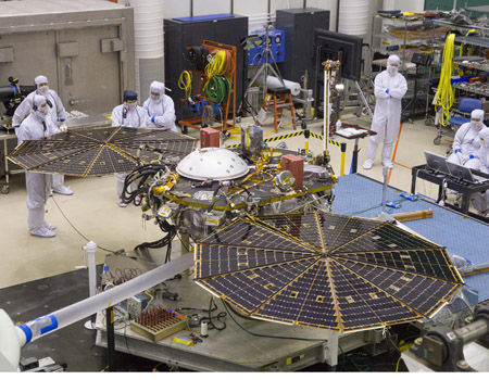
Clean room care: InSight Mars lander undergoes a solar array deployment test at Lockheed Martin.
Credit: Lockheed Martin
Lisa Pratt is a NASA Headquarters newbie, entering the role of Planetary Protection Officer in early February. As an Indiana University Bloomington astrobiologist, she’s taken the tiller just as the space agency office was shifted from the Science Mission Directorate to the Office of Safety and Mission Assurance.
To learn of Pratt’s check list of planetary protection do’s and don’ts, here’s my new Scientific American story:
As Space Becomes a Busy Place, NASA Bolsters Its Planet-Contamination Police
Lisa Pratt, the space agency’s new planetary protection officer, could soon oversee major shifts in regulations on public- and private-sector space missions
Curiosity Navcam Left B image taken on Sol 2098, July 1, 2018.
Credit: NASA/JPL-Caltech
“Curiosity is back on top of the Vera Rubin Ridge once more, having completed our drive over the weekend as we move toward our next drilling target in the ‘Pettegrove Point’ geological member,” reports Scott Guzewich, an atmospheric scientist at NASA’s Goddard Space Flight Center in Greenbelt, Maryland.
“After climbing back onto the ridge, there is no lack of interesting bedrock targets nearby and the ground is much smoother and suitable for driving compared to where we’ve been for the last many weeks while we studied our “Duluth” drill hole and its surroundings,” Guzewich adds.
Dust storm
A dust storm campaign continues with a variety of measurements of atmospheric dust opacity (which has continued a very slow decline from a peak about 2 weeks ago).
“We’ve had to alter existing measurement techniques for measuring dust opacity and create new ones to account for the high amounts of dust in the atmosphere and the corresponding low light levels at the surface,” Guzewich explains. “But this also affords us new opportunities to study the properties of dust particles themselves.”
Curiosity Mastcam Left photo acquired on Sol 2098, July 1, 2018.
Credit: NASA/JPL-Caltech/MSSS
Slippage
In an earlier report, Christopher Edwards, a planetary geologist at Northern Arizona University in Flagstaff, Arizona, noted that Curiosity was facing uphill challenges.
“Curiosity stopped its drive a bit earlier than anticipated. It so happens that the autonomous software onboard Curiosity designed to keep it driving safely kicked in and ended the drive short of the planned distance,” Edwards notes.
Setback to science
“When things like this happen, it’s a bit of a setback to science, but keeping the rover safe is priority number one,” Edwards adds.
Not only did the drive stop short, but Curiosity actually ended up in a location where there wasn’t a good surface model, Edwards remarks, triggering the Slip Risk Assessment Process (SRAP) to fail.
A failed SRAP means that Curiosity cannot safely carry out any arm-based activities, so the science team resorted to remote sensing activities using the cameras and the Chemistry and Camera (ChemCam) instrument to continue to assess the Vera Rubin Ridge.
Curiosity Mastcam Left photo acquired on Sol 2098, July 1, 2018.
Credit: NASA/JPL-Caltech/MSSS
Remote sensing activities
In a newly drafted three sol plan, Curiosity will first carry out a host of remote sensing activities including five ChemCam activities, Mastcam documentation images of the ChemCam locations and a small Mastcam mosaic of a layered rock outcrop on the horizon, Edwards explains.
On the second sol, the rover will make good progress driving along the previously planned path using only the existing terrain surface model that is available.
The usual suite of post-drive imaging to help decide science targets in the next plan will also be acquired.
Priority monitoring
“Importantly, as the dust storm on Mars continues to affect Curiosity, activities designed to monitor the amount of dust in the atmosphere will remain a priority and be made as frequently as possible,” Edwards concludes.

