Author Archive

Credit: Spaceflight
A red flag has been raised by a satellite and orbital debris analyst regarding the upcoming launch of SSO-A, currently scheduled for liftoff from Vandenberg Air Force Base in California on November 19.
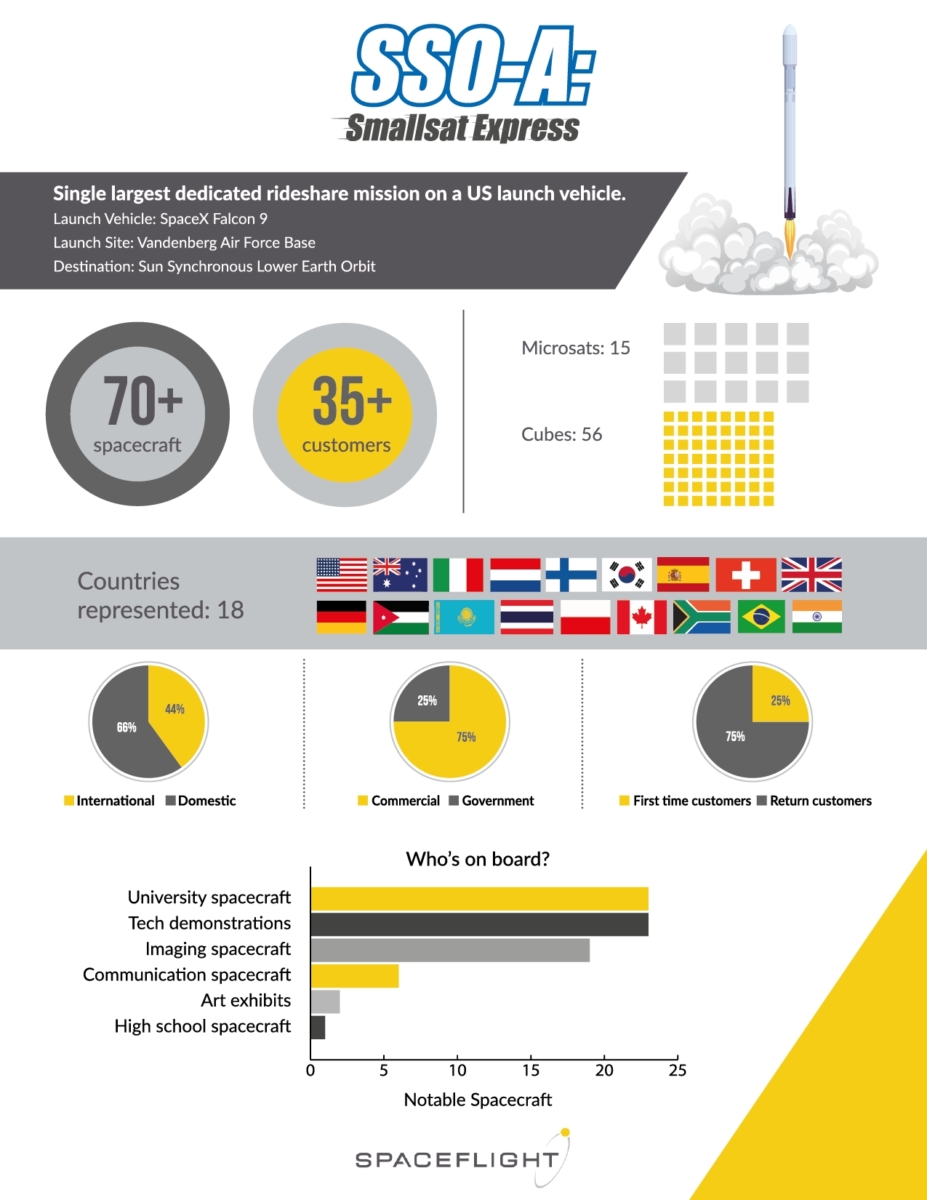
The bragging rights about the SmallSat Express involve the largest rideshare mission from a U.S.-based launch vehicle – SpaceX Falcon 9 booster — with 25 percent of the customers launching for the first time.
Targeted for sun-synchronous orbit (SSO), the mission is dubbed SSO-A: SmallSat Express.
Mission management provider, Spaceflight, has contracted with more than 70 spacecraft from approximately 35 different organizations, all to be propelled skyward by a SpaceX Falcon 9. Spaceflight is a service offering of Spaceflight Industries, based in Seattle, Washington.
Perhaps in a bit of irony, the 18th Space Control Squadron at Vandenberg Air Force Base is tasked with providing 24/7 support to the space sensor network, maintaining the space catalog and managing United States Strategic Command’s (USSTRATCOM) space situational awareness (SSA) sharing program to United States, foreign government, and commercial entities.
SHERPA platforms
“What they [Spaceflight] haven’t shared is how these 70+ satellites are going to be deployed,” says T.S. Kelso of CelesTrak, an analytical group that keeps an eye on Earth-orbiting objects. “I checked with one of the operators—trying to get a head start on how we’re going to ID all of these—and learned that the two SHERPA platforms are going to be released from the Falcon 9 with no attitude control or attitude determination.”
SHERPA is a free-flying secondary payload dispenser.

Credit: Spaceflight
Kelso’s bottom line: “I think this is not only irresponsible from a safety of flight perspective, but it jeopardizes the time and resources of many of the small operators who may never even hear from their satellites,” he told Inside Outer Space.
Space debris
Kelso says that his guess is that about a third of the satellites released will basically be space debris on release.
The SHERPA platforms will be in uncontrolled tumbles as they release these payloads. Since there will be no thrusting between deployments (with no attitude control), everything will likely be released into a big cloud. The only initial information satellite operators will have will be the post-deployment state vectors from SpaceX for the two SHERPA platforms, Kelso adds.
Credit: Spaceflight
Sorting out the mess
Cautions Kelso, there will be difficulties in sorting out this kind of mess.
“Having 70+ objects—many of which look the same to a radar—will result in observations being assigned to multiple tracks and causing bad orbits, which further compounds track association,” Kelso notes. “Until good tracks exist, it is impossible to ID the satellite…if you are a small operator and can’t find your satellite, you may be unable to do things required to keep that satellite healthy, like deploying arrays or controlling power usage.”
In a recently posted paper, “Challenges Identifying Newly Launched Objects” — Kelso outlines this issue:
https://celestrak.com/publications/IAC/2017/
Go to this video about Spaceflight’s SSO-A integrated payload stack:
https://www.youtube.com/watch?time_continue=10&v=9BEx1umVTTY

Taking the high road, aerial platforms could open up a new era of Venus exploration according to a new study.
Credit: Tibor Balint/JPL
Hellish and cloud-enveloped Venus is a world ready and waiting for renewed exploration.
A new Jet Propulsion Laboratory study released last month argues that the time is ripe to investigate Venus by high-tech aerial platforms.
These platforms can extensively probe the Venus atmosphere, its circulation, and also determine the chemical nature of the planet’s gaseous atmosphere and its clouds.
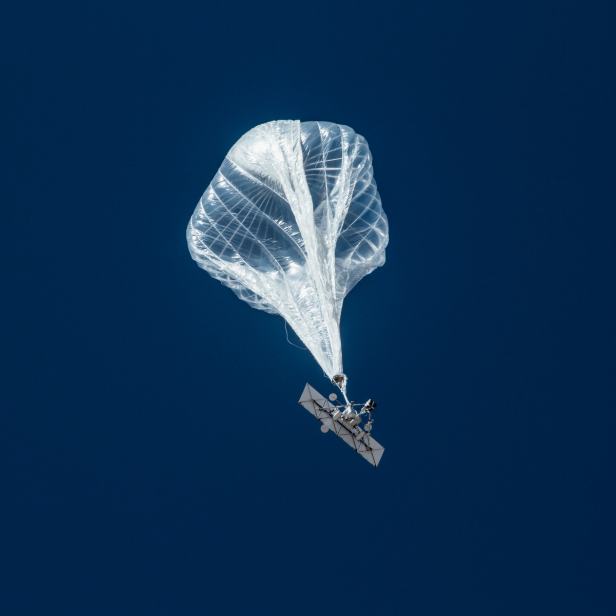
Google’s Loon program, an Earth network of long-lived balloons, is showcasing how similar technology might be applied to the next round of Venus investigation.
Credit: Loon LLC
Surprisingly, the back to Venus campaign has benefited by Google’s Loon program, an Earth network of long-lived balloons designed to deliver connectivity to people in Internet-deprived communities.

As seen in the ultraviolet, Venus image taken by NASA’s Pioneer-Venus Orbiter in 1979.
Credit: NASA
Take a look at my new Scientific American story:
Will NASA’s Next Mission to Venus Be a Balloon?
https://www.scientificamerican.com/article/will-nasas-next-mission-to-venus-be-a-blimp/
E.T. we’re home “porch light.”
Credit: MIT
There are those paranoid about letting any starfolk know we’re here, cringing on planet Earth.
But a new MIT study suggests that existing laser technology could be fashioned to attract alien astronomers – sort of an E.T. we’re home “porch light.”
The research stems from James Clark, a graduate student in MIT’s Department of Aeronautics and Astronautics and Clark’s advisor, Associate Professor Kerri Cahoy. The “feasibility study,” appears today in The Astrophysical Journal.
On the beam
The findings suggest that if a high-powered 1- to 2-megawatt laser were focused through a massive 30- to 45-meter telescope and aimed out into space, the combination would produce a beam of infrared radiation strong enough to stand out from the Sun’s energy.

The required laser power of 1 to 2 megawatts is equivalent to that of the U.S. Air Force’s Airborne Laser, a now-defunct megawatt laser that was meant to fly aboard a military jet for the purpose of shooting ballistic missiles out of the sky.
Credit: U.S. Air Force
Such a signal could be detectable by alien astronomers performing a cursory survey of our section of the Milky Way — especially if those astronomers live in nearby systems, such as around Proxima Centauri, the nearest star to Earth, or TRAPPIST-1, a star about 40 light-years away that hosts seven exoplanets, three of which are potentially habitable.
If the signal is spotted from either of these nearby systems, the study finds, the same megawatt laser could be used to send a brief message in the form of pulses similar to Morse code.
Detectable signal
“This would be a challenging project but not an impossible one,” Clark says in a MIT press statement.
“The kinds of lasers and telescopes that are being built today can produce a detectable signal, so that an astronomer could take one look at our star and immediately see something unusual about its spectrum,” Clark adds. “I don’t know if intelligent creatures around the Sun would be their first guess, but it would certainly attract further attention.”
Clarks says such a laser beacon could be installed on the far side of the Moon. “In general, this was a feasibility study. Whether or not this is a good idea, that’s a discussion for future work.”
Note: Story adapted from Jennifer Chu/MIT News Office release.
To access the paper — “Optical Detection of Lasers with Near-term Technology at Interstellar Distances” – by James R. Clark and Kerri Cahoy, go to:
http://iopscience.iop.org/article/10.3847/1538-4357/aae380/pdf

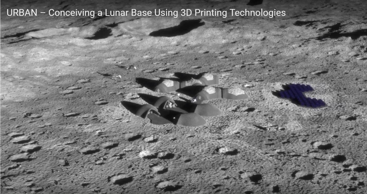
Credit: ESA/URBAN Consortium
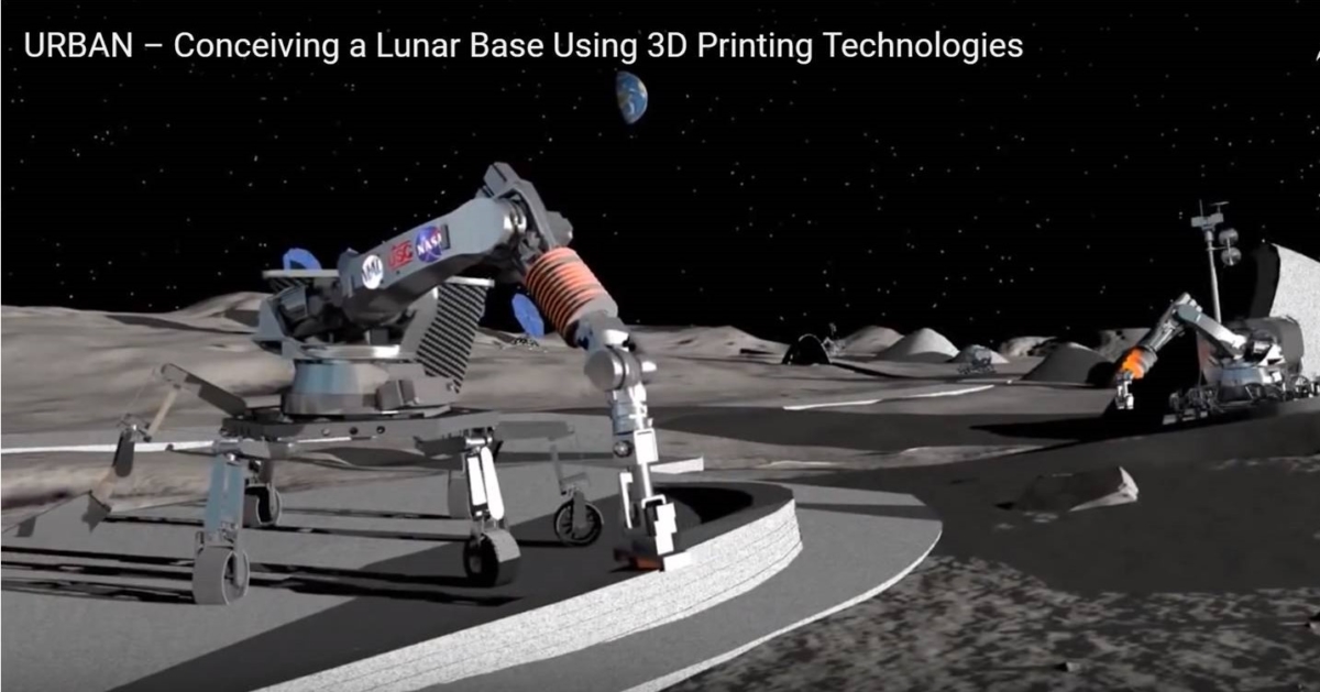
The European Space Agency (ESA) is moving forward on its Moon base plans, recently funding the study “Conceiving a Lunar Base Using 3D Printing Technologies” to the URBAN consortium.
Credit: NASA/ESA/URBAN Consortium
This new ESA-led project investigated the ways that 3D printing could be used to create and run a habitat on the Moon. Everything from building materials to solar panels, equipment and tools to clothes, even nutrients and food ingredients can potentially be 3D printed.
URBAN is an eleven-month study conducted by four partners for ESA’s General Studies Program; it will finish this month, November 2018. The URBAN consortium is comprised of COMEX, LIQUIFER Systems Group and SONACA Space GmbH under the lead of OHB System AG.

Credit: ESA/URBAN Consortium
3-phase approach
This new work focused on the feasibility and implementation effort of using Additive Layer Manufacturing in the construction, operations and maintenance of a lunar base.
A thorough exploration of state-of-the-art 3D-printing processes and associated printing materials for each process is conducted, with a specialized interest in identifying materials that already exist on the Moon, or that can be recycled from the spacecraft arriving from Earth.
Credit: ESA/URBAN Consortium
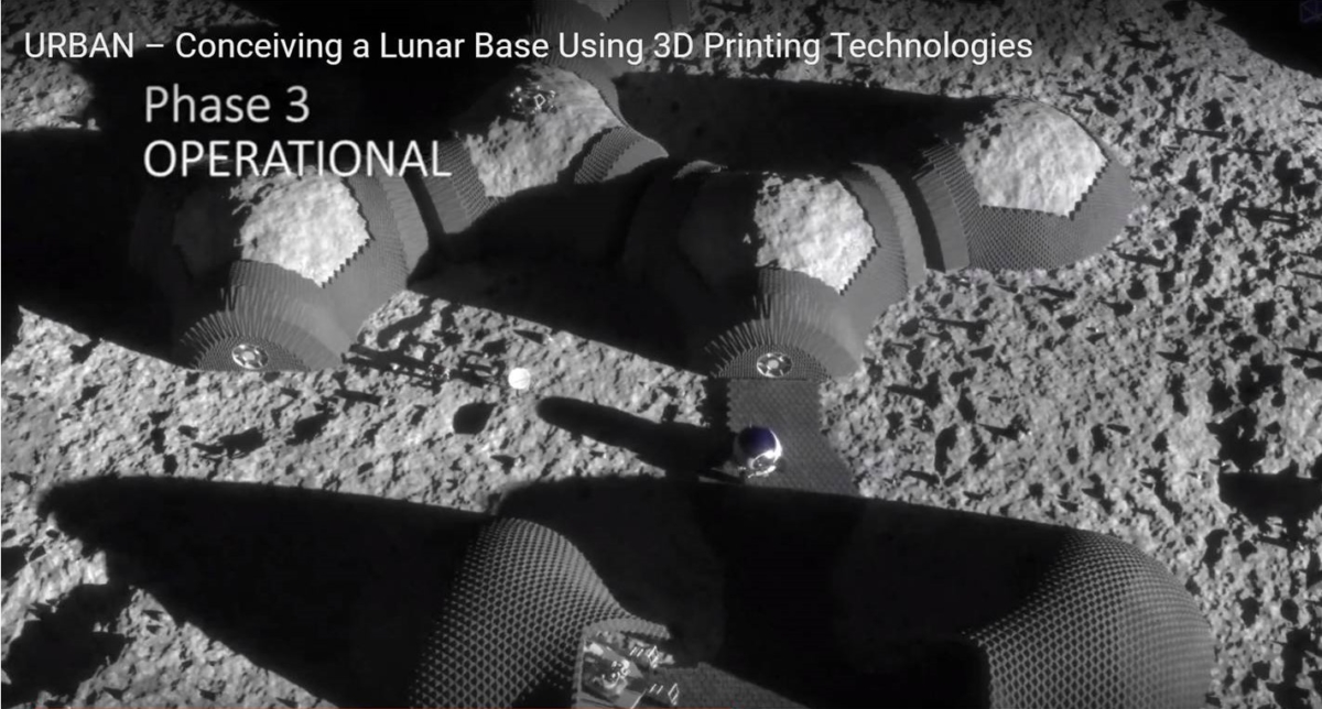
The overall goal of the project is devising a plan for reducing the up-launch requirements for building and maintaining a growing lunar base.
Credit: ESA/URBAN Consortium
The outcome of the study is a searchable database – which provides a matrix for understanding the concurrences and potential overlaps in
the independent variables: (1) items required for 3-phase lunar base, (2) advanced manufacturing technologies, (3) materials.
Go to this informative video at:
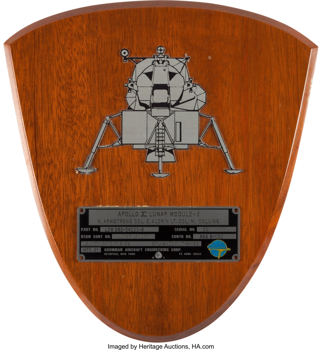
Credit: Neil Armstrong Family Collection/Heritage Auctions
A space memorabilia auction featuring The Neil Armstrong Family Collection™ realized more than $7.4 million Saturday, Nov. 3, at Heritage Auctions in Dallas, Texas.
Armstrong’s personally owned memorabilia – spanning a childhood letter to the Easter Bunny to the Apollo 11 ID Plate from the module he used to become the first person to walk on the Moon – sold for $5.2 million.
First of three auctions
The sale is the first of three auctions scheduled through 2019 of the legendary astronaut’s lifelong collection.
The Armstrong Family Collection™ is an extraordinary archive, chronicling the life and career of one of the most historic figures of the 20th century through the lens of the objects he loved, collected, and preserved for decades. Much of the Apollo 11 Mission Commander’s collection had never before been seen by the public or offered for sale.
Armstrong’s personal Spacecraft ID plate from Apollo 11’s Lunar Module Eagle, flown on the first manned lunar landing, July 16-24, 1969, sold for $468,500.
The Largest Size American Flag, measuring 17-3/4 inches by 11-1/2 inches, Armstrong kept as a treasured Apollo 11 souvenir, sold for $275,000.
Wright stuff
Two evocative relics commemorating mankind’s command of the air, a piece of the propeller and section of the wing fabric from Orville and Wilbur Wright’s invention of the first successful airplane, sold for $275,000 each. The relics from the Wright Brother’s historic flight were carried to the Moon just 66 years later when Armstrong’s made his footprint on the lunar surface.

Credit: Neil Armstrong Family Collection/Heritage Auctions
Armstrong’s light blue owned and worn Gemini flight suit, a rare, surviving memento of his legendary work on the Project Gemini program soared to $109,375, more than five times its $20,000 pre-auction estimate.
Authentication guaranty
To preserve and document the collection’s authenticity and provenance for generations to come, the Armstrong family and Heritage collaborated with Collectibles Authentication Guaranty (CAG) to accurately attribute and certify every item.
The unique Gemini 8 Flown 14 karat Gold Pin, Armstrong gave to his wife Janet, which he carried to space in a small Personal Preference Kit, sold for $17,500.
A Crayon Coloring of Flowers, from the first grade with a note from his mother, sold for $15,000.
Credit: Neil Armstrong Family Collection/Heritage Auctions
A lifelong supporter of the Boy Scouts, Armstrong’s Own Scouts Flat Field Hat sold for $12,000.
A Handwritten Letter to the Easter Bunny, possibly the earliest signed item ever offered from Neil Armstrong, sold for $4,000.
Heritage Auctions’ presentation of The Neil Armstrong Family Collection™ Part II is May 9-10, 2019, with a third and final sale set for November 2019.
For more information, go to:
https://historical.ha.com/c/auction-home.zx?saleNo=6206&type=surl-6206a
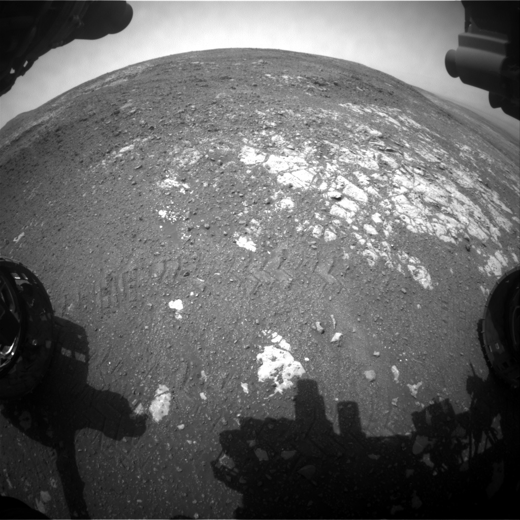
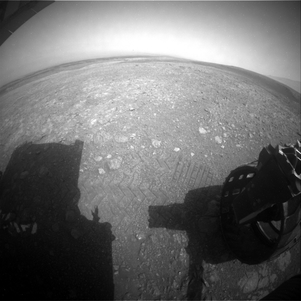
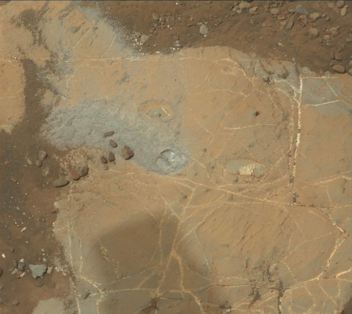
Curiosity Front Hazcam Left A image acquired on Sol 2219, November 3, 2018.
Credit: NASA/JPL-Caltech
NASA’s Curiosity Mars rover has just begun Sol 2220 science operations.
Reports Kristen Bennett, a planetary geologist for the USGS in Flagstaff, Arizona, the robot has made a drive for the first time since Sol 2166.
“Our intrepid explorer is truly back at it after a few weeks off due to the anomaly. The short drive — also called a bump — placed us in a workspace a few meters away from our previous location where we had attempted to drill,” Bennett says.
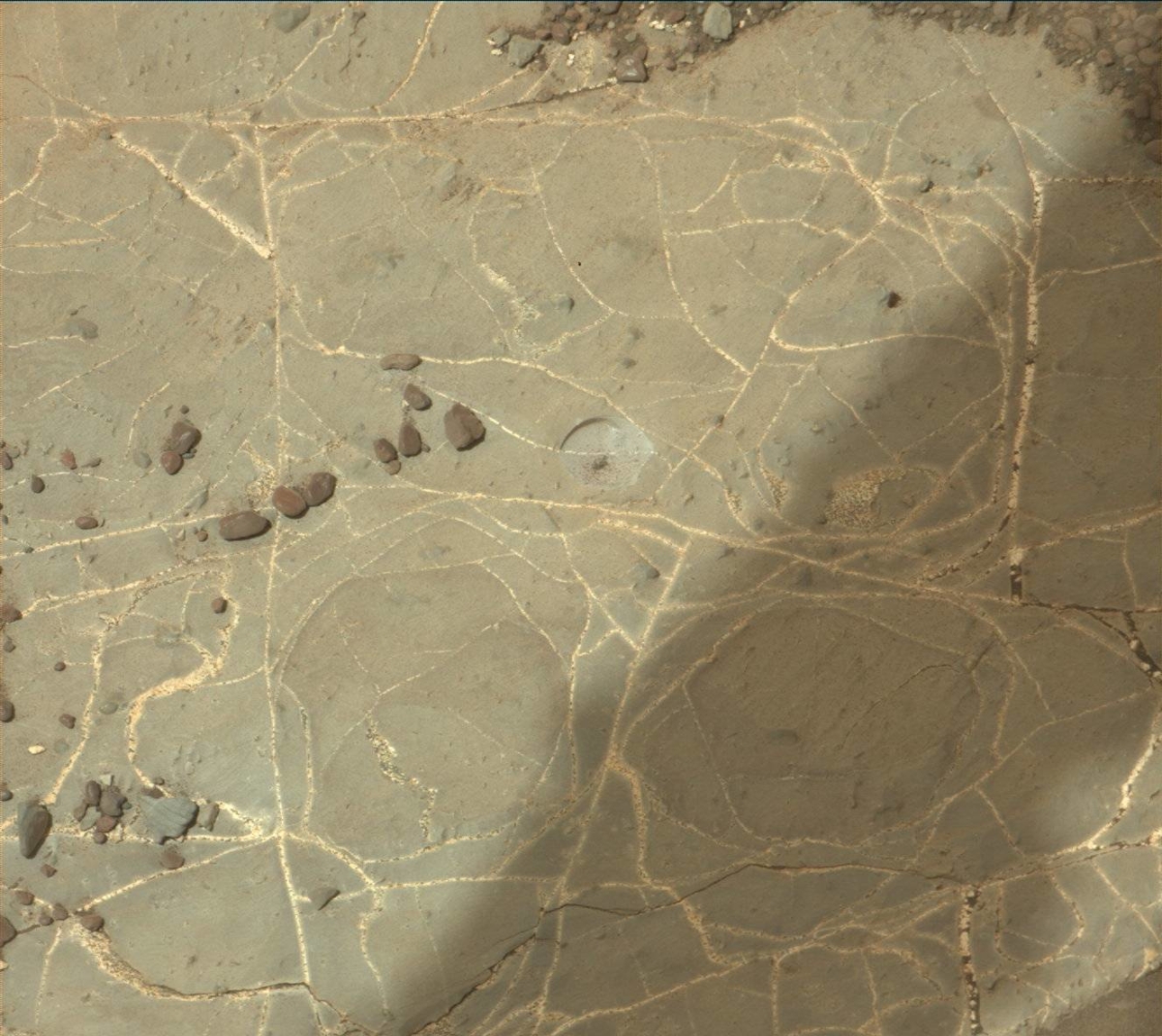
Curiosity Rear Hazcam Left A photo taken on Sol 2219, November 3, 2018.
Credit: NASA/JPL-Caltech
Weekend plan
“In this weekend’s three-sol plan there will be several diagnostic activities that will help us to understand the anomaly,” Bennett says, and in addition to the diagnostics, the weekend plan includes Chemistry and Camera (ChemCam) and Mastcam observations of “Dryden” and “Kirkness,” which are bedrock targets, and of “Housay,” which is a vein within the bedrock.
Also included in the extensive plan is a Mastcam observation of “Eynhallow” to document laminations within the bedrock, a Mars Descent Imager (MARDI) image, and a Navcam dust devil survey.
Curiosity Mastcam Left image acquired on Sol 2218, November 2, 2018.
Credit: NASA/JPL-Caltech/MSSS
Sky flats
There are ChemCam Remote Micro-Imager (RMI) Zenith Sky Flats scheduled on the first sol of the plan.
“In this activity ChemCam will take images looking up at the sky,” Bennett says. “This activity needs to happen near sunset because ChemCam should not look directly at the sun. These sky flats help us determine whether there is any dust contamination on ChemCam’s optical window, which is important right now because Mars just experienced a global dust event.”
Curiosity Mastcam Right photo acquiredd on Sol 2218, November 2, 2018.
Credit: NASA/JPL-Caltech/MSSS
Another drive slated
On the second sol of the plan, Curiosity’s Alpha Particle X-Ray Spectrometer (APXS) and Mars Hand Lens Imager (MAHLI) observations of two targets are on tap: “Calgary” and “Findon.”
Calgary is typical gray bedrock, and this target will be brushed with the Dust Removal Tool (DRT) prior to the MAHLI and APXS measurements.
On the plan’s third sol, the robot will drive towards Lake Orcadie, Bennett notes, “and next week we plan to start our drill campaign in the gray colored rocks at that location!”
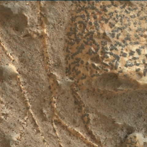
Dark inclusions
In another report, Sarah Lamm, a planetary geologist at Los Alamos National Laboratory in New Mexico, notes “Grange 2218” was targeted for more measurements, “so we have more information on the dark inclusions.”
Those odd inclusions have drawn comment from some researchers, wondering if they offer some clues to astrobiology on the Red Planet.
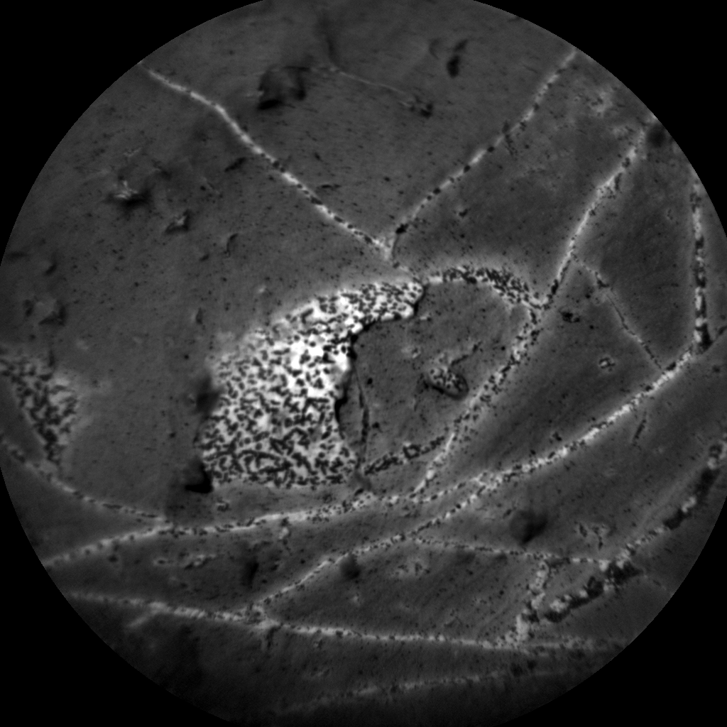
Curioisty ChemCam Remote Micro-Imager photo taken on Sol 2218, November 2, 2018.
Credit: NASA/JPL-Caltech/LANL
MAHLI image produced on Sol 2217, November 1, 2018.
Credit: NASA/JPL-Caltech/MSSS
Curiosity Navcam Left A image taken on Sol 2218, November 2, 2018.
Credit: NASA/JPL-Caltech
NASA’s Curiosity Mars rover is now wrapping up Sol 2218 tasks.
Curiosity Navcam Left A image taken on Sol 2218, November 2, 2018.
Credit: NASA/JPL-Caltech
Sol 2217 marked a return to contact science activities after a Curiosity memory anomaly complicated rover activities back on Sol 2172.
Poised to measure
Reports Lucy Thompson, a planetary geologist from the University of New Brunswick, Fredericton, New Brunswick, Canada, when the anomaly occurred, the robot’s Alpha Particle X-Ray Spectrometer (APXS) was poised to measure the composition of the freshly exposed “Inverness” bedrock surface.
This was to occur after an unsuccessful drill attempt on Sol 2170 to compare with the previously brushed surface and other fresh rock surfaces examined by APXS on the Vera Rubin Ridge.
Interesting target
A recently scripted plan is to recover this measurement, with accompanying Mars Hand Lens Imager (MAHLI) imaging, as well as to get chemical and textural data (with APXS and MAHLI) on another interesting target in the workspace, “Grange.”
Mars Hand Lens Imager (MAHLI) image produced on Sol 2218, November 2, 2018. MAHLI is located on the turret at the end of the rover’s robotic arm.
Credit: NASA/JPL-Caltech/MSSS
Thompson adds that “Grange appears to be an area of bright calcium sulfate (commonly observed as veins cross-cutting bedrock encountered throughout the mission), but with small, dark inclusions that might have an interesting composition.”
MAHLI image produced on Sol 2217, November 1, 2018.
Credit: NASA/JPL-Caltech/MSSS
Multispectral observations
Also planned is a Chemistry and Camera (ChemCam) investigation of a bedrock target tagged “Clune” with accompanying Mastcam imaging, as well as Mastcam imaging of an interesting area of rougher textured rock “Ayr” and multispectral Mastcam observations of the “Inverness” area.
The plan is rounded out with some environmental monitoring activities including a passive measurement using the Dynamic Albedo of Neutrons (DAN) and use of the Rover Environmental Monitoring Station (REMS).
Curioisty ChemCam Remote Micro-Imager photo taken on Sol 2218, November 2, 2018.
Credit: NASA/JPL-Caltech/LANL
New drive, drilling scheduled
“I am looking forward to getting the data down from these observations and comparing the chemistry and textures of these rocks with other rock targets encountered on the Vera Rubin Ridge,” Thompson explains. “The chemistry and textures can provide clues to the conditions the sediments were deposited in as well as subsequent events such as diagenesis (as the sediment is buried, compacted and cemented and turned into a rock), and later alteration.”
Looking ahead, Thompson points out that Curiosity is hoping to soon drive away from the current site towards an area, “Lake Orcadie,” “where we will attempt another drill into one of these interesting bright grey areas identified from orbit on the Vera Rubin Ridge.”
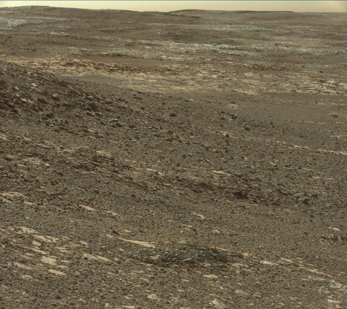
Curiosity Mastcam Right image taken on Sol 2171, September 14, 2018
Credit: NASA/JPL-Caltech/MSSS
NASA’s Curiosity Mars rover has just begun Sol 2217 science activities.
Melissa Rice, a planetary geologist at Western Washington University in Bellingham, Washington, reports that the full Curiosity science team is back in swing of things following the rover’s anomaly back on Sol 2172.
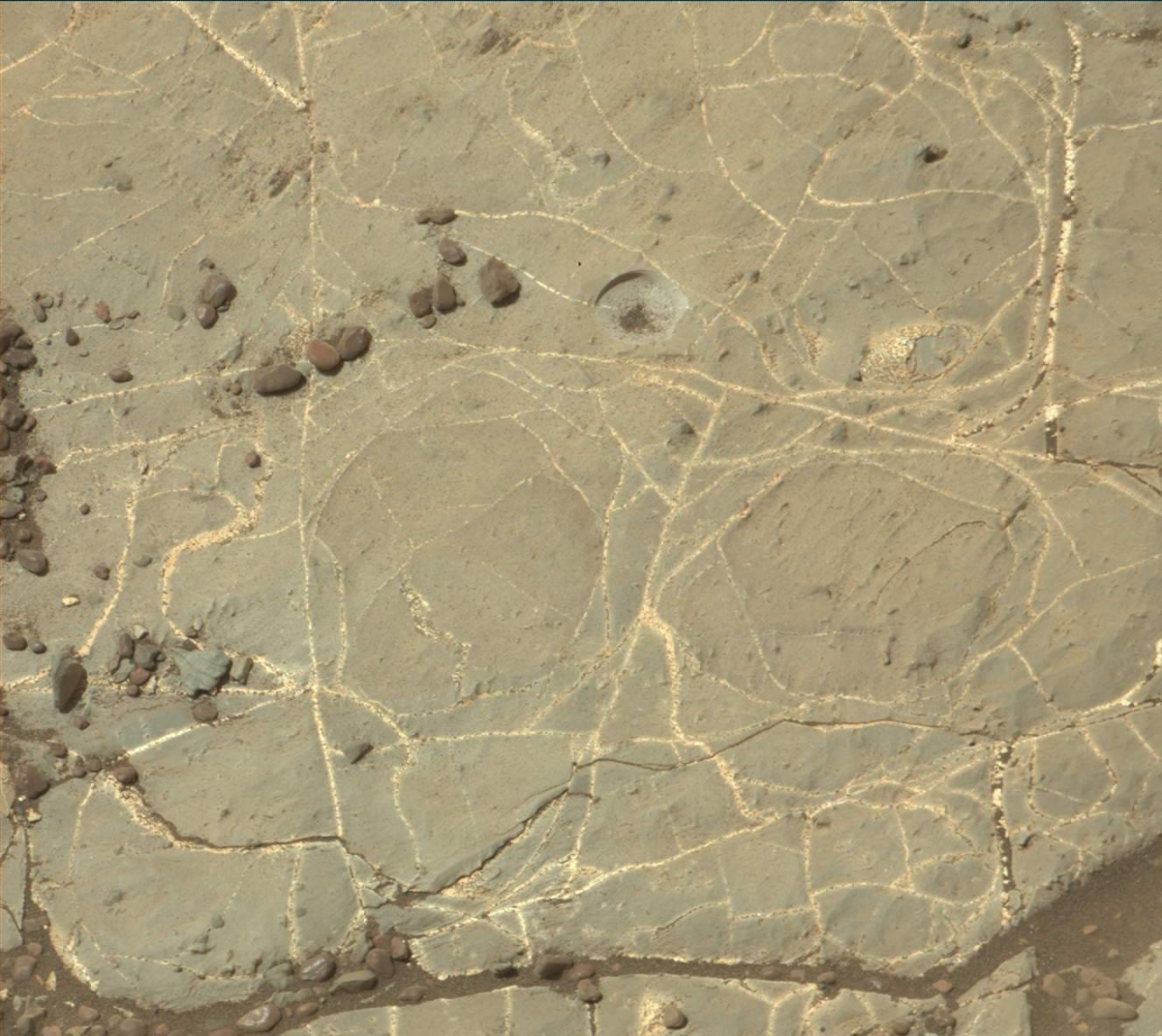
Curiosity Mastcam Right photo acquired on Sol 2211 October 25, 2018.
Credit: NASA/JPL-Caltech/MSSSNASA’s
“It has been over a month since we last looked at the ‘workspace,’ the region in front of the rover that the arm can reach,” Rice says, “and there were some surprises in store for us!”
Wind sweep
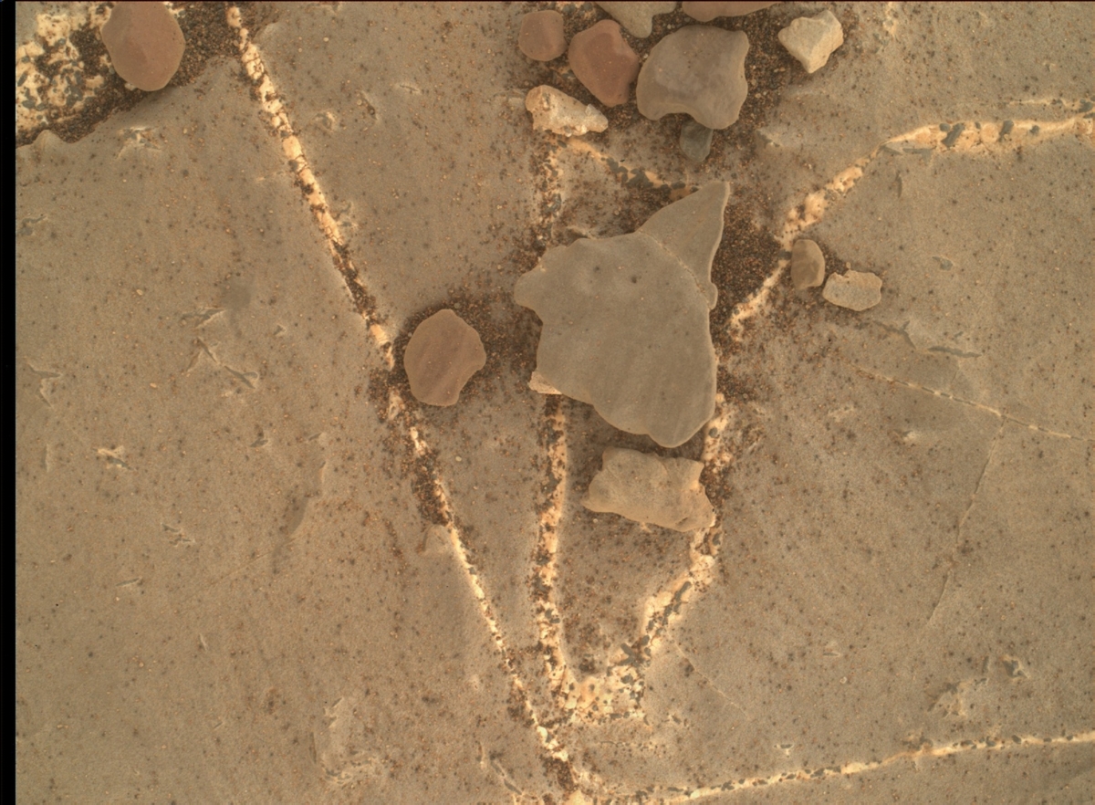
Prior to the robot’s anomaly, the rock eyed by Curiosity was covered with gray-colored tailings from a failed attempt to drill the “Inverness” target, however, those tailings are now gone – and so is a lot of the dark brown soil and reddish dust.
“So while Curiosity has been sitting still, the winds have been moving, sweeping the workspace clean,” Rice adds.

Curiosity Front Hazcam Left A image taken on Sol 2216, October 31, 2018.
Credit: NASA/JPL-Caltech
Later this week, the plan calls for Curiosity to take advantage of this freshly-scrubbed surface by taking close-up Mars Hand Lens Imager (MAHLI) images of fine details in the rock, including the light-toned veins crisscrossing the outcrop that are peppered with interesting dark inclusions.
Curiosity Navcam Right A image acquired on Sol 2214, October 29, 2018.
Credit: NASA/JPL-Caltech
Ripple field
As the science team eased back into science operations, on the plan is taking MAHLI images with the cover open and closed to inspect how much dust is on the cover, a MAHLI image of the Rover Environmental Monitoring Station (REMS) ultraviolet sensor, a Chemistry and Camera (ChemCam) observation of the vein target “Grange,” and some Mastcam images of the nearby ripple field “Sandend” to look for more changes due to the wind.
Curiosity Navcam Right A photo acquired on Sol 2214, October 29, 2018.
Credit: NASA/JPL-Caltech
As a long-term planner, Rice explains there’s excitement for a new drive by Curiosity to a selected spot where it can successfully drill into the gray rock.
Concludes Rice: “Soon the wind won’t be the only thing moving around here!”
Credit: CSPS
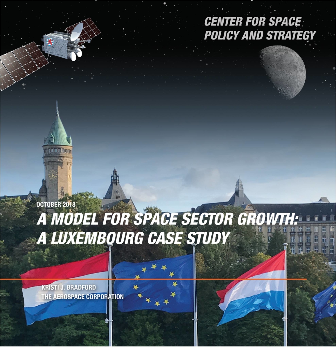
Luxembourg has demonstrated a successful five-point approach toward a unique space policy and strategy for space sector growth. How can the U.S. leverage the Luxembourg model to support other countries around the globe?
A new report from The Aerospace Corporation’s Center for Space Policy and Strategy (CSPS) has concluded that Luxembourg has taken a unique approach to space sector development, opting for a commercial-centric strategy rather than the traditional government-centric strategy.
Five points
Examination of Luxembourg’s approach to space reveals five keys points that can be extracted from it: commercial focus, risk tolerant, cross-cutting, international, and visible. These five points can be used as a model that others can use as guidance in starting or growing their space sectors.
The just-issued paper is authored by Kristi J. Bradford, a senior member of the technical staff in The Aerospace Corporation’s Space Architecture Department.
“With the rise of nations that have ambitions to diversify their national economies or grow their space capabilities, the U.S. public and private sectors have ample opportunity to provide support to these countries, which could open doors to many opportunities for the U.S. The Luxembourg five point model offers a potential framework for supporting foreign nations in their space capability development,” Bradford concludes.
The October 2018 paper — A Model for Space Sector Growth: A Luxembourg Case Study — is available at: https://aerospace.org/sites/default/files/2018-10/Bradford_Luxembourg_10242018.pdf
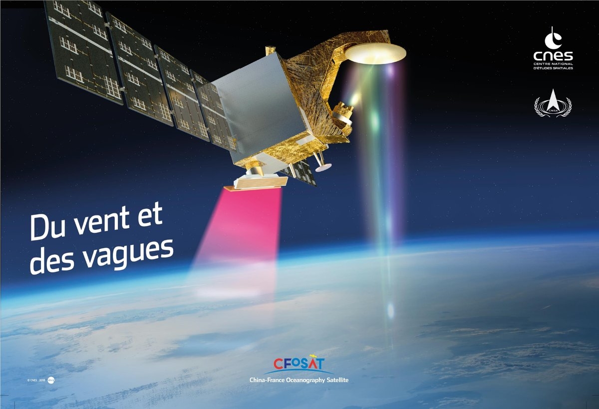
China-France Oceanographic Satellite (CFOSat)
Credit: CNES
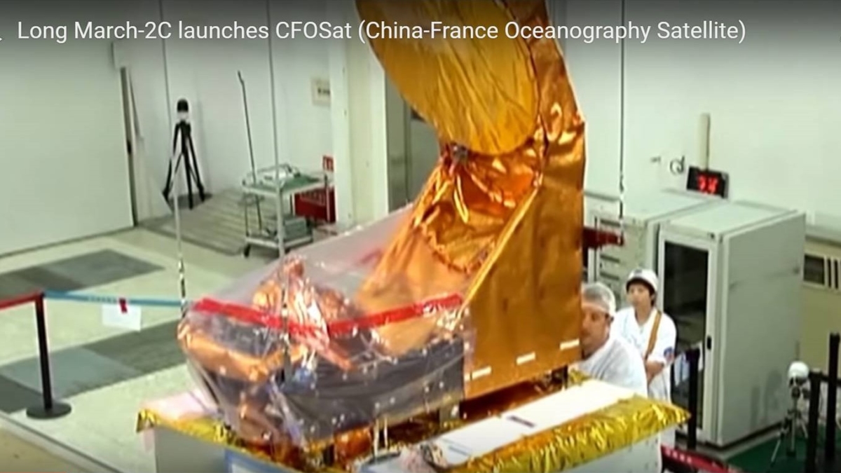
The China-France Oceanographic Satellite (CFOSat) was launched on October 29 by the Long March-2C carrier rocket from the Jiuquan Satellite Launch Center in northwest China’s Gobi Desert.
Jointly developed by the China National Space Administration (CNSA) and the Centre National d’Etudes Spatiales (CNES), the French space agency, CFOSat will conduct 24-hour observations of global wave spectrum, effective wave height and ocean surface wind field, according to the CNSA.

Long March-2C carrier rocket departs Jiuquan Satellite Launch Center in northwest China’s Gobi Desert.
Tidal patterns
The satellite carries an observation system with a French wavelength dispersive spectrometer designed to measure the direction and wavelength of ocean tidal patterns and a Chinese apparatus for monitoring wind strength and direction.
Chinese President Xi Jinping and French President Emmanuel Macron exchanged congratulatory letters, stressing the significance of the joint space project. Macron said in his message that the CFOSat launch marks an important step forward in bilateral space cooperation.
Credit: CCTV/Screengrab
Side-by-side
The effort was first conceived in 2005. In the 13 years since then, French and Chinese researchers have worked side-by-side to overcome a range of obstacles, according to China’s state-run CCTV.
“Both sides learn from each other and have gains in the cooperation. We reach a consensus on relevant procedures in such international cooperation, despite our differences in culture and tradition. That has created favorable conditions for our follow-up cooperation,” said Zhao Jian, deputy director of the systemic project department of China’s State Administration of Science, Technology and Industry for National Defense.
“Data acquired by the China-France Oceanography Satellite will be open to all the scientists and research institutes around the world so as to promote human research on the ocean,” said Zhao.
Video of launch can be viewed at:
https://youtu.be/RwPKzp3ScOQ?list=PLpGTA7wMEDFjz0Zx93ifOsi92FwylSAS3
Credit: China Central Television

