Author Archive

Credit: CNSA/CLEP
China’s Chang’e-4 farside lander/rover mission has been switched to “dormant mode” for the chilly lunar night.
The Lunar Exploration and Space Program Center of the China National Space Administration has also stated that the Yutu-2 rover has now chalked up 889 feet (271 meters) of wheeled exploration.
China’s Chang’e-4 probe was launched on Dec. 8, 2018, making the first-ever soft landing within the Von Kármán crater in the South Pole-Aitken Basin on the farside of the Moon on January 3, 2019.

Chang’e-4 farside mission – lander and Yutu-2 rover
Credit: CNSA/CLEP
Eighth lunar day
According to China’s Xinhua news agency, during the eighth lunar day of the Moon mission, the scientific instruments on the lander and rover worked well, and a new batch of scientific detection data were sent to the core research team for analysis.
A lunar day equals 14 days on Earth. A lunar night is the same length. The Chang’e-4 probe switches to dormant mode during the lunar night due to lack of solar power, adds the Xinhua story.

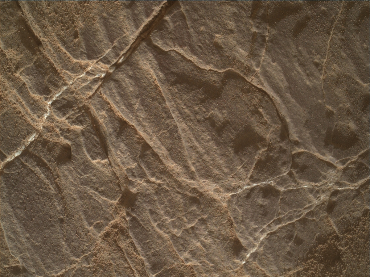
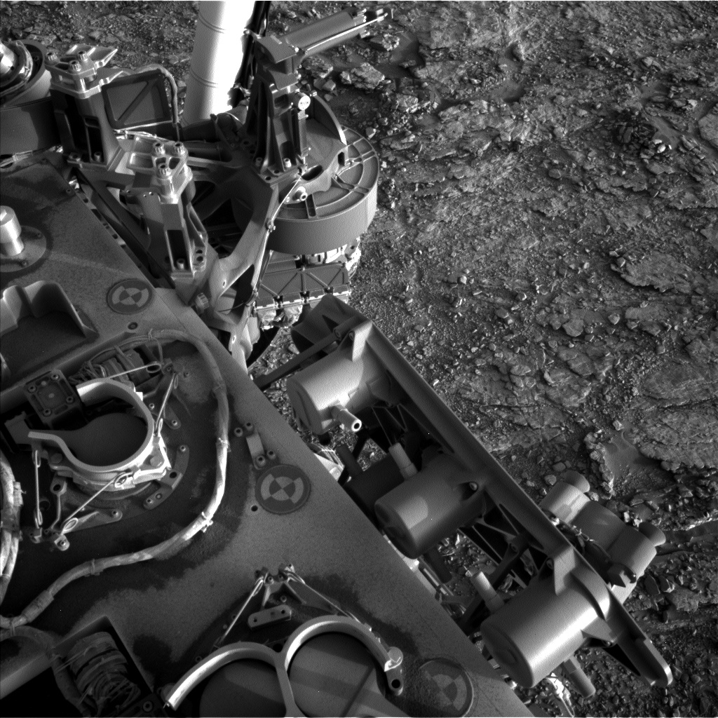
Curiosity Mastcam Right image taken on Sol 2486, August 4, 2019.
Credit: NASA/JPL-Caltech/MSSS
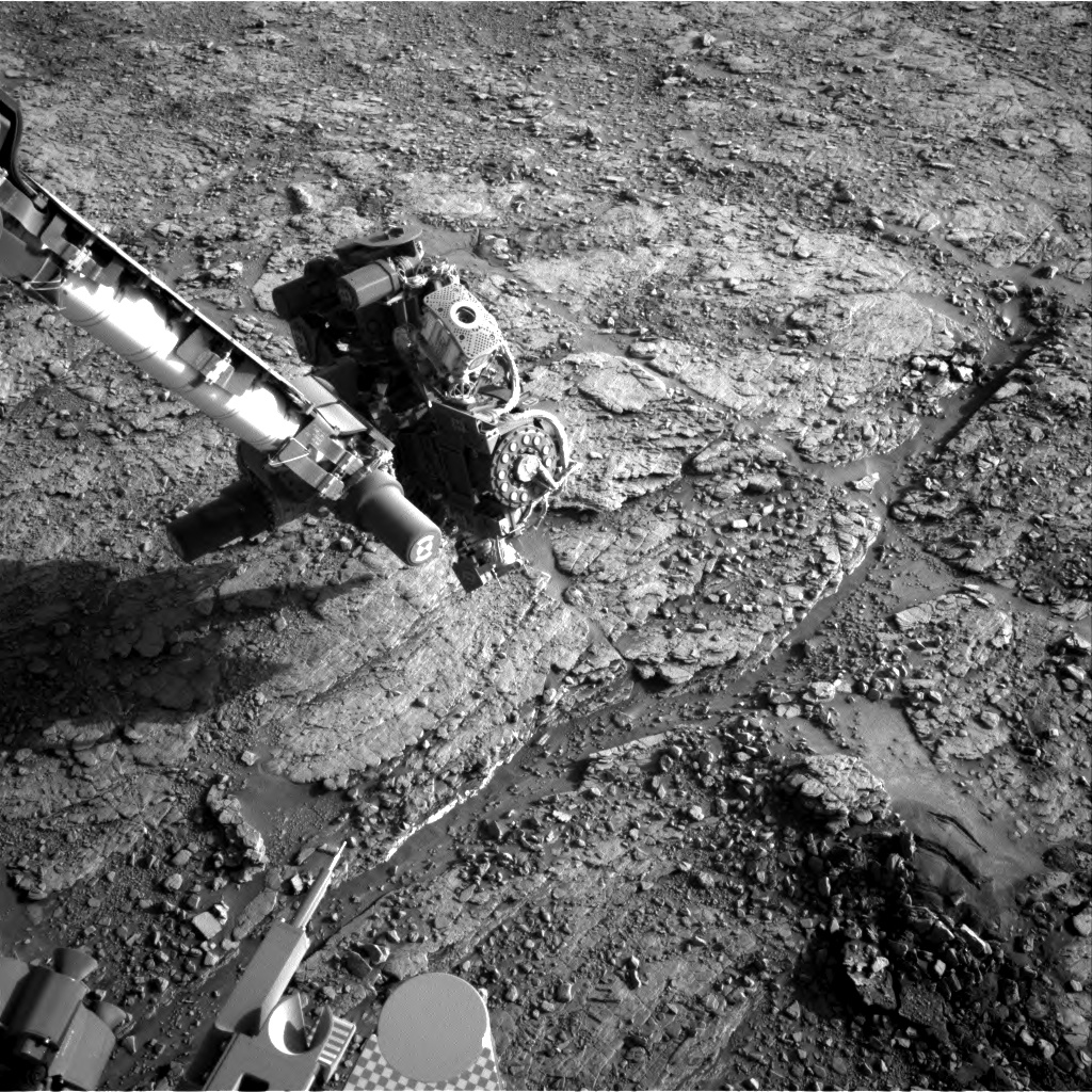
NASA’s Curiosity Mars rover is now performing Sol 2488 duties and there’s now official word on Curiosity Mars rover’s recent success.
On Sunday morning the team received the message that Curiosity’s latest drill hole was successful at “Glen Etive.” This is the 22nd full-depth drill hole on Mars, and we can celebrate its success on this final day of Earth-year 7 of the mission,” reports Roger Wiens, a geochemist at Los Alamos National Laboratory in New Mexico.
Clay unit: 3rd hole
Wiens adds that “Glen Etive” is the third hole in the clay unit. The other two holes, “Kilmarie” and “Aberladie,” were drilled near each other in April at a lower stratigraphic position.
This hole was achieved with no percussion, Wiens adds, and its depth is greater than 4 centimeters.

Curiosity Front Hazcam Left B image taken on Sol 2488, August 6, 2019.
Credit: NASA/JPL-Caltech
Tailings from the drill hole will be used for analyses of this outcrop by the robot’s Sample Analysis at Mars (SAM) Instrument Suite and its Chemistry & Mineralogy X-Ray Diffraction/X-Ray Fluorescence Instrument (CheMin), as well as the Mars Hand Lens Imager (MAHLI).
Hole-Mars observations
Wiens reports that Curiosity’s ChemCam will attempt to shoot down into the drill hole to analyze the rock layers on the wall of the hole. The drill hole is the size of a dime, he notes.
“These are fresh rock surfaces and should generally represent the same material that SAM and CheMin analyze. It is dark in the hole, so the autofocus feature of ChemCam is significantly challenged,” Wiens adds. “Getting a good image down the hole requires overexposing the other parts of the image so we can see better in the dark part of the hole.”

Curiosity Navcam Right B image acquired on Sol 2488, August 6, 2019.
Credit: NASA/JPL-Caltech
Sample material
The robot’s arm will be busy with drill portion characterization. The activity creates “test portions” in order to make sure that there is sample material in the drill and that the portions are of the expected amount (for instrument safety), Wiens points out.
“One is delivered to the ground and two to the back of the closed SAM inlet cover. The latter is the best ‘rehearsal’ for dropping portions to the instruments, since it also allows us to gauge the amount of deflection by wind at the height of the rover deck. Mastcam images are used for documentation in all cases,” Wiens adds.

Curiosity Surveys ‘Teal Ridge’: This panorama of a location called “Teal Ridge” was captured on Mars by the Mast Camera, or Mastcam, on NASA’s Curiosity rover on June 18, 2019, the 2,440th Martian day, or sol, of the mission.
Credit: NASA/JPL-Caltech/MSSS.
Slip check
Lastly, the robot’s Mastcam is slated to also take a mosaic of the area around the drill hole, and ChemCam will shoot one additional nearby target, “Argyll.” The Hazcams will take images for a slip check of the rover.
Wiens concludes by noting that the robot’s Navcam will do a dust-devil movie and a horizon movie to look for clouds. Curiosity’s Radiation Assessment Detector (RAD), the Rover Environmental Monitoring Station (REMS), and the Dynamic Albedo of Neutrons (DAN) onboard the rover will also take data.

Space 2.0: How Private Spaceflight, a Resurgent NASA, and International Partners are Creating a New Space Age by Rod Pyle; BenBella Books, Dallas, Texas; paperback: 320 pages, $21.95.
This is a well-researched, well written, and handsomely illustrated volume by well-known space expert and historian, Rod Pyle. Documented in its pages is the flourishing, new era in space exploration – where humanity is headed and why.
Space 2.0 is divided into 18 sweeping and excellent chapters, a collective that space-aged as well as newbies will find top-notch reflection and a well-spring/vortex of what next. This book has been done in collaboration with the National Space Society, an organization that continues to help shape long-term plans for exploration, utilization, and settlement. Pyle is also editor of the Society’s Ad Astra magazine.
Of particular value is the book’s look at the burgeoning space entrepreneurial community. As Pyle explains, “there are many investors, both large and small, eager to finance the people creating Space 2.0 and expanding its horizons.”
As Pyle also makes clear: “We are now in a far better position to embark upon a sustainable program of human spaceflight and space development, and toward a permanent, robust human presence off Earth that will offer wide-ranging benefits for everyone who participates, directly or indirectly.” All that duly noted, welcome to Space 2.0.
In this volume there’s no room for pessimism! Today, in the United States and other spacefaring countries, humankind is embarking on a new space age, Pyle reports. This profound time in history will surely lead to settlement beyond our home planet, and the author expertly guides the reader along on this weighty and wonderful trajectory.
Space 2.0 is must reading. You’ll find great solace about humanity’s hunger – past and future tense — to shoot for the stars.
For more information on this book, go to:
https://www.benbellabooks.com/shop/space-2-0/

Geologist Harrison Schmitt performs Moon tasks during Apollo 17 mission in December 1972.
Credit: NASA
A new study has determined that the Moon is significantly older than previously believed. Earlier research had estimated the Moon to have formed approximately 150 million years after the solar system’s formation.
This new finding has been spearheaded by Earth scientists at the University of Cologne’s Institute of Geology and Mineralogy, constraining the age of the Moon to roughly 50 million years after the formation of the solar system – 4.56 billion years ago.
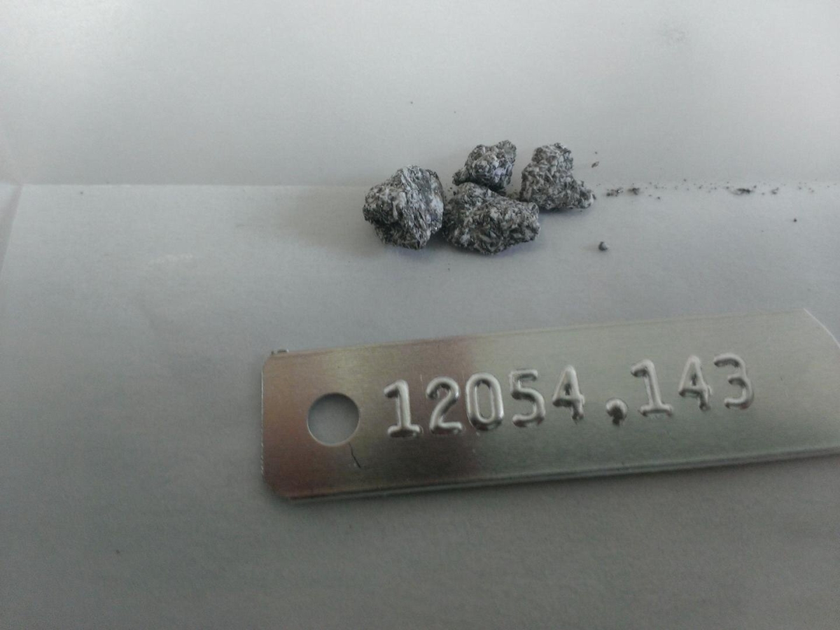
Apollo 12 sample is an ilmenite basalt. It has glass on it, deposited by the splash of material when another basalt was struck by an impactor. Samples like 12054 allow scientists to reconstruct the history of the Moon with the stories they tell.
Credit: Maxwell Thiemens
Range of samples
To achieve these results, the scientists analyzed the chemical composition of a diverse range of samples – nearly 30 specimens — collected during the Apollo lunar landing missions.
Determining the age of the Moon is also important to understand how and at which time the Earth formed, and how it evolved at the very beginning of the solar system.
Earth’s Moon is likely to have formed in the aftermath of a giant collision between a Mars-sized planetary body and the early Earth. Over time, the Moon accreted from the cloud of material blasted into Earth’s orbit.

Earth’s Moon continues to surprise.
Credit: NASA
The newborn Moon was covered in a magma ocean, which formed different types of rocks as it cooled. These time capsules have recorded information about the formation of the Moon, and are found today on the lunar surface.
Natural radioactive clock
The Cologne scientists used the relationship between the rare elements hafnium, uranium and tungsten as a probe to understand the amount of melting that occurred to generate the Moon’s mare basalts, i.e., the black regions on the lunar surface. The study could identify distinct trends amongst the different suites of rocks, which now allows for a better understanding of the behavior of these key rare elements.
According to a University of Cologne press statement:
“Studying hafnium and tungsten on the Moon are particularly important because they constitute a natural radioactive clock of the isotope hafnium-182 decaying into tungsten-182. This radioactive decay only lasted for the first 70 million years of the solar system. By combining the hafnium and tungsten information measured in the Apollo samples with information from laboratory experiments, the study finds that the Moon already started solidifying as early as 50 million years after solar system formed.”

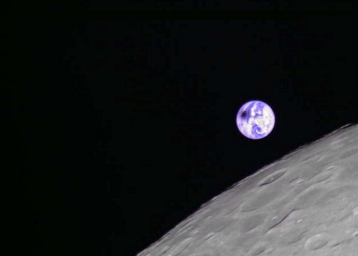
Credit: JAXA/NHK
Timing and evolution
Maxwell Thiemens, former University of Cologne researcher and lead author of the study notes: “Mankind’s first steps on another world exactly 50 years ago yielded samples which let us understand the timing and evolution of the Moon. As the Moon’s formation was the final major planetary event after Earth’s formation, the age of the Moon provides a minimum age for Earth as well.”
The study — Early Moon formation inferred from hafnium-tungsten systematics — was published in the journal Nature Geoscience.
More information about this research paper can be found here:

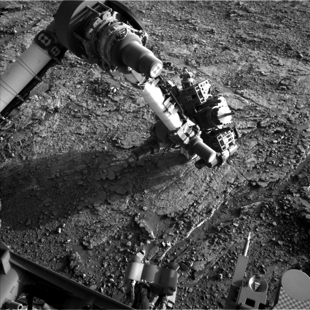
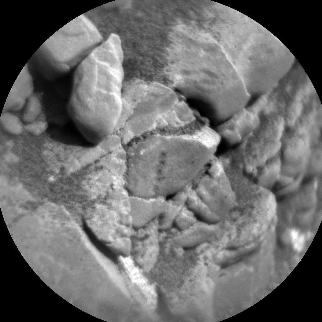
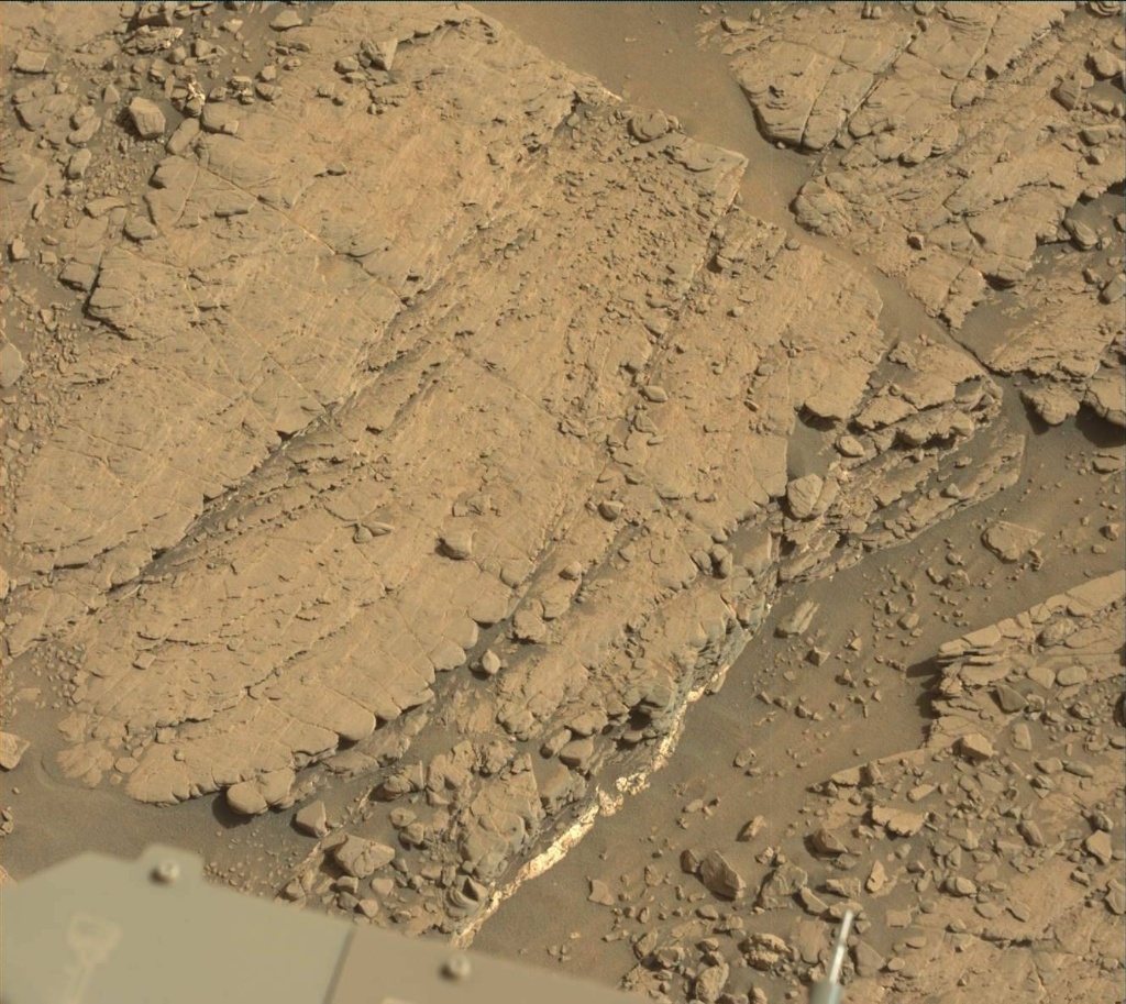
Roughly 35 centimeter standoff Mars Hand Lens Imager (MAHLI) photo of the Glen Etive 1 target after brushing and the preload test. Photo produced on July 31, 2019, Sol 2482.
Credit: NASA/JPL-Caltech/MSSS
NASA’s Curiosity Mars rover is now performing Sol 2485 duties.
“We are go for drilling at Glen Etive 1,” reports Lucy Thompson, a planetary geologist at University of New Brunswick.

Curiosity MAHLI photo produced on Sol 2484, August 2, 2019.
Credit: NASA/JPL-Caltech/MSSS
Scientists have received the results of the Alpha Particle X-Ray Spectrometer (APXS) and Chemistry and Camera (ChemCam) compositional analysis of the prospective drill target, as well as the Mars Hand Lens Imager (MAHLI) imaging of the area both before and after a preload test.
Curiosity MAHLI photo produced on Sol 2484, August 2, 2019.
Credit: NASA/JPL-Caltech/MSSS
Force of drilling
“The preload test is exactly what it sounds like; exerting a load onto the surface bedrock to check that it can withstand the force of drilling,” Thompson explains. “The engineers and science team assessed the results of these analyses and concluded that it is safe to drill the Glen Etive target. Therefore, the weekend plan is dominated by the drill activity, which will take place on the second sol of the plan.”

Curiosity Navcam Left B photo acquired on Sol 2483, August 1, 2019.
Credit: NASA/JPL-Caltech
The robot managed to fit in some environmental science and a Mastcam 360°mosaic of its surrounding terrain on the first sol of the plan to provide context for our drill site, Thompson notes, “prior to the rover going to sleep in order to recharge itself for the power intensive drilling.”
Curiosity Rear Hazcam Left B photo taken on Sol 2484, August 2, 2019.
Credit: NASA/JPL-Caltech
Post-drill
The environmental observations include a ChemCam passive sky observation, a rear Hazcam dust devil movie, a Mastcam crater rim extinction and basic tau pointed towards the sun.
“We filled a post-drill science block with geological observations. These include observations of what will hopefully be a new drill hole and associated tailings on Mars, with ChemCam passive spectroscopy and remote microscopic imaging as well as Mastcam multispectral imaging,” Thompson reports.
Curiosity’s ChemCam will also continue to investigate the variation in chemistry of the bedrock in the vicinity of the drill target, firing its laser at the “Clarkly Hill” target. Mastcam will document the ChemCam target.
Curiosity ChemCam Remote Micro-Imager photo acquired on Sol 2484, August 2, 2019.
Credit: NASA/JPL-Caltech/LANL
Environmental monitoring
Curiosity is slated to wake up and carry out an early morning science block with some more environmental monitoring including a Mastcam full tau pointed towards the sun, a Navcam zenith movie, suprahorizon movie, line of sight image and 360°sky survey.
Standard background Radiation Assessment Detector (RAD), Dynamic Albedo of Neutrons (DAN) and Rover Environmental Monitoring Station (REMS) passive measurements are also planned.
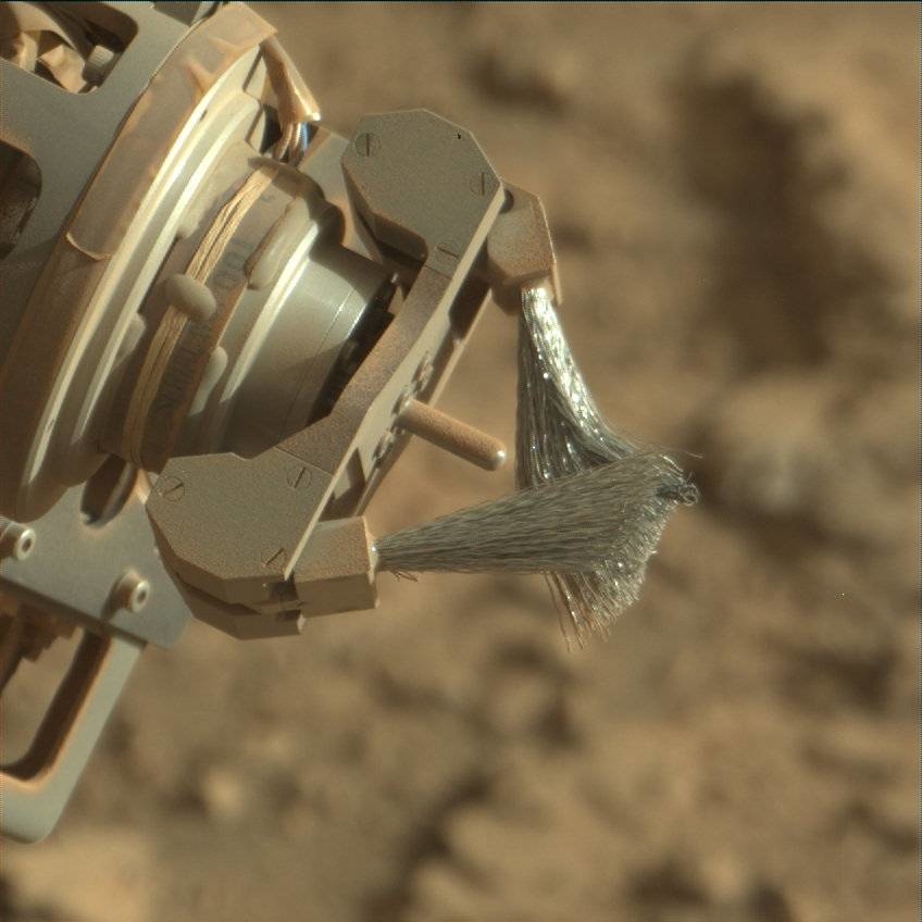
Curiosity Mastcam Right photo of dust removal brush taken on Sol 2483, August 1, 2019.
Credit: NASA/JPL-Caltech/MSSS
22nd drill hole
“Everyone on the team will be eagerly awaiting the first downlinked data after the drill activity, to see if we have our 22nd drill hole on Mars destined for Curiosity’s analytical lab,” Thompson points out.
If successful, next week should see drop off of sample to the robot’s Chemistry & Mineralogy X-Ray Diffraction/X-Ray Fluorescence Instrument (CheMin), Thompson concludes, and the preliminary mineralogical results, which Mars researchers can compare with previous drill holes within Glen Torridon and the Murray formation.

Illustration shows examples of an Earth-Moon “transportation network,” a key architectural element for access throughout cislunar space.
Credit: Purdue University image/Kate Starr
Transforming cislunar space into an economic wellspring is in the sights of a new university-based initiative.
Purdue University’s Cislunar Initiative is geared to evaluating access to cislunar space, supplying the building blocks for infrastructure, identifying and utilizing space resources, advancing the development of space policy and providing critical educational opportunities.
The “cislunar region” is the orbital area encompassing the Earth and the Moon.

David Spencer, associate professor in the School of Aeronautics and Astronautics, leads the Cislunar Initiative.
Credit: Purdue University
50-year time horizon
Leader of the Initiative is David Spencer, associate professor in the School of Aeronautics and Astronautics. “The Cislunar Initiative aims to conceive, design, and enable the utilization of cislunar space over a 50-year time horizon,” Spencer notes in a university statement.

Exploration of south pole crater. Water ice-rich resource ready for processing?
Credit: NASA
There are five objectives formulated to accelerate the development of a cislunar region’s economy, Spencer explains:
— Advancing access to space, enabling frequent and sustained transportation to and within the cislunar environment.
— Envisioning and enabling the infrastructure that provides the necessary support for cislunar space exploration and development through a strong university-industry-government collaborative approach.
— Identifying and utilizing space resources and materials.
— Leading in the areas of space policy, economics and space defense.
— Initiating K-12 educational programs and courses, professional development, internships, co-ops and a Purdue curriculum for the future leaders in cislunar development.
Resources
Go to the Cislunar Initiative website at:
Also, go to this informative video that focuses on the Initiative:
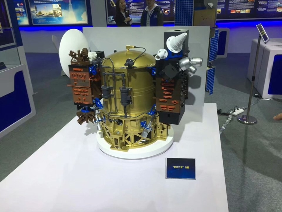
Credit: Harbin Institute of Technology
China’s micro lunar orbiter — Longjiang-2 (also known as DSLWP-B) – crashed into the Moon’s farside on July 31 (Beijing Time), reports the Lunar Exploration and Space Program Center of the China National Space Administration.
Weighing 104 pounds (47 kilograms) Longjiang-2 was sent into space on May 21, 2018, together with the Chang’e-4 lunar probe’s relay satellite and entered the lunar orbit four days later.
Lifespan
The small spacecraft operated in orbit for 437 days, exceeding its one-year designed lifespan, reports China’s Xinhua news agency.
The satellite carried an ultra-long-wave detector, developed by the National Space Science Center of the Chinese Academy of Sciences, aiming to conduct radio astronomical observation and study solar radiation.
Credit: Daniel Estévez/Dwingeloo
Longjiang-2 also carried an optical camera developed by the King Abdulaziz City for Science and Technology of Saudi Arabia. The camera was used successfully to capture 30 high-definition images of the Moon, Xinhua notes.
Rest in pieces
“There is a new crater on the Moon,” tweeted satellite observer and astronomer working at ASTRON, the Netherlands Institute for Radio Astronomy, Cees Bassa. On the day of the crash, he reported: “We are already 5 minutes past the moment DSLWP-B would have appeared from behind the Moon if it had not crashed. The fact that we are no longer receiving signals means it has impacted the lunar surface. RIP DSLWP-B.”
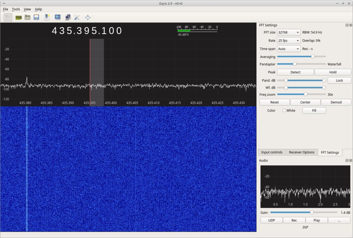
Credit: Cees Bassa
The collision with the Moon was planned since January of year, adds amateur radio expert, Daniel Estévez, and was done as a means to end the mission without leaving debris in lunar orbit.
Estévez explains that on January 24, the periapsis (low point) of the lunar orbit of DSLWP-B was lowered approximately by 310 miles (500 kilometers), so that orbital perturbations would eventually force the satellite to collide with the Moon.
Curiosity Navcam Left B photo acquired on Sol 2483, August 1, 2019.
Credit: NASA/JPL-Caltech
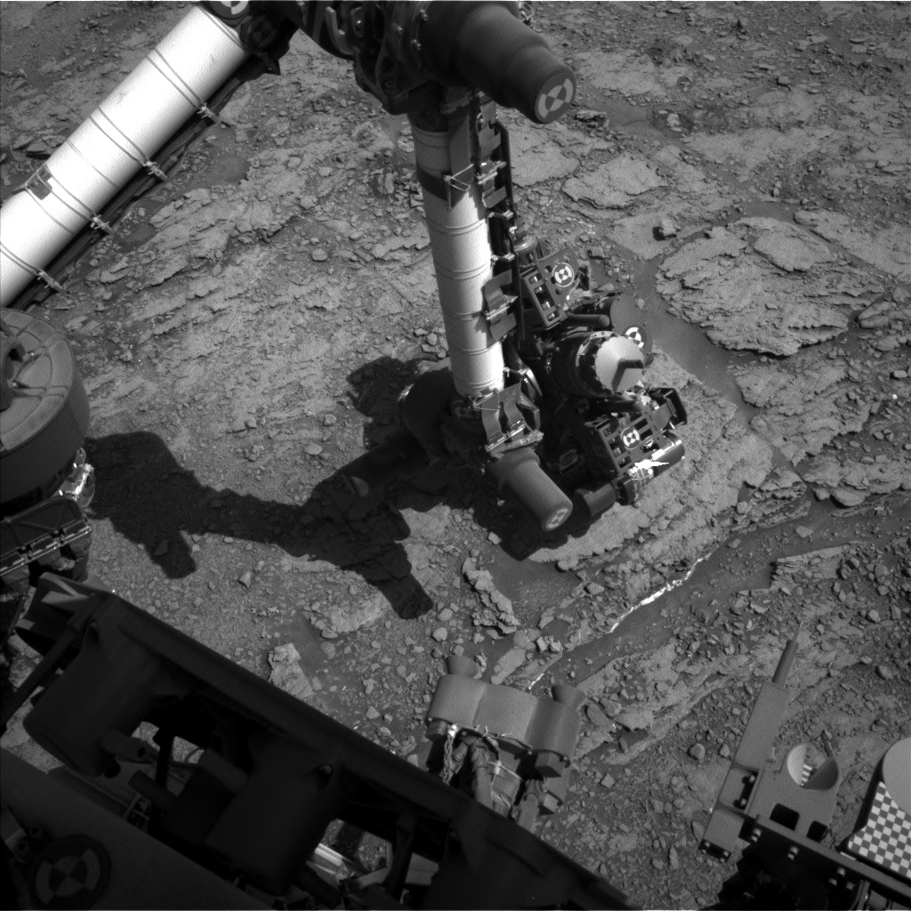
NASA’s Curiosity Mars rover is now carrying out Sol 2484 tasks.
Mark Salvatore, a planetary geologist at the University of Michigan, reports that weekend drilling is in the plan.
Scientists have been largely interested in characterizing the large block of exposed bedrock in front of the rover to derive as much information as possible before the robot punches through the surface and exposes the rock’s interior, Salvatore adds.
Curiosity Navcam Right B image taken on Sol 2483, August 1, 2019.
Credit: NASA/JPL-Caltech
Spatial variability
Curiosity has brushed the dust off of the rock and made some geochemical measurements using the Alpha Particle X-Ray Spectrometer (APXS) instrument.
A recent plan, Salvatore notes, called for acquiring a multispectral image of this brushed surface in addition to two remote laser induced breakdown spectroscopy (LIBS) measurements of the bedrock’s chemistry to determine whether there is spatial variability in the chemistry of this geologic unit.
Enigmatic feature
“We also have an opportunity to acquire a large Mastcam mosaic of the large and flat geologic feature to the south of Curiosity known as the Greenheugh pediment,” Salvatore explains. “This enigmatic feature has been a target of interest ever since Gale crater was first being considered as a potential landing site for the Curiosity rover, and so documenting it from this new vantage point has been a high priority for the geologists on the team.”
Curiosity ChemCam Remote Micro-Imager photo taken on Sol 2484, August 2, 2019.
Credit: NASA/JPL-Caltech/LANL
Ground controllers have placed Curiosity in a good place to drill this unit over the weekend, Salvatore reports, followed by several additional days to document the new drill hole and the tailings.
“If all goes well, we should receive additional geologic data from the rover’s instruments on the mineralogy of this unit sometime next week,” Salvatore concludes. “It’ll be great to compare this location with the other drill holes acquired since the investigation of Vera Rubin ridge.”
Curiosity Navcam Left B photo taken on Sol 2483, August 1, 2019.
Credit: NASA/JPL-Caltech
NASA’s Curiosity Mars rover is presently performing Sol 2483 duties.
Reports Mariah Baker, a planetary geologist at Johns Hopkins University, the robot is currently located in the southern part of the “Visionarium,” with planning underway to start the next drill campaign.
Curiosity Mastcam left image taken on Sol 2481 of target for weekend drilling.
Credit: NASA/JPL-Caltech/MSSS
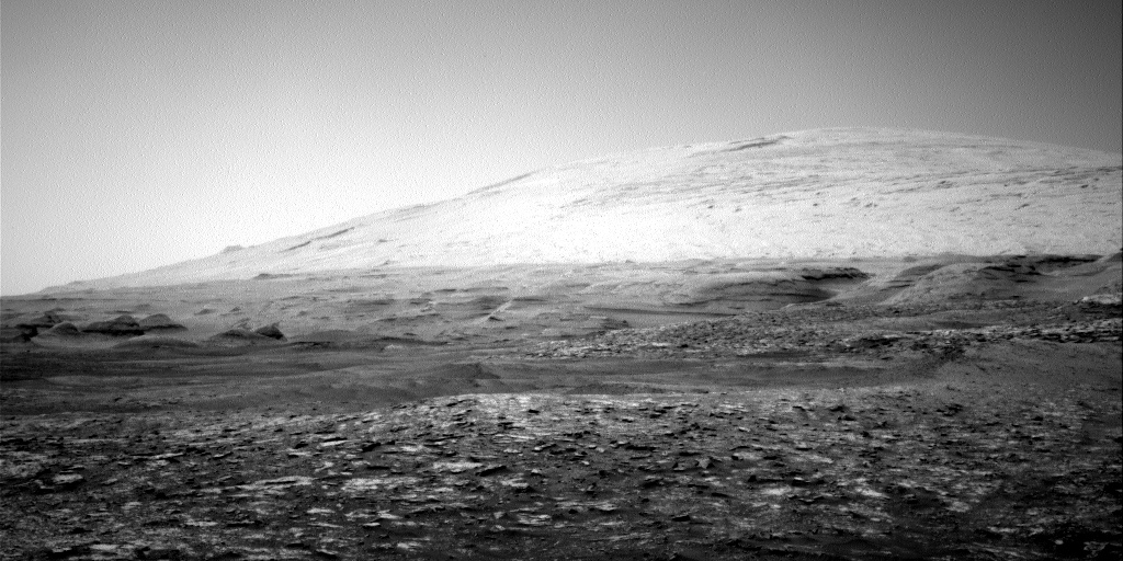
“And we can’t help but take in the scenery! Perched on top of a small escarpment, we have arguably one of the best backdrops we have ever had during a drill campaign,” Baker adds. “The stunning panoramic views of Mount Sharp and surrounding terrains could truly take one’s breath away – if the lack of oxygen wasn’t enough!”

Curiosity Front Hazcam Left B photo taken on Sol 2483, August 1, 2019.
Credit: NASA/JPL-Caltech
Drillable rocks
Curiosity embarked on drill Sol 1, which meant the team was focused on locating and prioritizing drillable rocks in the rover’s workspace.
The target “Glen Etive 1” was selected as the primary drill option; Chemistry and Camera (ChemCam), Mars Hand Lens Imager (MAHLI), and Alpha Particle X-Ray Spectrometer (APXS) measurements on Glen Etive 1 will provide information on the geologic and chemical properties of this rock before Curiosity starts to drill.
Curiosity Mars Hand Lens Imager (MAHLI) photo produced on Sol 2483, July 31, 2019.
Credit: NASA/JPL-Caltech/MSSS
Distant sandstone
Baker notes that ChemCam will also target another spot on the same rock layer (“Glen Etive 2”) as well as a target on another outcrop nearby, “Ninian”.
Also in the plans were various Mastcam observations, such as documentation images of the three ChemCam targets, a stereo image of a layered rock target called “Liddel,” and a larger mosaic image of a distant sandstone unit, Baker reports.
Curiosity Navcam Right B image taken on Sol 2482, July 31, 2019.
Credit: NASA/JPL-Caltech
A set of environmental measurements rounds out recent planning, including two Dynamic Albedo of Neutrons (DAN) activities, Rover Environmental Monitoring Station (REMS) monitoring, and Navcam images to monitor dust loading and dust devil activity.
Curiosity Navcam Right B image taken on Sol 2482, July 31, 2019.
Credit: NASA/JPL-Caltech
“The team is eager and ready to jump into drilling at this new location, especially given the picturesque backdrop we get to enjoy while we work,” Baker concludes. “And since a full drill campaign can last weeks, we can continue to revel in the beauty of Gale crater’s vast and diverse landscapes for at least a little while longer.”
Curiosity Navcam Left B image taken on Sol 2482, July 31, 2019.
Credit: NASA/JPL-Caltech
Weekend drilling
In a new update, Lucy Thompson, a planetary geologist at University of New Brunswick, says there’s anticipation regarding drill hole number three, and maybe number four within Glen Torridon.
New planning has been focused on getting more compositional and textural information on top of this small ridge that we plan to attempt drilling at the weekend, Thompson adds.
“This ridge is representative of one of the units mapped from orbit prior to landing, the ‘fractured clay bearing unit.’ We previously drilled two holes into the ‘smooth clay bearing unit’ and it will be interesting to compare the composition and mineralogy of these orbitally distinct units to each other and with the rest of the Murray formation,” Thompson explains.

Curiosity ChemCam Remote Micro-Imager photo acquired on Sol 2483, August 1, 2019.
Credit: NASA/JPL-Caltech/LANL
Science targets
On tap is use of ChemCam to investigate the composition of two more spots (“Glen Dessary” and “Canisbay”) on the same block that scientists intend to drill to see if different layers have the same chemistry, and there will be Mastcam documentation imaging of these targets.
There’s potential for two separate contact science targets in a new plan and science team members are discussing whether they wanted two APXS and MAHLI targets or whether they want to devote one of those targets to MAHLI oblique imaging of the layers in the block they plan to drill – as opposed to imaging just the top surface.
Brushing
“We decided to brush, get APXS and MAHLI on the second potential drill target ‘Glen Etive 2,’ and then do the MAHLI oblique imaging,” Thompson points out, “to hopefully inform us of the third dimension that we will encounter when we drill, as well as of any sedimentary structures present.”
Standard environmental activities rounded out the new plan with REMS, Radiation Assessment Detector (RAD) and DAN active and passive measurements, Mastcam crater rim extinction and basic tau of the sun, and a Navcam suprahorizon movie, Thompson concludes.
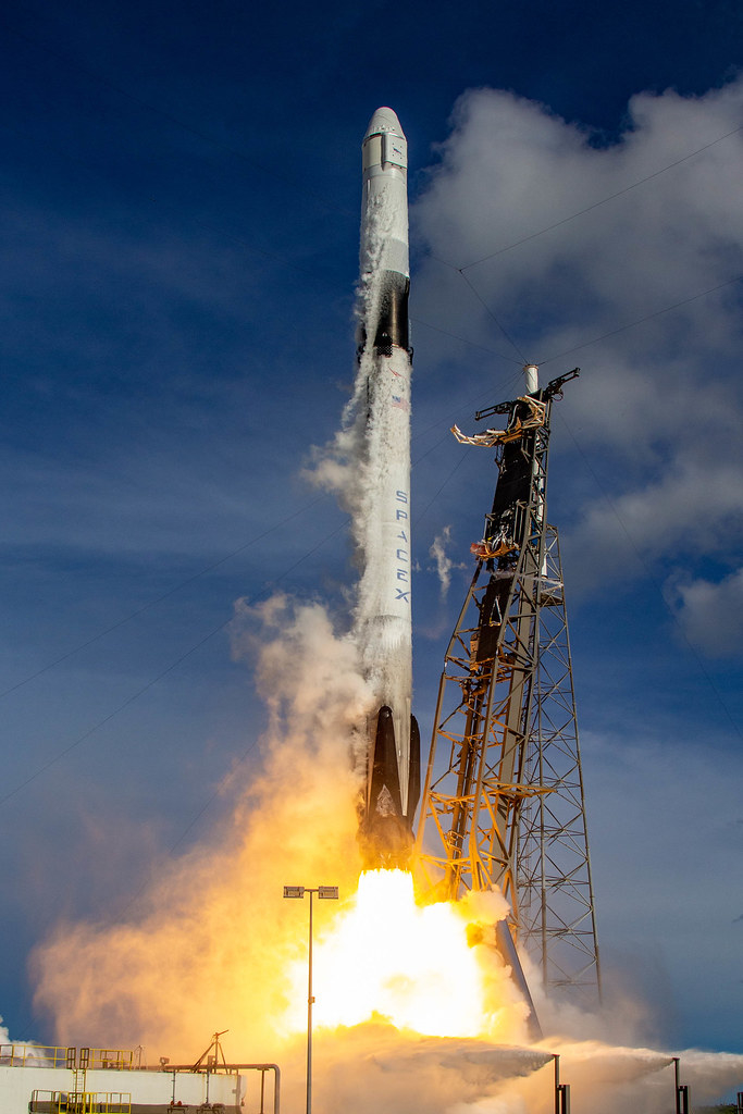
On July 25, SpaceX launched its eighteenth Commercial Resupply Services mission (CRS-18) to the International Space Station.
Credit: SpaceX
Matchbox-sized prototypes – called biomining reactors – have been sent to the International Space Station (ISS).
The “space mining kits” are dedicated to studying how microscopic organisms could be used to recover minerals and metals from space rocks – from asteroids and other celestial targets.
Space testing is expected to reveal how low gravity affects bacteria’s natural ability to extract useful materials – such as iron, calcium and magnesium – from rocks, researchers at the University of Edinburgh say.
Their findings could also help improve the process – known as biomining – which has numerous applications on Earth, including in the recovery of metals from ores.
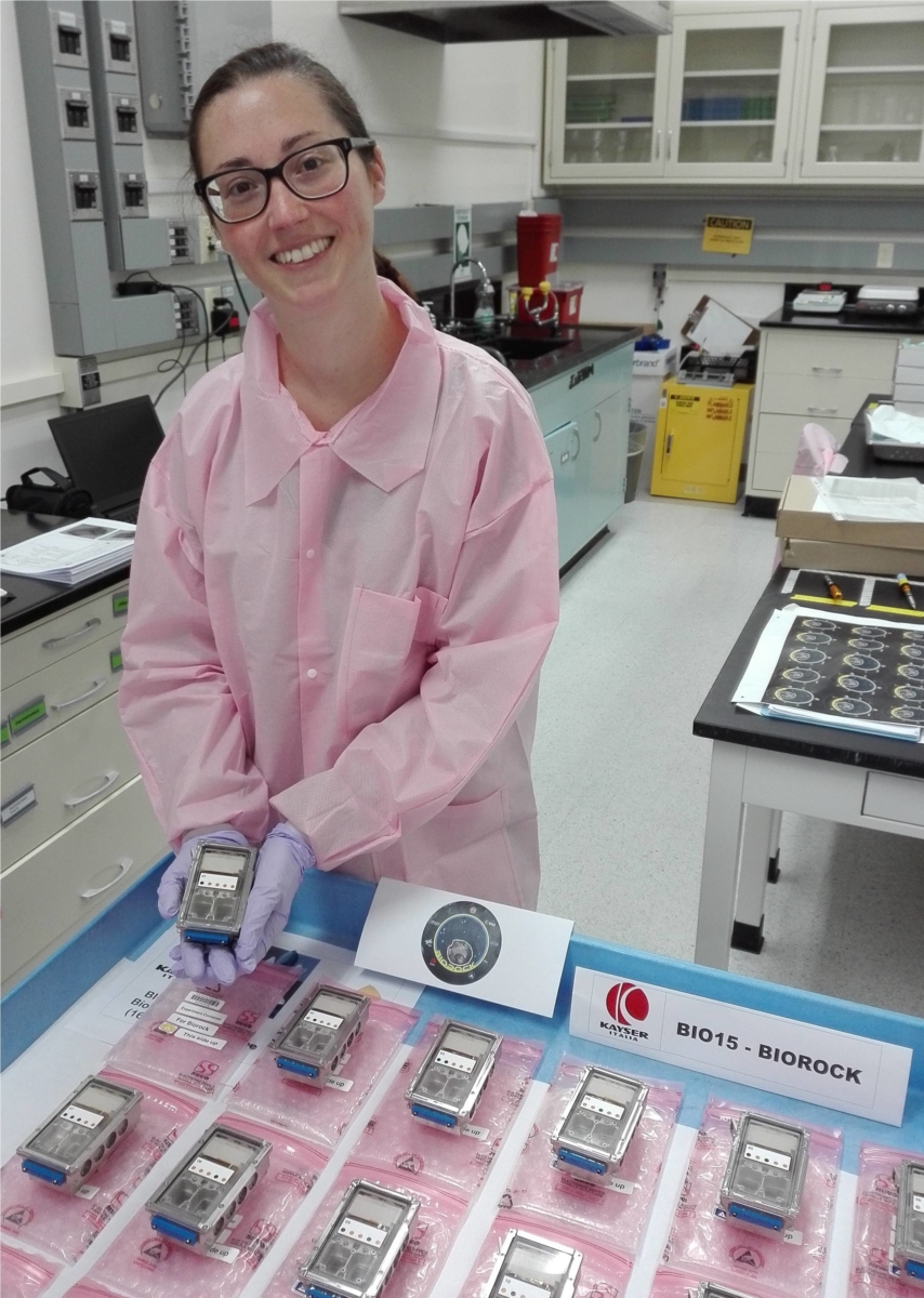
Rosa Santomartino
School of Physics and Astronomy at the University of Edinburgh checks out space mining kits pre-launch.
Credit: Rosa Santomartino
Three-week experiment
On July 27, eighteen of the devices reached the International Space Station, along with a host of other experiments, via a SpaceX Dragon supply ship.
Onboard the ISS, small pieces of basalt rock – which makes up the surface of the Moon and Mars – will be loaded into each device and submerged in bacterial solution.
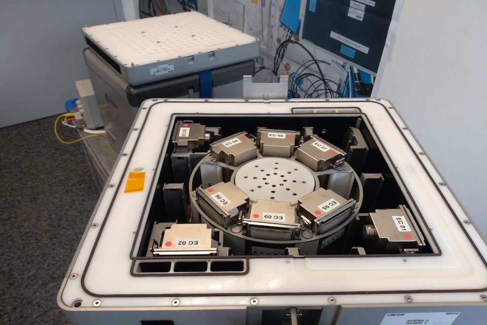
Biomining reactors.
Credits: Rosa Santomartino, UK Centre for Astrobiology/University of Edinburgh
According to a University of Edinburgh press statement, the three-week experiment will also study how microbes grow and form layers – known as biofilms – on natural surfaces in space. As well as providing insights into how low gravity affects biofilms, the findings will also improve understanding of how microbes grow on Earth.
Once returned to Earth, the rocks will be analyzed by the Edinburgh team in a lab at Stanford University in California.
Fundamental insights
The groundbreaking study could aid efforts to establish human settlements on distant worlds by helping develop ways to source minerals essential for survival in space.
“This experiment will give us new fundamental insights into the behavior of microbes in space, their applications in space exploration and how they might be used more effectively on Earth in all the myriad way that microbes affect our lives,” explains Charles Cockell of the School of Physics and Astronomy and project lead at the University of Edinburgh.
Matchbox-sized prototypes – called biomining reactors.
Credits: Rosa Santomartino, UK Centre for Astrobiology/University of Edinburgh
“Microbes are everywhere, and this experiment is giving us new ideas about how they grow on surfaces and how we might use them to explore space,” added Rosa Santomartino, also of the School of Physics and Astronomy. She is leading the study of the rocks when they return.
The “BioRock” experiment is led by the University of Edinburgh, with the European Space Agency and the UK Space Agency, in collaboration with DLR (Germany) and SCK-CEN (Belgium), and is funded by the Science and Technology Facilities Council, part of UK Research and Innovation (UKRI).

