Archive for October, 2026
 Author:
 October 18th, 2026
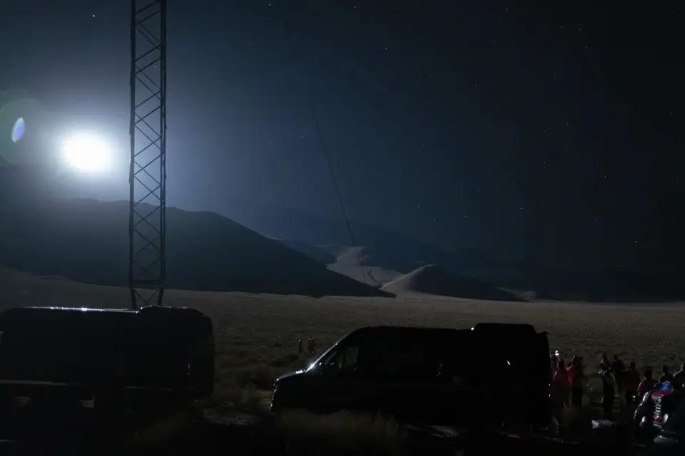
Image credit: Reflect Orbital
Reflect Orbital continues to make progress on placing giant mirrors in Earth orbit to produce and sell sunlight after dark.
On October 10, the space startup set up spotlights near Lone Pine, California to simulate the illumination its proposed satellites could provide.
The plan by Reflect Orbital is to build and operate orbital mirrors that enable controlled lighting without ground infrastructure. “This lighting will support a variety of customers, from remote search-and-rescue operations to solar farms generating clean power,” according to the company.
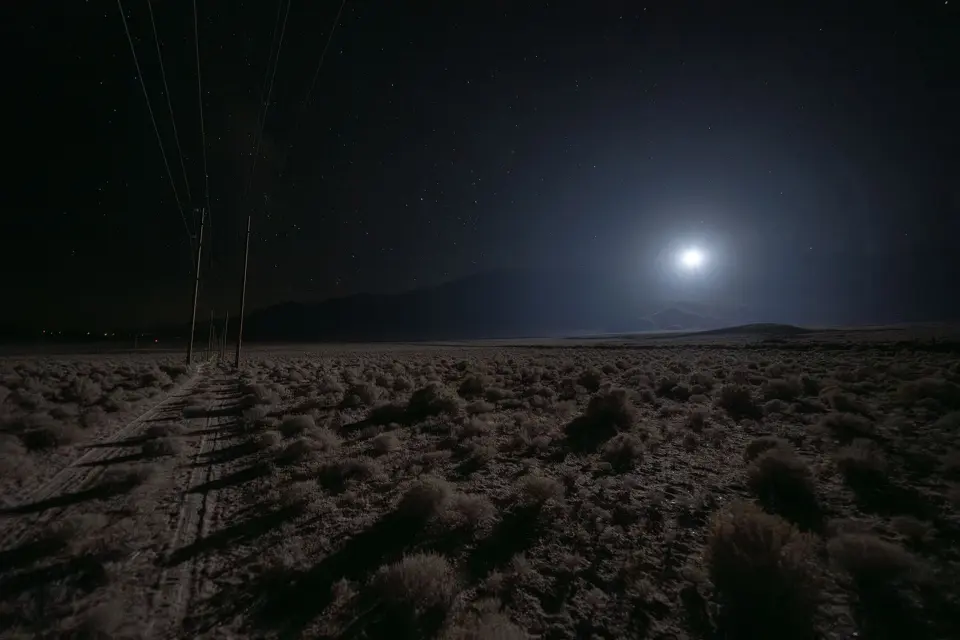
Image credit: Reflect Orbital
Mountain rescue
The October 10 illumination test between 7 p.m. and midnight involved members of the China Lake Mountain Rescue Group (CLMRG) who practiced searching and training with night time equipment for the controlled tests.
CLMRG is an all-volunteer, 501 (c) non-profit that operates under the auspices of the Kern County Sheriff’s Office providing search and rescue (SAR) services on an on-call basis at no cost.

Image credit: CLMRG
Go to this story carried by the San Francisco Chronicle regarding the illumination test at:
https://www.sfchronicle.com/outdoors/article/reflect-orbital-light-mt-whitney-22475517.php
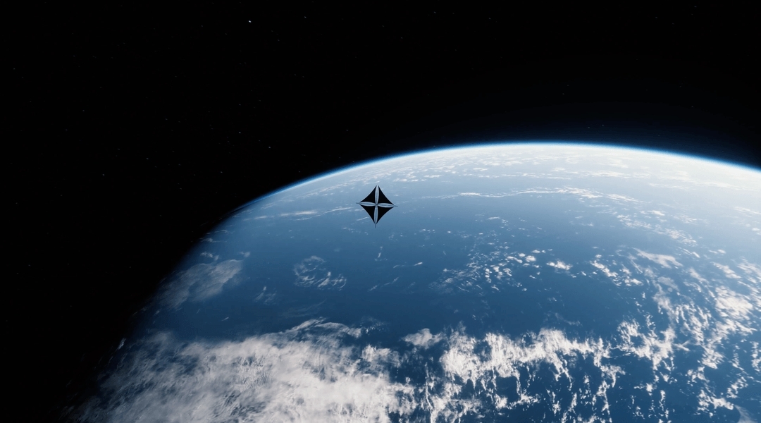
Image credit: Reflect Orbital
India’s Skyroot Aerospace
In a related development, Reflect Orbital announced this month the purchase of two Skyroot Aerospace launches to deploy future spacecraft. “These dedicated launches provide assured schedule and capacity, and complement Reflect Orbital’s other planned launches from sites in the United States,” Reflect Orbital explained in a statement.
Skyroot’s Vikram-1 launcher is a product of India’s private space sector, first flying from India’s Sriharikota launch site last July.
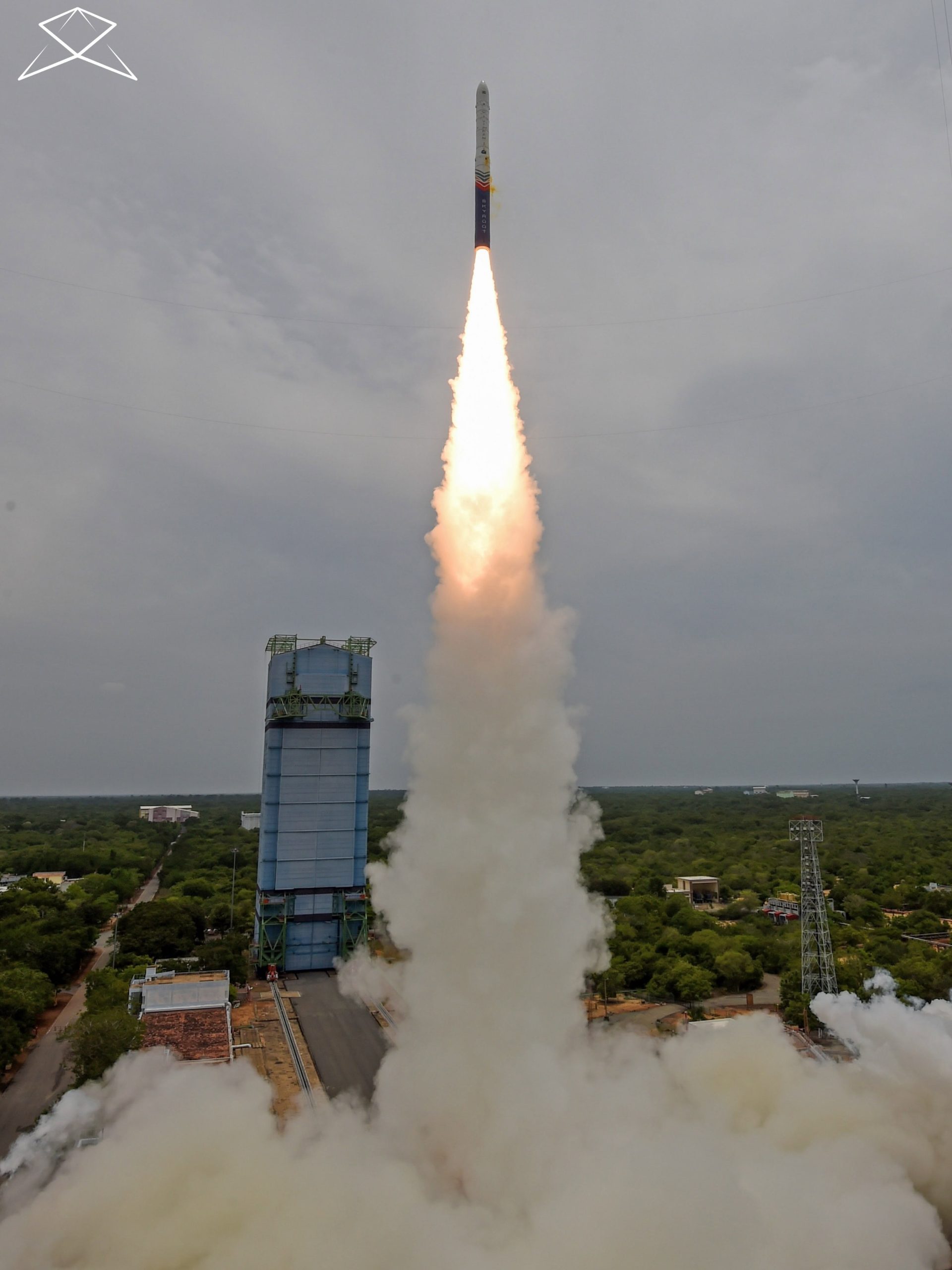
Image credit: Skyroot Aerospace
 Posted in


The ICEYE space firm owns the world’s largest and most advanced SAR (synthetic aperture radar) satellite constellation.
Image credit: ICEYE
Russia’s Cosmos-2612 satellite has made a series of maneuvers that have made it almost perfectly co-planar with the radar satellite ICEYE-X36.
ICEYE is natively European, founded in Finland.
Bart Hendrickx, a longtime observer of the Russian space program, reports that, in the past two days or so, the Russian spacecraft has made a further orbit adjustment. That change has now brought it in the immediate vicinity of the ICEYE satellite.
According to the latest TLE sets, the Russian satellite is now just about 0.932 miles (1.5 kilometers) from ICEYE and getting closer. A two-line element set (TLE) is a data format that provides the orbital parameters of a satellite.
War in Ukraine
Hendrickx notes that among duties, ICEYE satellites are used to provide intelligence data to Ukraine’s armed forces.
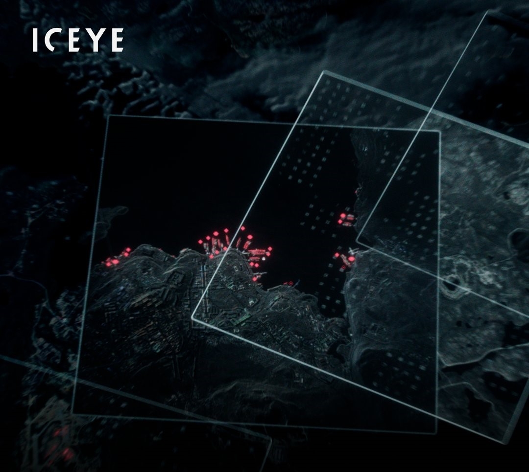
ICEYE satellites provide Intelligence, Surveillance, and Reconnaissance (ISR).
Image credit: ICEYE
The ICEYE space firm owns the world’s largest and most advanced SAR (synthetic aperture radar) satellite constellation.
As explained on the ICEYE website, the war in Ukraine proved that satellite constellations are a core component of modern Intelligence, Surveillance, and Reconnaissance (ISR).
“ICEYE systems are directly supporting strike planning and battlefield decisions across thousands of kilometers of frontline. Persistent, all-weather, and beyond the reach of electronic warfare.”
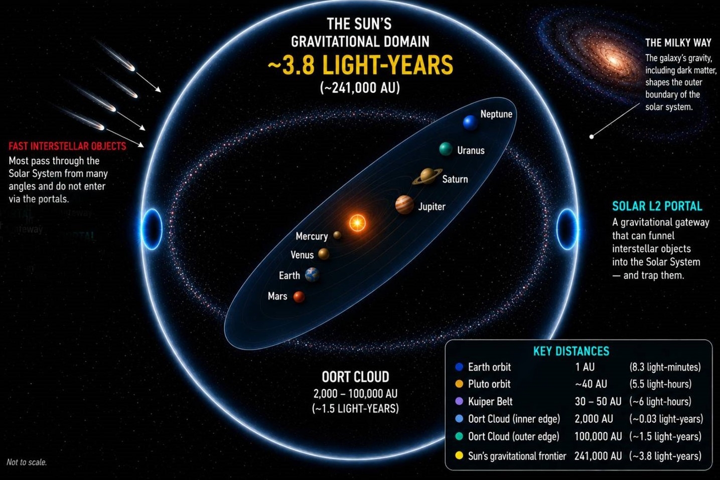
Image credit: ROOM, the Space Journal of Asgardia
There is need to redefine the edge of the solar system. That’s the outcome of new work by two leading space scientists. They present a theory that the Milky Way’s gravity, including its dark matter, redraws the Sun’s frontier.
Moreover, it allows the Solar Lagrange points L1 and L2 to form “portals” that funnel interstellar visitors into the system, perhaps capturing them for future study.
The solar system’s gravitational frontier extends to nearly 3.8 light-years from the Sun, they contend, roughly 241,000 astronomical units (AU), a distance that brings the “edge” of the solar system to within the same scale as the separation between neighboring stars.
That frontier may be a region defined not by a sharp boundary but by a “complex dance among forces, energies and trajectories,” they write.
For more details, go to my new Space.com story – “It’s time to reassess the size of our solar system, scientists say” – at
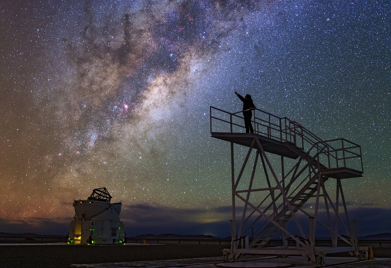
A universe of complex dances among forces, energies and trajectories.
Image credit: ESO/B. Tafreshi/twanight.org
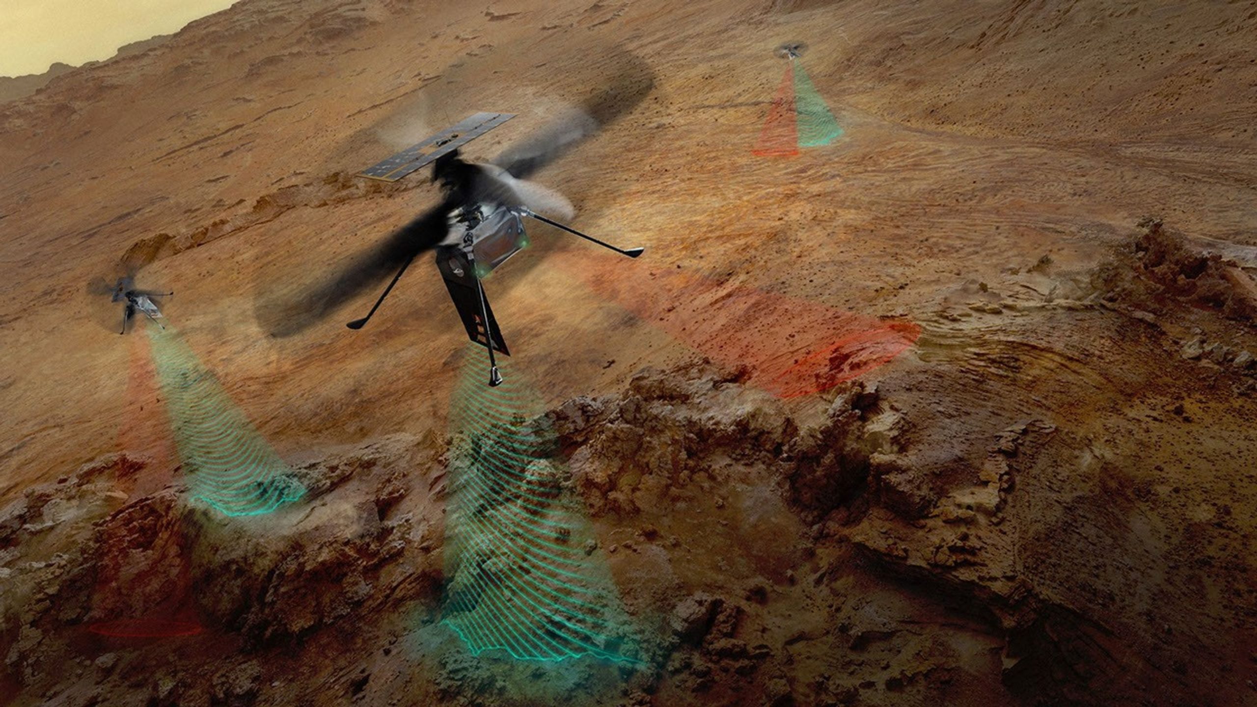
Artwork depicts the three SkyFall Mars helicopters collecting data while flying over the surface of the Red Planet.
Image credit: NASA/JPL-Caltech
Work has reached an accelerated mode in readying three Ingenuity-class helicopters for deployment at Mars by NASA’s Space Reactor‑1 Freedom spacecraft.
Slated for launch in 2028, SR-1 Freedom is the first fission nuclear-powered interplanetary spacecraft and is assigned the duty of dropping off the SkyFall entry capsule loaded with the trio of reconnoitering aerial vehicles at the Red Planet.
The SR-1 trajectory has Mars arrival of the SkyFall helicopters in northern spring to avoid dust storms.
For more details, go to my new Space.com story — “NASA’s SkyFall helicopters will ‘show us parts of Mars we’ve never seen before’, scientists say” – at:

Image credit: Virgin Galactic
The suborbital Virgin Galactic’s next generation spaceship is on tap to evaluate sensor systems to collect space weather data during flights.
Under a new Cooperative Research and Development Agreement, Virgin Galactic has joined research interests with the Air Force Research Laboratory’s (AFRL) Space Warfare Directorate at Kirtland Air Force Base, New Mexico.
Under the 24-month agreement, the spaceship will gather direct data at mesosphere and lower thermosphere levels during suborbital excursions – a region often tagged as the “ignorosphere.”
It’s a province not reachable by low-flying Earth orbiting satellites and high-flying aerial vehicles.

Credit: Virgin Galactic
Least-measured regions
“This layer of the atmosphere could shape everything from climate modeling to orbital tracking, yet it remains one of the least-measured regions of our planet,” noted Virgin Galactic President Mike Moses.
“We believe our spaceships can change that,” said Moses in a statement. “Our spaceships are built to fly into the mesosphere and lower thermosphere again and again. Each ship is designed to fly up to twice a week, and with our initial fleet we’re planning for around 125 flights a year, scaling to many more than that as the fleet grows. That’s a research cadence this region has never had,” he added.
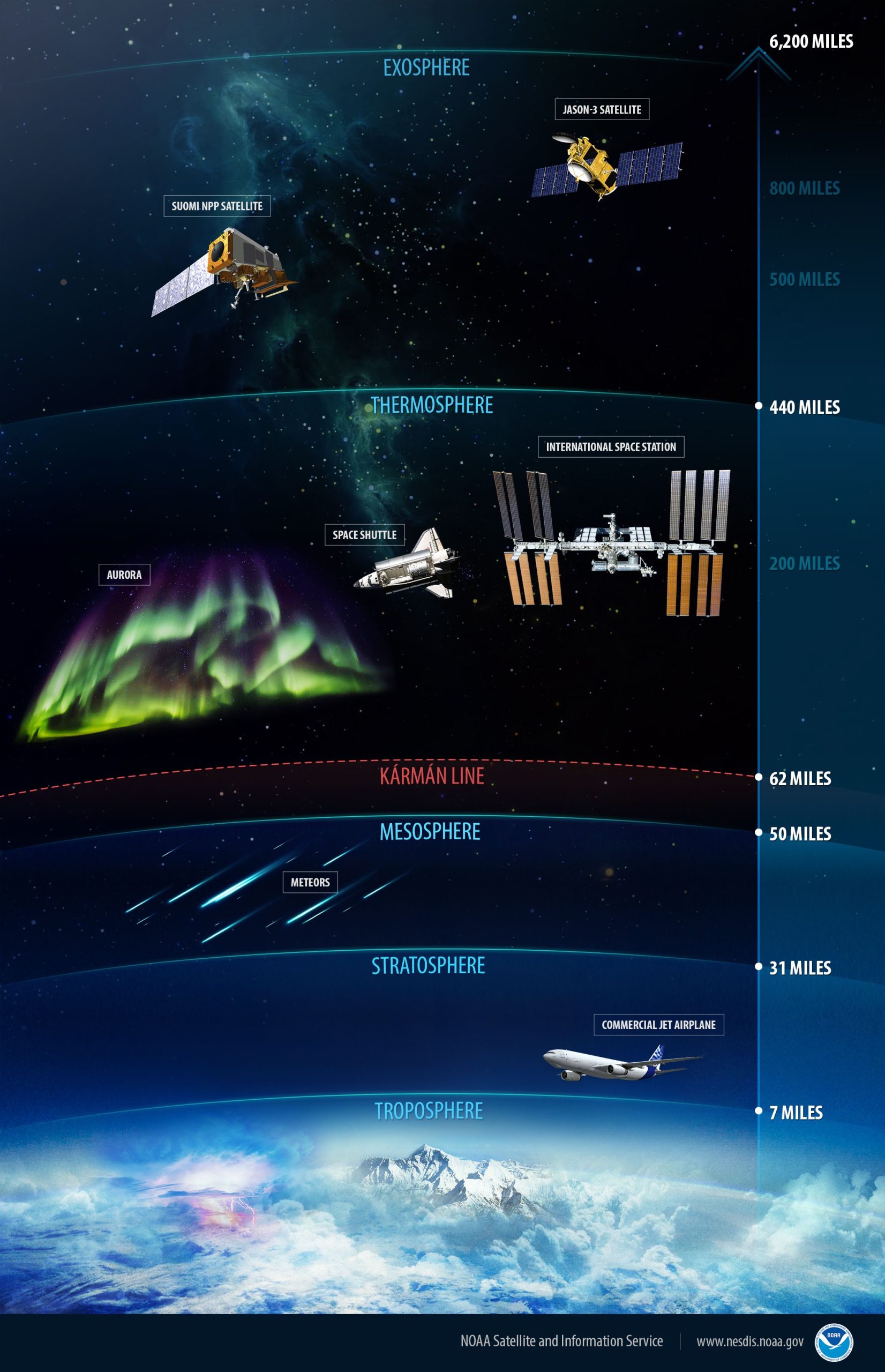
Image credit: NOAA
Fill that gap
According to Shaun Ard, Senior Research Chemist at AFRL: “Understanding space weather dynamics in the mesosphere and lower thermosphere depends on consistent, high-quality observational data, which has remained limited at scale. This collaboration gives our researchers access to a platform particularly well-suited to fill that gap, supporting efforts to protect and advance space-based systems essential to modern infrastructure and exploration.”
Virgin Galactic signed a similar agreement with Lawrence Livermore National Laboratory (LLNL) in December 2025.
Under that agreement, Virgin Galactic and LLNL are assessing the use of sensor systems aboard Virgin Galactic’s launch vehicle with the aim of gathering data and accelerating the development of next-generation high-altitude image-capture capabilities.
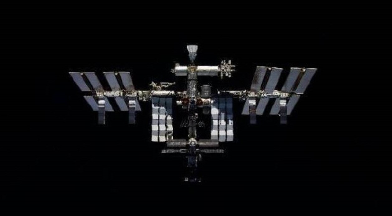
Image credit: NASA/Roscosmos
Late last week NASA launched its request for proposals via its “Commercial Low Earth Orbit (LEO) Destination Contract (CLDC).”
The October 9 RFP’s principal purpose is for NASA to acquire services from a commercially owned and operated LEO Destination that can provide safe, reliable, and cost-effective end-to-end services to succeed the International Space Station (ISS).
“This will ensure NASA has a sustained human presence in LEO for crew members to perform science and exploration,” the RFP explains.
For submissions to NASA’s Johnson Space Center, proposals are due by December 8, 2026 at 1:00 p.m. Central Time.
For a look at this RFP, go to:
https://sam.gov/workspace/contract/opp/aee4374189ab4118b3ec0dcb00ae8408/view

Image credit: CCTV/Inside Outer Space screengrab
China is planning to open the country’s space station to other countries, intended to transform the orbital facility into a global research platform.
Yang Liwei, China’s first astronaut and deputy chief designer of the China Manned Space Agency (CMSA), discussed the plan during the now underway 77th International Astronautical Congress in Türkiye’s Mediterranean city of Antalya.
In a China Central Television (CCTV) story, Yang noted that one of two Pakistani astronaut candidates — currently undergoing joint training with their Chinese counterparts – will carry out a short-duration flight mission as a payload specialist on the station in the second half of this year.
To date, 27 Chinese astronauts in 11 crews have been sent to live and work on the Tiangong space station, including the now-orbiting Shenzhou-23 team, who arrived at the outpost in late May.

Artwork depicts China’s Tiangong space station.
Image credit: China Manned Space Agency
Human Moon landing work underway
In related news, China Daily reports that China continues on a path to land astronauts on the Moon by 2030. The country is “shifting from a long-term blueprint to tangible reality, with major infrastructure construction and hardware testing being carried out at pace by the nation’s space industry” the state-run news outlet adds.
The CMSA points out they are in full swing to push forward the construction of facilities and equipment required for lunar landing missions at the Wenchang Space Launch Center in Hainan province.
Additionally, building of other ground support systems such as telemetry, tracking, command and communications, is underway, as are preparations for the landing site.

Image credit: CCTV/Inside Outer Space screengrab
Major flight vehicles
Now in full-swing and progressing smoothly CMSA states, is development of major flight vehicles:
- the Long March 10 heavy-lift carrier rocket
- the Mengzhou crew spacecraft
- the Lanyue lunar lander
“A series of critical tests have been completed in succession, including the pad abort and the maximum dynamic pressure escape flight tests for the Mengzhou, the landing and takeoff tests for the Lanyue, and the static ignition and low-altitude flight tests for the Long March 10,” China Daily explains, citing the CMSA.
Chinese space authorities have been training astronauts for lunar expeditions, preparing them for the unique environment on the “silver sphere.” Once on the Moon, the major tasks of the Chinese astronauts will include driving a Tansuo rover to carry out scientific assignments and collect lunar samples.

Image credit: CCTV/Inside Outer Space screengrab
Mars return sample
Viewed as the next step in its deep-space exploration program, China plans to collect martian samples and bring them back to Earth around 2028 via the Tianwen 3 mission. The primary scientific objective of this mission is to look for traces of life on the Red Planet.
Sun Zezhou, an expert on deep space exploration at the China Academy of Space Technology, told CCTV that the sample return Mars effort is challenging.
“At the beginning, we were also quite anxious when we encountered problems. We always had issues on various experiment. When the phone rang, we would feel nervous, thinking it was probably another experiment that didn’t turn out as expected,” Sun said. “We progressed and kept on testing key technologies on the ground. The more problems we encountered, the fewer errors we would face in the future, that is the rule.”
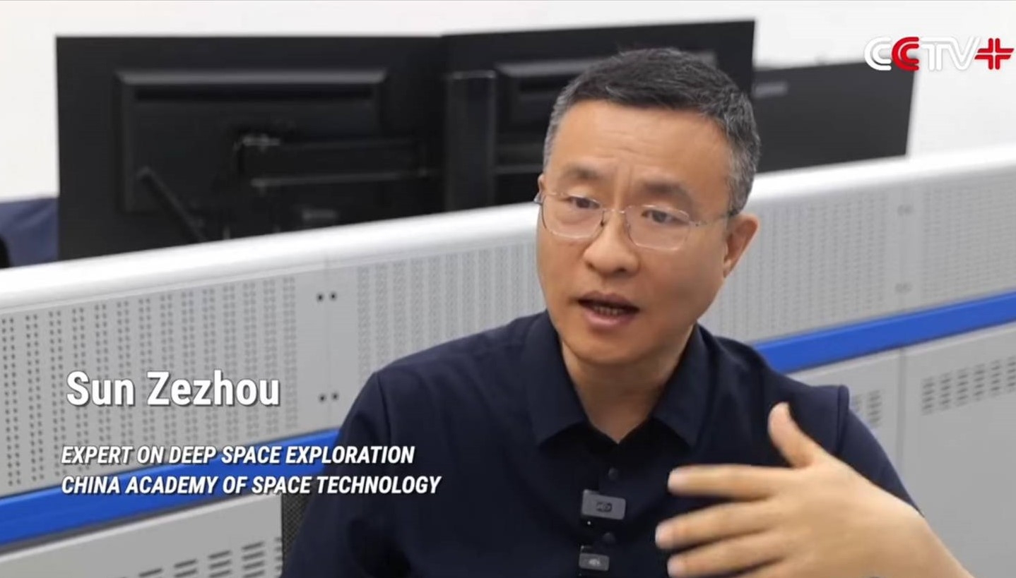
Image credit: CCTV/Inside Outer Space screengrab
Among the planets in the solar system, Mars is the most similar celestial body to Earth, said Sun.
“If we compare Earth as a young adult in its prime, Mars is more like an elder in its twilight years. As for the exploration of Mars, to put it most simply and directly, we want to understand the evolutionary process of our close neighbor and what insights it can offer us,” Sun concluded.
For details on China’s Mars sample return program, go to:
https://www.facebook.com/reel/2164187321174141
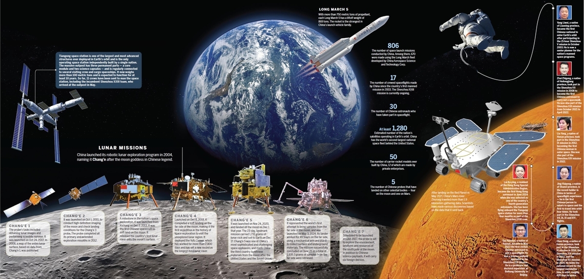
Image credit: China Daily/People’s Daily Online
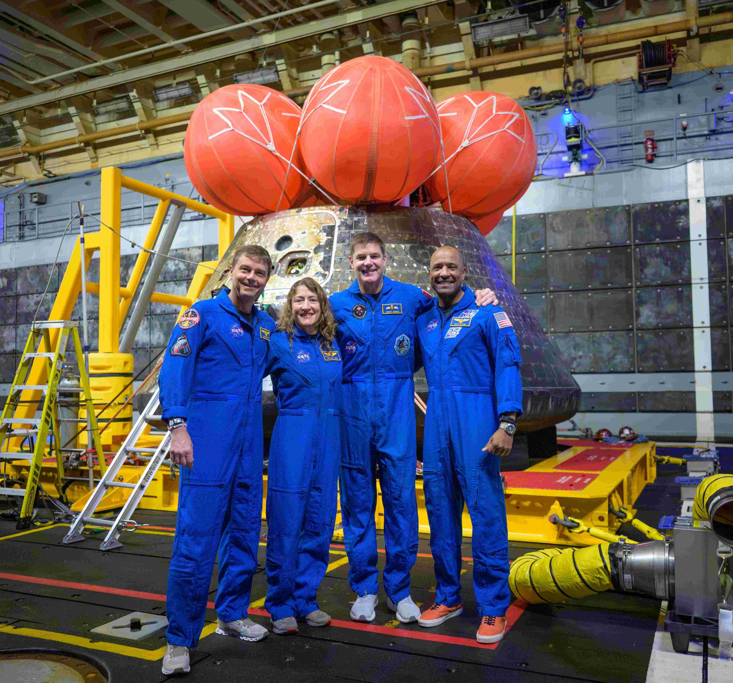
NASA astronauts Reid Wiseman, commander; left, Christina Koch, mission specialist; CSA (Canadian Space Agency) astronaut Jeremy Hansen, mission specialist; and NASA astronaut Victor Glover, Artemis II pilot, right, pose for a group photo after viewing the Orion spacecraft in the well deck of USS John P. Murtha, Saturday, April 11, 2026, in the Pacific Ocean off the coast of California. The quartet splashed down Friday, April 10.
Image credit: NASA/Bill Ingalls
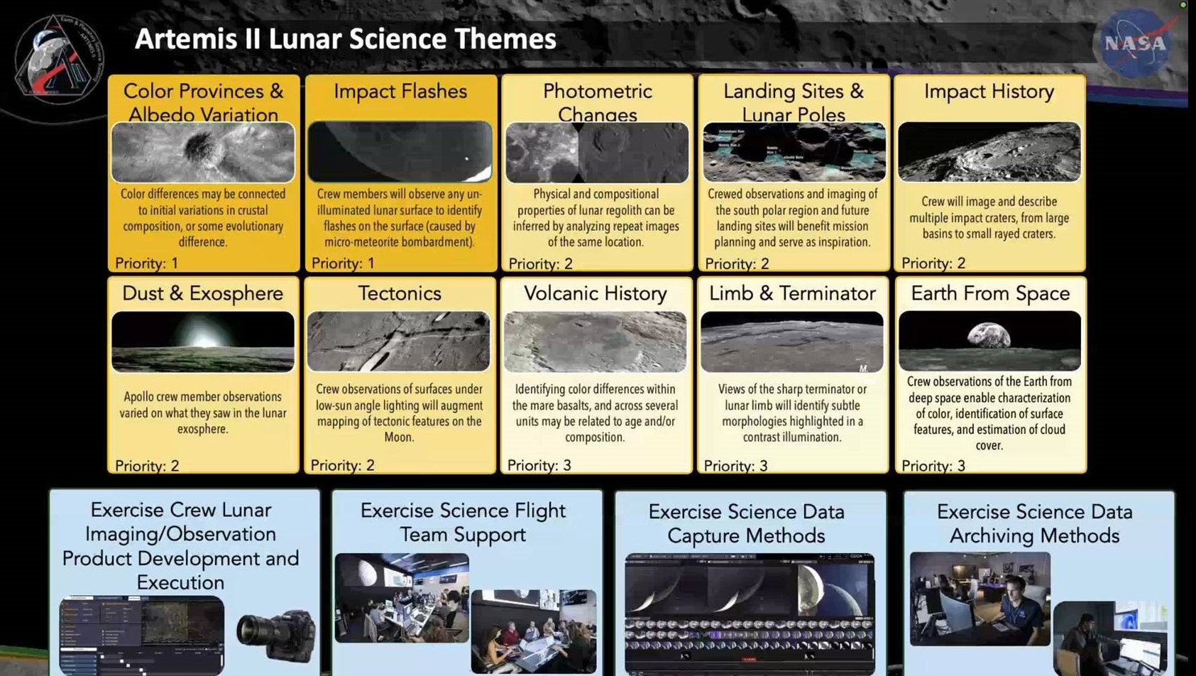
More than 800 gigabytes of Artemis II lunar science data – some of it previously unreleased – was released today, posted to NASA’s Planetary Data System.
Most of the images from the mission were previously made public – although this Oct. 7 release is the official data archive with high resolution imagery and robust metadata.
Audio recordings
Other new material coming out includes the crew’s notes with annotated images, nearly a thousand new photos and videos from vehicle cameras, and more than 8.5 hours of audio recordings of the crew’s scientific observations from the lunar flyby.
In addition, a number of reports were issued, detailing lessons learned about integrating science into Mission Control.
Flash in the Pan…orama!
While not “moonbreaking” science results — those will come later with scientific publishing – there’s a treasure trove of Artemis II insights, including audio recordings of the four-person crew are as they observe the Moon, seeing flashes resulting from lunar impactors.
Interactive website
“The Artemis II Lunar Science Team is very proud to announce the release of an interactive multimedia web page exploring today’s release as well as three reports to accompany the data,” noted Kelsey Young, Artemis II Lunar Science Lead, on behalf of the Artemis II Lunar Science Team.
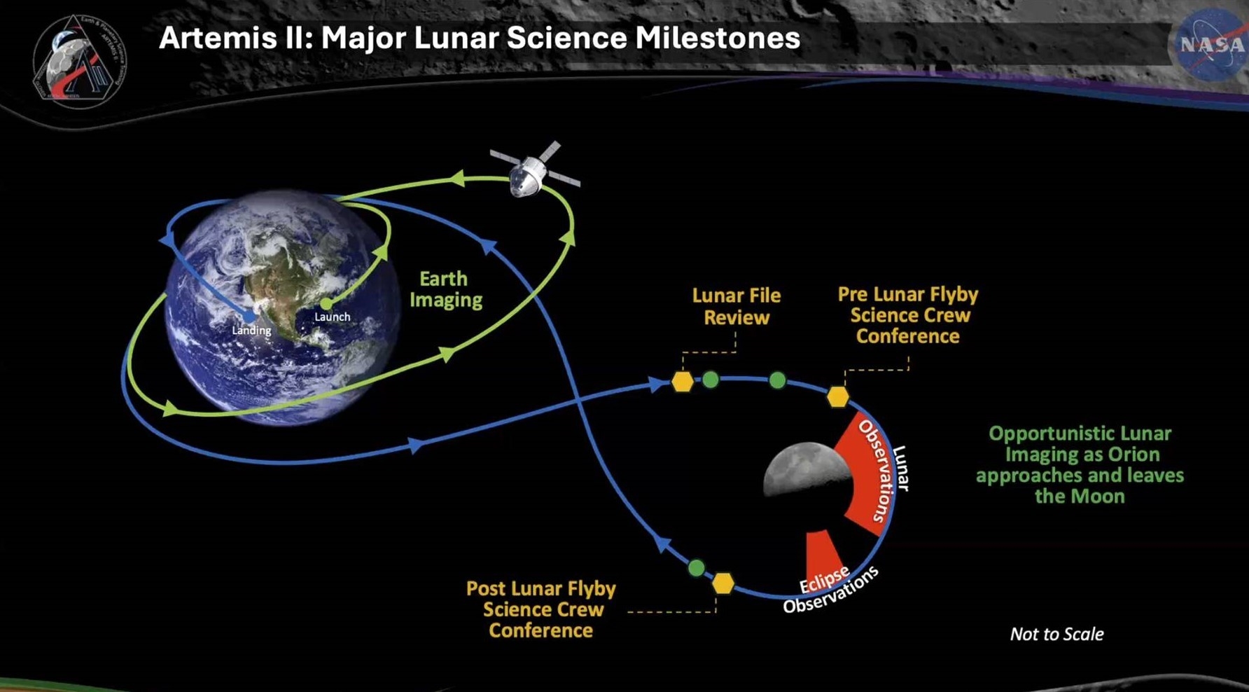
Image credit: NASA
Visit the interactive website at:
https://science.nasa.gov/feature/artemis-ii-preliminary-lunar-science-report/
Lunar science in this historic mission of Artemis II comes the first mission reports on crewed exploration of the Moon since the 1970’s, Young said.
A new beginning
“Our entire team put everything we had into not only the mission but in bringing these items to you today. Though our time as the active Lunar Science Team is ending, today marks a new beginning of you, the lunar community, being able to use the data to advance science discovery with this new tool in the planetary science toolbox,” said Young.
Data archives
The NASA Planetary Data System (PDS) announced the release of the data
archives from the Artemis II mission.
This release contains source, raw, processed, derived, browse, and document products from the
mission: crew handheld camera images, Orion vehicle camera images and video,
mission audio with transcripts and crew annotations, Orion storage locker
temperature and humidity data, mission documents, and SPICE kernels. The data
are archived at various PDS nodes.
Mission documents and Orion environment data at the Geosciences Node
Crew camera, Orion camera, and mission audio data at the Cartography and Imaging Sciences Node
SPICE data at the NAIF Node
The data may be accessed at:
https://pds-geosciences.wustl.edu/missions/artemis2/index.htm
Or for a bundle-oriented view:
https://pds.nasa.gov/datasearch/subscription-service/SS-20261007.shtml
Images acquired by the crew with the Apple iPhone 17 are not included in this delivery and will be archived at a later date, according to the PDS team.
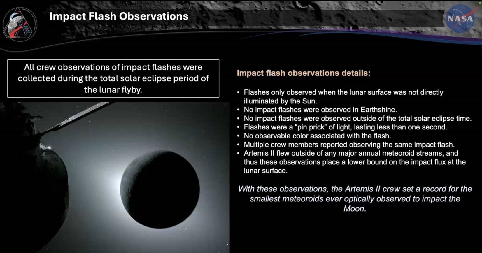
Image credit: NASA
Check out these detailed reports and data user guide at:
ARTEMIS II PRELIMINARY LUNAR SCIENCE REPORT:
ARTEMIS II LUNAR SCIENCE DATA USER GUIDE:
ARTEMIS II LUNAR SCIENCE OPERATIONS REPORT:
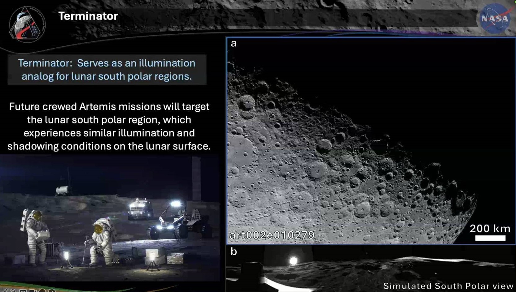
Image credit: NASA
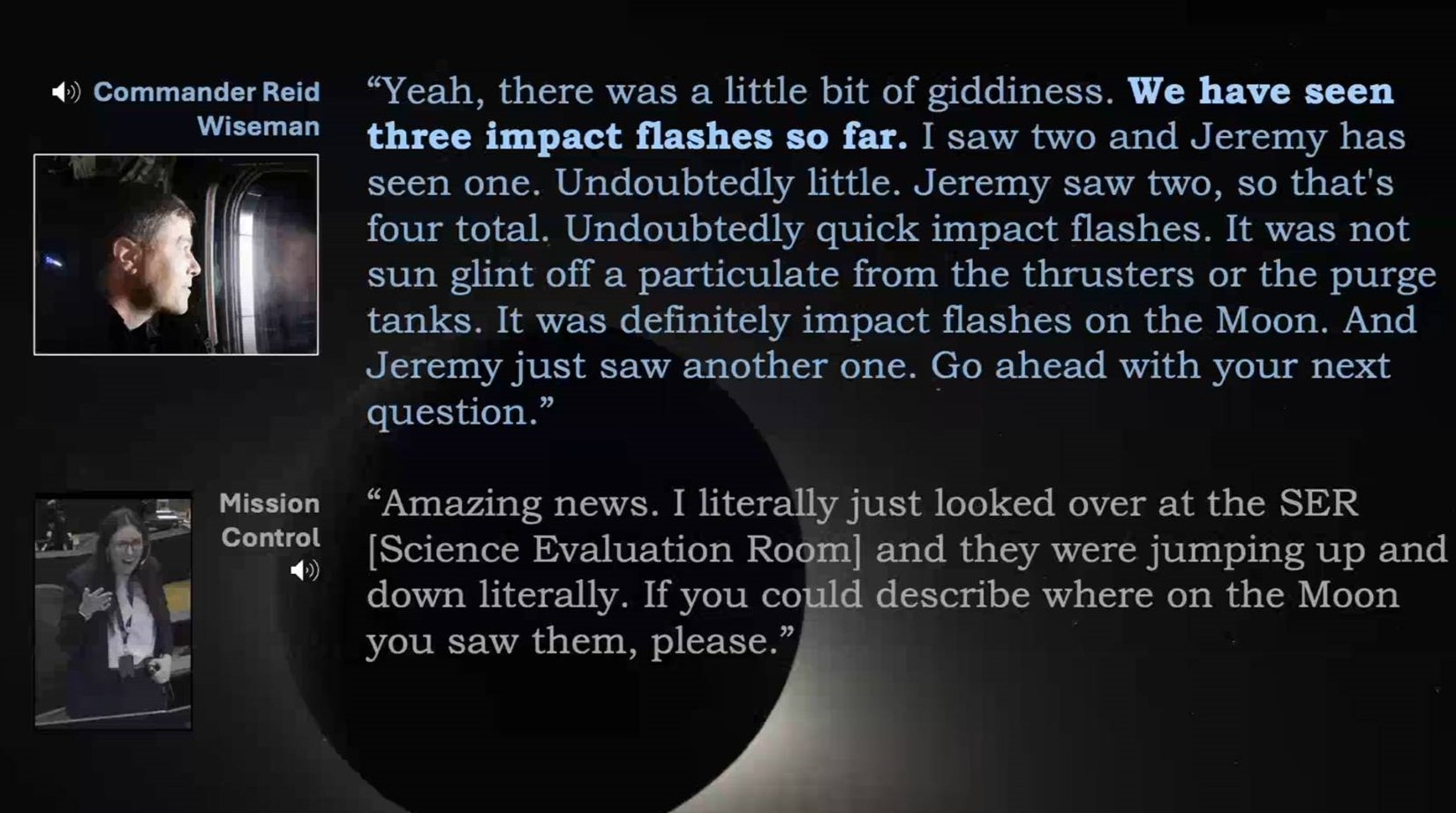
Image credit: NASA
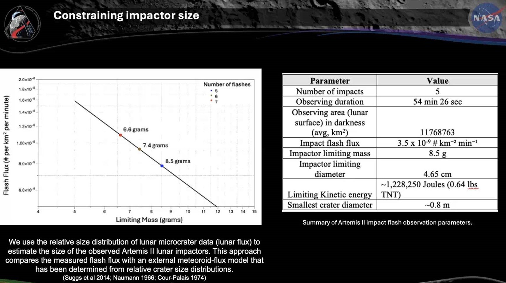
Image credit: NASA
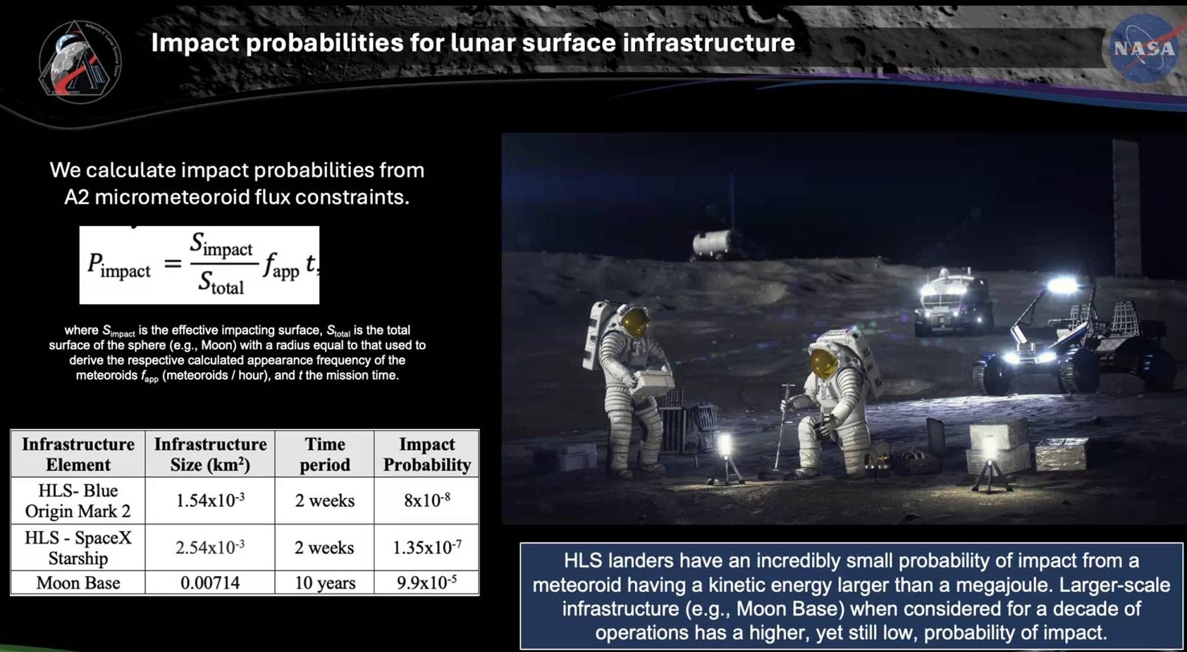
Image credit: NASA
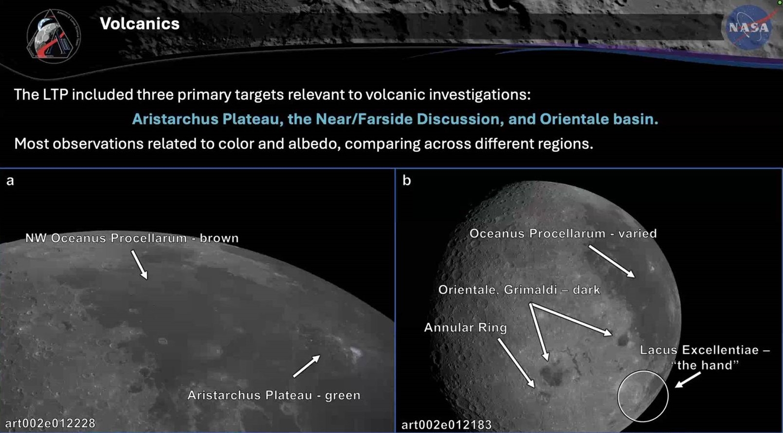
Image credit: NASA
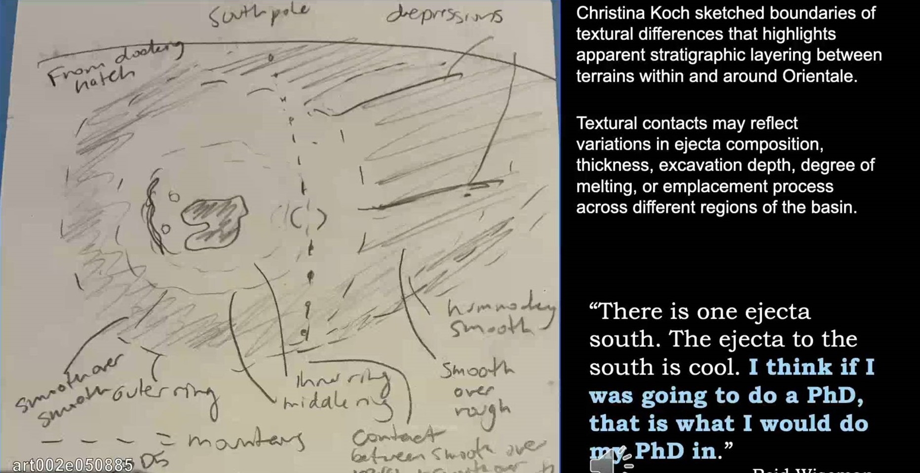
Image credit: NASA
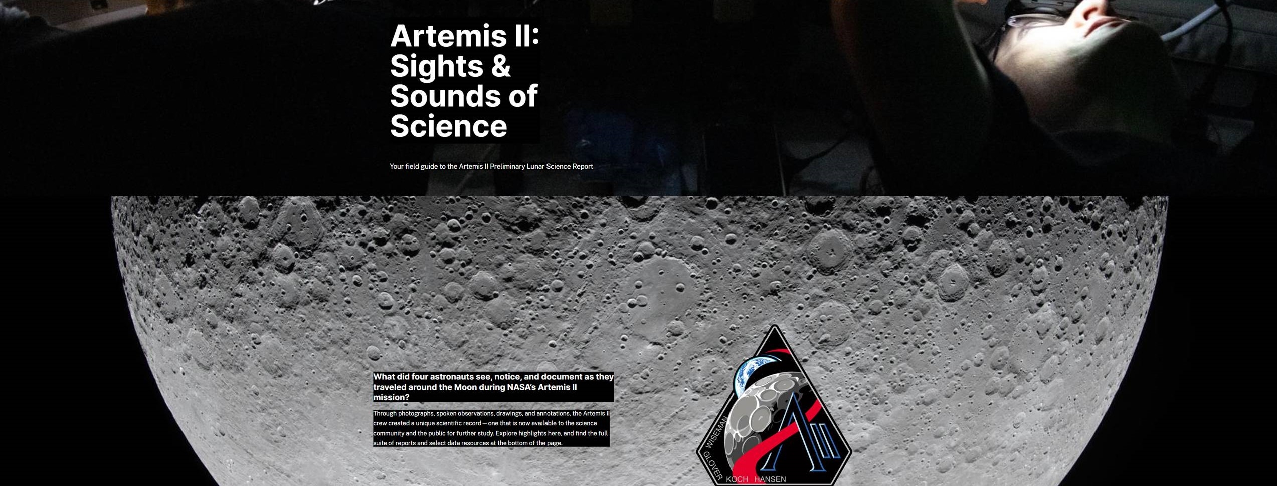
Image credit: NASA
Hear from the Artemis II crew about impact flashes — bursts of light caused by pieces of space debris hitting the ground — that they saw while they were on the other side of the Moon, during a planned loss of comms.
Here’s what it was like at two key points in the story: when the crew witnessed the flashes, and when the Lunar Science Team received the news back at Mission Control.
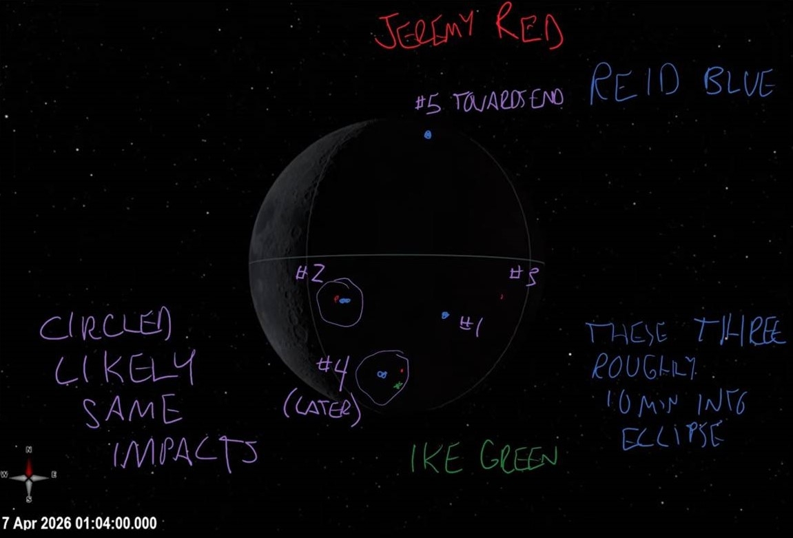
Image credit: NASA
What else did the Artemis II crew see around the Moon? Their photographs, observations, drawings, and annotations created a unique scientific record that’s now available for you to explore:
https://go.nasa.gov/Artemis2LunarScience
Download this video (and additional versions) here:
https://svs.gsfc.nasa.gov/15103
The impact flash observations happened during a planned loss of communications while the Artemis II crew was on the far side of the Moon. Here’s what it was like at two key points in the story: when the crew witnessed the flashes, and when the Lunar Science Team received the news at NASA’s Johnson Space Center Mission Control Center in Houston.
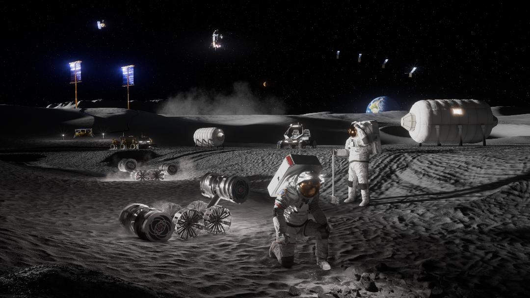
Image credit: NASA
Earth’s Moon is a historical landmark – a celestial body continually peppered with robotic landers shot from our home planet as well as being an in-your-face world dotted with human footprints planted there by a dozen visiting moonwalkers from 1969 to 1972.
A recent gathering in Italy of the International Scientific Committee on Aerospace Heritage looked at protecting lunar heritage with an eye towards guidelines for spacecraft de-orbiting onto the Moon’s surface.
Particular attention was paid to the risks posed by the impacts of de-orbited satellites and rocket stages, recently highlighted by the crash of a SpaceX upper stage onto the Moon’s surface last August.
As pointed out in the meeting, as lunar traffic increases, controlled crash landings of orbiters and rocket stages are becoming an attractive and sustainable end-of-mission disposal strategy.
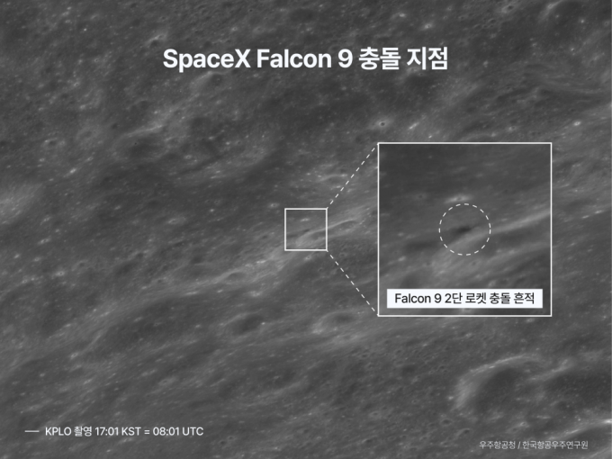
Image credit: Korea Aerospace Administration
And that’s a problem.
For more details, go to my new Space.com story – “Can we protect historic sites on the moon from the coming lunar rush?” – at:

