Archive for September, 2020
 Author:
  September 8th, 2020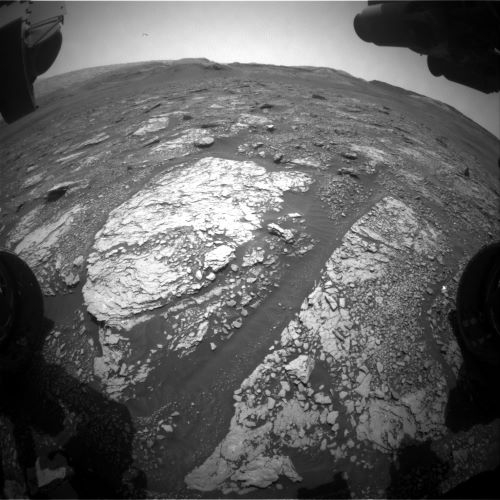
Curiosity Front Hazard Avoidance Camera Right B image taken on Sol 2876, September 8, 2020.
Credit: NASA/JPL-Caltech
NASA’s Curiosity Mars rover is now performing Sol 2977 duties.
Reports Lucy Thompson, a planetary geologist at the University of New Brunswick; Fredericton, New Brunswick, Canada:
“As we wait to drop the ‘Mary Anning 3’ drilled sample off to SAM [Sample Analysis at Mars Instrument Suite] (hopefully in the next plan), Curiosity will utilize the time and power to continue monitoring the current dusty atmosphere on Mars, as well as the interesting chemistry of the rock at this location.”
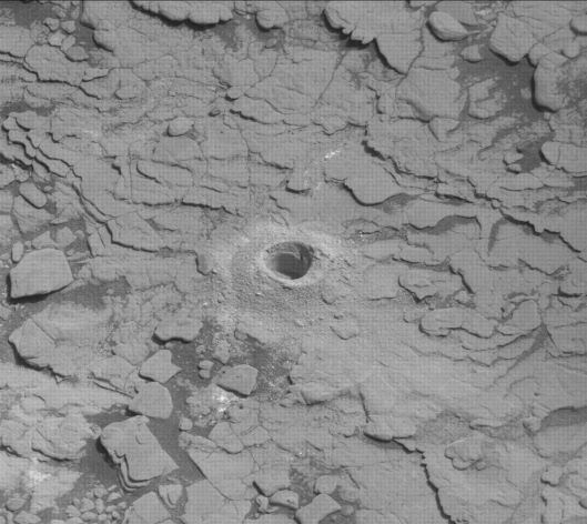
Curiosity Mast Camera Right image acquired on Sol 2874, September 6, 2020.
Credit: NASA/JPL-Caltech/MSSS
Firing up the laser
Thompson adds that the Chemistry and Camera (ChemCam) instrument will fire its laser at three targets, “Burgi,” “Woodside” and “Snowy Owl” to continue documenting the variations in element concentrations associated with different layers, colors and nodular/patchy features within the rock at the robot’s location.
“We will also acquire color Mastcam documentation images of these targets and extend the imaging of the workspace,” Thompson notes.
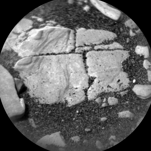
Curiosity Chemistry & Camera Remote Micro-Imager (RMI) photo taken on Sol 2876, September 8, 2020.
Credit: NASA/JPL-Caltech/LANL
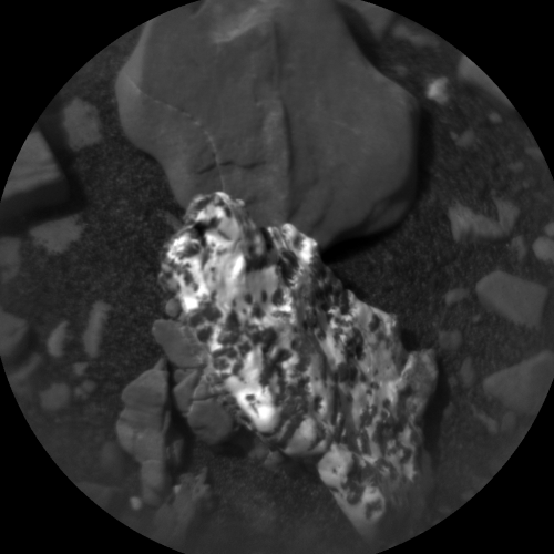
Curiosity Chemistry & Camera Remote Micro-Imager (RMI) photo taken on Sol 2876, September 8, 2020.
Credit: NASA/JPL-Caltech/LANL
Dusty season
It is the dusty season on Mars, so the environmental scientists on the team have taken the opportunity to plan a comprehensive suite of activities.
“Their prime goal is to monitor how the dust in the atmosphere affects opacity and to look for dust devil activity, but they also planned an observation to monitor cloud formation,” Thompson reports.
Both Curiosity’s Mastcam and Navcam will be utilized for these observations.
Argon measurement
“While we have drilled sample in the Sample Acquisition, Processing, and Handling (SA/SPaH) subsystem,” scientists are unable to use the other instruments on the rover arm — (the Mars Hand Lens Imager (MAHLI) and the Alpha Particle X-Ray Spectrometer) for contact science.

This Sol 2874 Navcam right image shows Curiosity’s turret and the APXS instrument (top, right of center) pointed away from the ground. Mount Sharp is in the background. APXS made measurements of the Argon content of the Martian atmosphere.
Credits: NASA/JPL-Caltech
“This means that as a member of the APXS team, it is normally a relatively quiet time for me, as we wait to dump the drilled sample from the SA/SPaH system,” Thompson explains. “However, we are able to use the APXS, pointing away from the ground, to make measurements of the Argon content of the atmosphere.”
That measurement is done roughly every 4 weeks to record seasonal fluctuations, and scientists took the opportunity to plan such a measurement recently.
Thompson concludes that the remainder of the current plan includes standard Rover Environmental Monitoring Station (REMS), Dynamic Albedo of Neutrons (DAN) and Radiation Assessment Detector (RAD) activities.
 Posted in
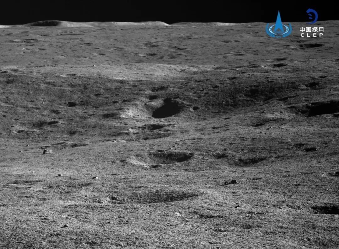
Yutu-2 view of farside surroundings.
Credit: CNSA/CLEP
China’s Chang’e-4 mission that landed in the Von Kármán crater on the Moon’s farside has determined the thickness of the regolith and revealed the fine subsurface structures and evolutionary history of the probe’s landing site.

Credit: CCTV/Inside Outer Space screen grab
Carried by the Yutu-2 rover, a penetrating radar has found a three-unit substructure at the landing site. The data supports the contention that the explored zone of the Moon had experienced multiple impact events and basalt magma eruptions.
The Yutu-2 results show that the materials detected stem from the nearby Finsen impact crater rather than the basalt erupted from the lunar mantle, which filled the bottom of the Von Kármán crater. It was also revealed that the landing area had experienced multiple impact events and basalt magma eruptions.
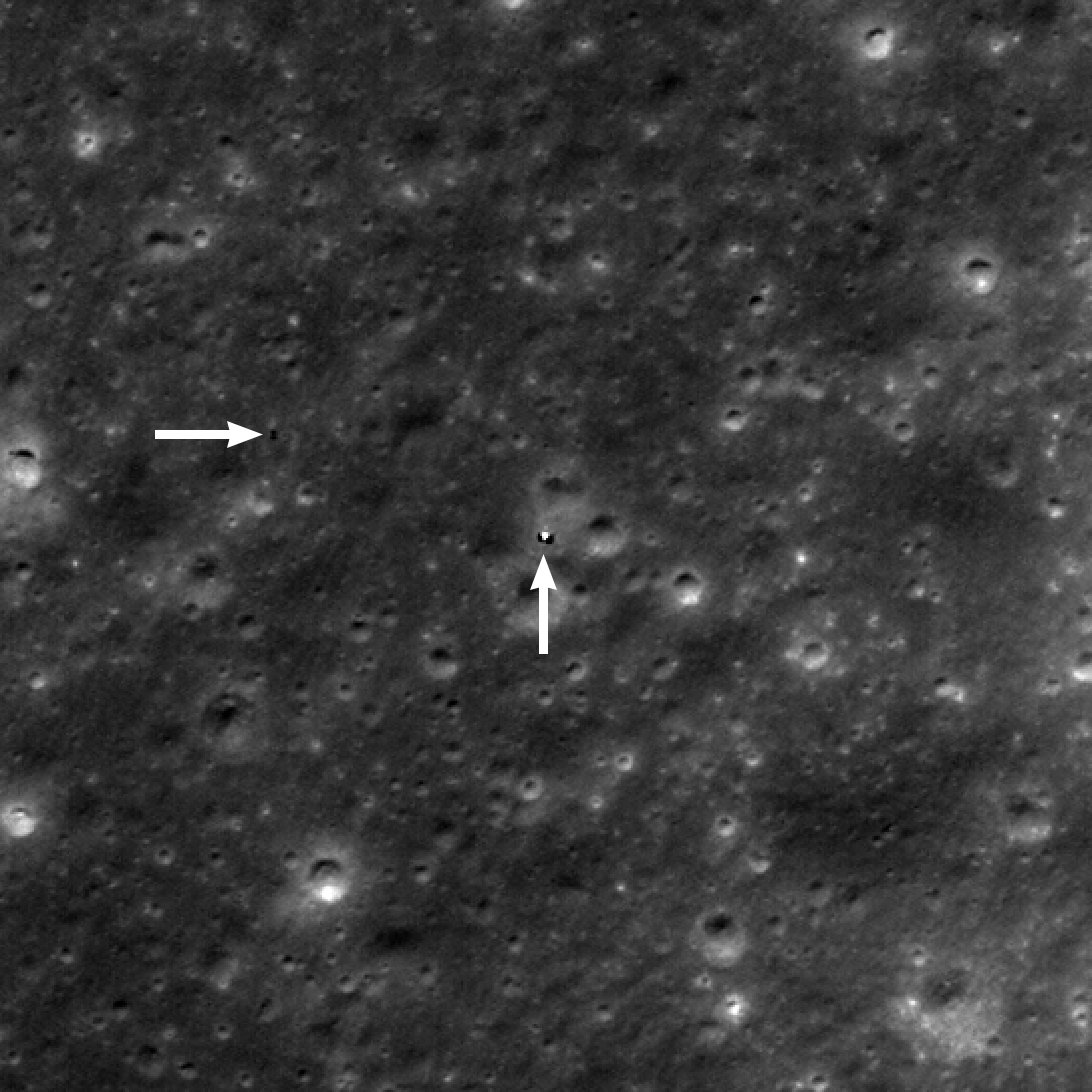
Yutu-2 (horizontal arrow) was about 130 meters west of the Chang’e 4 lander (vertical arrow) on June 3, 2019.
Credit: NASA/GSFC/Arizona State University
Deep interior materials
“Our results reveal that the surface materials at the Chang’e-4 landing site are unambiguously dominated by the ejecta from the Finsen crater with a minor contribution from other neighboring craters. The regolith measured by Yutu-2 is representative of the initial lunar deep interior materials, rather than the later erupted basalts,” explains a new paper published in the latest issue of the journal, Nature Astronomy.
The lead author of the paper – “Lunar regolith and substructure at Chang’E-4 landing site in South Pole–Aitken basin” — is Jinhai Zhang of the Key Laboratory of Earth and Planetary Physics, Institute of Geology and Geophysics, Chinese Academy of Sciences in Beijing, China.
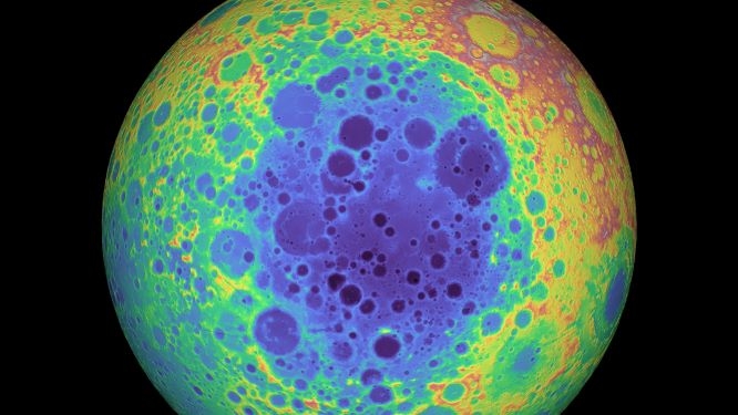
The South Pole-Aitken Basin on the lunar farside.
Credit: NASA/GSFC/University of Arizona
Large impact structure
Making the first-ever soft landing on the Von Kármán crater in the South Pole-Aitken Basin on the farside of the Moon, the Chang-e-4 lunar mission landed there on January 3, 2019.
The South Pole–Aitken (SPA) basin is the oldest and largest impact structure on the Moon, and it gives particular insight on the lunar interior composition.
For access to the paper — “Lunar regolith and substructure at Chang’E-4 landing site in South Pole–Aitken basin” – go to:

Credit: Icarus Films
Space Dogs from Icarus Films focuses on Laika, a stray dog picked up by the Soviet space program on the streets of Moscow. This dog became the first living being to orbit the Earth when she was launched into space on Sputnik 2.

Soviet Union’s Sputnik 2 carried the dog, Laika, into Earth orbit in 1957.
Courtesy: NASA
Although Laika would not survive the journey, directors Elsa Kremser and Levin Peter trace the persistence of her memory and legacy into the present day. As the capsule containing Laika re-entered Earth’s orbit and began to burn up, the narrator announces “What had been a Moscow street dog had become a ghost.”
The adventures of her descendants, living on the streets of Moscow today.
Opens September 11, presented by Alamo Drafthouse (NY), Laemmle (LA) and more local theaters.

Credit: Martin Parr Collection
Video trailers at:
https://vimeo.com/ondemand/spacedogsofficial/442468916
For more information, also go to:

Purported spaceplane launch image courtesy LaunchStuff via weibo.com
China’s just-returned reusable spacecraft “may be like US’ X-37B, focusing on civilian use, tapping into space application potential,” experts say.
That statement comes not from twitter-feeding and fueling appraisals but from China’s state-run Xinhua news agency.
Following a flight of two days, the Chinese craft landed at a “designated site” on Sunday, “marking a breakthrough in China’s technology for reusing spacecraft,” Xinhua reports.
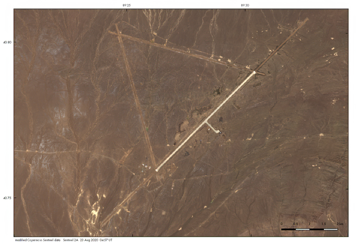
Possible landing site for Chinese space plane? Airfield photo credit: ESA/Copernicus Sentinel via Marco Langbroek
Tight-lipped
Meanwhile, Chinese space authorities remain tight-lipped on the experimental flight, launched last Friday from the Jiuquan Satellite Launch Center atop a Long March-2F booster, the launch vehicle for China’s crewed space projects.
Reportedly, local Chinese rocket watchers were requested to not photograph or video record the liftoff from outside the launch site – although one takeoff image has seemingly emerged.
“No official renders or photos of the spacecraft have been made public as of press time, Xinhua notes, adding that “the successful experiment of the spacecraft offers more convenient solutions for future peaceful use of the space and enables cheaper round-trips.”

China has had a long-standing interest in reusable space planes.
Courtesy: Jean Deville/China Aerospace Blog
New materials, new age of modularization
Song Zhongping, a military expert and TV commentator, told the Global Times on Sunday, that the just-concluded mission was designed to test the performance of new materials for the reusable vehicle and to test the monitor and control system.
Also, Wang Ya’nan, chief editor of Beijing-based Aerospace Knowledge magazine was cited as saying the test would focus on the vehicle’s capability to enter orbit via a carrier rocket launch and the reliability of its returning to Earth, which are key for a reusable orbital vehicle.

X-37B Air Force space plane.
Credit: Boeing/Inside Outer Space Screengrab
“The vehicle could be equipped with robotic arms to conduct maintenance and supply missions for on-orbit spacecraft such as satellites. And in return, Chinese satellites could enter a new age of modularization, further tap into the potential of space application,” Wang said. It is too early to determine when the Chinese orbital vehicle could be put into practical use, as the project has only just had its first launch and return test, Wang added, noting that once the technology matures, China would be the third country to have such space planes, following the U.S. and Russia.
“China has not developed this kind of reusable orbital vehicle before, and once it achieves maturity and puts into practical use, it will transform the current space use landscape in both civilian and military use,” experts said in the just-posted Xinhua story.

Boeing handout describes X-37B program.
Credit: Boeing
X-37B-like?
Regarding comparisons between China’s “mysterious vehicle,” if it is a fixed wing space plane, and the X-37B space plane owned by the US Air Force, the Xinhua article explains that, considering the data and method of launch, “China’s orbital vehicle could be very similar to US’ X-37B, and the vehicle could have a fixed wing span of more than four meters,” citing a remark from Wang.
The use of the Long March-2F booster for the mission shows that the experiment mission is of great significance, Xi Yazhou, a military expert, said in his column published by Guancha.com on Friday.
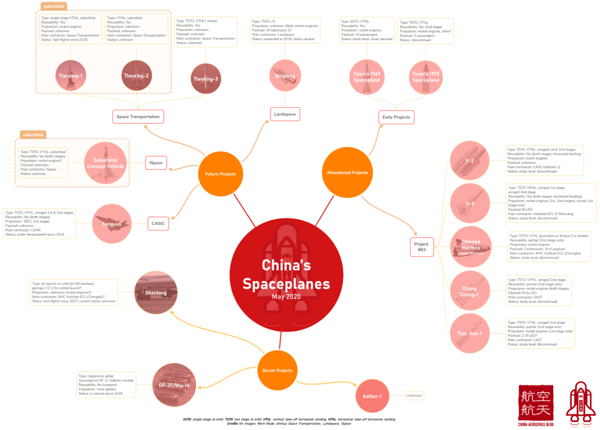
Credit: Jean Deville
As related in the Xinhua news story, China’s reusable orbital spacecraft would be first used in civilian domains, conducting operations such as surveying the Earth, monitoring the environment and maintenance for in-orbit satellites, tagging that statement to space experts.
“China’s authorities have not revealed any intention of military use for the vehicle, but observers stressed that just as the US Air Force’s X-37B claimed to have the capability to strike anywhere on Earth within half an hour, China should at least have that capability,” the Xinhua article concludes.
A recent two-piece blog post by Jean Deville at China Aerospace Blog on the evolution of Chinese space planes could help decipher the intent of China’s space plane ambitions.
Go to these postings by Deville at:
and
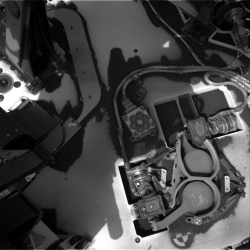
Curiosity Right B Navigation Camera image taken on Sol 2873, September 5, 2020.
Credit: NASA/JPL-Caltech
NASA’s Curiosity Mars rover is now performing Sol 2874 tasks.
The word is that there’s been no sample drop-off to the rover’s Sample Analysis at Mars (SAM) Instrument Suite.
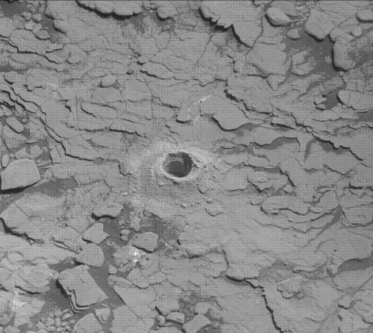
Curiosity Mast Camera Right photo acquired on Sol 2872, September 4, 2020.
Credit: NASA/JPL-Caltech/MSSS
Ken Herkenhoff, Planetary Geologist at USGS Astrogeology Science Center in Flagstaff, Arizona reports that the science team expected the weekend plan to include drop-off of some of the drill sample to the SAM instrument. But it was later recognized that the detailed requirements for the dropoff and SAM analysis could not be met in a recent plan.
“So the arm and SAM activities had to be removed from the plan, freeing up power for other observations,” Herkenhoff adds. The robot will be busy gathering important data over the upcoming holiday weekend.
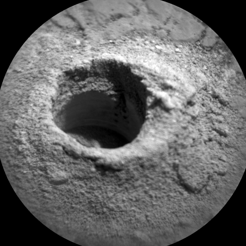
Curiosity Mast Camera Right photo acquired on Sol 2872, September 4, 2020.
Credit: NASA/JPL-Caltech/MSSS
A trio of Sols
Planning is no longer restricted, so Saturday is a “soliday” and the rover team is planning three sols of activities (Sols 2874-2876) to get the rover through Labor Day.
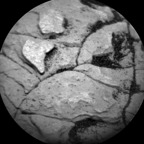
Curiosity Chemistry & Camera (ChemCam) Remote Micro Imager (RMI) photo taken on Sol 2873, September 5, 2020.
Credit: NASA/JPL-Caltech/LANL
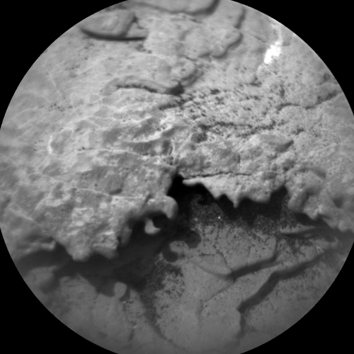
Curiosity Chemistry & Camera (ChemCam) Remote Micro Imager (RMI) photo taken on Sol 2873, September 5, 2020.
Credit: NASA/JPL-Caltech/LANL
On Sol 2874, Curiosity’s Chemistry and Camera (ChemCam) will measure the chemistry of the atmosphere above Gale Crater by looking upward and acquiring spectra. Then ChemCam will fire its laser at the wall of the “Mary Anning 3” drill hole and at a soil target named “Insh Marshes.”
After the Right Mastcam takes pictures of the ChemCam targets, Mastcam will acquire a stereo mosaic to extend the coverage of the area in front of the rover.
Navcam will then search for dust devils and, later that evening, take images of the sky for calibration.
Similarly, just after sunset, the ChemCam Remote Micro Imager (RMI) will take images of the sky above the rover to check the camera’s calibration, Herkenhoff notes.
Room for other activities
The second sol (2875) was originally filled with arm and SAM activities, and after they were removed from the plan there was room for other activities, so added was a long Dynamic Albedo of Neutrons (DAN) passive observation and some engineering checks to go along with the usual Rover Environmental Monitoring Station (REMS) atmospheric measurements.
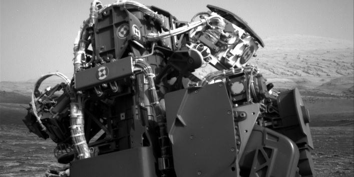
Curiosity Right B Navigation Camera image taken on Sol 2873, September 5, 2020.
Credit: NASA/JPL-Caltech
Herkenhoff continues by pointing out that on Sol 2876, Mastcam will look for changes in the sandy “Upper Ollach” area and take some pictures of the rover deck to look for changes there as well.
Then ChemCam will analyze the chemistry of rock targets “Njuggleswater” and “Rocabarrigh” and the Right Mastcam will image them as well. “Don’t ask me how to pronounce those names,” Herkenhoff says.
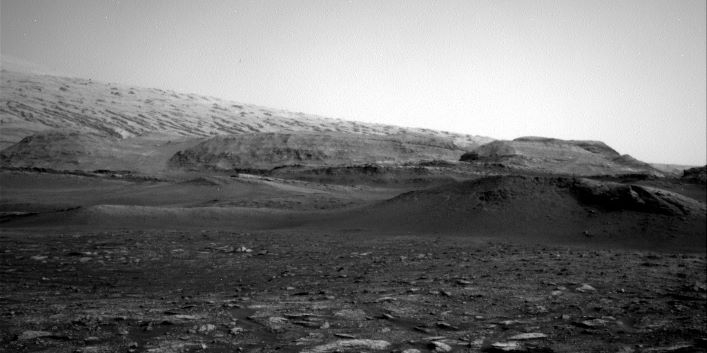
Curiosity Right B Navigation Camera image taken on Sol 2873, September 5, 2020.
Credit: NASA/JPL-Caltech
Finally, during the morning of 2877, Navcam will search for clouds and Mastcam will measure the opacity of dust in the atmosphere, Herkenhoff concludes.

Artwork depicts a notional Chinese space plane design.
Credit: Unknown source
China’s space plane – ‘round and ‘round it goes – when and where it stops, nobody knows.
China’s unpiloted and reusable experimental spacecraft was sent up on Friday (Beijing time) and continues to circuit the globe.
China Aerospace Science and Technology (CAST) Corporation, the leading State-owned space conglomerate, said the robotic vehicle will stay in its orbit for a period to verify reusable technologies.
Then the spacecraft will fly back to Earth and auto-land at an unspecified, preset site.
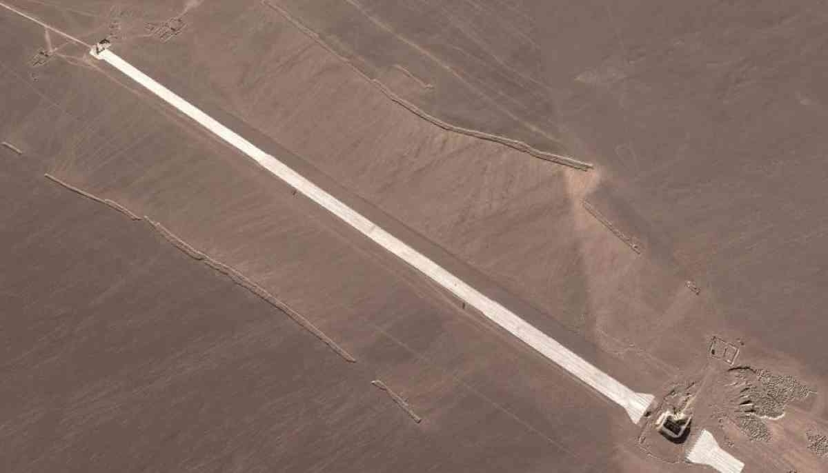
Landing strip for possible touch down of China’s space plane in the Gobi Desert? Credit: Maxar Technologies 2020, Google Earth)
CAST has not elaborated on details of the mission and the spacecraft. It has not published pictures of the space plane-boosted, Long March 2F liftoff, nor scenes inside the command and control hall.
Friday’s mission was the 344th launch of the Long March rocket fleet and the 14th of the Long March 2F. That launcher is primarily tasked with serving China’s crewed space program.
All of the Long March 2F’s previous flights involved space piloted missions; the rocket sent six crewed and five unpiloted spaceships into low-Earth orbit, as well as two space labs.
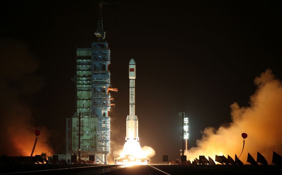
Chinese websites have displayed various images of a Chinese Long March 2F launch, but experts say no true image of the space plane booster have been issued.
Credit: file pic
Sky-watching observers
Meanwhile, sky-watching observers are keeping an eye on the craft.
The North American Aerospace Defense Command (NORAD) ID for the craft is: 46389. The international code is: 2020-063A
Tracking information has the space plane pegged at a perigee (low point to Earth) of 338.2 kilometers with an apogee of 354 kilometers, with an inclination of 50.2 degrees.
One tool in use to help track the whereabouts of the Chinese space plane is: https://www.n2yo.com/
This Chinese craft is circling the Earth every 91.3 minutes.
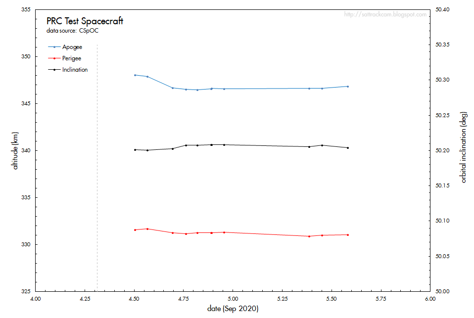
Skywatcher Marco Langbroek of the Netherlands tweets graph showing changes in apogee, perigee and inclination of the Chinese reusable test spacecraft.
Credit: Marco Langbroek
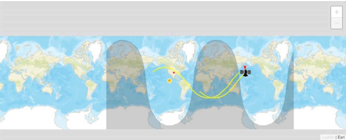
China space plane tracking chart.
Credit: n2yo.com

Virgin Galactic’s suborbital plans involve toting well-dressed space travelers into near space, perhaps starting early next year.
Credit: Virgin Galactic/Quasar Media 2018
The Congressional Research Service (CRS) has issued The Future of Space Tourism, taking a look at a variety of issues that will shape the promise of public space travel.
Diving into the history and development of the space tourism sector, the report spotlights new entrants, such as Virgin Galactic, SpaceX, Blue Origin, and the high-altitude balloon concept offered by Space Perspective.

Credit: Space Perspective
The CRS is a nonpartisan, shared staff to congressional committees and Members of Congress that reviews a host of topics.
Safety of launch vehicles
“At present, the U.S. government has no procedures for certifying the safety of launch vehicles for tourist passengers,” the CRS document explains. Flagged in the report is that launch providers must receive a license for their rockets from the Federal Aviation Administration (FAA), “but this licensing process addresses propulsion and trajectory aspects of spaceflight missions and public safety on the ground rather than passenger safety.”

Blue Origin’s crew capsule – a suborbital six-seater craft.
Credit: Blue Origin
For flights with passengers, the report notes, “FAA requires crew and pilots of commercial spaceflight vehicles to meet certain training and medical standards, but it has no standards applicable to passengers.”
Considerations for Congress
The CRS report offers a set of “considerations for Congress,” such as the Congress may want to consider whether the law restricting FAA’s authority to regulate the safety of commercial spacecraft with humans onboard “should be extended, lifted, or allowed to expire in phases.”

Virgin Galactic pilot Todd Ericson and NTSB investigators at SpaceShipTwo accident site. Craft broke apart during a test flight on October, 31, 2014.
Credit: NTSB
Congress has supported the development of voluntary safety standards by industry, interagency working groups, and the aerospace medical community, with the CRS report saying they may want to consider whether the federal government should adopt such standards as regulations.
The CRS report, written by Alyssa K. King, an analyst in transportation policy, also looks at medical concerns for spaceflight participants as well as how best to handle accident investigations.
To review the full report — The Future of Space Tourism – go to:
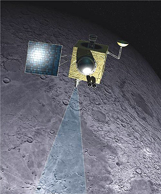
Chandrayaan-1 was an Indian Space Research Organization (ISRO) mission that carried a U.S.-provided Moon Mineralogy Mapper (M3) science instrument.
Credit: ISRO
Researchers continue to plumb data from the Moon Mineralogy Mapper (M3) that was carried onboard the Indian Chandrayaan-1 mission.
As the first Indian lunar probe under the country’s Chandrayaan program, the orbiter was launched by the Indian Space Research Organization (ISRO) in October 2008. The Moon-circling probe operated until August 2009.
M3 was a NASA-supported guest instrument on ISRO’s Moon remote sensing mission.
Credit: NASA/ESA
Nearside, farside facts
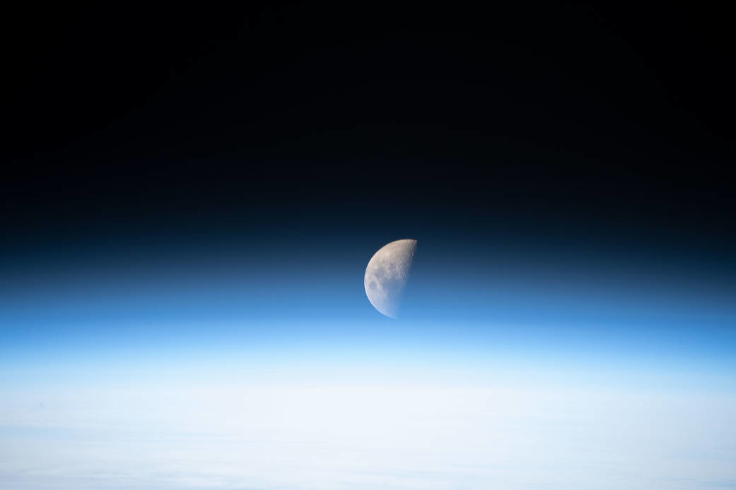
New analyses of the M3 data show that hematite, a ferric mineral, is present at high latitudes on the Moon, mostly associated with east- and equator-facing sides of topographic highs, and is more prevalent on the Moon’s nearside than the lunar farside.
Leading the research, published in Science Advances, is Shuai Li of the Hawai’i Institute of Geophysics and Planetology, University of Hawaii in Honolulu.

Using local resources on the Moon can help make future crewed missions more sustainable and affordable.
Credit: RegoLight, visualization: Liquifer Systems Group, 2018
Evolution of Earth’s atmosphere
“Hematite (Fe2O3) is a common oxidization product on Earth, Mars, and some asteroids.
Although oxidizing processes have been speculated to operate on the lunar surface and form ferric iron–bearing minerals, unambiguous detections of ferric minerals forming under highly reducing conditions on the Moon have remained elusive,” the study team notes.

The Earth straddling the limb of the Moon, as seen from above Compton crater.
Credit: NASA/GSFC/Arizona State University
Oxygen delivered from Earth’s upper atmosphere could be the major oxidant that forms lunar hematite, the researchers point out.
“Hematite at craters of different ages may have preserved the oxygen isotopes of Earth’s atmosphere in the past billions of years. Future oxygen isotope measurements can test our hypothesis and may help reveal the evolution of Earth’s atmosphere,” the research paper adds. “Studying the oxygen isotopes of hematite at different age craters may help reveal the evolution of Earth’s atmosphere in the past billions of years.”
Wanted: ground truth
“We really need ground truth to verify these new observations,” says lunar resource expert, Clive Neal, a professor at the University of Notre Dame in the Department of Civil & Environmental Engineering and Earth Sciences.
“Shuai Li has once again presented intriguing results from orbital data that challenge one of the basic paradigms of our understanding of the Moon,” Neal told Inside Outer Space, “that it represents a reducing environment. The presence of hematite, if verified, will shift that paradigm in terms of space weathering processes.”
Here on Earth, Hematite is used for a number of purposes. For one, it is a very dense and inexpensive material that is effective at stopping x-rays. For that reason it is used for radiation shielding around medical and scientific equipment.
For more information, go to:
“Widespread hematite at high latitudes of the Moon,” by Shuai Li, Paul G. Lucey, Abigail A. Fraeman, R. Poppe, Vivian Z. Sun, Dana M. Hurley, and Peter H. Schultz, go to:
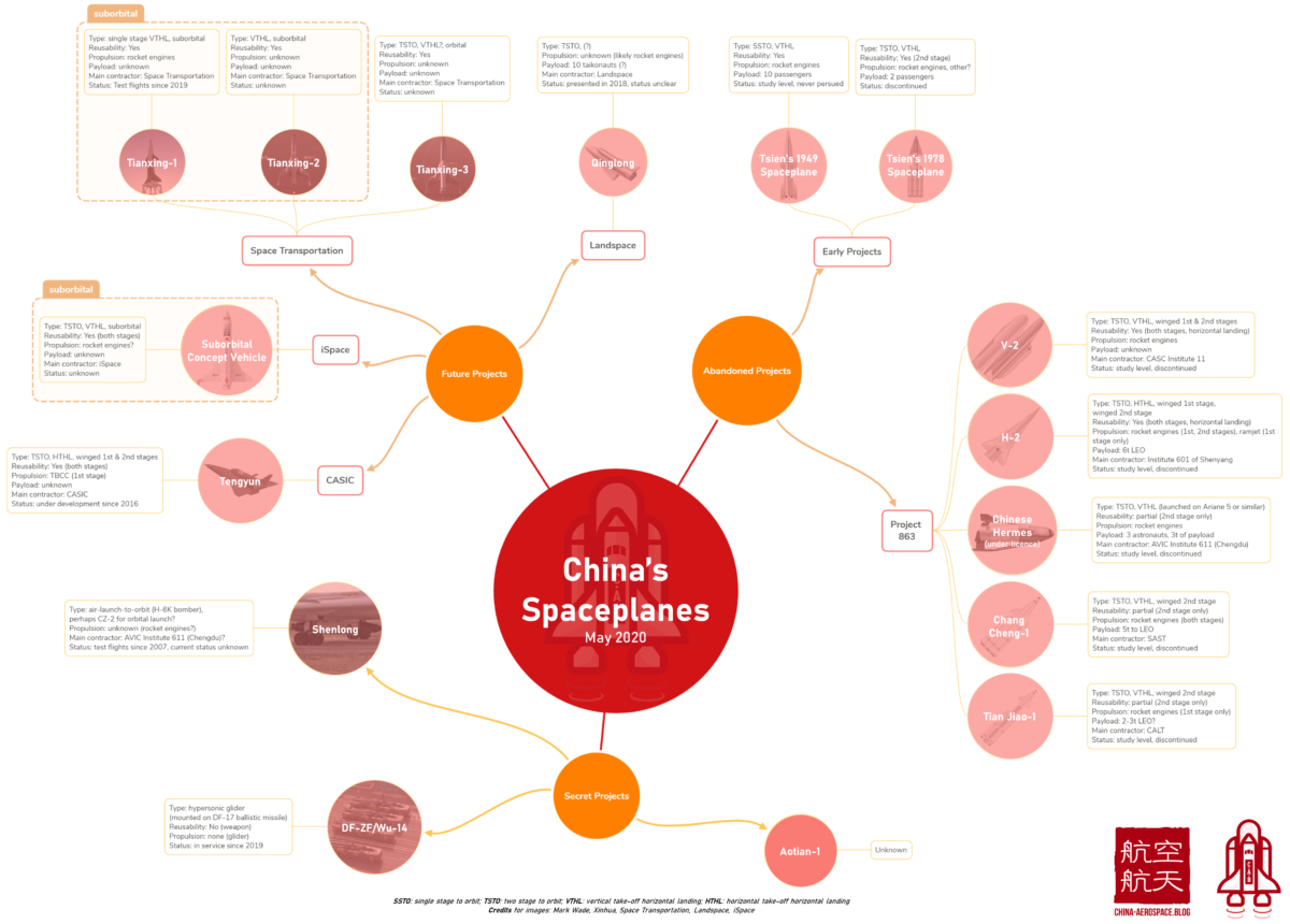
China has had a long-standing interest in reusable space planes.
Courtesy: Jean Deville/China Aerospace Blog
China launched an experimental reusable spacecraft Friday from the Jiuquan Satellite Launch Center.
Boosting the craft spaceward was a Long March-2F carrier rocket.
It’s the first mission of a small re-usable space plane, possibly associated with China’s space station program and may be intended for long duration missions before return to Earth, posts Robert Christy of Zarya.info.
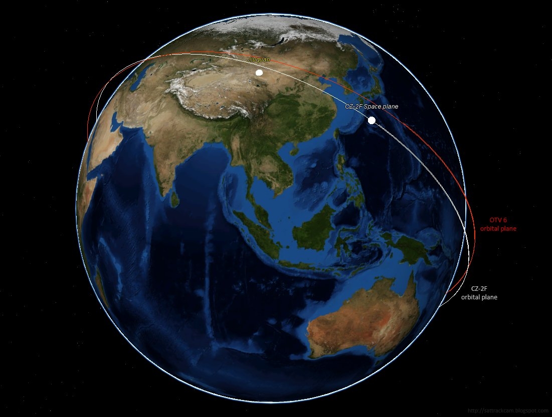
Chinese space watchers believe the non-piloted space plane is meant to mimic the U.S. Air Force X-37B space plane, now circuiting the Earth on its sixth mission and dubbed Orbital Test Vehicle (OTV-6).
Shroud of mystery
Christy told Inside Outer Space that the booster’s launch time was two hours later than implied by an associated Notice to Airmen (NOTAM) filed by China, implying a glitch in the countdown.
It’s not been launched to match the U.S. military’s OTV-6. The inclination of the Chinese space plane is 50° – “so it misses being coplanar with OTV by a country mile,” Christy adds.
“Beware of launch vehicle photos,” Christy says. “I’ve seen two so far, but both show signs of editing in the shroud area. They may be based on Shenzhou launcher images modified with someone’s idea of what the shroud might look like.”
Speculation only, but Christy suspects China’s space plane is bigger than the Air Force’s OTV (could it have a crew cabin?) and might not have used a fully enclosed shroud at launch.
“That could explain why there’s no proper photos,” Christy points out. “I also get the impression that local Chinese public were warned off photographing and filming from outside the launch site – why do that if everything was under a standard cylindrical shroud?”
The craft rode atop the 14th mission of the Long March-2F carrier rocket – a booster only previously used for launches of Shenzhou piloted spacecraft and China’s Tiangong space lab, Christy adds.
Landing strip. Possible touch down spot for China’s space plane in the Gobi Desert? Credit: Maxar Technologies 2020, Google Earth)
Landing site in China
The Chinese space plane appears to be in a 332 x 348 kilometer orbit with a 50.20 degree inclination.
“After a period of in-orbit operation,” reports Xinhua, the state-run news agency, “the spacecraft will return to the scheduled landing site in China. It will test reusable technologies during its flight, providing technological support for the peaceful use of space.”

Encapsulated X-37B Orbital Test Vehicle for U.S. Space Force-7 mission, now in Earth orbit.
Credit: Boeing
Credit: Satellite watcher, Marco Langbroek in the Netherlands.
Space plane ambitions
Similar to OTV-6, understanding what China’s space plane is intended to showcase is puzzling.
A recent two-piece blog post by Jean Deville at China Aerospace Blog on the evolution of Chinese space planes could help decipher the intent of China’s space plane ambitions.
Go to these postings by Deville at:
and
Courtesy: Jean Deville/China Aerospace Blog

Key Governance Issues in Space is a new report from the Center for Strategic and International Studies (CSIS) – a bipartisan, nonprofit policy research organization dedicated to advancing practical ideas to address the world’s greatest challenges.
The report explores the global landscape of national space policies concerning space sustainability, rendezvous and proximity operations, and insurance requirements – elements that they say are “uneven and irregular.”
Solutions for space sustainability
“Without clear national regulations and policies, the challenge to find international consensus and define technical standards for key issues in space governance remains bleak,” the report explains.

The crowded space environment may look like this a decade from now, with proposed mega-constellations.
Credit: Center for Space Policy & Strategy
“However, there are a few areas of consensus among nations, such as the need from the global space community for nations to support solutions for space sustainability.
Orbital debris
A concern expressed in the report, by several in the space community, is that real efforts to protect the space domain will not occur until another major debris-creating event occurs.
The report, by Kaitlyn Johnson, an associate fellow and associate director of the Aerospace Security Project at the Center for Strategic and International Studies, is available at:
https://aerospace.csis.org/wp-content/uploads/2020/09/Johnson_GovernanceInSpace_WEB_FINAL-1.pdf

