Archive for March, 2020

Credit: NASA
And you thought dealing with Pluto as a planet was tough.
There is an enduring debate over capitalizing the M for Earth’s Moon. Some organizations, like NASA, have it capitalized in their style guide. However, the Associated Press (AP), considered a gold standard for guidelines in print journalism, downgrades our celestial next door neighbor to a small m.

Earth’s Moon and cislunar space looms large in our future.
Credit: ESA/NASA
Will this brew-ha over editorial rules ever be resolved…for good?
Key individuals make the case for upper case or lower.
Go to my new Space.com story at:
A capital debate: Should Earth’s natural satellite be ‘Moon’ or ‘moon’?
How should we write the name of Earth’s nearest celestial neighbor?
https://www.space.com/moon-name-controversy-capital-letter.html
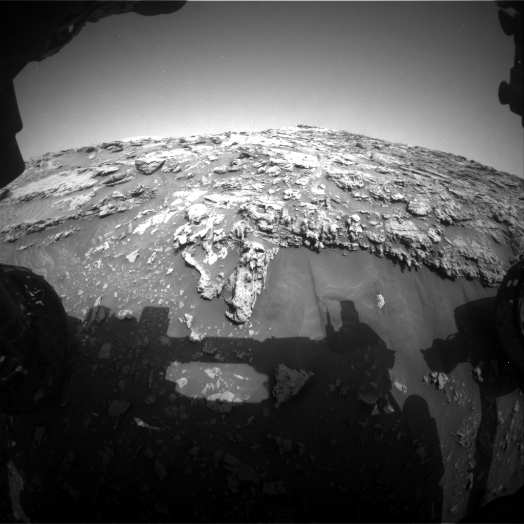
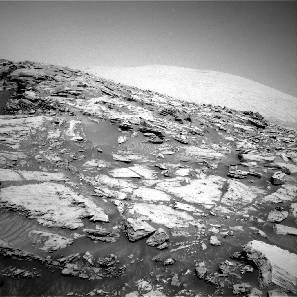
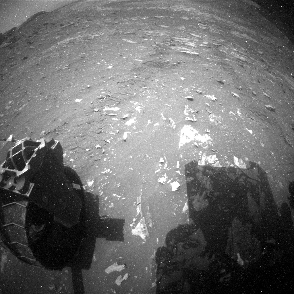
Extreme Tilt! Curiosity Front Hazard Avoidance Camera Left B image acquired Sol 2693, March 4, 2020.
Credit: NASA/JPL-Caltech
NASA’s Curiosity Mars rover is wrapping up Sol 2693 duties.
The robot is making progress on its “impressive ascent,” reports Susanne Schwenzer, a planetary geologist at the Open University; Milton Keynes, U.K.
“The planning started with intense discussions on the question of what to do, and for a very good reason,” Schwenzer notes. “The sedimentology experts in the team had determined that we can see very interesting structures related to a possible contact between the Murray and the overlying pediment.”
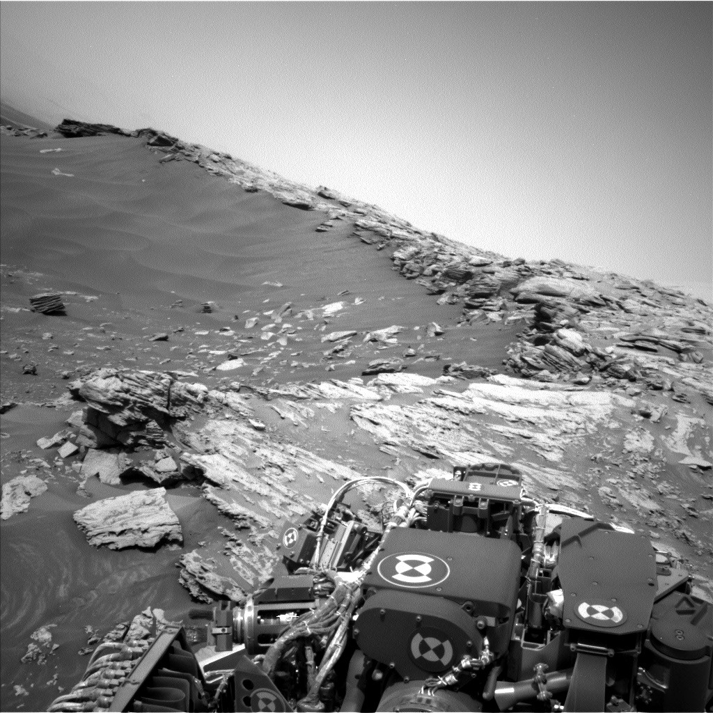
Curiosity Left B Navigation Camera photo acquired Sol 2693, March 4, 2020.
Credit: NASA/JPL-Caltech
Small adjustment
Decisions were made early in planning to possibly collect contact science near the contact, or if the rover should continue its climb to the top.
Curiosity Left B Navigation Camera photo acquired Sol 2693, March 4, 2020.
Credit: NASA/JPL-Caltech
“Changing the plan from ‘keep moving’ to ‘stay’ is never taken lightly, and the discussions reflected this as we were weighing options. The reason for the discussion was that we found a site close to the contact that looked much more accessible, detail rich and valuable up close than it had originally looked from the bottom of the hill,” Schwenzer adds.
This justified not driving all the way onto the top of the pediment…and instead doing a small adjustment to allow Mars researchers to do contact science at interesting targets.
“The data we will be acquiring here is getting the team excited!”
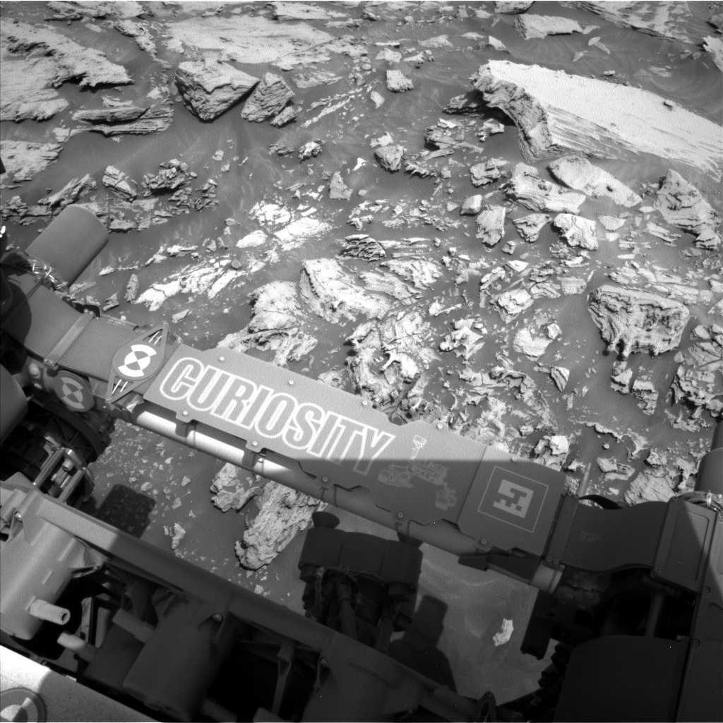
Curiosity Right B Navigation Camera image taken Sol 2693, March 4, 2020.
Credit: NASA/JPL-Caltech
Bedrock targets
A recent plan has the rover scheduled to have two Chemistry and Camera (ChemCam) targets on bedrock: target “Ariundle” is in front of the rover.
The ChemCam target “Hutton’s Section” is higher up on the slope and thus closer to the pediment. “We are expecting to see some differences in chemistry between the two. Mastcam has a mosaic in this plan, which covers the two targets and documents the sedimentary structures around them,” Schwenzer points out.
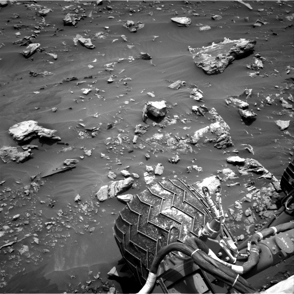
Challenging terrain
The plan calls for slightly adjusting the rover to prepare for an Alpha Particle X-Ray Spectrometer (APXS) measurement in the area of the Hutton’s Section target.
“The adjustment should get us into a position to where we can reach the target with our arm,” Schwenzer explains. But use of the rover’s robot arm is yet to be seen, because the robot is driving through very challenging terrain.
On the last drive the tilt of the rover exceeded 30 degrees.
“And, of course, that sparked the question if we are now holding the martian rover tilt record. Well, the colleagues who also did operations on the MER rovers reminded us that the MER rover Opportunity still holds the record by a fraction of a degree,” Schwenzer reports.
Curiosity Right B Navigation Camera image taken Sol 2693, March 4, 2020.
Credit: NASA/JPL-Caltech
Tilt record?
The plan also includes further imaging and a ChemCam Autonomous Exploration for Gathering Increased Science (AEGIS) observation after the drive.
“This will set us up nicely for the next planning, hopefully with some contact science if it can be done safely – and then to continue the climb onto the pediment,” Schwenzer concludes. “Will we break the martian tilt record? The jury is still out – and a big shout of ‘awesome, thank you’ goes to the engineers, who make Curiosity climb as never before!”
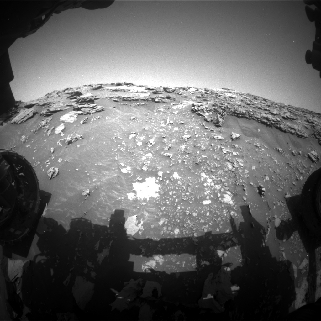
In an earlier report, Lucy Thompson, a planetary geologist at University of New Brunswick, notes that Curiosity successfully completed the first drive of the ascent path onto the Greenheugh pediment, and ended up at a 26.7 degree tilt and at the highest elevation so far on Mount Sharp.
Curiosity Left B Navigation Camera photo taken Sol 2692, March 3, 2020.
Credit: NASA/JPL-Caltech

Raytheon and the National Science Foundation radio astronomy facilities to detect dark asteroids in space.
Credit: Raytheon
A new collaboration to detect and characterize near-Earth asteroids large enough to cause significant damage melds together radio astronomy and radar techniques.
The new agreement brings together the talents of Raytheon and the National Science Foundation radio astronomy facilities to detect dark asteroids in space.
Radar imagery
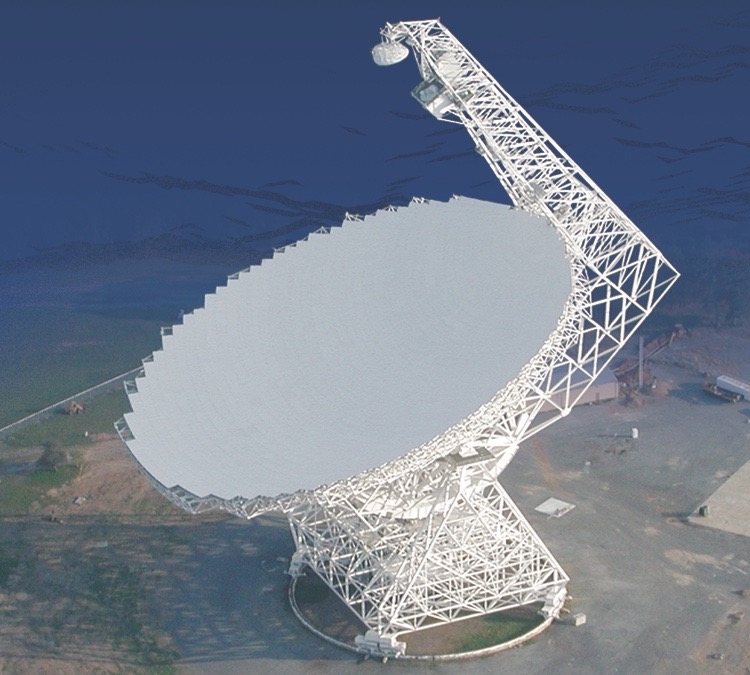
100m Robert C. Byrd Green Bank Telescope.
Credit: Green Bank Observatory
The Raytheon-NRAO/GBO collaboration will integrate a radar transmitter into the Green Bank Telescope (GBT) in West Virginia and use the National Science Foundation’s far-flung Very Long Baseline Array (VLBA) as a receiver to provide a very detailed radar image.
The GBT and the VLBA will each point at the same celestial body, such as the Moon, to conduct radar experiments. This approach increases the probability of detection and characterization of objects out to the orbit of Jupiter and possibly farther.
New capabilities
“Very energetic dusty asteroids – we’re talking from several hundred feet to miles in size – don’t reflect sunlight very well, and that makes them incredibly difficult, if not impossible to detect in our solar system,” said Art Morrish, vice president, Raytheon Advanced Concepts & Technologies in a company statement.
“We’re collaborating with the [National Radio Astronomy Observatory] NRAO to combine radio astronomy and radar techniques to bring new capabilities to the astronomical community to solve problems like this,” Morrish added.

Credit: Green Bank Observatory
Next-generation
Tony Beasley, director of the National Radio Astronomy Observatory and Associated Universities Inc. vice president for Radio Astronomy Operations stated: “This partnership between Raytheon and NRAO/GBO is one of several promising research and technology collaborations we’re exploring that may greatly benefit our next-generation Very Large Array project.”
The NRAO and the Green Bank Observatory are facilities of the National Science Foundation, operated under cooperative agreement by Associated Universities, Inc.
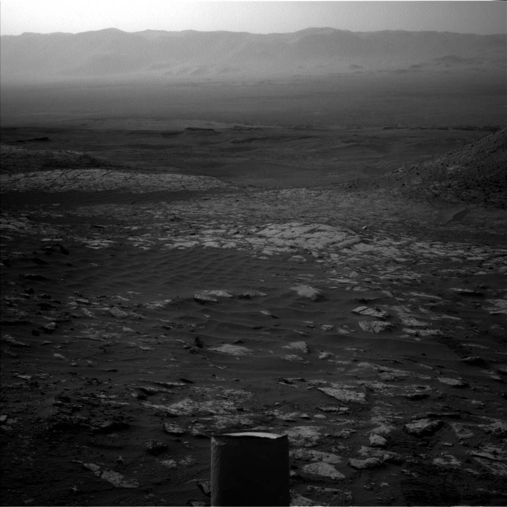
Curiosity Front Hazard Avoidance Camera Left B image taken on Sol 2692, March 3, 2020.
Credit: NASA/JPL-Caltech
NASA’s Curiosity Mars rover is now performing Sol 2693 tasks.
A selection of new imagery from the robot shows its progress to date:
Curiosity Rear Hazard Avoidance Camera Left B photo acquired on Sol 2692, March 3, 2020.
Credit: NASA/JPL-Caltech

Curiosity Left B Navigation Camera image acquired on Sol 2692, March 3, 2020.
Credit: NASA/JPL-Caltech

Curiosity Left B Navigation Camera image acquired on Sol 2692, March 3, 2020.
Credit: NASA/JPL-Caltech

Curiosity Left B Navigation Camera image taken on Sol 2691, March 2, 2020.
Credit: NASA/JPL-Caltech

Credit: NASA/JPL-Caltech/Univ. of Arizona
Road work
A newly released map shows the route driven by NASA’s Mars rover Curiosity through the 2691 Martian day, or sol, of the rover’s mission on Mars (March 2, 2020).
Numbering of the dots along the line indicate the sol number of each drive. North is up. The scale bar is 1 kilometer (~0.62 mile).
From Sol 2664 to Sol 2691, Curiosity had driven a straight line distance of about 38.83 feet (11.83 meters), bringing the rover’s total odometry for the mission to 13.62 miles (21.92 kilometers).
The base image from the map is from the High Resolution Imaging Science Experiment Camera (HiRISE) in NASA’s Mars Reconnaissance Orbiter.

Yutu-2 rover (Jade Rabbit-2).
Credit: CNAS/CLEP
China’s Chang’e-4 lander and rover have concluded their work for the 15th lunar day. Both have switched to “dormant” mode for the 14-day lunar night.

Making tracks. China’s Yutu-2 robot dispatched from farside lander.
Credit: CNSA/CLEP
The rover — Yutu-2 — has worked much longer than its three-month design life, becoming the longest-working lunar rover on the Moon, reports the Xinhua news agency. It has driven over 1,300 feet (399.788 meters) on the farside of the Moon.
Farside landing
China’s Chang’e-4 mission was launched on December 8, 2018, making the first-ever soft landing on the Von Kármán crater in the South Pole-Aitken Basin on the farside of the Moon on January 3, 2019.
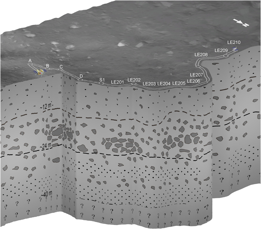
Schematic representation of the subsurface geological structure at the CE-4 landing site inferred from LPR observations.
Credit: Chunlai Li, et al.
The Yutu-2 rover is equipped with Lunar Penetrating Radar (LPR), transmitting radio signals deep into the surface of the Moon, reaching a depth of over 130 feet (40 meters).
Recently released data indicates that the subsurface is essentially made by highly porous granular materials embedding boulders of different sizes.
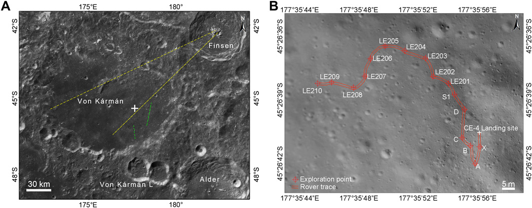
Chang’e-4 mission landed in the eastern floor of Von Kármán crater as indicated by the white cross on a bright ejecta blanket. The yellow and green lines show the ejecta direction from Finsen and Von Kármán L, respectively.
Credit: Chunlai Li, et al.
Sample return

Chang’e 5 lunar sample return capsule has undergone thermal vacuum tests.
Credit: China Aerospace Science and Technology Corporation (CASC).
Next up and out in terms of China’s lunar exploration projects is the launch of the Chang’e-5 lunar probe, weighing about 8.2 tons.
It is expected to be launched in 2020 to rocket lunar samples weighing 4.4 pounds (2 kilograms) back to Earth.
View this CCTV video on the Chang’e-4 mission at:
To read the paper – “The Moon’s farside shallow subsurface structure unveiled by Chang’E-4 Lunar Penetrating Radar” – in Science Advances February 26, 2020, go to:

