Archive for June, 2019
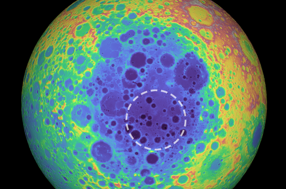
This false-color graphic shows the topography of the far side of the Moon. The warmer colors indicate high topography and the bluer colors indicate low topography. (Credit: NASA/Goddard Space Flight Center/University of Arizona) The South Pole-Aitken (SPA) basin is shown by the shades of blue. The dashed circle shows the location of the mass anomaly under the basin.
It is not quite the monolith uncovered at Clavius crater in the epic 2001: A Space Odyssey movie – but still a surprise.
New research points to the existence of a large excess of mass in the Moon’s mantle under the South Pole‐Aitken basin. It may contain metal from an asteroid that crashed into the Moon and formed the crater.
The surprisingly large amount of mass hundreds of miles underneath the South Pole-Aitken basin has been reported in a study – “Deep Structure of the Lunar South Pole-Aitken Basin” — published in the journal Geophysical Research Letters.
Unexpected mass
“Imagine taking a pile of metal five times larger than the Big Island of Hawaii and burying it underground. That’s roughly how much unexpected mass we detected,” said lead author Peter B. James, Ph.D., assistant professor of planetary geophysics in Baylor’s College of Arts & Sciences in a university press statement.

NASA’s twin GRAIL probes.
Credit: NASA
James and his fellow researchers analyzed data from dual spacecraft used for the NASA Gravity Recovery and Interior Laboratory (GRAIL) mission.
“When we combined that with lunar topography data from the Lunar Reconnaissance Orbiter, we discovered the unexpectedly large amount of mass hundreds of miles underneath the South Pole-Aitken basin,” James said. “One of the explanations of this extra mass is that the metal from the asteroid that formed this crater is still embedded in the Moon’s mantle.”

NASA’s Lunar Reconnaissance Orbiter (LRO).
Credit: NASA/Goddard Science Visualization Studio (SVS)
Iron-nickel core
The dense mass — “whatever it is, wherever it came from” — is weighing the basin floor downward by more than half a mile, he said. Computer simulations of large asteroid impacts suggest that, under the right conditions, an iron-nickel core of an asteroid may be dispersed into the upper mantle (the layer between the Moon’s crust and core) during an impact.
Another possibility is that the large mass might be a concentration of dense oxides associated with the last stage of lunar magma ocean solidification.
Important clues
The South Pole‐Aitken (SPA) basin is the largest preserved impact basin on the Moon and perhaps the largest universally recognized impact structure in the solar system.
The formation and structure of the SPA basin hold important clues about the history and evolution of the Moon.
Resource mining
Could this new finding have implications for on-the-spot resource mining?
“For the most part, no – the anomalies that we detect are likely far deeper than any practical drilling could exploit.,” James told Inside Outer Space. “However, modeling by my coauthor Jordan Kendall has suggested that oblique impacts like the one that created SPA may have resulted in some of the impactor core remaining at the surface, mixed in with the crust or ejecta.”
To read the new paper — Deep Structure of the Lunar South Pole-Aitken Basin – go to:
https://agupubs.onlinelibrary.wiley.com/doi/full/10.1029/2019GL082252

NASA astronaut Tracy Caldwell Dyson, Expedition 24 flight engineer, looks through a window in the Cupola of the International Space Station. A blue and white part of Earth and the blackness of space are visible through the windows.
Credit: NASA
A Reason Foundation study is calling for, and has outlined, a 10-year plan for shifting from a space exploration model centered on NASA to a commerce-based structure.
That structure is one in which the private sector assumes responsibility for all space transportation, large payload launch vehicles and launch operations, in-space facilities and more.

Credit: NASA
Basic space infrastructure
Using only NASA’s current funding levels, the study presents a timeline for public-private development of basic space infrastructure, including fuel depots for space vehicles, a shuttle for travel to the moon, lunar facilities to resupply and aid construction in space, and an orbital facility complex that would be part of the foundation for large-scale space exploration, research and commercialization.
The 86-page study by two veterans of the private space industry — Jeff Greason and James Bennett — concludes the private sector’s long-term space efforts could be funded by self-sustaining commercial activities and supplemented by government contracts.
Jeff Greason was a founder and initial CEO of commercial space company XCOR Aerospace, with prior experience at Rotary Rocket and Intel.
James Bennett was a co-founder of two space-launch start-ups, Starstruck, Inc. and American Rocket Company, which pioneered hybrid rocket propulsion.

Space rock slips by Earth.
Courtesy: Texas A&M
Commercial potential
Areas of commercial potential discussed in the study includes:
Tapping space-based clean energy sources;
Mining asteroids for useful raw materials;
Developing safe venues for new scientific experiments;
Sequestering hazardous but valuable debris in space;
Tapping sources of water in space, for several important uses;
And using low-gravity and low-temperature properties of space for research and manufacturing.

Honey Bee Robotic asteroid capture for ISRU resource return, as viewed in this artist’s conception.
Credit: TransAstra Corporation
Reason Foundation’s nonpartisan public policy research promotes choice, competition and a dynamic market economy as the foundation for human dignity and progress.
Links to the study and related materials can be found here:
The Economics of Space: An Industry Ready to Launch (Executive Summary) By Jeff Greason and James Bennett
https://reason.org/policy-study/the-economics-of-space/
Full Study (.pdf)
https://reason.org/wp-content/uploads/economics-of-space.pdf
Robert Poole’s Overview: New Study Calls for Major Rethinking and Reorganization of U.S. Space Policy By Robert Poole, director of transportation policy and Searle Freedom Trust Transportation Fellow at Reason Foundation.
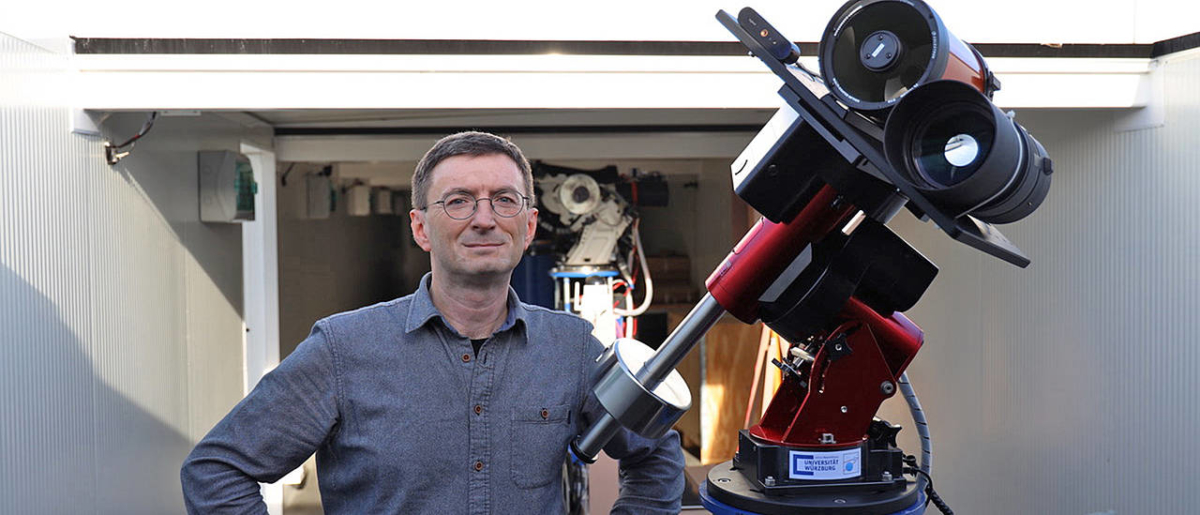
Hakan Kayal next to specialized Moon telescope.
Credit: Tobias Greiner/Universität Würzburg
Flashes of light that occur on the Moon are attracting renewed attention.
Called transient lunar phenomena, or TLPs for short, these bursts of light from the lunar surface have been known since the 1950s. Claims of short-lived lunar phenomena go back at least 1,000 years.
Maintaining a systematic and a long-term lunar look-see is on the astronomical agenda of Hakan Kayal, Professor of Space Technology at Julius-Maximilians-Universität Würzburg (JMU) in Bavaria, Germany.
Remote control
Kayal and his team have built a specialized lunar telescope, putting it into operation in April 2019. Situated in a private observatory in Spain, the weather conditions there viewed as ideal for observing the Moon.
The telescope is remote-controlled from the JMU campus. It consists of two cameras that keep an eye on the Moon night after nightfall, on the prowl to spot flashes of light. If both cameras register a luminous phenomenon at the same time, the telescope triggers further actions. It then stores photos and video sequences of the event and sends an e-mail message to Kayal’s team.

This map displays an approximate distribution of transient lunar phenomena. It is based on a monochrome map by Barbara Middlehurst and Patrick Moore that was published in the book, On the Moon in 2001. Red dots indicate TLP that appeared to the observer as a reddish cloud. Yellow dots are all other events.
Puzzling phenomena
Scientists do not know precisely how these phenomena occur on the Moon. Perhaps they occur due to impacts of a meteor, creating a brief glow. Maybe such flashes occur when electrically charged particles of the solar wind react with lunar dust.
“Seismic activities were also observed on the Moon. When the surface moves, gases that reflect sunlight could escape from the interior of the Moon. This would explain the luminous phenomena, some of which last for hours,” says Kayal in a JMU press statement.
AI software
Augmenting the system — and not yet completely finished – is the software, which automatically and reliably detects flashes and other light phenomena.
Kayal and his colleagues plan to use artificial intelligence methods to distinguish a Moon flash from technical faults or from objects such as birds and airplanes passing in front of the camera. It is estimated that another year of work will be required before this can be done.
Reducing the false alarm rate as much as possible is only the first milestone in this project. The system will later be used on a satellite mission. The cameras could then work in orbit around the Earth or the Moon and free of disturbances caused by our planet’s atmosphere.
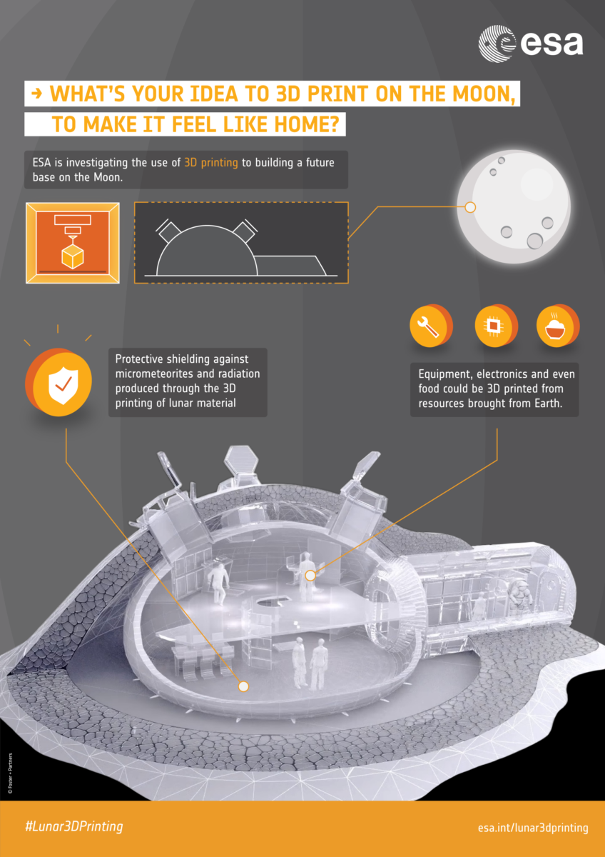
A new ESA-led project is investigating the ways that 3D printing could be used to create and run a habitat on the Moon. Everything from building materials to solar panels, equipment and tools to clothes, even nutrients and food ingredients can potentially be 3D printed.
Credit: ESA
Moonbase planning
Interest in the lunar luminous phenomena is currently high, stirred up in part by Moon exploration plans of Europe, China, India, the United States and others.
“Anyone who wants to build a lunar base at some point must of course be familiar with the local conditions,” says Kayal. So identifying what triggers the mysterious flashes and luminous phenomena is worthy of new study.

Credit: CMSA
China is set to announce selected experiments to be flown on the country’s space station.
In May 2018, the United Nations Office for Outer Space Affairs (UNOOSA) published an “Announcement of Opportunity” inviting Member States to submit applications to conduct scientific experiments onboard China’s space outpost.

Prototype of the Tianhe core module. China’s space station is expected to be operational around 2022.
Credit: CCTV/Screengrab/Inside Outer Space
By October, 42 applications from 27 countries had been submitted, with proposals extending across nine areas, including space medicine, space life science, and fundamental physics.
A preliminary selection of experiments was carried out, yielding a shortlist of 18 ideas.
Forward-looking initiative
Next week, on June 12, there will be a United Nations/China Joint Announcement Event on selected experiments, held at the Vienna International Center.
According to the UNOOSA, the forward-looking initiative is to open China’s space station “to all countries and create a new paradigm in building capabilities in space science and technology, in particular for developing countries.”
According to government plans, China will start piecing together the country’s multi-module space station around 2020. Named Tiangong, or Heavenly Palace, the complex will comprise three main parts: a core module attached to two space labs, combining for a weight of 66 metric tons.

Credit: CMSA
Station assembly
China’s space station build-up will first see use of a Long March 5B heavy-lift rocket to orbit the outpost’s core module. About four crewed spaceflights will then be made sending astronauts to assemble the station.
According to Chinese news reports, the space station is expected to be fully operational around 2022 and is to operate for at least 10 years.
Along with the station, a main section of an Optical Module System would be launched into orbit separately and flies along the same orbit as China’s space station. This system can support multi-color photometry, seamless spectrum survey and Earth observation with multi-function optical capabilities. If necessary, it can dock with the station for refueling, equipment maintenance, payload equipment upgrade and other maintenance activities.
NOTE: The original United Nations/China Cooperation on Utilization of the China Space Station Application Form is available at:
http://www.unoosa.org/documents/doc/psa/hsti/CSS_1stAO/CSS_1stAO_ApplicationForm_2018.doc
To read the handbook — China Space Station and its Resources for International Cooperation – go to:
http://www.unoosa.org/documents/doc/psa/hsti/CSS_1stAO/CSS_1stAO_Handbook_2018.pdf
More information about the United Nations/China Cooperation on the Utilization of the Chinese space station can be found here:
http://www.unoosa.org/oosa/en/ourwork/psa/hsti/chinaspacestation/ao_main.html
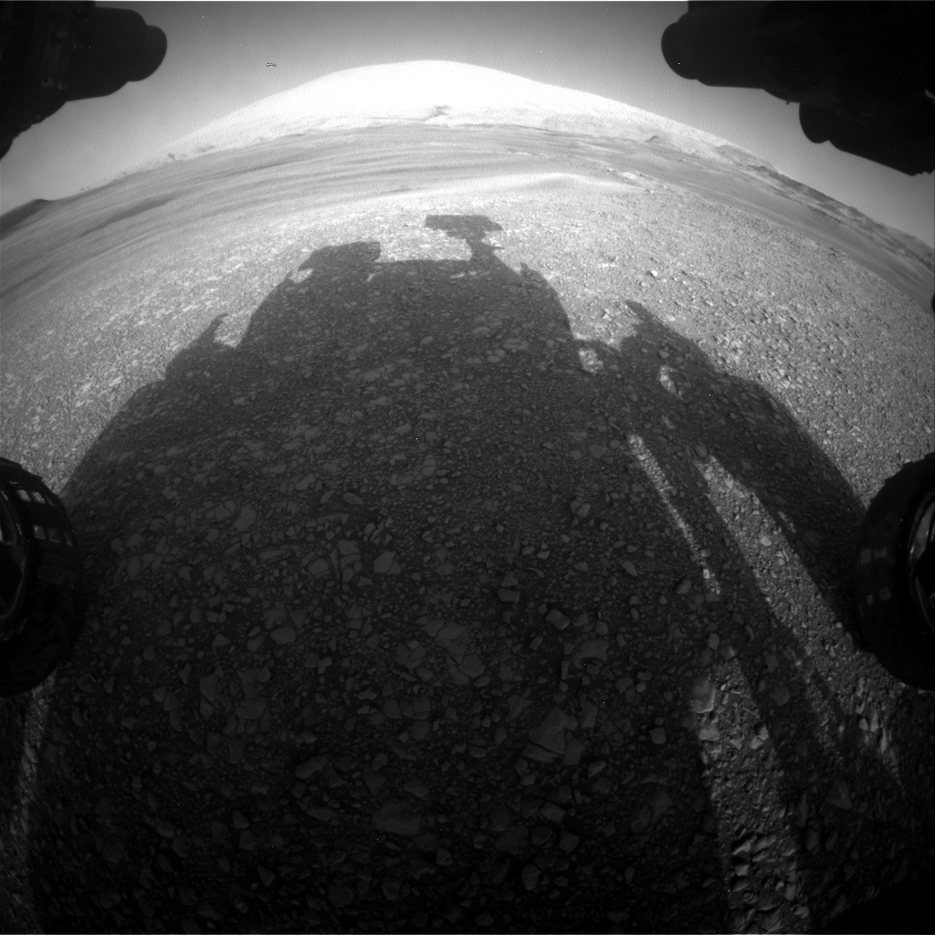
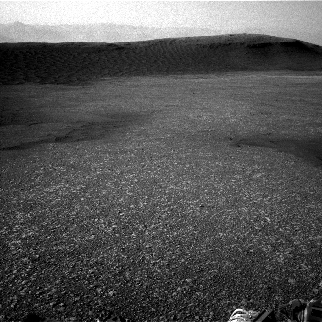
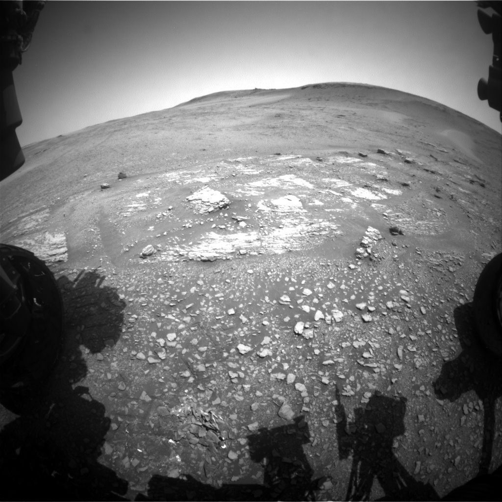
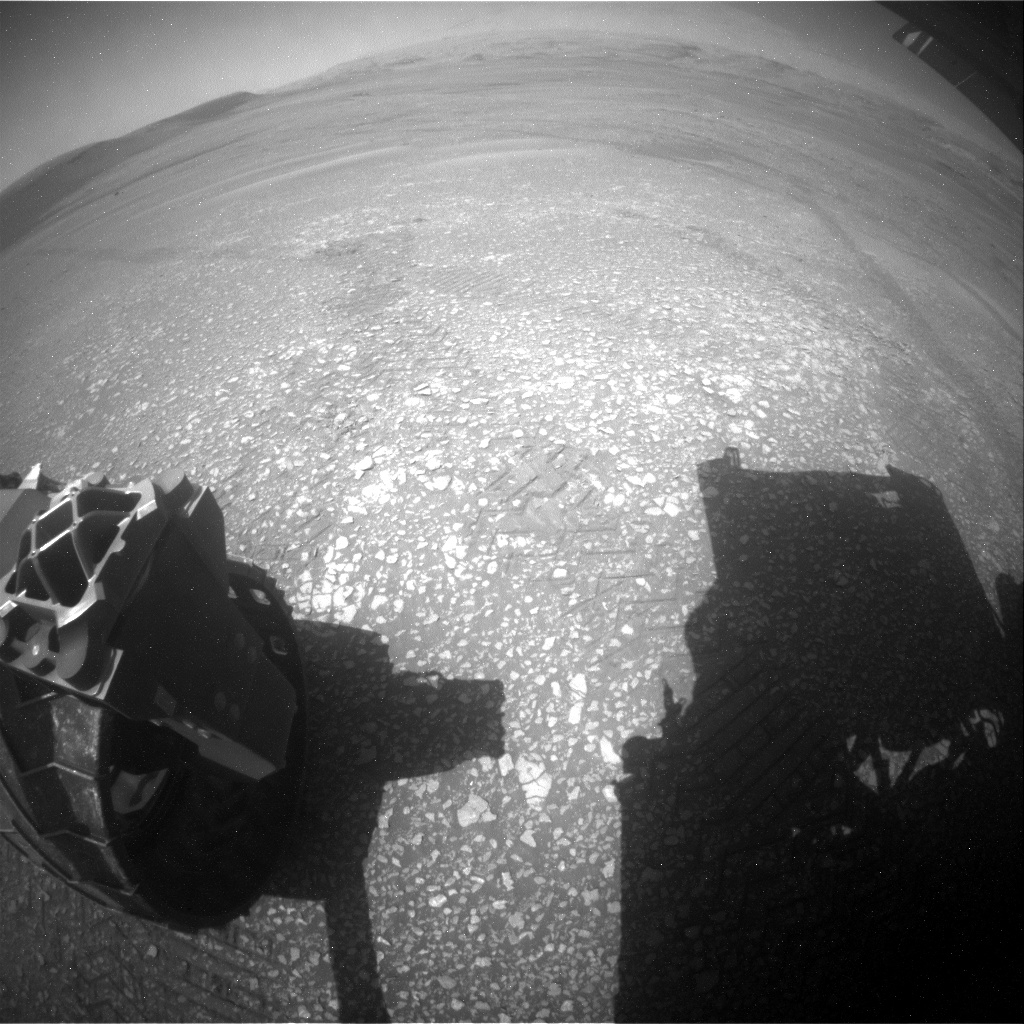
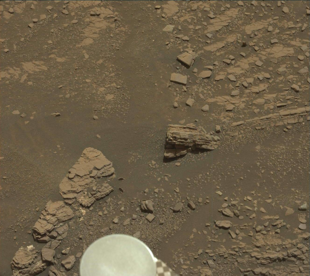
Curiosity Front Hazcam Right B image taken on Sol 2429, June 7, 2019.
Credit: NASA/JPL-Caltech
NASA’s Curiosity Mars rover is now performing Sol 2430 duties.
Brittney Cooper, an atmospheric scientist at York University, Toronto, Ontario, Canada reports that the original plan for Sol 2429 involved a “touch-and-go” where the rover would have engaged in contact science (that’s the “touch” portion) followed by a drive (the “go” portion).

Curiosity Front Hazcam Left B photo acquired on Sol 2429, June 6, 2019.
Credit: NASA/JPL-Caltech
However, the instrument leads for the rover determined tactically that they were satisfied with the contact science already acquired at this location.
“Thus, we planned a ‘no-touch-and-go,’ and were able to take the time planned for contact science and use it to extend the length of a remote sensing science block before the drive,” Cooper explains.
Curiosity Navcam Left B image taken on Sol 2429, June 7, 2019.
Credit: NASA/JPL-Caltech
Nearby gravel
This science block contains two Mastcam multi-filter observations, a 10×1 Chemistry and Camera (ChemCam) raster on target “Awe,” a 5×1 raster on target “Castle Rock,” and a Mastcam stereo mosaic to capture nearby gravel.
Curiosity will then drive an hour and twenty minutes, Cooper adds, and wrap up the sol with some post-drive imaging of the new workspace, a Mastcam tau to measure atmospheric opacity, and a post-drive Dynamic Albedo of Neutrons (DAN) active measurement.
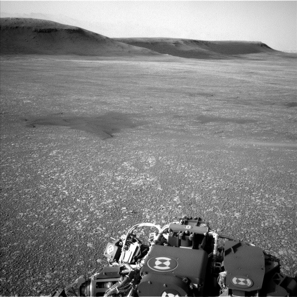
Curiosity Navcam Left B image taken on Sol 2429, June 7, 2019.
Credit: NASA/JPL-Caltech
Cosmic rays
“For those not familiar, a post-drive DAN active consists of the DAN instrument shooting neutrons into the ground and measuring the energy of the reflected neutrons to detect hydrogen just below the surface,” Cooper points out. “A DAN active occurs after every drive so that the DAN team can acquire these measurements at every location that Curiosity stops and does science.”
DAN actives run in conjunction with DAN passives, Cooper adds, “and while you may not hear about them often, the passive measurements run pretty much anytime Curiosity is awake for more than an hour. In passive mode, DAN relies on cosmic rays to provide a source of neutrons for its measurements.”
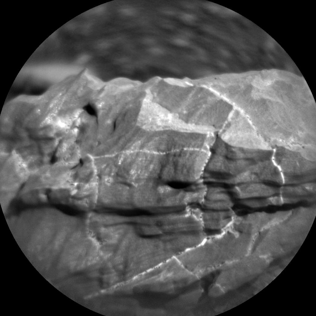
Curiosity ChemCam Remote Micro-Imager photo taken on Sol 2429, June 6, 2019.
Credit: NASA/JPL-Caltech/LANL
Pre-determined pointings
The second sol plan consists of a science block that will occur following the sol 2429 drive, thus researchers don’t know what the robot’s workspace will look like.
In this block a planned Autonomous Exploration for Gathering Increased Science (AEGIS) activity to find a target of interest is on tap, then run a 3×3 ChemCam raster on it, along with two types of Navcam movies with pre-determined pointings to hunt for dust devils.
Curiosity Mars Hand Lens Imager (MAHLI) photo produced on Sol 2427, June 5, 2019. MAHLI is located on the turret at the end of the rover’s robotic arm
Credit: NASA/JPL-Caltech/MSSS
UV radiation
Lastly, standard Rover Environmental Monitoring Station (REMS) extended block and nominal hourly measurements of temperature, pressure, humidity and UV radiation were also included in this plan, Cooper notes.
“We made sure to include an extra REMS extended block over the dust devil surveys,” Cooper concludes, “because the pressure monitoring can be used in combination with the visual imagery to measure and detect these low-pressure vortices.”

Credit: SpaceX/Starlink
I wanna see it painted, painted black
Black as night, black as coal
I wanna see the sun blotted out from the sky
I wanna see it painted, painted, painted, painted black
— “Paint It Black” by the Rolling Stones
Last month, the SpaceX launch of the first group of sixty Starlink satellites signaled the intent of connecting the entire Earth via a cocoon of internet service. Clearly that’s a laudable goal, one that will rely on lots more follow-on spacecraft circuiting our planet.
Prior to going operational, Starlink has already produced a global shout-out – in interconnecting the ire of the astronomical community.

An image of the NGC 5353/4 galaxy group made with a telescope at Lowell Observatory in Arizona, USA on the night of Saturday 25 May 2019. The diagonal lines running across the image are trails of reflected light left by more than 25 of the 60 recently launched Starlink satellites as they passed through the telescope’s field of view. Although this image serves as an illustration of the impact of reflections from satellite constellations, please note that the density of these satellites is significantly higher in the days after launch (as seen here) and also that the satellites will diminish in brightness as they reach their final orbital altitude.
Credit: Victoria Girgis/Lowell Observatory
Due to the reflective solar panels and other metal surfaces on Starlink satellites they have been observable to the naked eye at night. The visibility of the satellites, combined with a rapid increase in the number of satellites in low Earth orbit has caused anxiety in astronomical and stargazing circles.
On the receiving end of their anger, SpaceX lead rocketeer and space entrepreneur, Elon Musk responded by tweet: “There are already 4900 satellites in orbit, which people notice ~0% of the time. Starlink won’t be seen by anyone unless looking very carefully & will have ~0% impact on advancements in astronomy. We need to move telescopes to orbit anyway. Atmospheric attenuation is terrible.”
“We care a great deal about science,” Musk also tweeted, saying he has sent a note to the Starlink team to decrease spacecraft albedo – the amount of light the satellites reflect.
Eye contact
“While I am concerned about the potential implications for these large constellations on ground-based astronomy, I’m trying to get some analysis put together to better assess the impact,” explains T.S. Kelso, operator of CelesTrak that keeps a disciplined eye on satellites and orbital debris.
Kelso said he’s had eye contact with the Starlink train of satellites, “even though the sky still wasn’t fully dark and I was looking through thin clouds,” he told Inside Outer Space.

Falcon 9 booster topped with sixty Starlink satellites.
Credit: SpaceX
“But I’ve gone out twice since looking under clear skies and not been able to see anything. I’m sure the visibility is directly related to the Sun-satellite-observer angle where the panels are tracking the Sun and the sunlight is reflecting toward the observer – much like the Iridium flares. So, it may only affect a small part of the sky,” Kelso adds.
“I suspect the result was unexpected for SpaceX, given that they had to consider a lot of other things in the design and never considered the implications,” Kelso says. “They would have had to ask some astronomers for feedback to understand. At least Musk seems to be considering what can be done now to minimize the impact.”
Trade-offs
“The Starlink debate has certainly caught my interest,” says orbital debris expert, Hugh Lewis, a Professor of Astronautics and Head of the Astronautics Research Group at the U.K’s University of Southampton.
For Lewis the debate about astronomy versus space-enabled connectivity is representative of a broader debate about trade-off: To do a lot of good — connecting the world — we might have to do a little harm – increase debris concerns, affect astronomy, others.
“At the moment, our technology is not good enough to avoid all harm, so we have to figure out how much harm we are willing to accept; clearly, different people and different communities have different thresholds. I’m encouraged by the signals coming from SpaceX and Musk about ambitions to address the albedo issue,” Lewis said.
“But it’s frustrating because this issue wasn’t already on their agenda, and they hadn’t already engaged with the astronomy community. Had these conversations happened at an early enough stage, then the satellite design might have been changed – although given the publicity Starlink has received since launch, the slight cynic in me also suspects that nothing would have changed.”
Acceptable risk/harm
Lewis told Inside Outer Space: “For me, it’s definitely not about putting up roadblocks to progress. I’m a big fan of connecting the world! It should be about enabling companies like SpaceX to meet their ambitions whilst also respecting the thresholds related to acceptable risk/harm.
There is a huge collective of support, knowledge and wisdom that could get behind these ambitions, but this collective is seemingly being ignored, or only thought about after the fact, for reasons that I understand, if not fully support. The silver lining is that SpaceX/Musk seems willing to listen now, at least, on Twitter! Perhaps there is still an opportunity to enable,” Lewis concludes.
Credit: AURA
Nuisance or real problem?
Meanwhile, the Association of Universities for Research in Astronomy (AURA) has issued a statement on the Starlink constellation of satellites. AURA is the managing organization for many ground-based telescopes for the National Science Foundation (NSF). They note that the launch of the Starlink system may have impacts on the observational capabilities of these facilities.
For example, one facility is the Large Synoptic Survey Telescope (LSST), under construction by NSF in Chile and slated to begin wide-field imaging of the sky in 2021.
“LSST will create an astronomical survey that depends on dark skies for its core science,” AURA says. “LSST’s frequent imaging of the same region of sky will be a mitigating factor for Starlink interference, providing enough uncontaminated images to reject the images that contain satellite trails or other anomalies.
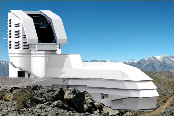
Credit: LSST Project/NSF/AURA
In the case of the full constellation of Starlink satellites, initial calculations show that LSST images would, on average, contain about one satellite trail per visit for an hour or two after sunset and before sunrise. A very conservative upper limit on the number of LSST pixels affected by Starlink satellites is about 0.01%, and quite likely smaller. Therefore, for LSST, even a constellation of about 10,000 Starlink satellites would be a nuisance rather than a real problem.
That said, AURA emphasizes, however, that the impact of satellite constellations on other AURA telescopes that have wider fields, longer exposures, and/or less sophisticated data processing pipelines may be much more significant.
“Furthermore, Starlink may be only the first in a series of new technologies that could impact LSST and other ground-based astronomy facilities,” AURA says. “We believe that the design and implementation of these constellations should be undertaken in consultation with the astronomical community to minimize their impact.”
Understanding the impact
Another organization, the International Astronomical Union (IAU), is also concerned about these satellite constellations.
“Until this year, the number of such satellites was below 200, but that number is now increasing rapidly, with plans to deploy potentially tens of thousands of them. In that event, satellite constellations will soon outnumber all previously launched satellites,” an IAU statement points out.
“We do not yet understand the impact of thousands of these visible satellites scattered across the night sky,” adds the IAU. Despite their good intentions, these satellite constellations may threaten both the principle of a dark and radio-quiet sky but also as a resource for all humanity and for the protection of nocturnal wildlife.
“Satellite constellations can pose a significant or debilitating threat to important existing and future astronomical infrastructures,” the IAU observes, “and we urge their designers and deployers as well as policy-makers to work with the astronomical community in a concerted effort to analyze and understand the impact of satellite constellations. We also urge appropriate agencies to devise a regulatory framework to mitigate or eliminate the detrimental impacts on scientific exploration as soon as practical.”
For more information on Starlink, go to:
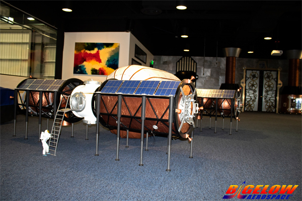
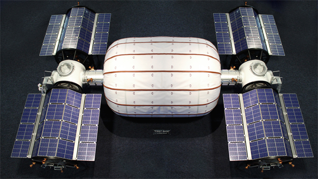
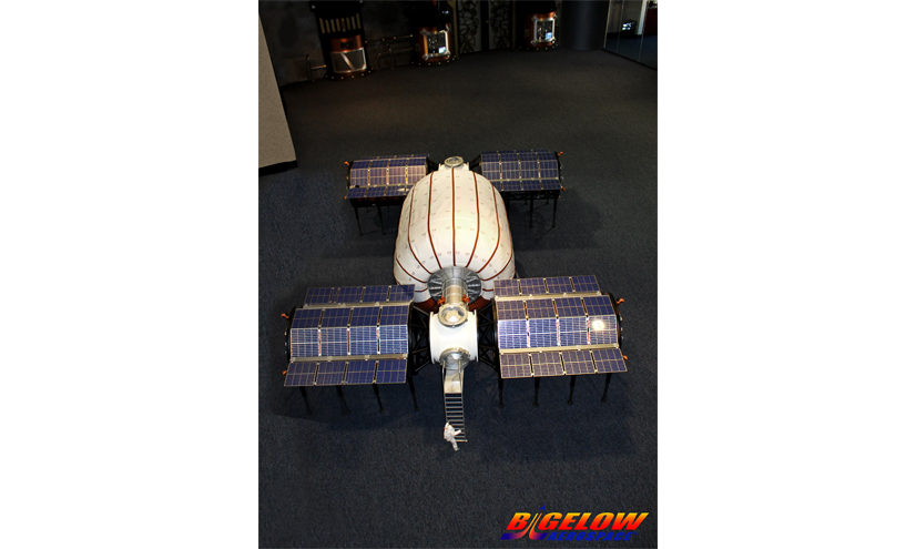
Credit: Bigelow Aerospace
Bigelow Aerospace of North Las Vegas has unveiled new plans to create a Moon base.
This base can accommodate four people for a long duration or six people for 120 days on the surface of the Moon. Habitat interior volume is 330m³, not including two airlocks.
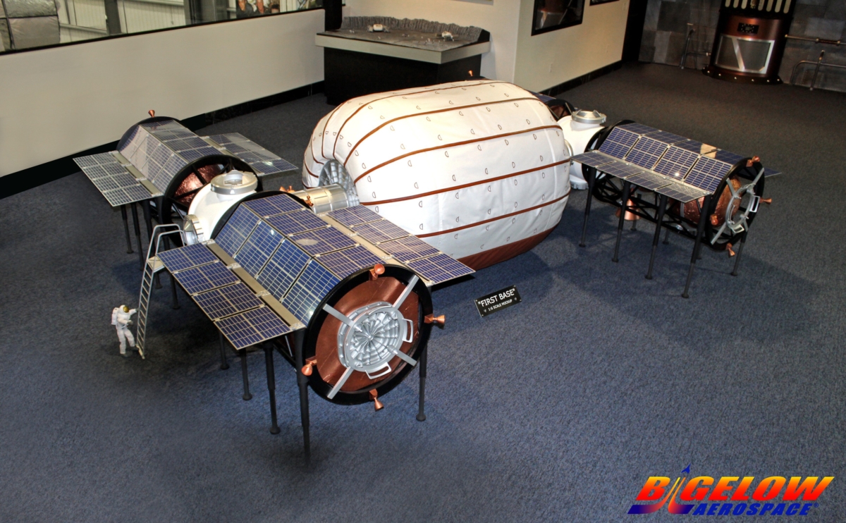
Credit: Bigelow Aerospace
Crew quarters
Interior accommodations include six large crew quarters, a large amount of storage capacity, two toilets and two galleys. On either side of the habitat are two airlocks- each with double compartments.
Credit: Bigelow Aerospace
Attached to the airlocks are opposing propulsion and warehouse structures: One warehouse is large enough for a solar array field to handle all of the power needs. The second warehouse is large enough to store two full-scale, two person cabin enclosed lunar rovers.
Credit: Bigelow Aerospace

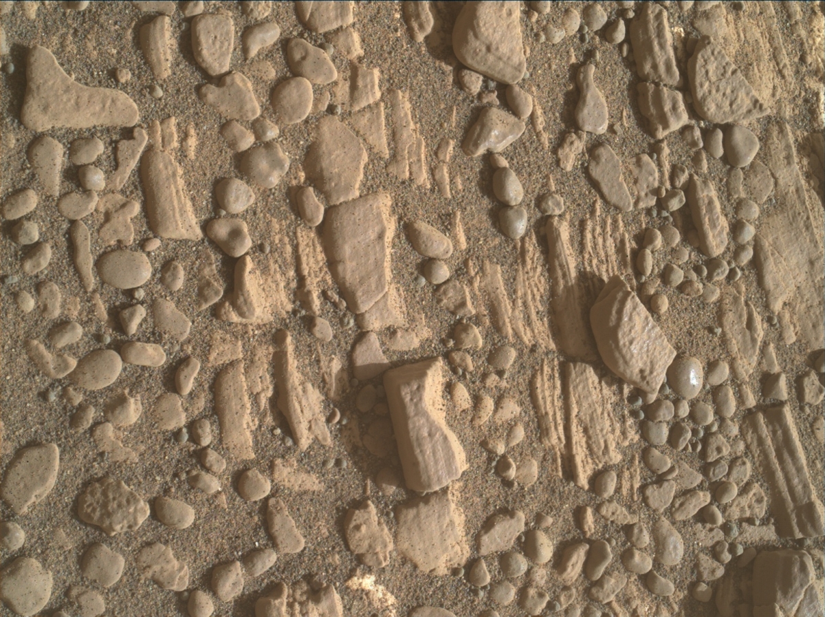
Curiosity Mastcam Left Sol 2425, June 3, 2019.
Credit: NASA/JPL-Caltech/MSSS
NASA’s Curiosity Mars rover is now performing Sol 2427 duties.
Curiosity Mastcam Left Sol 2425, June 3, 2019.
Credit: NASA/JPL-Caltech/MSSS
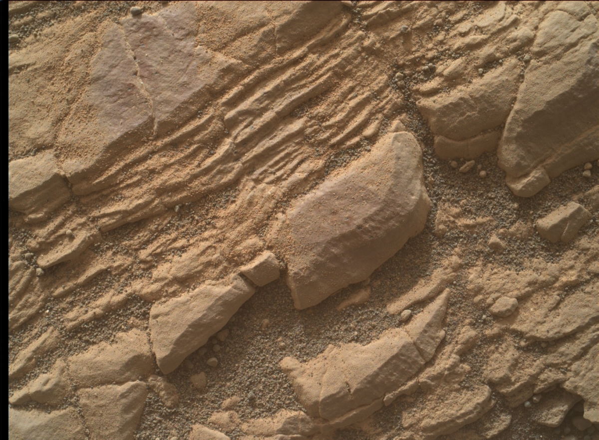
Reports Sarah Lamm, a planetary geologist at the Los Alamos National Laboratory in Los Alamos, New Mexico, plans for Curiosity have been scripted for weekend activities at Woodland Bay.
Woodland Bay is a location in Glen Torridon, in the clay bearing unit.
The plan scripted three sols of work in the area using the robot’s Alpha Particle X-Ray Spectrometer (APXS), the Mars Hand Lens Imager (MAHLI), Chemistry and Camera (ChemCam), as well as Mastcam, and Navcam.
Curiosity Front Hazcam Left B image taken on Sol 2426, June 3, 2019.
Credit: NASA/JPL-Caltech
Geological context
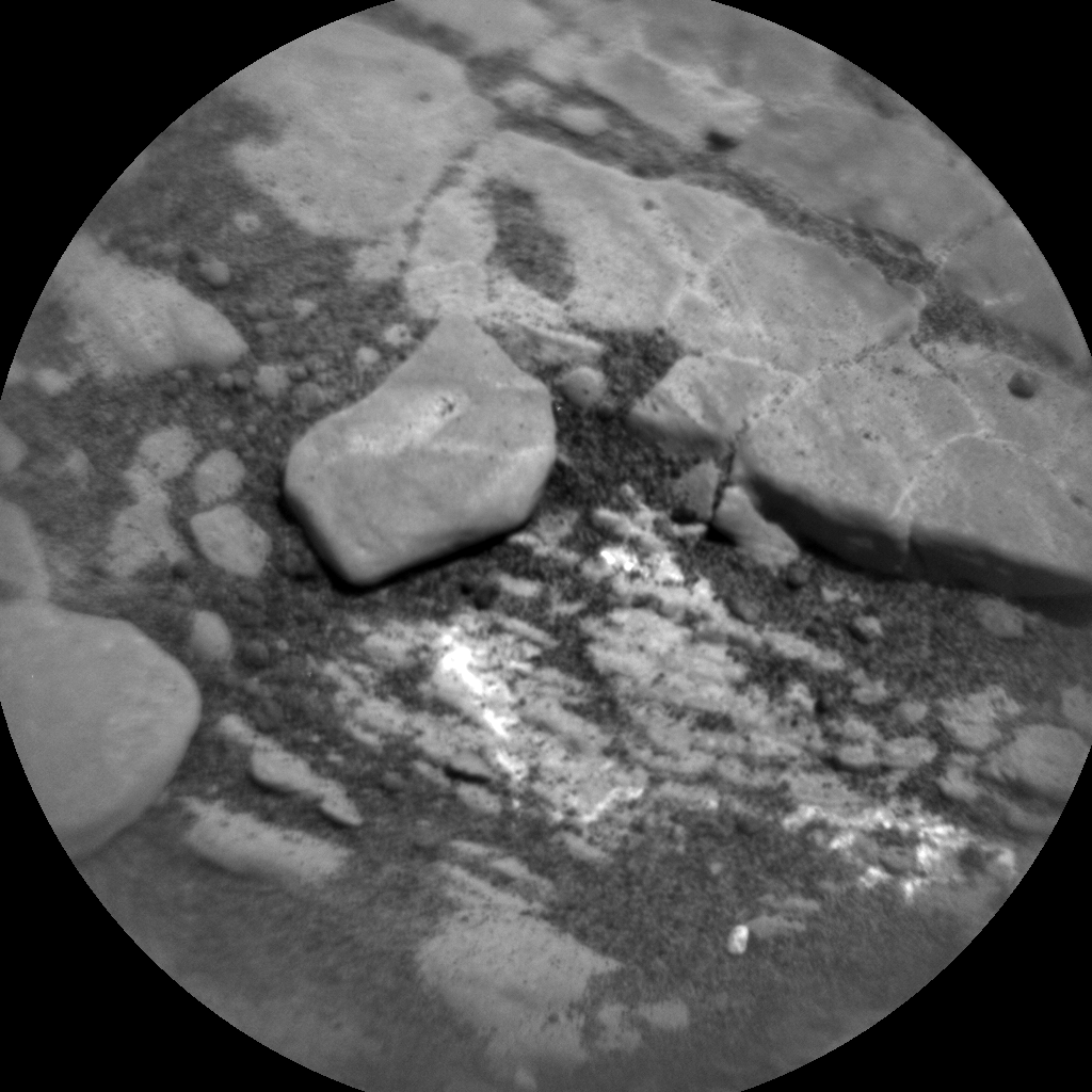
On Sol 2424, the target “Morningside” was slated to be analyzed by APXS.
Then MAHLI was set to image the subtle morphological textures of “Morningside.” ChemCam was also to be used on targets: “Whiteadder,” “Wester Ross,” “West Wemyss,” and “Water Haven.” Mastcam images were to be taken of all targets for geological context.
Curiosity Mars Hand Lens Imager (MAHLI) photo produced on Sol 2426, June 3, 2019. MAHLI is located on the turret at the end of the rover’s robotic arm.
Credit: NASA/JPL-Caltech/MSSS
Catching a dust devil
On Sol 2425, the plan called for the rover’s NavCam to take a short movie of the area in hopes of catching a dust devil.
“Dust devils have been spotted on Mars’ surface, but we could always use more movies and pictures of them,” Lamm points out.
“West Side” and “Morningside” were on tap for multispectral images to be taken by Mastcam.
Mastcam will also be used to document clouds in Mars’ night sky.
Curiosity ChemCam Remote Micro-Imager photo taken on Sol 2426, June 3, 2019.
Credit: NASA/JPL-Caltech/LANL
Cloud movie
On the Sol 2426 to do list, ChemCam was to have one target called “Watten.”
Navcam was also scheduled to take four short 8 frame movie of clouds. These movies will be taken at different times of day and at different locations in the sky.
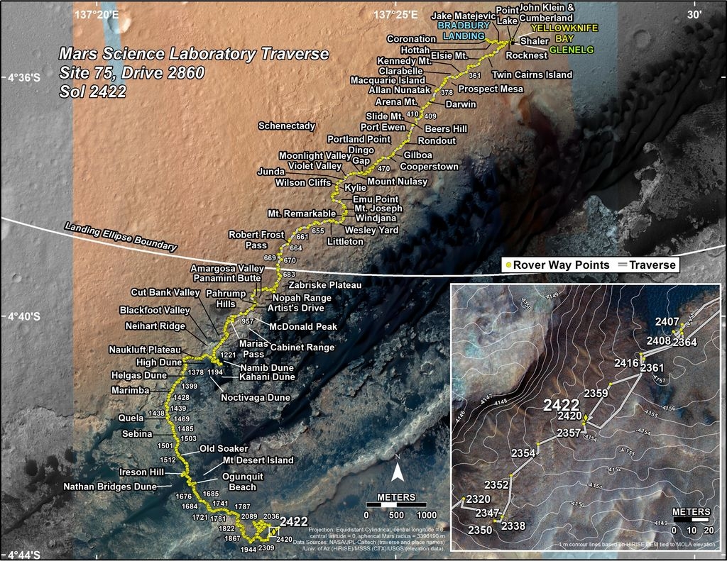
Credit: NASA/JPL-Caltech/Univ. of Arizona
Traverse map
Meanwhile, a new Curiosity’s traverse map through Sol 2422 has been posted.
The map shows the route driven by NASA’s Mars rover Curiosity through the 2422 Martian day, or sol, of the rover’s mission on Mars (June 01, 2019).
Numbering of the dots along the line indicate the sol number of each drive. North is up. The scale bar is 1 kilometer (~0.62 mile).
From Sol 2420 to Sol 2422, Curiosity had driven a straight line distance of about 6.28 feet (1.91 meters), bringing the rover’s total odometry for the mission to 12.83 miles (20.65 kilometers).
The base image from the map is from the High Resolution Imaging Science Experiment Camera (HiRISE) in NASA’s Mars Reconnaissance Orbiter.
Curiosity Rear Hazcam Left B image acquired on Sol 2426, June 3, 2019.
Credit: NASA/JPL-Caltech
Curiosity Mastcam Left photo taken on Sol 2425, June 2, 2019.
Credit: NASA/JPL-Caltech/MSSS
Curiosity Navcam Right B image taken on Sol 2426, June 3, 2019.
Credit: NASA/JPL-Caltech

