Archive for February, 2019
 Author:
  February 7th, 2019
Instrument Context Camera (ICC) photo was acquired on February 6, 2019, Sol 70 of the InSight mission.
Credit: NASA/JPL-Caltech
NASA’s InSight Mars lander has “skirted” the issue of fully deploying the wind and thermal shield (WTS) over the French-built seismometer.
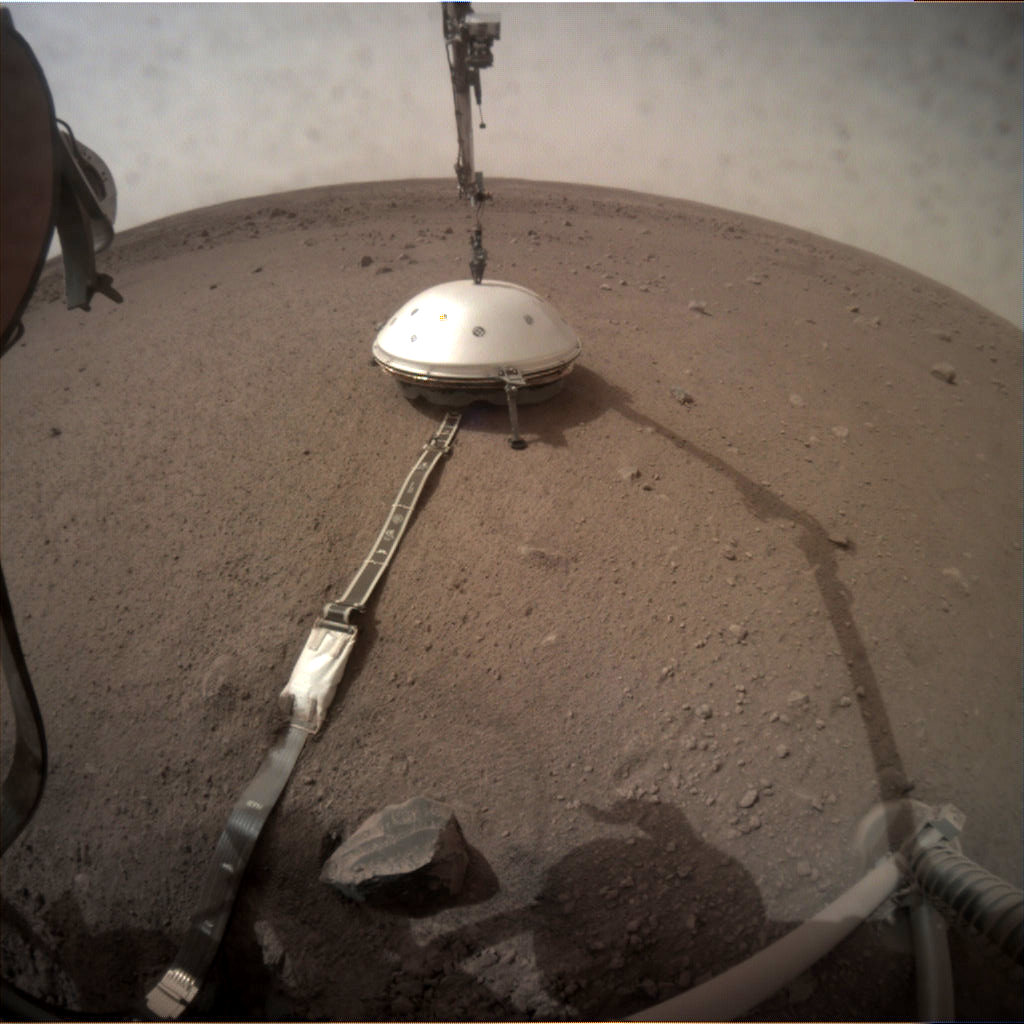
Instrument Context Camera (ICC) photo was acquired on February 2, 2019, Sol 66 of the InSight mission.
Credit: NASA/JPL-Caltech
Photos taken by the lander’s Instrument Context Camera (ICC) show the gold-coated thermal skirt. The WTS was developed by NASA’s Jet Propulsion Laboratory.
The WTS consists of an aerodynamically shaped aluminium cover with a honeycomb structure to which is attached a gold-coated thermal skirt.
The extendable skirt is bordered around its circumference by a kind of chain-mail, not unlike that worn as armor by mediaeval knights.

Ground test of deploying the wind and thermal shield skirt.
Credit: NASA/JPL-Caltech/IPGP/Philippe Labrot
Its weight alone allows the skirt to descend. Its platelet structure cover obstacles such as pebbles, sealing off the WTS.
 Posted in

Credit: NASA/GSFC/Arizona State University
NASA’s sharp-shooting Lunar Reconnaissance Orbiter (LRO) has successfully imaged China’s Chang’e-4 spacecraft on the floor of Von Kármán crater.
On January 3, 2019 the Chinese spacecraft landed on the Moon’s farside.

Credit: NASA/GSFC/Arizona State University
Four weeks later, on January 30, as LRO approached the (116 mile (186 kilometer) diameter crater from the east, it rolled 70° to the west to snap a spectacular view looking across the floor towards the west wall.
Because LRO was 205 miles (330 kilometers) to the east of the landing site, the Chang’e 4 lander is only about two pixels across (bright spot between the two arrows), and the small rover is not detectable.

Previously released image of Chang’e-4 lander taken by Yutu-2 rover.
Credit: CNSA/CLEP
The massive mountain range in the background is the west wall of Von Kármán crater, rising more than 9,850 feet (3,000 meters) above the crater’s floor.
NASA’s Lunar Reconnaissance Orbiter’s LROC imaging system is operated by Mark Robinson at Arizona State University in Tempe.
To take a look at the imagery and the special zoomify image, go to:
http://lroc.sese.asu.edu/posts/1090

NASA’s Lunar Reconnaissance Orbiter (LRO).
Credit: NASA/Goddard Science Visualization Studio (SVS)
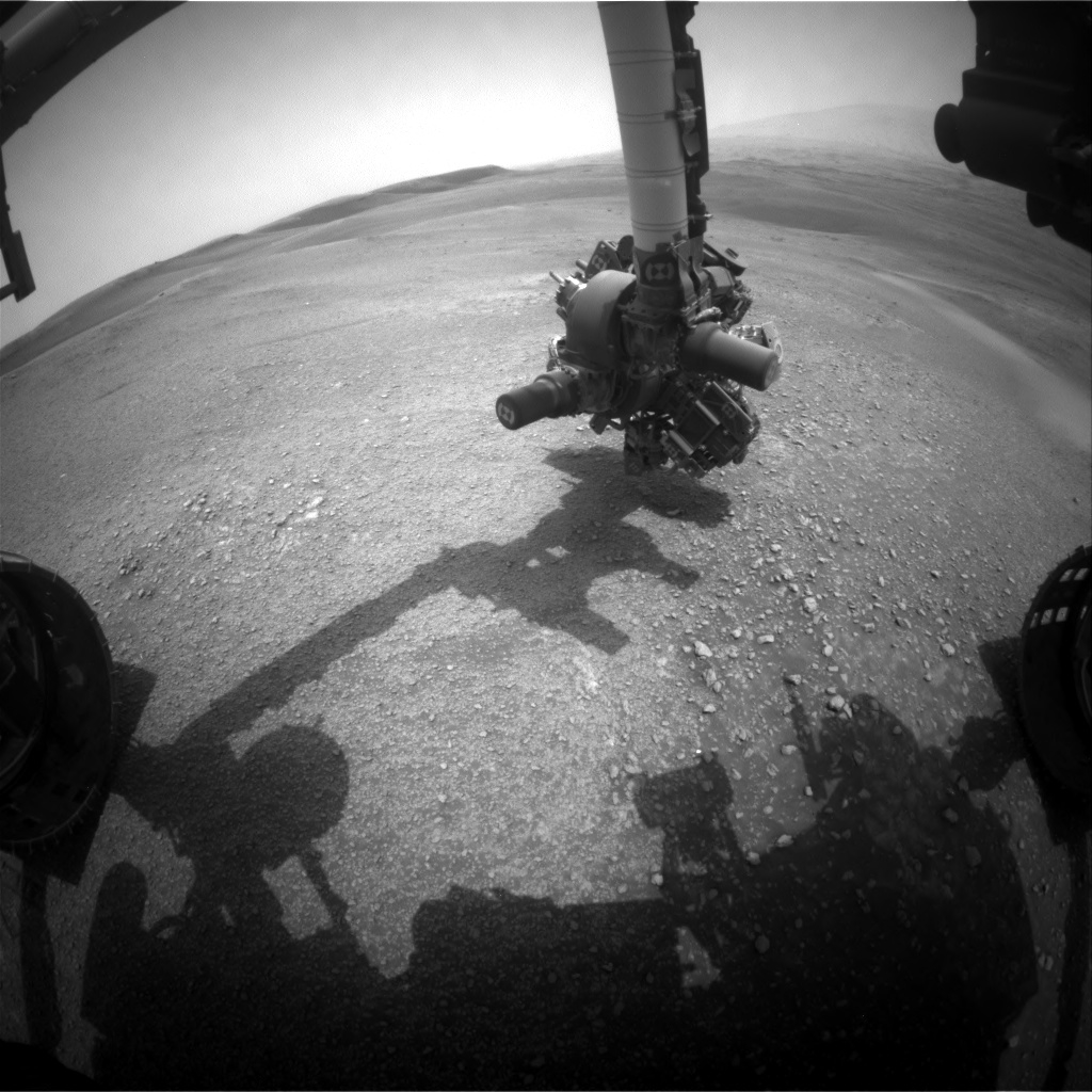
Curiosity Front Hazcam Left A photo taken on Sol 2311, February 5, 2019.
Credit: NASA/JPL-Caltech
NASA’s Curiosity rover on Mars is well into Sol 2312 operations.
Curiosity is targeting small bedrock patches, pebbles, and soil reports Roger Wiens, a geochemist at Los Alamos National Laboratory in Los Alamos, New Mexico.
Over the weekend Curiosity completed a drive over 65 feet (20 meters).

Curiosity Navcam Left A image taken on Sol 2311, February 5, 2019.
Credit: NASA/JPL-Caltech
Heading east
“Curiosity is heading east and will be driving below the upper side of Vera Rubin Ridge, toward waypoint 2. One of the goals for this portion of the traverse is to image the rock layers along its upper slope, but so far the slope appears to be mostly covered with soil,” Wiens notes.
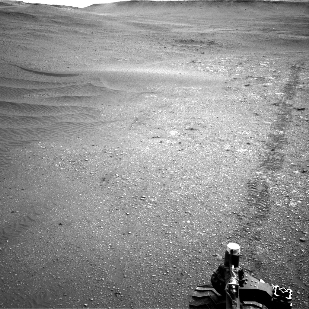
Curiosity Navcam Left A image taken on Sol 2311, February 5, 2019.
Credit: NASA/JPL-Caltech
A recent plan included observations of what appears to be small bedrock targets, with Mastcam, Alpha Particle X-Ray Spectrometer (APXS), Chemistry and Camera (ChemCam), and Mars Hand Lens Imager (MAHLI) observations of target “Isbister,” ChemCam Remote Micro-Imager (RMI)-only observation of “Magnus,” and Mastcam observation of the ChemCam Autonomous Exploration for Gathering Increased Science (AEGIS) target from the weekend.
The robot’s Mastcam was tasked with imaging “Knockfarril Hill,” “Crawton,” and “Elgol.”
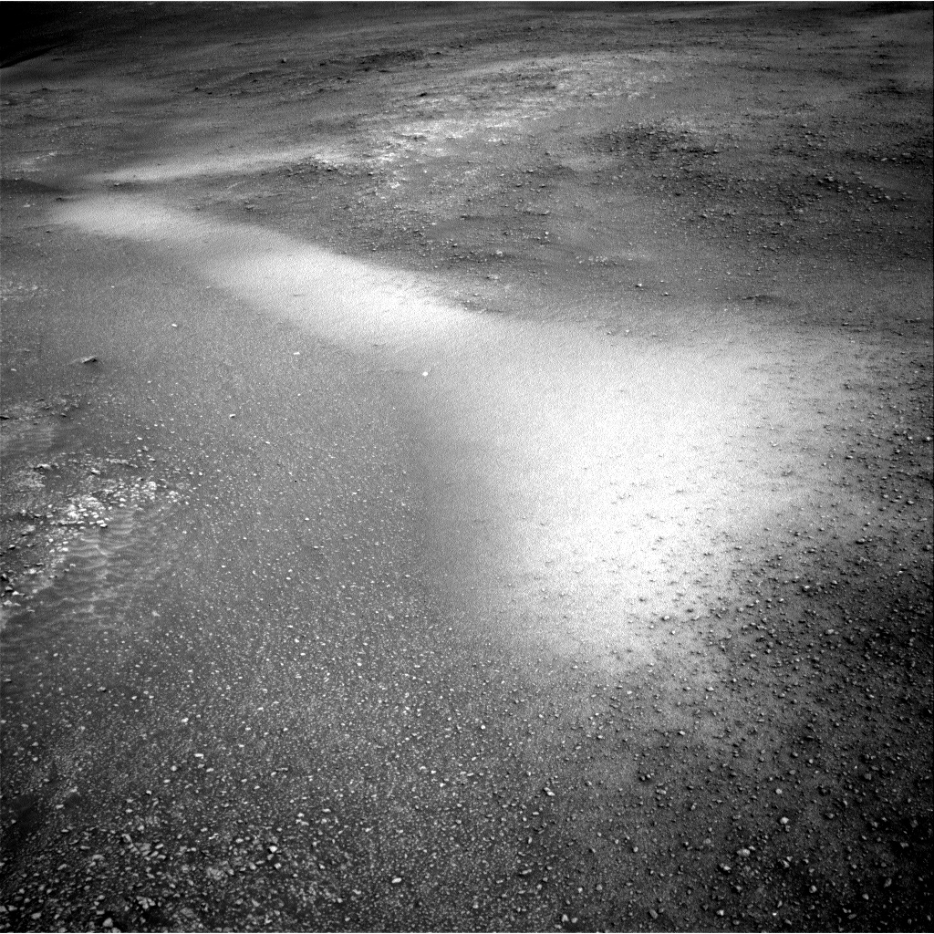
Curiosity Navcam Left A image taken on Sol 2311, February 5, 2019.
Credit: NASA/JPL-Caltech
Pebbly surface
Following a planned drive of 144 feet (44 meters) and post-drive imaging, the rover’s Mars Descent Imager (MARDI) will get a view of the pebbly surface in the new location, and the Radiation Assessment Detector (RAD), Dynamic Albedo of Neutrons (DAN) and the Rover Environmental Monitoring Station (REMS)
RAD, DAN, and REMS are on tap to take measurements, Wiens says, along with Mastcam mosaic and Navcam horizon and dust-devil surveys.
“The plan also includes a number of engineering checks, including one on the current thermal environment,” Wiens adds.
Road map
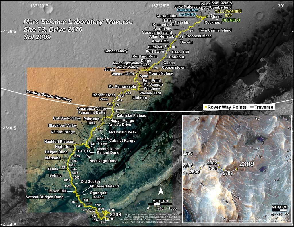
Meanwhile, a new Curiosity traverse map through Sol 2309 has been issued.
The map shows the route driven by NASA’s Mars rover Curiosity through the 2309 Martian day, or sol, of the rover’s mission on Mars (February 04, 2019).
Credit: NASA/JPL-Caltech/Univ. of Arizona
Numbering of the dots along the line indicate the sol number of each drive. North is up. The scale bar is 1 kilometer (~0.62 mile).
From Sol 2306 to Sol 2309, Curiosity had driven a straight line distance of about 62.57 feet (19.07 meters), bringing the rover’s total odometry for the mission to 12.48 miles (20.08 kilometers).
The base image from the map is from the High Resolution Imaging Science Experiment Camera (HiRISE) in NASA’s Mars Reconnaissance Orbiter.
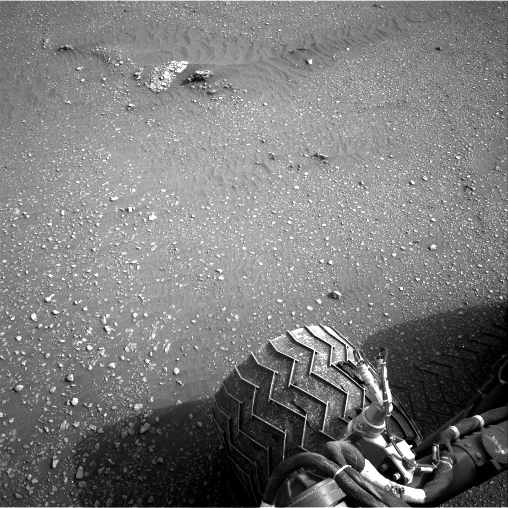
Curiosity Navcam Right A photo acquired on Sol 2311, February 5, 2019.
Credit: NASA/JPL-Caltech
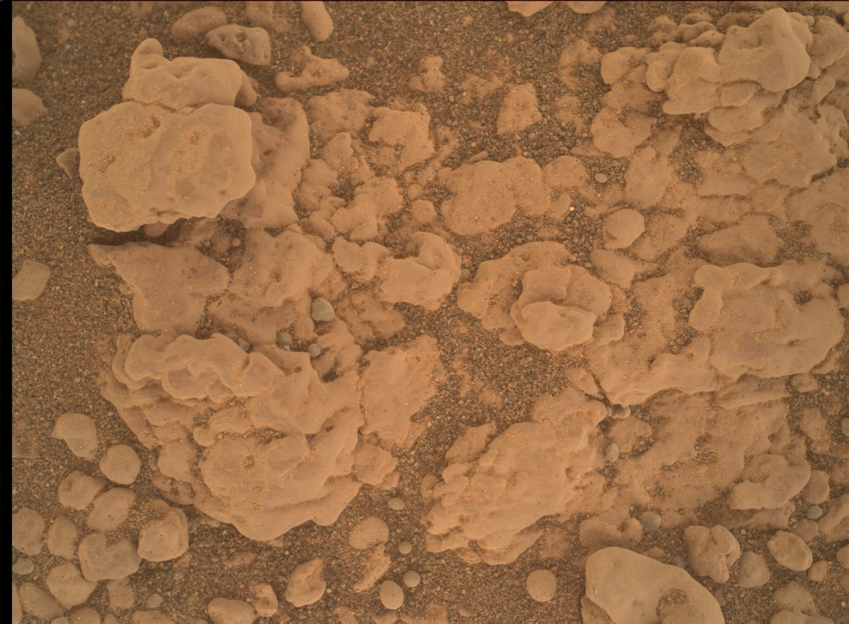
Curiosity Mars Hand Lens Imager (MAHLI) photo produced on Sol 2311, February 5, 2019.
Credit: NASA/JPL-Caltech/MSSS

Image shows the target “Brent” in the lower right corner; it was analyzed with ChemCam and APXS, and imaged with MAHLI over the weekend. It is a rounded pebble roughly an inch (2.5 cm) in diameter. In spite of the fact that it has been rounded by mechanical abrasion, it still shows faint layering. You can also see inclusions that are partially filled with brighter material. Marching vertically across the face of the pebble are five laser pits from ChemCam. The bottom of each pit has a telltale whitish appearance.
Curiosity MAHLI Sol 2308, February 2, 2019
Credit: NASA/JPL-Caltech/MSSS

CubeSats deployed from the International Space Station.
Credit: NASA
Bryce Space and Technology, an analytics and engineering firm for space and satellite, cyber, and R&D clients, has released two informative reports: Smallsats by the Numbers: 2019 and 2018 Orbital Launches Year in Review.
Organizations have deployed more than 1,300 smallsats since 2012. This latest report from Bryce includes data on commercial, government, and academic trends.
Here are the 2018 highlights:
36% of smallsats were launched from the US in 2018
2018 saw 6x as many smallsats launched as 2012
CubeSats have dominated the smallsat market; 961 launched 2012 – 2018
This report is available at:
http://brycetech.com/downloads/Bryce_Smallsats_2019.pdf
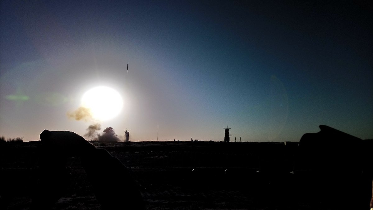
Long March-2C carrier rocket departs Jiuquan Satellite Launch Center in northwest China’s Gobi Desert.
Also available is 2018 Orbital Launches Year in Review.
In 2018, there were 114 orbital launches. This is the most launches worldwide since 1990. U.S. launch providers conducted the most commercial launches while China launched the highest volume of launches.
View the data in the 2018 Orbital Launches Year in Review report at:
http://brycetech.com/downloads/Orbital_Launches_Year_in_Review_2018.pdf
NASA’s Curiosity Mars rover is now performing Sol 2310 duties.
New imagery from February 3 is available of the robot’s new surroundings:
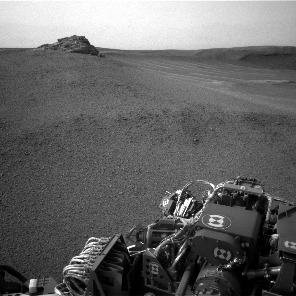
Curiosity Navcam Left A image acquired on Sol 2309, February 3, 2019.
Credit: NASA/JPL-Caltech
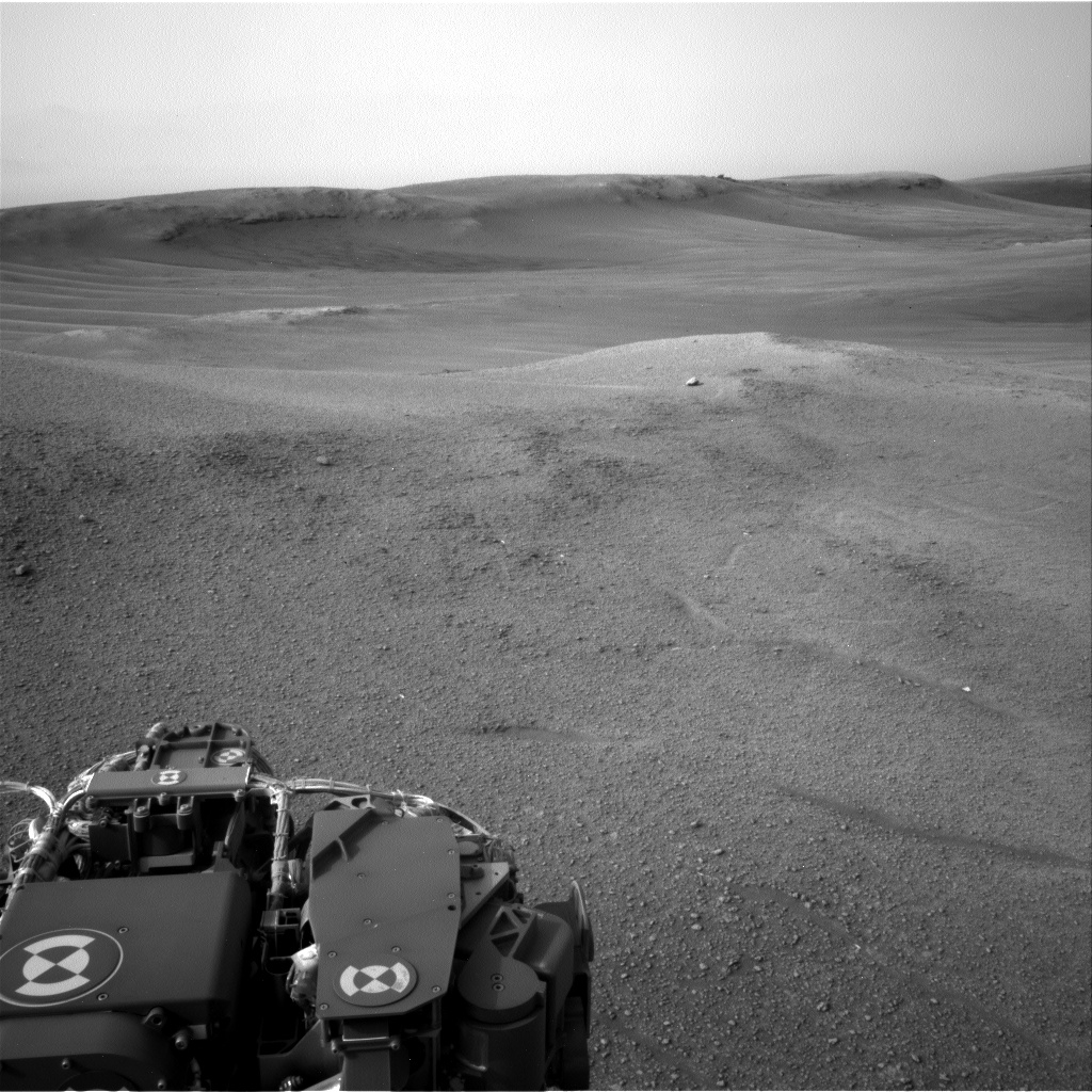
Curiosity Navcam Left A image acquired on Sol 2309, February 3, 2019.
Credit: NASA/JPL-Caltech
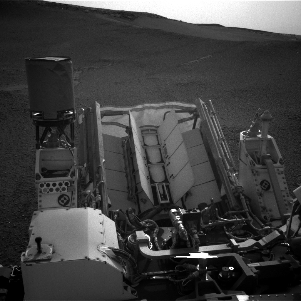
Curiosity Navcam Left A image acquired on Sol 2309, February 3, 2019.
Credit: NASA/JPL-Caltech
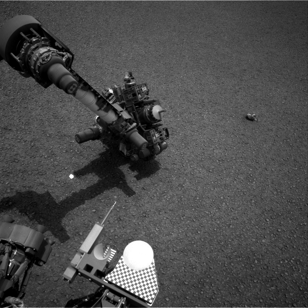
Curiosity Navcam Right A image acquired on Sol 2309, February 3, 2019.
Credit: NASA/JPL-Caltech
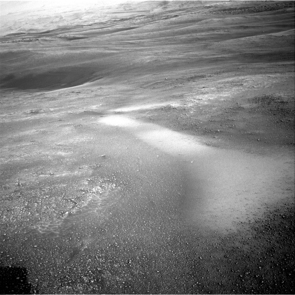
Curiosity Navcam Right A image acquired on Sol 2309, February 3, 2019.
Credit: NASA/JPL-Caltech
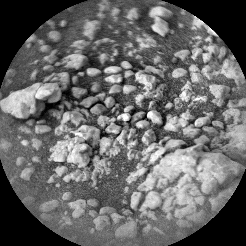
Curiosity ChemCam Remote Micro-Imager photo taken on Sol 2309, February 3, 2019.
Credit: NASA/JPL-Caltech/LANL

Yutu-2 rover as imaged by Chang’e-4 lander earlier in the farside mission.
Credit: CNSA/CLEP
China’s lunar rover Yutu-2 has begun taking its second snooze today, a midday nap, on the farside of the Moon.
According to China Central Television (CCTV), without a good thermal control ability, the rover is experiencing midday temperatures surpassing 100 degrees Celsius.
The rover will be awakened again on Friday.
Nighttime temperatures
The Yutu-2 and lander of the Chang’e-4 mission were awakened by sunlight on Jan. 29 and 30 respectively after a long “sleep” during the first extremely cold night on the Moon.

Image of Chang’e-4 lander taken by Yutu-2 rover early in the farside mission.
Credit: CNSA/CLEP
Nighttime temperatures on the Moon plummeted to minus 190 degrees Celsius, the first data China has obtained about temperature on the lunar surface during the 14-day long nighttime.
China’s Chang’e-4 lander/rover landed on January 3 within the Von Kármán crater in the South Pole-Aitken Basin on the farside of the Moon.

Von Kármán crater as viewed by NASA’s Lunar Reconnaissance Orbiter Camera, or LROC,
Credit: NASA/GSFC/Arizona State University
Scientific tasks
During the first lunar day (14 days in length), the lander and the rover photographed each other, and a camera installed on the top of the lander took 360-degree panoramic photos of the surrounding of the probe.
The Chang’e-4 mission carries four payloads developed by the Netherlands, Germany, Sweden and Saudi Arabia.
Scientific tasks of the farside exploration include low-frequency radio astronomical observation, surveying the terrain and landforms, detecting the mineral composition and shallow lunar surface structure, and measuring neutron radiation and neutral atoms.

Soviet Lunokhod rover
Credit: NASA/GSFC/Arizona State University
Washout
Yutu-2’s on again/off again surface treks sparked a comment from Ron Creel, Apollo Lunar Roving Vehicle Team Member.
“The ‘Lunar Nap’ that the Chinese vehicles are taking is most likely caused by ‘washout’ of visibility of lunar terrain for driving at times near lunar noon,” Creel told Inside Outer Space.
“This is what the Russians have shared with me that they also had to do the same driving pauses with their Lunokhods,” Creel advised. The former Soviet Union’s Lunokhod 1 rover was the first of two robotic lunar rovers that successfully landed on the Moon. It surveyed the Sea of Rains in 1970-1971. Lunokhod 2 wheeled about in Le Monnier crater in 1973.

Credit: NASA/JPL-Caltech

Credit: NASA/JPL-Caltech

Credit: NASA/JPL-Caltech

Credit: NASA/JPL-Caltech

Credit: DLR/Screengrab/Inside Outer Space

Components of the HP3 heat flow probe. Top left: the radiometer (RAD), which is used to measure the radiation temperature (roughly equivalent to the ground temperature) of the surface. Right: the casing with the mole penetrometer, the temperature measuring cable (TEM-P) and the data cable (ET) connected to the lander. In addition, the casing contains an optical length meter for determining the length of the temperature measuring cable that has been pulled from the casing. The mole contains the TEM-A active thermal conductivity sensor and the STATIL tiltmeter. Bottom left: the electronic control unit, known as the back end electronics (BEE), which remains on the lander and is connected to the probe via the ET.
Credit: DLR
InSight has deployed its domed Wind and Thermal Shield (WTS), setting it atop the French-supplied SEIS, short for Seismic Experiment for Interior Structure – a seismometer.
The WTS has a tripod and a protective skirt that tightly ‘hugs’ the ground around the seismometer to stop wind blowing and influence measurements.
Next up…and down!
The next major milestone for the Interior Exploration using Seismic Investigations, Geodesy and Heat Transport (InSight) mission is deploying the German Heat Flow and Physical Properties Package (HP3).
It too, like the seismometer and Wind and Thermal Shield, will be placed on the surface of Mars by InSight’s robotic arm. HP3 is designed to burrow down beneath the Red Planet’s topside — with its tether embedded with heat sensors — to a depth of 16 feet (five meters). If successful, the HP3 will plow deeper than any previous arms, scoops, drills or probes before it.
On the surface
According to Tilman Spohn, HP3’s principal investigator at the German Aerospace Center’s Institute of Planetary Research in Berlin, Germany:
“We expect to be on the surface of Mars on February 13th and start operations about a week later,” Spohn told Inside Outer Space. “However, be aware that these dates are still not cast in concrete yet.”
Mole action plan
HP3 can take Mars’ temperature to reveal how much heat is still flowing out of the interior of the planet. Weighing a little over 6.5 pounds (about 3 kilograms) HP3’s “Mole” hammers itself under the surface. A maximum of 2 watts of power is available while burrowing underneath the surface.
The German Aerospace Center’s (DLR) HP3 heat flow probe has the Mole pulling a ribbon cable equipped with 14 temperature sensors behind it. Once the probe has reached its target depth, the temperature will be measured by all of the sensors every 15 minutes for several months.
For an informative DLR video detailing how the Heat Flow and Physical Properties Package (HP3) works, go to:

Credit: ISRO
India continues to advance its human spaceflight goals.
On January 30, Indian Space Research Organization (ISRO) officials inaugurated a Human Space Flight Center (HSFC) at ISRO Headquarter campus in Bengaluru.

India space program officials are all thumbs up. Behind them, full scale model of the Gaganyaan crew module.
Credit: ISRO
Dignitaries posed in front of a full scale model of the Gaganyaan crew module during the event.
End-to-end mission planning
According to an ISRO press statement, the HSFC is responsible for implementation of the Gaganyaan Project that involves end-to-end mission planning, development of engineering systems for crew survival in space, crew selection and training and also pursue activities for sustained human space flight missions.
Furthermore, the HSFC will support existing ISRO Centers to implement the first development flight of Gaganyaan crew module.
The Gaganyaan project is to propel India to become the fourth nation able to independently rocket humans into Earth orbit by 2022.
Credit: ISRO
Booster business
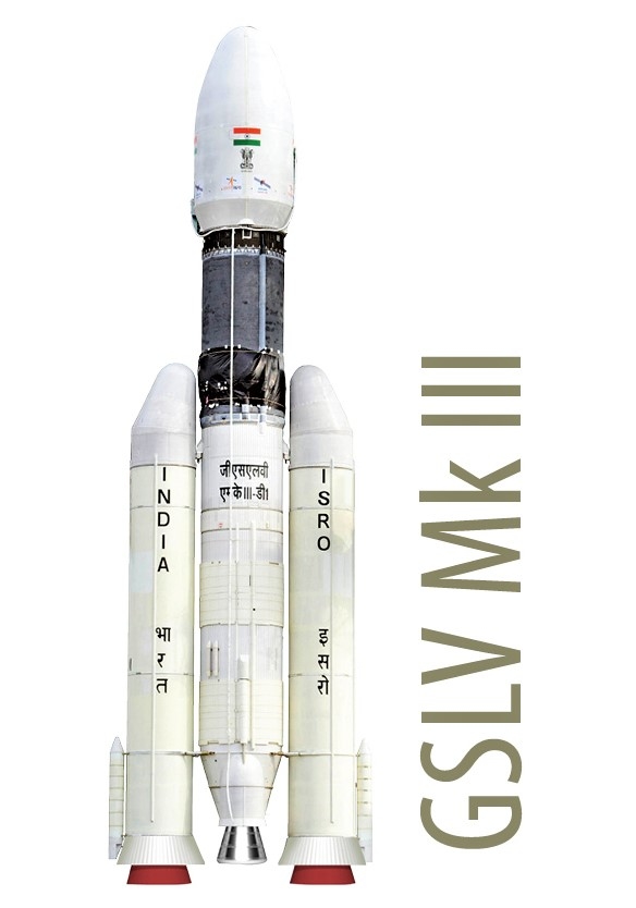
ISRO hopes to deploy its biggest rocket, the Geosynchronous Satellite Launch Vehicle Mark III (GSLV Mk III), to send three Indians into space from the Sriharikota space port in Andhra Pradesh. GSLV Mk III is a three-stage heavy lift launch vehicle using two solid strap-ons, a core liquid booster, and a cryogenic upper stage.
Earlier outlines of the Gaganyaan initiative called for a “demonstration phase” that involves undertaking two unmanned flights and one human flight using Indian technology to catapult a crew of three into a low Earth orbit for 5-7 days.
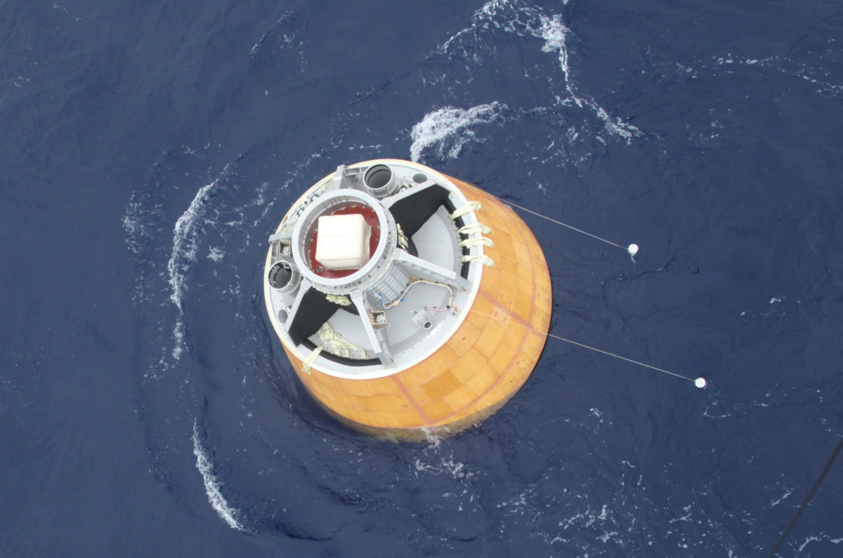
Crew Module Atmospheric Re-entry Experiment (CARE).
Credit: ISRO
Vyomnauts
India has inked agreements with Russia and France for assistance in THE Gaganyaan effort. ISRO plans to call its astronauts “Vyomnauts” since “Vyom” in Sanskrit means space. ISRO has also mastered the art of making a spacesuit to be used by Indian astronauts.
In 2014, India tested a Crew Module Atmospheric Re-entry Experiment (CARE), where a 3,745 kg space capsule – a prototype of the crew module that will be used by the Indian astronauts – was launched into the atmosphere on the first flight of the GSLV Mk III and then safely recovered from the Bay of Bengal. CARE was designed to showcase blunt body re-entry aerothermodynamics and parachute deployment in cluster configuration.
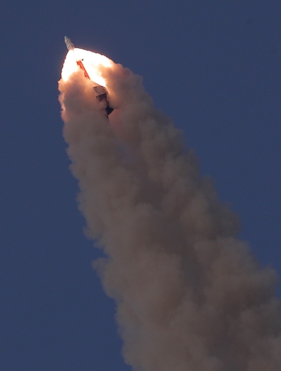
Pad Abort Test.
Credit: ISRO
Pad abort test
Last year, ISRO carried out a crucial Pad Abort Test on July 5, using a 12.6-ton crew module. This escape measure is designed to quickly pull the astronaut-carrying crew module to a safe distance from the launch vehicle in the event of a launch abort.
The test took place at Satish Dhawan Space Center, Sriharikota. The crew module reached an altitude of nearly 1.7 miles (2.7 kilometers) under the power of its seven fast-acting solid rocket motors.
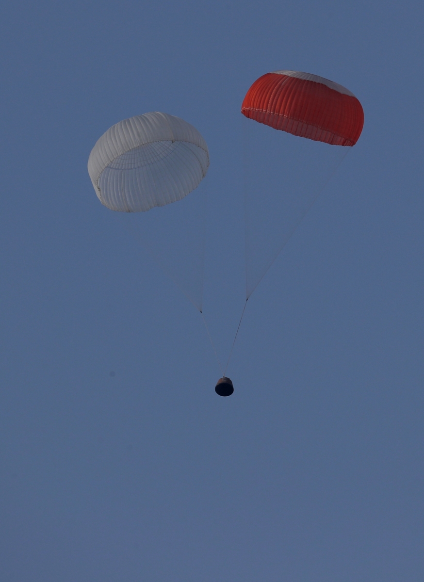
Pad Abort Test capsule parachutes to watery touchdown.
Credit: ISRO
Nearly 300 sensors recorded various mission performance parameters during the test flight.
The test last 259 seconds, during which the Crew Escape System along with crew module soared skyward, racing out over the Bay of Bengal and floated back to Earth under its parachutes about 2 miles ( 2.9 kilometers) from Sriharikota.
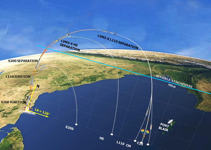
Credit: ISRO
Technology testing
In a human spaceflight-related test, back on January 10, 2007, ISRO launched the Space capsule Recovery Experiment (SRE-1).
Launched by a Polar Satellite Launch Vehicle (PSLV-C7) from Satish Dhawan Space Center (SDSC) SHAR, Sriharikota, SRE-1 was successfully recovered on January 22, 2007 after being maneuvered to reenter the Earth’s atmosphere and descend over the Bay of Bengal.
The SRE – 1 capsule weighed 1,213 pounds (550 kilograms) and demonstrated, among a host of technologies, development of reusable thermal protection system (TPS). The experiment tested lightweight silicon tiles that can protect a spaceship as it re-enters the Earth’s atmosphere.
Go to this New Delhi Television Limited (NDTV) video about India’s human spaceflight plans:
Here’s a video of the pad abort test:
https://www.isro.gov.in/sites/default/files/videos/pat_test_video.mp4.mp4
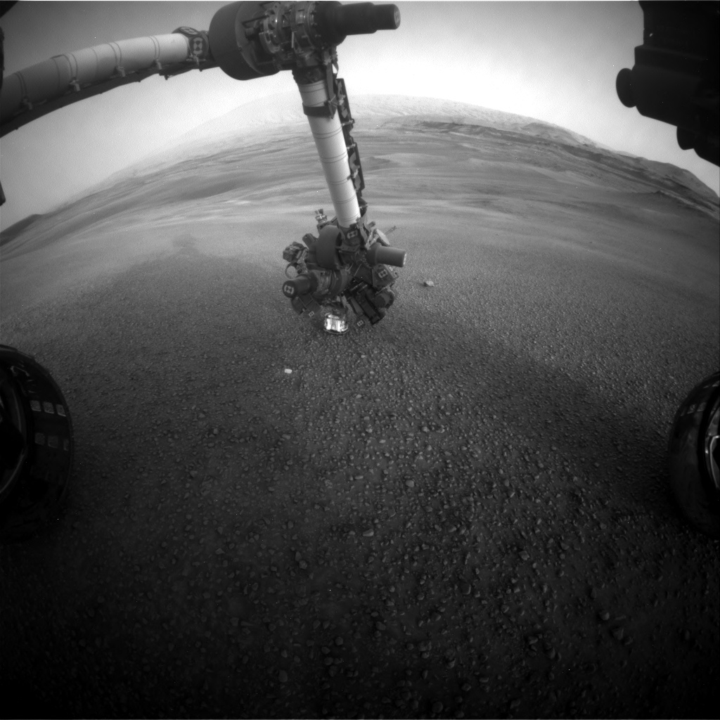
Curiosity Front Hazcam Left A photo acquired on Sol 2308, February 2, 2019.
Credit: NASA/JPL-Caltech
NASA’s Curiosity Mars rover is now performing Sol 2309 duties.
A new set of images from the robot show operations, working the current workspace in front of the Mars machinery that is very rubbly, with no bedrock that is reachable by the rover arm.

Curiosity Navcam Left A image taken on Sol 2308, February 2, 2019.
Credit: NASA/JPL-Caltech
Reports Vivian Sun, a planetary geologist at NASA/JPL in Pasadena, California, most of the clay-bearing unit is likely composed of this rubbly material, so it’s important to characterize its composition and texture.
Overlapping areas
To that end, scientists made Alpha Particle X-Ray Spectrometer (APXS) measurements of this material on Sol 2308, using a rastering technique where the APXS was slated to be placed over three overlapping spots in the workspace.

Curiosity Mars Hand Lens Imager (MAHLI) photo produced on Sol 2308, February 2, 2019.
Credit: NASA/JPL-Caltech/MSSS

Curiosity ChemCam Remote Micro-Imager photo taken on Sol 2308, February 2, 2019.
Credit: NASA/JPL-Caltech/LANL
By obtaining chemical measurements over different, but slightly overlapping areas, Sun notes, scientists will be able to distinguish the compositions of the pebbles from the sand and soil in the APXS field of view.

Instrument Context Camera (ICC).
Credit: NASA/JPL-Caltech
NASA’s InSight Mars lander has made another deployment milestone in readying the probe for performing an agenda of scientific duties.
Following the InSight team finishing fine-tuning the cable position last Sunday — the tether link to the Seismic Experiment for Interior Structure (SEIS) now in position on the surface of Mars – that action was just capped by placing the Wind and Thermal Shield (WTS) atop the SEIS.

Instrument Context Camera (ICC).
Credit: NASA/JPL-Caltech
Honeycomb structure
The WTS consists of an aerodynamically shaped aluminum cover with a honeycomb structure to which is attached a gold-coated thermal skirt.
The whole assembly rests on three legs that were to deploy automatically once the robotic arm lifted the dome off the lander’s platform.
The robotic arm’s five grapple fingers close around a handle that resembles a ball on top of a stem. Each of the three items – the seismometer, the Wind and Thermal Shield, and the still to be deployed heat flow probe have one of these handles.

Instrument Deployment Camera (IDC) image acquired on February 2, 2019, Sol 66.
Credit: NASA/JPL-Caltech

Instrument Context Camera (ICC).
Credit: NASA/JPL-Caltech

The wind and thermal shield (WTS).
Credit: Agence Idé/CNES).

Artist concept showing the protective role of the wind and thermal shield (WTS) at the martian surface.
Credit: IPGP/David Ducros

