Archive for April, 2017
 Author:
  April 18th, 2017
Tianzhou-1 atop Long March-7 Y2 carrier rocket.
Credit: CGTN
Preparatory work for launch of China’s first cargo spacecraft launch – the Tianzhou-1 — continues.
Work is in the homestretch for a launch that is set between Thursday and next Monday.
On Feb. 13, the Tianzhou-1 was delivered to Wenchang Space Launch Center in south China’s Hainan Province.
On March 11, the Long March-7 Y2 carrier rocket was transported to the center. The Tianzhou-1 will blast off on the Long March-7 Y2.
A week later, the vertical assembly of the Long March-7 Y2 carrier rocket was finished.
A Chinese tracking ship, Yuanwang-7, set sail on April 10 for its first independent voyage into the Pacific Ocean to start its maritime space monitoring and communication mission for Tianzhou-1.

Credit: CMSA
In-orbit testing
Last Monday, the Tianzhou-1 was vertically transported to the launch tower in 2.5 hours.
If the supply ship is successfully orbited, it will dock with the Tiangong-2 space lab for three times to test in-orbit liquid propellant refueling.
The mission is viewed by China’s space planners as a crucial step toward China’s goal of establishing its own space station around 2022.
Wenchang visitors
In a related CCTV-Plus story, as final preparations move forward on the Tianzhou-1 liftoff, space enthusiasts and students are taking the opportunity to visit a nearby space science education center to learn more about the wonders of space exploration.

Wenchang Space Launch Center in south China’s Hainan Province.
Credit: CCTV
Located just a short walk from China’s newest and only coastal launch site, the Wenchang Space launch center, visitors to the education center can learn about the history of space flight, gaze at rocket components and model spacecraft, and even immerse themselves in virtual reality experiences to get a better understanding of China’s developing space program.
Theme park
The space education center is only part of a larger space theme park, with the park’s investors planning to build more facilities in the future to integrate tourism with academic exchanges and science education.
“In addition to this science center, we are going to introduce more high-tech experience facilities and provide better services for tourists. This space theme park will build on the experiences of the Houston Space Center in the U.S. and other space theme parks around the world,” said Wang Xiaojia, deputy manager of the Wenchang Tourism Investment Holding company, during the CCTV-Plus interview
The park is expected to be finished by the end of this year.
Space day
Meanwhile, China is also ready to celebrate its second Space Day.
According to the State Administration of Science, Technology and Industry for National Defense, China designated April 24 as the Space Day last year, when the country marked the anniversary of the country’s first satellite launch Dongfanghong-1 in 1970.
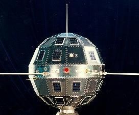
Dongfanghong-1 – China’s first satellite.
Courtesy: Sven Grahn
As reported by CCTV-Plus, the celebration activities will include talks by astronauts, an exhibition at the Northwestern Polytechnical University and other activities focusing on the applications of space technology in economic and social development, the Administration announced on Monday.
Aerospace facilities
The exhibition will show the achievements in China’s lunar probe and the BeiDou satellite navigation system. Some aerospace facilities, labs and workshops will be open to the public, especially to middle and primary school students on the day.
To be present at the main theater of the activities in Xi’an City, Shaanxi Province, northwest China, representatives from the United Nations Office for Outer Space Affairs and the Asia-Pacific Space Cooperation Organization, and foreign diplomats from a dozen countries including Egypt, Saudi Arabia and Chile.
Xi’an is home to more than 200 aerospace research centers and enterprises.
There will be more than 200 events in other cities as well.
To view the CCTV-Plus videos, go to:
Tianzhou-1 Launch preparations:
http://cd-pv.news.cctvplus.com/2017/0418/8048156_Preview_9607.mp4
Wenchang Education center:
http://cd-pv.news.cctvplus.com/2017/0417/8048069_Preview_7520.mp4
China Space Day:
http://cd-pv.news.cctvplus.com/2017/0418/8048194_Preview_1276.mp4
 Posted in
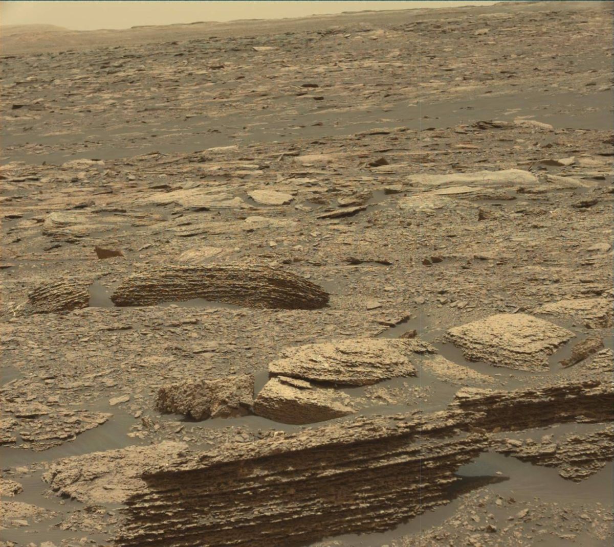
Curiosity Mastcam Left image acquired on Sol 1669, April 17, 2017.
Credit: NASA/JPL-Caltech/MSSS
NASA’s Curiosity Mars rover has just begun Sol 1671 activities.
Reports Roger Wiens, Curiosity’s Chemistry & Camera (ChemCam) Principal Investigator, the rover has nailed a drive of 112 feet (34 meters) to another rock exposure identified in orbital images.
Mud cracks
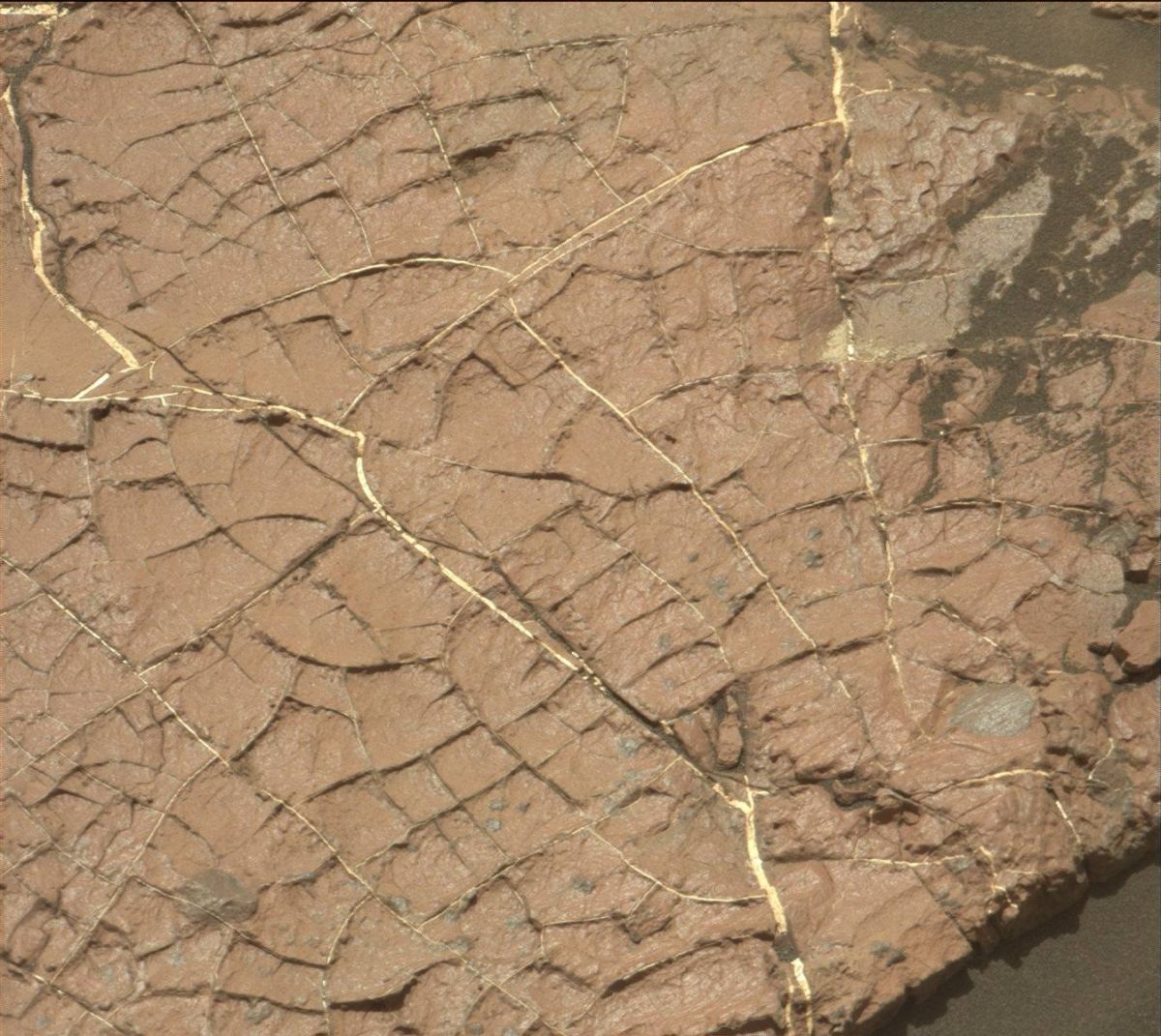
Curiosity Mastcam Right image of “Old Soaker,” taken on Sol 1568, January 3, 2017. Credit: NASA/JPL-Caltech/MSSS
“Ever since we observed possible mud cracks at Old Soaker,” Wiens said, “the rover team has been pursuing the idea that Curiosity is exploring strata that represent occasional dry-lake periods.”
Interesting rocks
As the rover drives further from the dunes, Wiens added, “it is nice to be seeing more and more interesting rocks out the front window.”
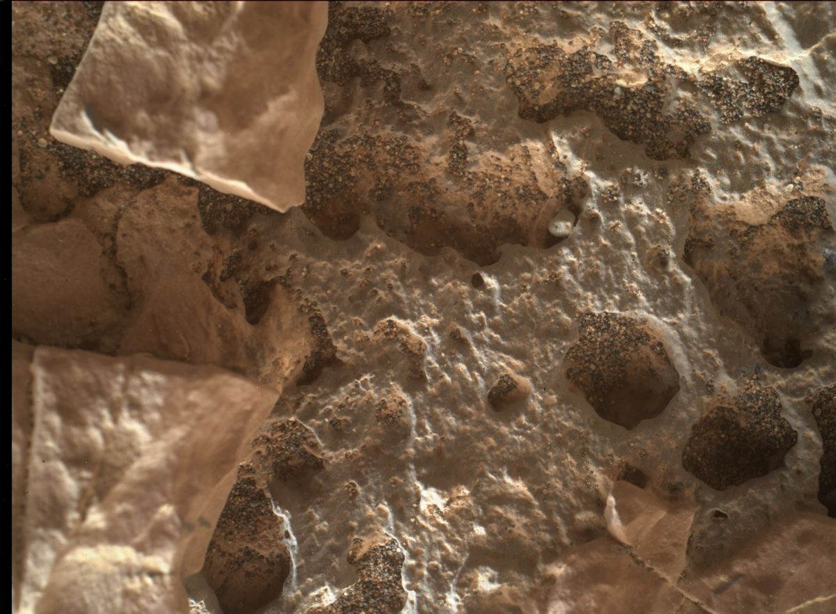
Curiosity Mars Hand Lens Imager (MAHLI) photo, acquired on Sol 1668, April 16, 2017.
Credit: NASA/JPL-Caltech/MSSS
The main activities in the plan that were sent up on Monday to Curiosity included a 9×7 Mastcam mosaic of the rock outcrop “Jellison Cove,” along with Mars Hand Lens Imager (MAHLI), Alpha Particle X-Ray Spectrometer (APXS), and ChemCam on “Deer Isle,” and a second ChemCam analysis of “Calf Island.”
Credit: CMSA
China is set to launch its first cargo resupply craft – the Tianzhou-1 – in the April 20-24th time period and is viewed by the country’s space officials as a key step toward building a larger space station in the 2020’s.
Tianzhou-1 has been transferred atop its Long March-7 Y2 carrier rocket from the testing center to the launch zone in Wenchang, south China’s Hainan Province.
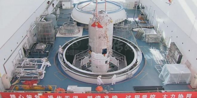
Chinese supply ship — Tianzhou-1 — undergoing pre-flight checks.
Credit: CMSA
According to the state-run Xinhua news agency, the transfer to the launch zone took 2.5 hours.
Since February, rocket technicians have been testing both the Tianzhou-1 and the carrier rocket for the upcoming launch.
“Once the combination is transported onto the launching tower, this mission enters its final stage. At present, all work is going smoothly, and we are ready for refueling and launching,” said Mao Wanbiao, deputy commander of the command office at the launch site in a CCTV-Plus interview.
Refueling tests
Tianzhou-1 is slated to dock with the now orbiting Tiangong-2 space lab and perform a series of in-orbit refueling tests.
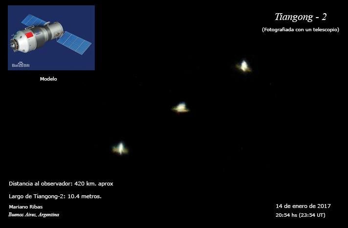
China’s Tiangong-2 space lab as imaged by skywatcher, Mariano Ribas.
Credit: Mariano Ribas
The Tianzhou-1 supply craft, if successfully launched, is expected to dock with the Earth-circling and now unoccupied space lab three times. During the docking, a new experiment of independent quick docking will be conducted, which requires that the two spacecraft dock with each other within six hours.
In recent video reports via CCTV-Plus, details of the Tianzhou-1 cargo spacecraft show it to be 35 feet (10.6 meters) tall with its largest diameter at 11 feet (3.35 meters) and a weight of 13 tons. The upper part with the bigger diameter is designated as a warehouse while the lower part with smaller diameter will propel the spacecraft.
Tianzhou-1 – “heavenly vessel” — will be able to carry about five tons of cargo into space.
Optimized booster
This is the second flight of a Long March-7 booster. It completed its maiden flight mission on June 25, 2016 from the launch site in Wenchang. The Long March-7 Yao-2 type launcher has been optimized for lofting the Tianzhou-1.
Xinhua reported earlier that Tianzhou-1 will orbit on its own for about three months and together with Tiangong-2 for about two months after their rendezvous.
Tianzhou-1’s flight will check and verify such technologies as supply of goods, in-orbit re-fueling and fast automated rendezvous and docking.
With tasks completed, the autopiloted Tianzhou-1 will fall back to Earth while Tiangong-2 is to remain in orbit and continue conducting experiments.

Credit: CSIS
Shenzhou-11
The Tiangong-2 space lab was occupied by the two-person crew of Shenzhou-11 last year. It was China’s sixth piloted spaceflight, and also the country’s longest mission to date, chalking up in total 33 days.
After the Shenzhou-11 liftoff on October 17, the spacecraft docked two days later with Tiangong-2. The two astronauts — Jing Haipeng and Chen Dong — lived and worked in the lab for 30 days.
For Chinese space program officials, the Tianzhou-1 resupply mission wraps up a second phase of China’s piloted space agenda and is a vital milestone for the country to establish a larger space station around 2022.
Core module
Meanwhile, China is readying a space station core module for flight in 2018, one of many segments that will comprise the orbiting complex.

Larger Chinese space station to be constructed on orbit in the 2020s.
Credit: CMSA
Assembly of that central module — named “Tianhe-1” — has already been completed and tests are currently under way, reports Bao Weimin of the China Aerospace Science and Technology Corp. (CASC).
The Chinese space station will initially be much smaller than the current International Space Station (ISS), but could be expanded for future scientific research and international cooperation, according to the country’s space officials.
Given present plans to retire the ISS in 2024, China’s space station will be the only country with a permanent space station.
According to Bao, the larger Chinese outpost will function in orbit for “dozens of years,” adding that all key parts of the facility are designed to be serviceable and replaceable.
For a video look at the transfer of booster and supply craft at Wenchang, go to this video from China Global Television Network:
https://video.twimg.com/amplify_video/853940080129396736/vid/1280×720/8iW5eHNoSbZOO999.mp4
Also, go to this CCTV-Plus video at:
http://cd-pv.news.cctvplus.com/2017/0417/8048093_Preview_3175.mp4
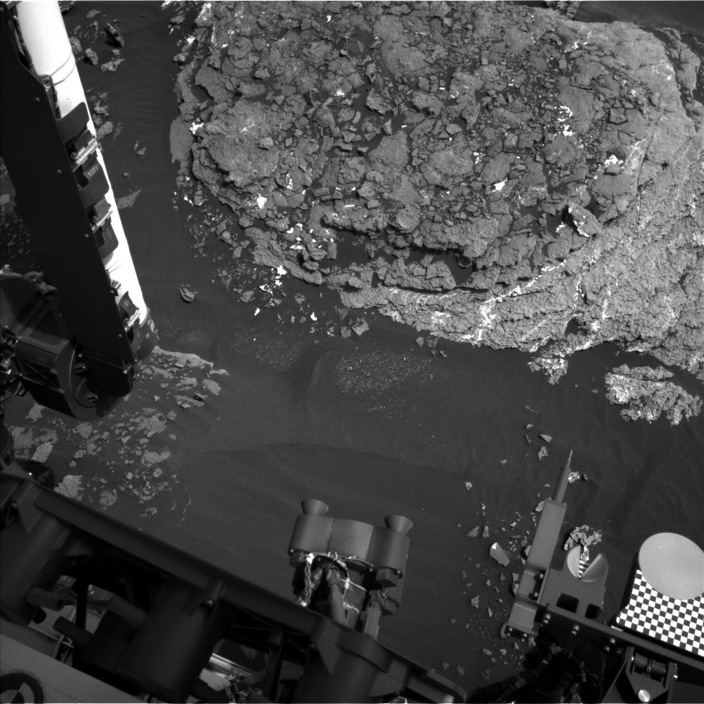
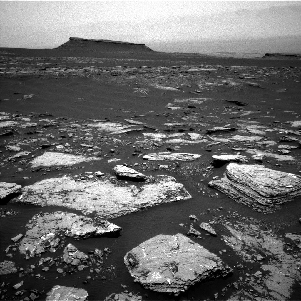
Curiosity Navcam Left B image acquired on Sol 1666, April 14, 2017.
Credit: NASA/JPL-Caltech
NASA’s Curiosity rover on Mars has just begun Sol 1668.
A drive by the robot has put it into position in front of the interesting “Moosehead Lake” outcrop with lots of veins and grey patches, “plenty to keep Curiosity busy over the weekend!”
That’s the word from Ryan Anderson, a planetary scientist at the USGS Astrogeology Science Center in Flagstaff, Arizona and Michael Battalio, a Ph.D. candidate in atmospheric science at Texas A&M.
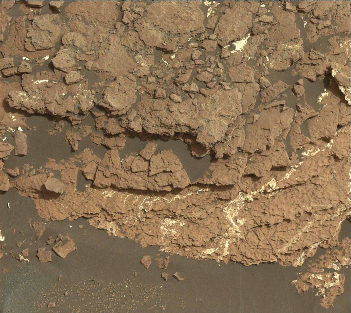
Curiosity Mastcam Left image taken on Sol 1666, April 14, 2017.
Credit: NASA/JPL-Caltech/MSSS
Long science block
The Sol 1668 plan is to start off with a long science block.
Curiosity’s Chemistry & Camera (ChemCam) is to make observations of targets “Sheldrake Island,” “Crabtree Neck,” “Waukeah Neck,” “Morancy Stream” and “Ogden Point.”
This is to be followed by a dust devil survey and several Mastcam mosaics. These include one covering Moosehead Lake, a few frames to extend the coverage of the area near the rover, and a big 22 frame mosaic of the outcrop at the rover’s next stop.
The robot’s Mastcam is slated to also take a picture of the ChemCam auto-targeted location after the drive. After that the Mars Hand Lens Imager (MAHLI) is to acquire pictures of the targets “Morancy Stream” and “Sheldrake Island” and then the Alpha Particle X-Ray Spectrometer (APXS) is on tap to analyze those two targets.
Curiosity Navcam Left B image acquired on Sol 1666, April 13, 2017.
Credit: NASA/JPL-Caltech
Atmospheric scans
On Sol 1669, the robot’s arm is to be retracted for the next drive, followed by post-drive imaging and a Mars Descent Imager (MARDI) observation in the evening.
On Sol 1670, the plan calls for a short morning block of atmospheric observations and a longer afternoon block containing a Mastcam image of the rover deck, another dust devil observation, and an auto-targeted ChemCam observation.
“We will wrap up Sol 1670 with some observations of the dust in the atmosphere to compare with the morning,” report Anderson and Battalio.
Environmental science
A recap of environmental science done over the last week has Curiosity acquiring the usual Rover Environmental Monitoring Station (REMS) and Dynamic Albedo of Neutrons (DAN) measurements. In addition, the rover performed Navcam cloud observation movies throughout the week.
The pointing direction of the cloud movies was shifted from north-facing to south-facing to avoid the sun. The movies will remain pointed towards the south until just after the southern hemisphere spring equinox in May 2018.
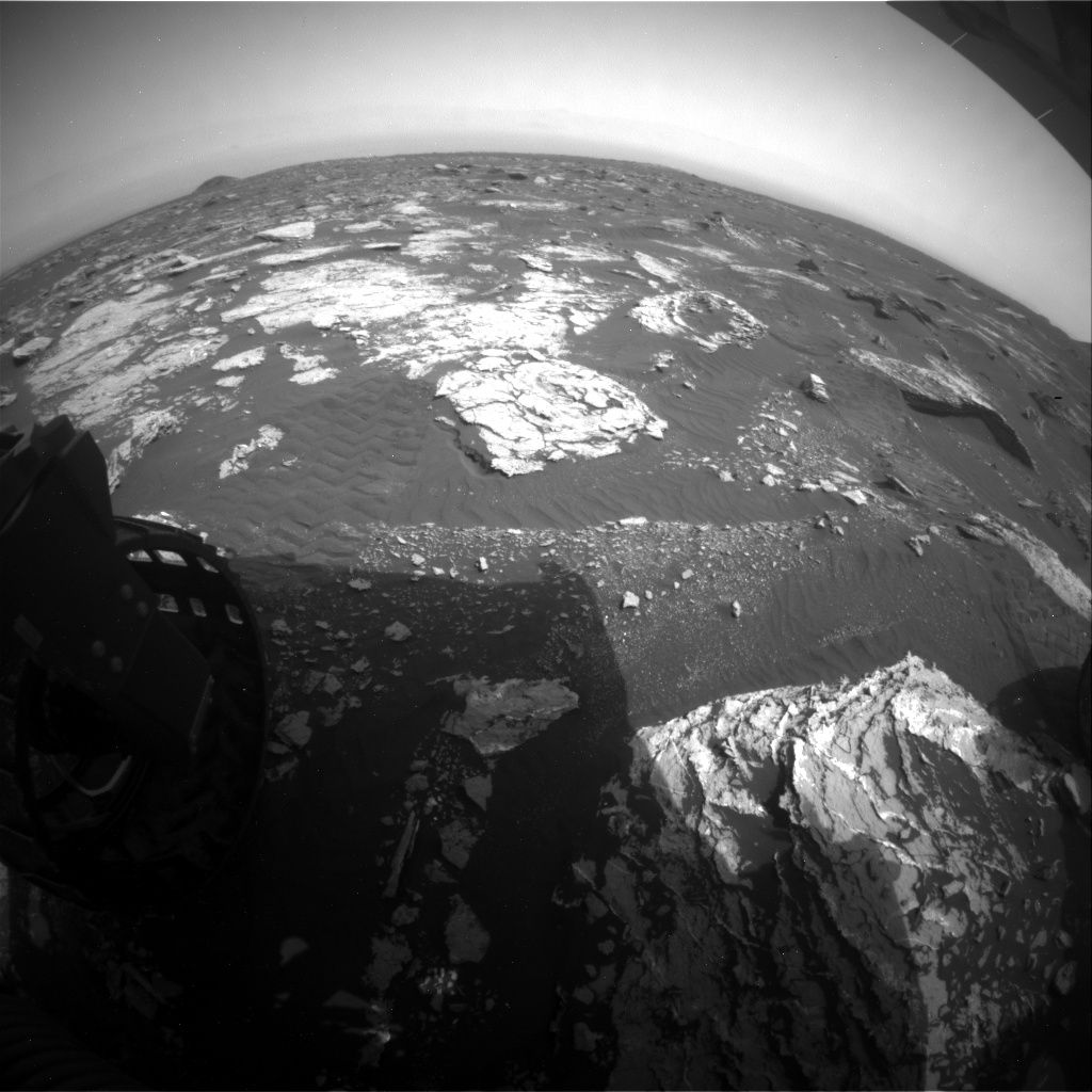
Curiosity Rear Hazcam Right B image acquired on Sol 1667, April 14, 2017.
Credit: NASA/JPL-Caltech
Also, there was a Navcam dust devil survey on Sol 1670, as well as one earlier in the week on sol 1668.
Also captured earlier last week was a ChemCam passive sky observation on sol 1665 that had been previously dropped twice from the plan due to the DSN outage two weeks ago and sun safety issues the week before.
Difficult sky observations
“Planning passive sky observations is difficult,” Anderson and Battalio report, “they are among the most time consuming and time constrained atmospheric observations.”
This is because the observation requires ChemCam to take passive spectra of the sky at two different azimuths and the instrument must avoid the Sun’s path as it slews between those locations, the two Mars scientists add. “This can be difficult near equinoxes when the Sun passes directly overhead!”
As always, carrying out planned rover activities are subject to change due to a variety of factors related to the Martian environment, communication relays and rover status.
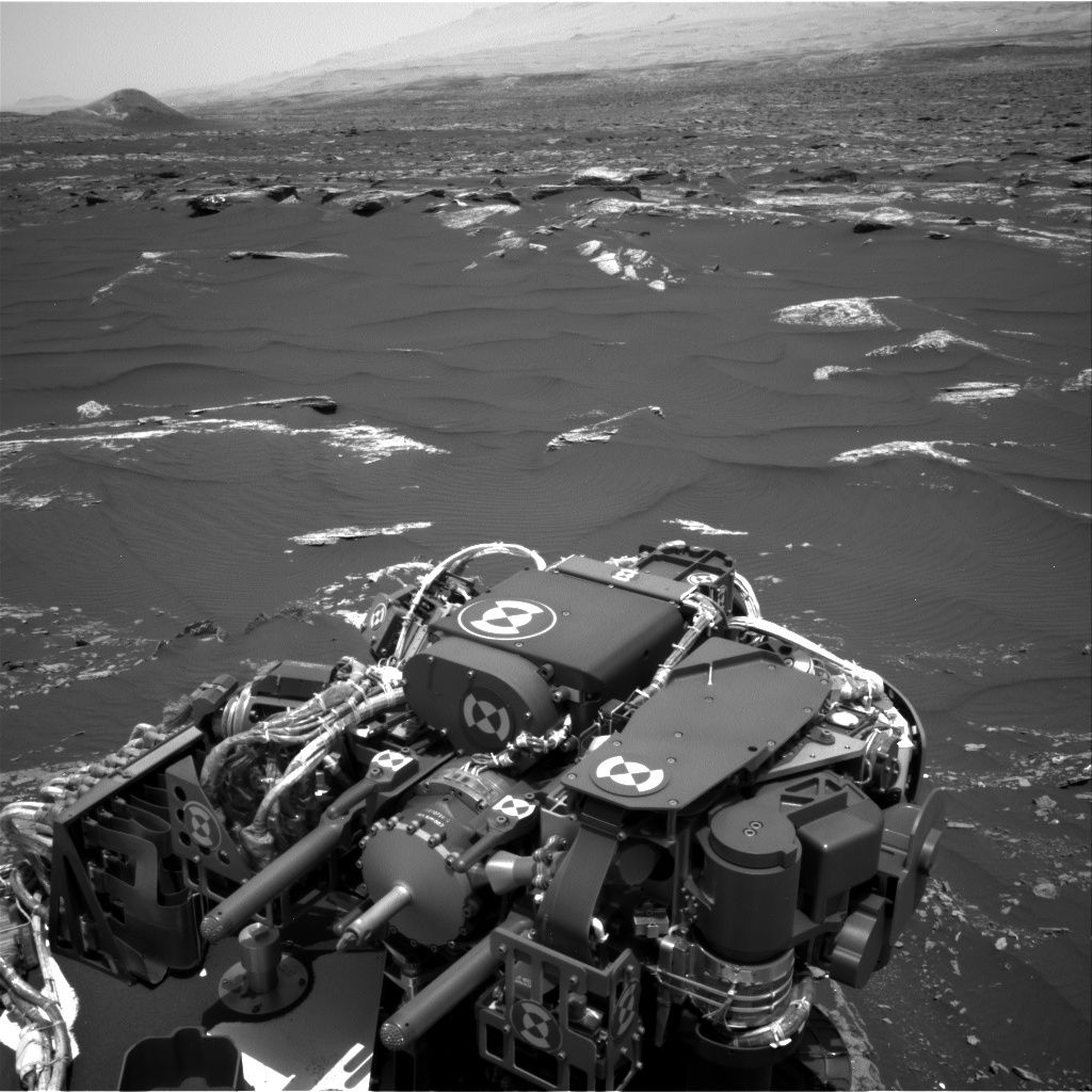
Curiosity Navcam Right B image taken on Sol 1666, April 13, 2017.
Credit: NASA/JPL-Caltech
Now at work during Sol 1667, NASA’s Curiosity Mars rover had its drive cut short during Sol 1664. The robot had driven less than 6 feet (2 meters) then halted due to the angle of the left bogie wheel side that slightly exceeded the suspension limit.
“Such limits are routinely set based on the results of detailed modeling of the vehicle’s response to the terrain, so that unexpected conditions will automatically cause the rover to stop and wait for further instructions,” reports Ken Herkenhoff, a rover scientist at the USGS Astrogeology Science Center in Flagstaff, Arizona.
Later analysis of the vehicle’s orientation showed nothing that concerned the mobility team, so a drive was planned for Sol 1666.
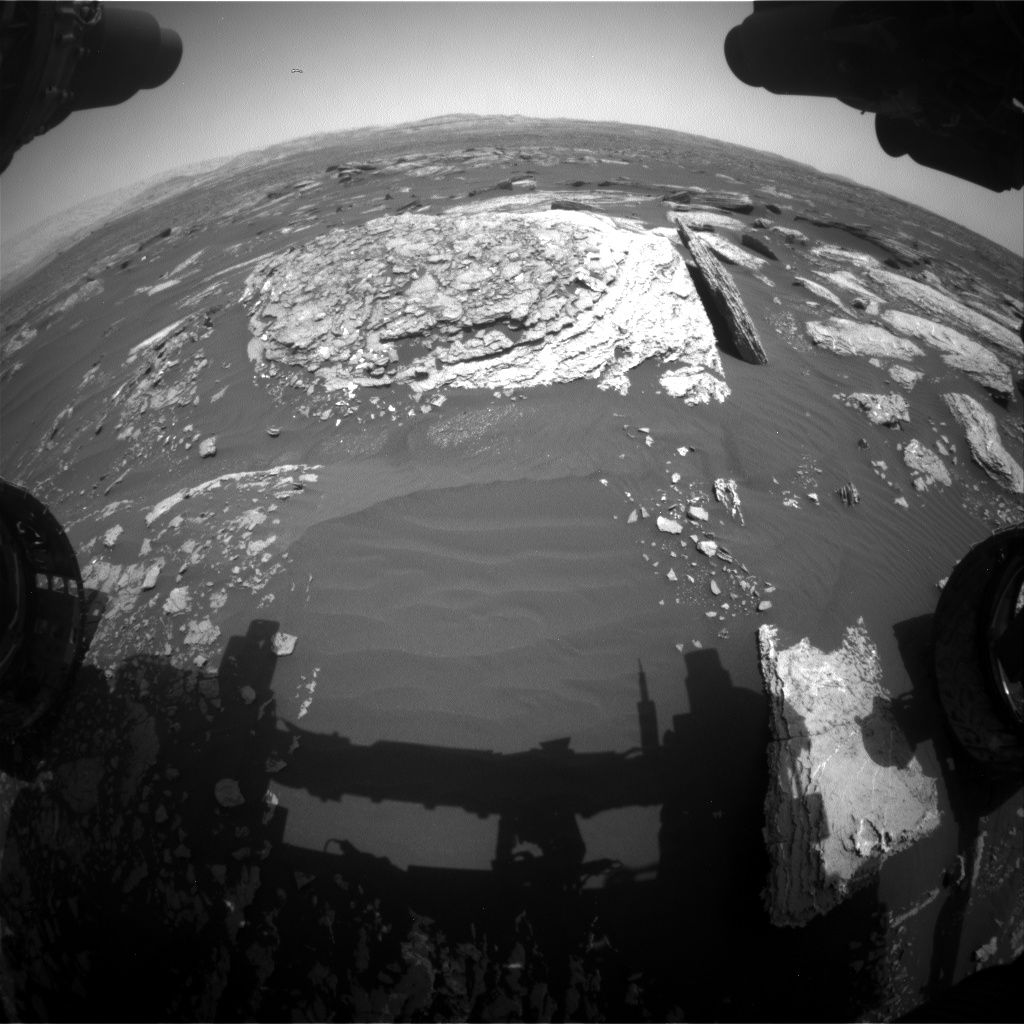
Curiosity Front Hazcam Right B image acquired on Sol 1666, April 13, 2017.
Credit: NASA/JPL-Caltech
Outcrop target
Before the drive, Curiosity’s Chemistry & Camera (ChemCam) and Right Mastcam were slated to observe a vein target named “Ingalls Island,” a nearby outcrop target dubbed “Yellow Island,” and color boundary targets called “Bunker Cove” and “Cromwell Cove.”
The rover’s Mastcam was then to acquire a multispectral observation of Moosehead Lake, the drive goal.
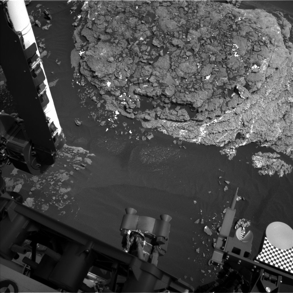
Curiosity Navcam Left B image taken on Sol 1666, April 14, 2017.
Credit: NASA/JPL-Caltech
After the drive and usual post-drive imaging, the arm will be unstowed for more drill diagnostic tests and moved out of the way for Navcam and Left Mastcam imaging of the arm workspace, to support planning today.
Autonomously-selected target
Later in the afternoon, Mastcam was slated to measure dust in the atmosphere, Navcam will search for clouds, and the auto-software (AEGIS) was to acquire a ChemCam observation of an autonomously-selected target.
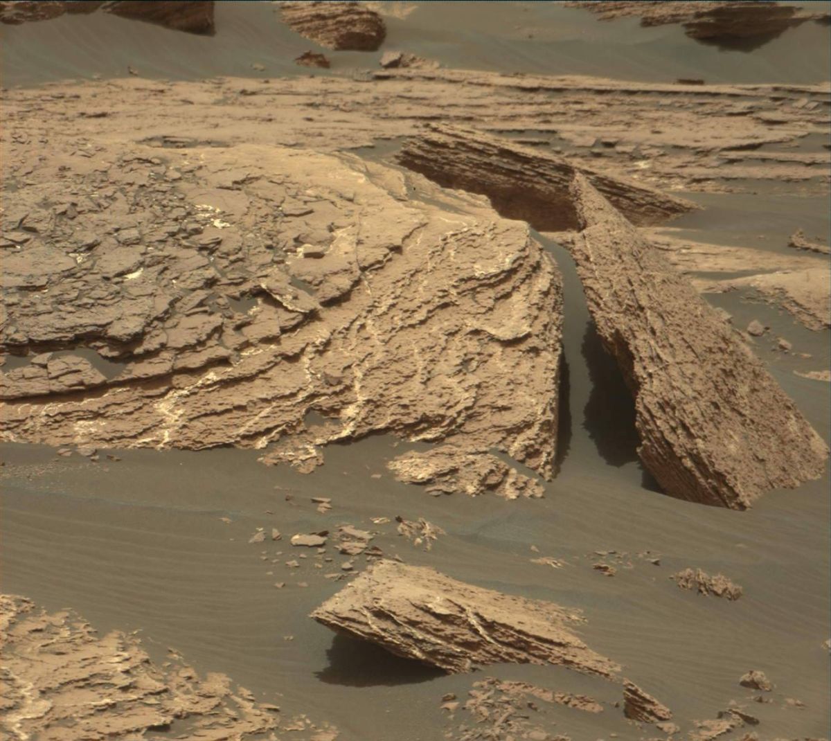
Curiosity Mastcam Right image taken on Sol 1664, April 11, 2017.
Credit: NASA/JPL-Caltech/MSSS
The Sol 1667 plan was to begin with Navcam searches for dust devils and clouds above the horizon. In the afternoon, ChemCam will acquire calibration data.
“The rover will then get some sleep before what could be a busy weekend plan,” Herkenhoff adds.
Location, location, location
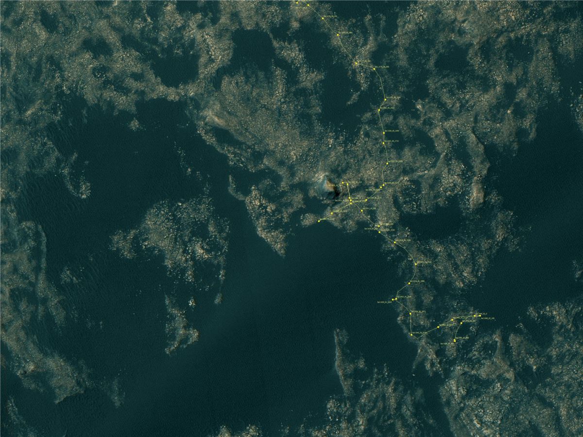
Meanwhile, the Jet Propulsion Laboratory has released a new map showing Curiosity’s location as of Sol 1664, April 12, 2017.
Credit: NASA/JPL-CalTech/University of Arizona
This map is periodically updated by the mission team as Curiosity drives on its way to the base of Mount Sharp.
Numbering of the dots along the line indicate the sol number of each drive. North is up.
From Sol 1662 to Sol 1664, Curiosity had driven a straight line distance of about 4.96 feet (1.51 meters).
Since touching down in Bradbury Landing in August 2012, Curiosity has driven 9.93 miles (15.98 kilometers).
The base image from the map is from the High Resolution Imaging Science Experiment Camera (HiRISE) in NASA’s Mars Reconnaissance Orbiter.

Credit: NASA
The Office of Inspector General (OIG) at NASA evaluated the space agency’s plans for deep space exploration and crewed missions to Mars.
The April 13, 2017 OIG report notes:
NASA’s initial exploration missions on its Journey to Mars – EM-1 and EM-2 – face multiple cost and technical challenges that likely will affect their planned launch dates.
Although the Agency’s combined investment for development of the SLS, Orion, and Ground Systems Development and Operations (GSDO) programs will reach approximately $23 billion by the end of fiscal year 2018, the programs’ average monetary reserves for the years leading up to EM-1 are much lower than the 10 to 30 percent recommended by Marshall Space Flight Center guidance.
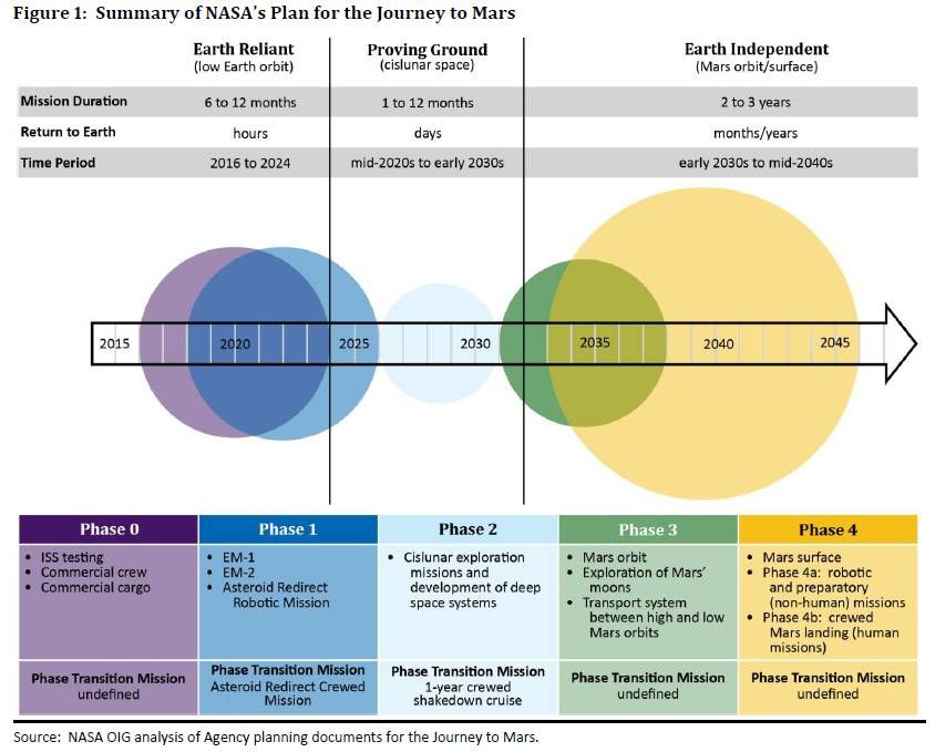
Credit: NASA/OIG
Low monetary reserves
Low monetary reserves limit the programs’ flexibility to cover increased costs or delays resulting from unexpected design complexity, incomplete requirements, or technology uncertainties. Moreover, software development and verification efforts for all three programs are behind schedule to meet a November 2018 EM-1 launch.
NASA does not have a life-cycle cost estimate or integrated schedule for EM-2, which makes it difficult for Agency officials and external stakeholders to understand the full costs of EM-2 or gauge the validity of launch date assumptions.

International Space Station.
Credit: NASA
International Space Station: implications
NASA’s decision whether to continue spending $3 to $4 billion annually to maintain the International Space Station after 2024 will affect its funding profile for human exploration efforts in the 2020s, and therefore has implications for the Agency’s Mars plans.

Credit: NASA/OIG
Wanted: more rigorous cost and schedule estimates
To increase the fidelity, accountability, and transparency of NASA’s human exploration goals beyond low Earth orbit, the report recommends the Associate Administrator for Human Exploration and Operations:
(1) complete an integrated master schedule for the SLS, Orion, and GSDO programs for the EM-2 mission;
(2) establish more rigorous cost and schedule estimates for the SLS and associated GSDO infrastructure for EM-2;
(3) establish objectives, need-by dates for key systems, and phase transition mission dates to flesh out its Journey to Mars framework; and
(4) include cost as a factor in NASA’s Journey to Mars feasibility studies when assessing various potential missions and systems.
Resources:
To read the full report — NASA’s Plans for Human Exploration Beyond Low Earth Orbit – go to:
https://oig.nasa.gov/audits/reports/FY17/IG-17-017.pdf
A video detailing the report can be viewed at:
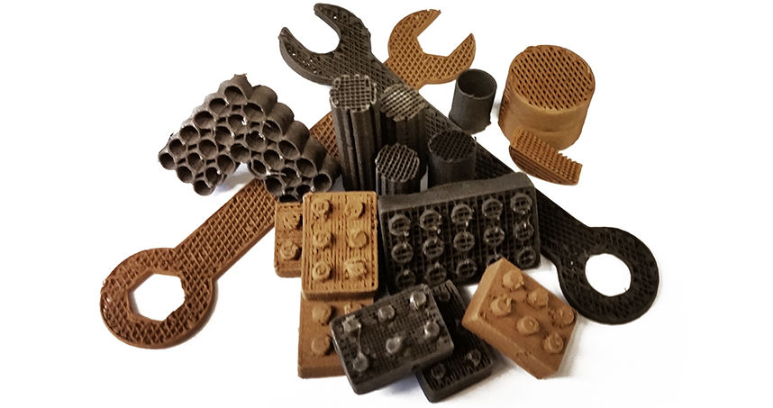
Tools and building blocks made by 3D printing using Moon and Mars simulant.
Credit: Northwestern University
New research demonstrates the ability to use Moon and Mars stimulants to produce 3D-print structures. That ability presents an easy, highly scalable, sustainable manufacturing method for lunar and Red Planet travelers.
3-D printing allows off-planet settlers the wherewithal to make everything from small tools to large buildings using surrounding extraterrestrial resources.
Northwestern Engineering’s Ramille Shah and her Tissue Engineering and Additive Manufacturing (TEAM) Laboratory have demonstrated the ability to 3D-print structures with simulants of Martian and lunar dust.

Credit: Northwestern Engineering/Tissue Engineering and Additive Manufacturing (TEAM) Laboratory
3D-painting
This research draws from earlier work of a “3D-painting process,” a term that Shah and her team use for their novel 3D inks and printing method, utilized to print hyperelastic “bone” as well as 3D grapheme, carbon nanotubes, metals and alloys.
“For places like other planets and moons, where resources are limited, people would need to use what is available on that planet in order to live,” said Shah, assistant professor of materials science and engineering at Northwestern’s McCormick School of Engineering and of surgery in the Feinberg School of Medicine.
“Our 3D paints really open up the ability to print different functional or structural objects to make habitats beyond Earth,” Shah added in a press statement.
Stimulating simulant
The innovative research makes use of NASA-approved lunar and Martian dust stimulants. Those materials mimic in particle shape, and size the dusts found on the Moon and at Mars.
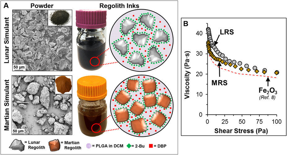
Credit: Northwestern Engineering/Tissue Engineering and Additive Manufacturing (TEAM) Laboratory
Shah’s team created the lunar and Martian 3D paints using the respective dusts, a series of simple solvents, and biopolymer, then 3D printed them with a simple extrusion process. The resulting structures are over 90 percent dust by weight, according to the research team.
The resulting 3D-painted material is flexible, elastic, and tough — similar to rubber.
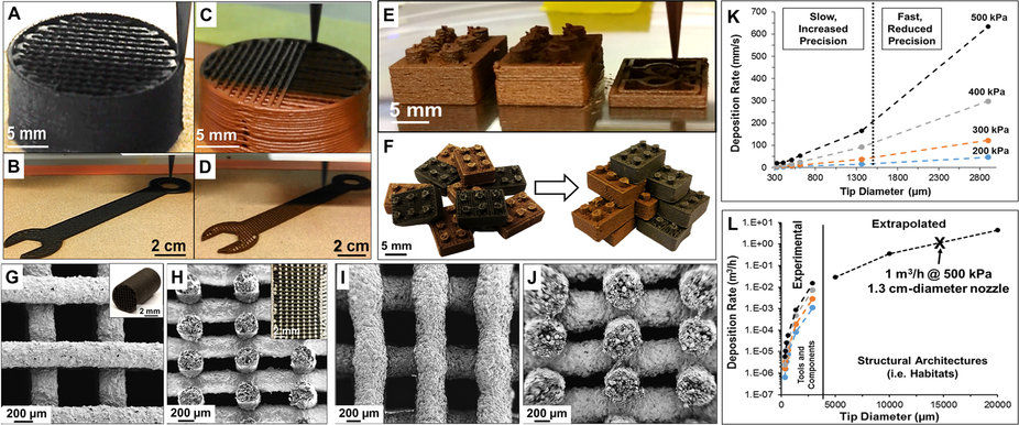
Credit: Northwestern Engineering/Tissue Engineering and Additive Manufacturing (TEAM) Laboratory
Roll me, fold me, shape me
This is the first example of rubber-like or soft materials resulting from lunar and Martian simulant materials. The material can be cut, rolled, folded, and otherwise shaped after being 3D painted, if desired. In addition, Shah said that Lego-like interlocking bricks can be made by the process.
Partially supported by a gift from Google and performed at Northwestern’s Simpson Querrey Institute, the research was recently published in Nature Scientific Reports.
For that scientific research paper – “Robust and Elastic Lunar and Martian Structures from 3D-Printed Regolith Inks” – go to:
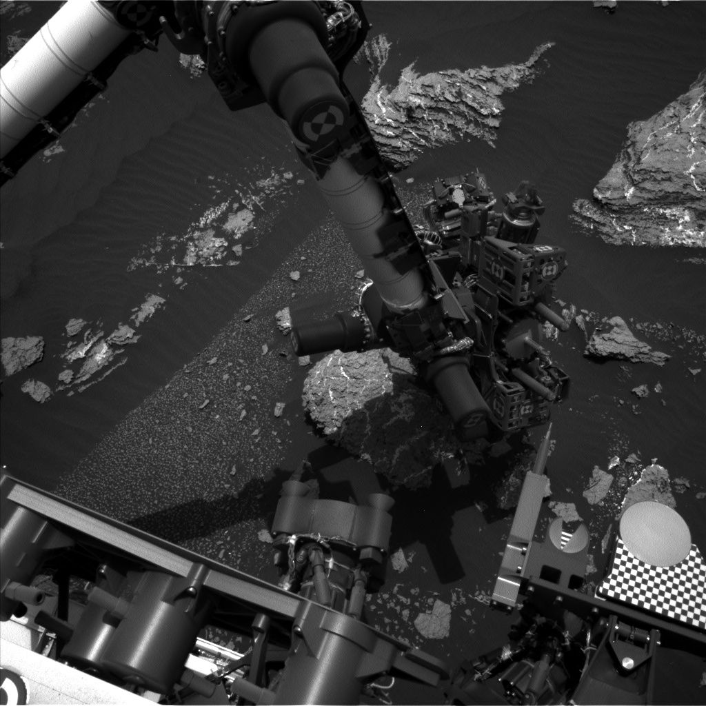
Curiosity Mastcam Right image taken on Sol 1661, April 8, 2017.
Credit: NASA/JPL-Caltech/MSSS
NASA’s Curiosity Mars rover is performing Sol 1663 science duties.
On Sol 1662 the robot drove roughly 79 feet (24 meters) and another drive is planned for Sol 1664.
Targeted remote sensing
“Before the drive, lots of targeted remote sensing is planned,” reports Ken Herkenhoff of the USGS Astrogeology Science Center in Flagstaff, Arizona.
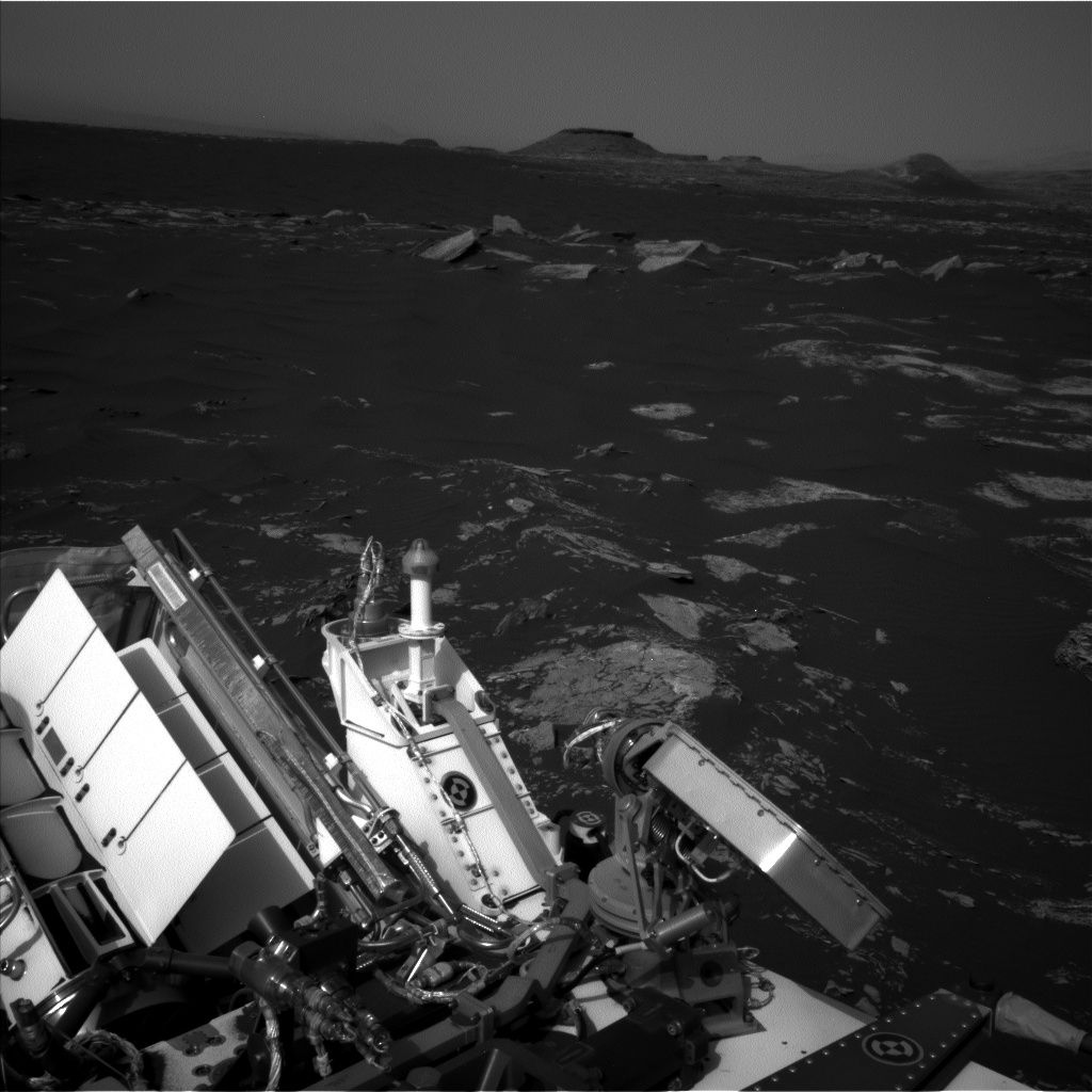
Curiosity Mastcam Right image taken on Sol 1661, April 8, 2017.
Credit: NASA/JPL-Caltech/MSSS
That plan calls for the rover’s Chemistry & Camera (ChemCam) and Right Mastcam to observe a bright rock named “Peaks Island,” an exposure of bedding dubbed “Great Wass Island,” a sand ripple called “Baldpate Mountain,” and an interesting rock that was selected by Autonomous Exploration for Gathering Increased Science (AEGIS) software after the Sol 1662 drive, now named “Chebeague Island.”
Mosaic of outcrops
Curiosity’s Mastcam is scheduled to acquire a stereo mosaic of outcrops toward the south, in the direction of the planned drive, Herkenhoff adds.
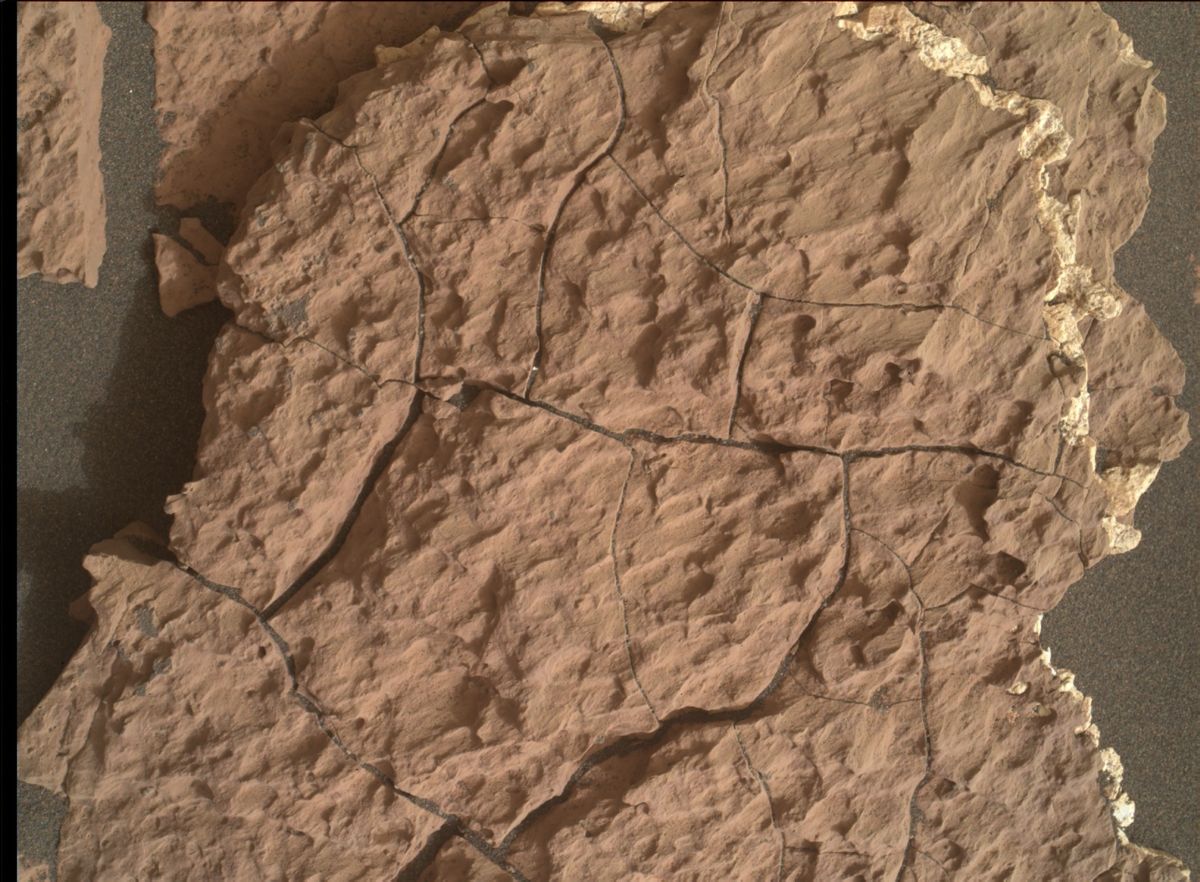
Photo taken by Curiosity’s Mars Hand Lens Imager (MAHLI), located on the turret at the end of the rover’s robotic arm. Sol 1661, April 8, 2017.
Credit: NASA/JPL-Caltech/MSSS
Untargeted remote sensing planned for Sol 1665 includes passive (no laser) ChemCam sky observations and two ground LIBS (Laser Induced Breakdown Spectroscopy) targets selected using the AEGIS software.
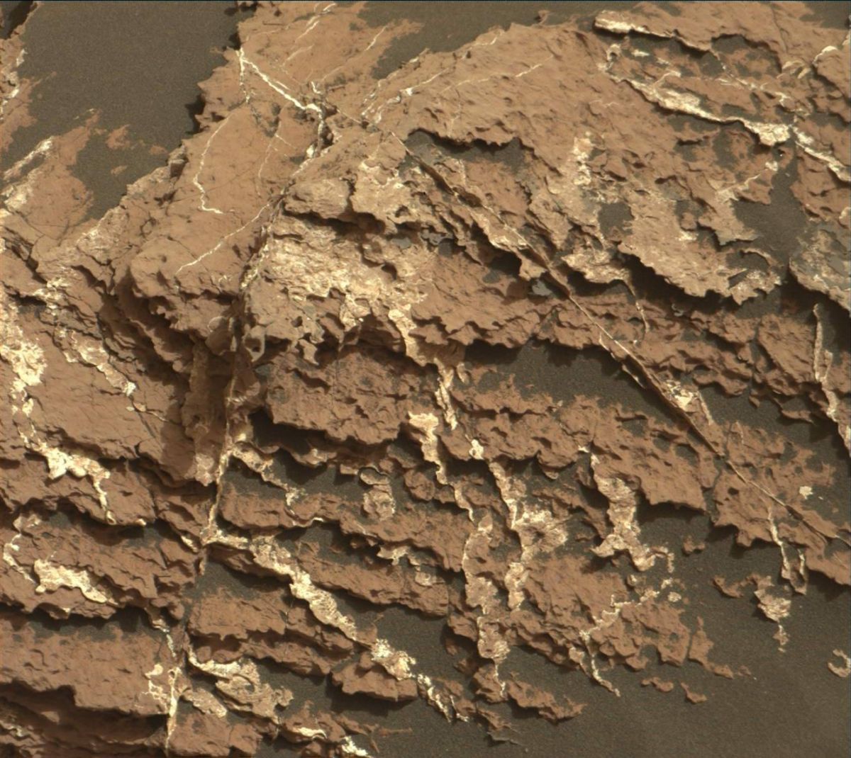
Curiosity Mastcam Right image taken on Sol 1661, April 8, 2017.
Credit: NASA/JPL-Caltech/MSSS
Curiosity’s Navcam is slated to then search for dust devils and clouds before the rover rests in preparation for Wednesday’s plan, Herkenhoff concludes.
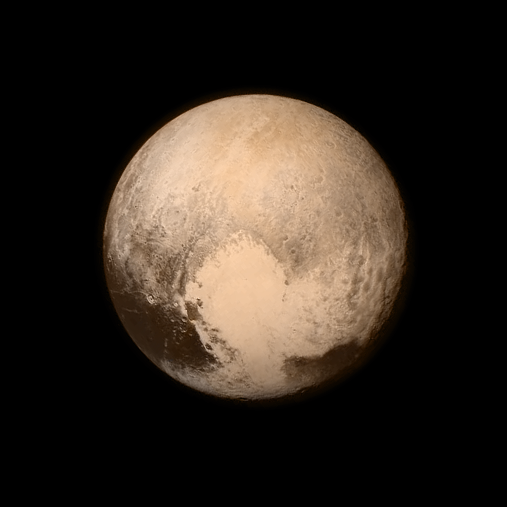
Pluto nearly fills the frame in this image from the New Horizon’s Long Range Reconnaissance Imager (LORRI).
Credit: NASA/APL/SwRI
The NASA Innovative Advanced Concepts (NIAC) Program nurtures visionary ideas that could transform future NASA missions with the creation of breakthroughs.
Among a new slate of NIAC 2017 Phase I awards is a “Pluto Hop, Skip, and Jump” concept.
The idea has been proposed by Benjamin Goldman of Global Aerospace Corporation in Irwindale, California.
Low fuel load
According to Goldman, imagine a craft that could enter Pluto’s atmosphere and deliver a lander to the surface using aerodynamic drag and just a few kilograms of propellant.

Credits: Benjamin Goldman
Pluto’s surface pressure is just 10 millionths of Earth’s, but its atmosphere is about seven times higher than Earth’s and its volume is about 350 times the volume of Pluto itself.
Over a several hundred kilometer entry distance, this ultra-low ballistic coefficient craft can dissipate over 99.999% of its initial kinetic energy, resulting in a terminal velocity comparable to or less than past planetary landers or rovers.
With this architecture, the total propellant requirement for landing on Pluto is less than 8 pounds (3.5 kilograms).
Surface science
“After making science measurements at its initial landing site, the lander switches to “hopper” mode,” Goldman reports, “taking advantage of the low gravitational acceleration (0.063 gee) and a modest propellant store to literally hop, skip, and jump around the surface, sometimes kilometers at a time, investigating features of interest.”
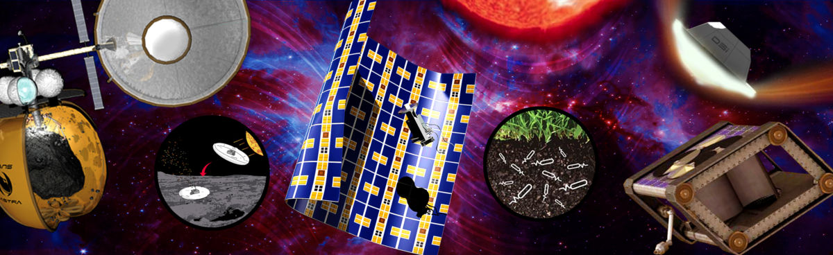
The NASA Innovative Advanced Concepts (NIAC) Program nurtures visionary ideas that could transform future NASA missions with the creation of breakthroughs.
Credit: NIAC
Goldman suggests that the proposed concept would enable on-the-spot surface science at Pluto with low overall mass, a reasonable cost, and in a timeframe of about 10-15 years.
Initial definition and analysis
Phase I awards are valued at approximately $125,000, for nine months, to support initial definition and analysis of their concepts. If these basic feasibility studies are successful, awardees can apply for Phase II awards.
For more information on NIAC’s just announced Phase 1 and Phase 2 awards, go to:
https://www.nasa.gov/press-release/nasa-invests-in-22-visionary-exploration-concepts

Long distance look of cliff face of Mt. Sharp. Curiosity ChemCam Remote Micro-Imager photo taken on Sol 1661, April 8, 2017.
Credit: NASA/JPL-Caltech/LANL
NASA’s Curiosity rover is now performing Sol 1662 science duties.
A recent drive by the rover placed it away from the “Ogunquit Beach” sand dune, taking the robot about 115 feet (35 meters) to the southwest.
Curiosity has wheeled into “a good location to continue measuring the composition of the bedrock as we drive up Mt. Sharp,” reports Ryan Anderson, a planetary scientist at the USGS Astrogeology Science Center in Flagstaff, Arizona.
Mt. Sharp imagery
A Sol 1661 plan started out with a Mastcam mosaic of “Old Speck Mountain” and some Navcam cloud detection observations.
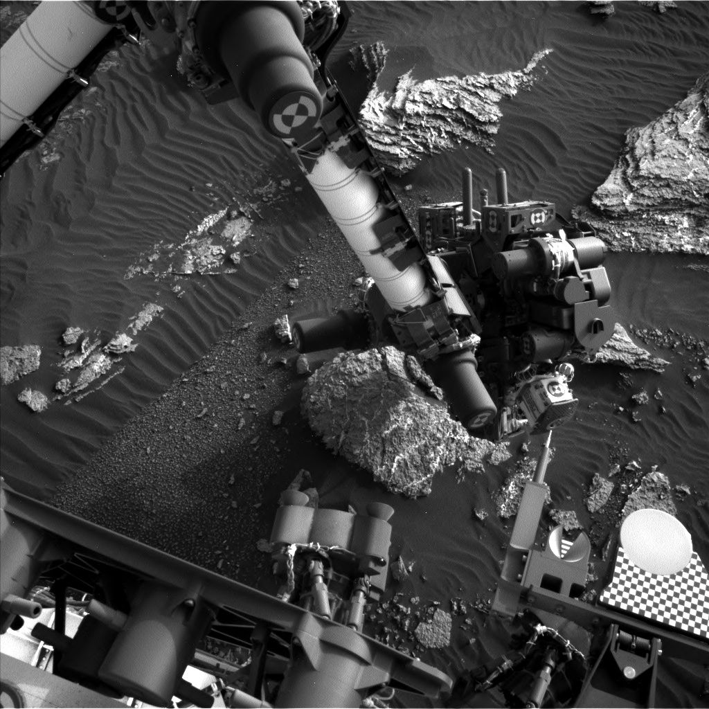
Curiosity Navcam Left B image taken on Sol 1661, April 8, 2017.
Credit: NASA/JPL-Caltech
The rover’s Chemistry & Camera (ChemCam) was slated then to analyze the targets “Blueberry Mountain,” “Brewer Mountain,” and “Mud Hole” with Mastcam documentation images for each target.
Also carried out where long distance ChemCam images of a cliff face on Mt. Sharp.
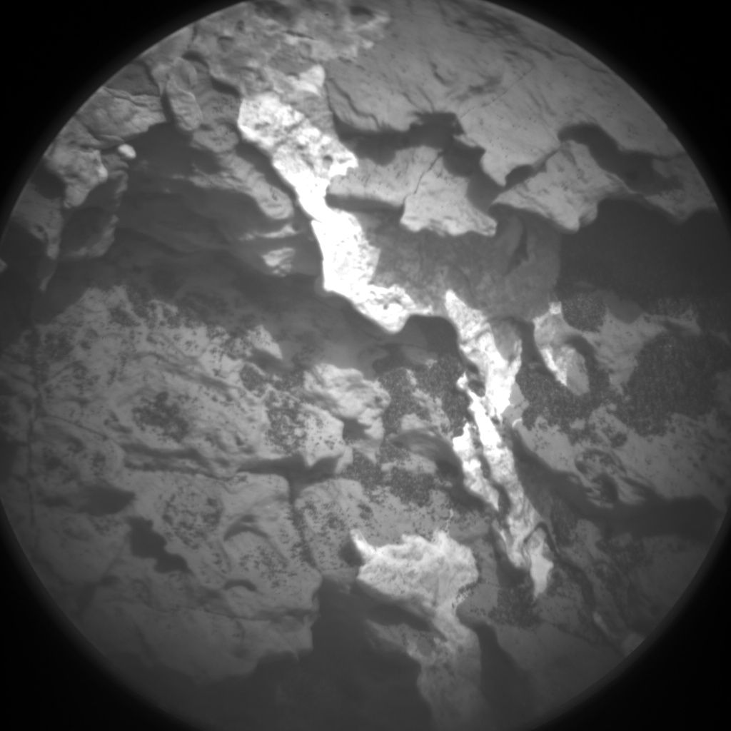
Curiosity ChemCam Remote Micro-Imager photo taken on Sol 1661, April 8, 2017.
Credit: NASA/JPL-Caltech/LANL
Curiosity ChemCam Remote Micro-Imager on Sol 1661 April 8, 2017
Credit: NASA/JPL-Caltech/LANL
Overnight analysis
Once the remote sensing is done, Curiosity’s Mars Hand Lens Imager (MAHLI) was slated to take pictures of the targets “Paradise Hill” and “Treasure Island.”
The rover’s Alpha Particle X-Ray Spectrometer (APXS) was then to analyze both targets, with an overnight analysis of Treasure Island.
Easy day
On Sol 1662, the plan calls for driving again, followed by an autonomously targeted ChemCam observation, and on sol 1663 Curiosity will have “a pretty easy day,” Anderson notes, with some Mastcam atmospheric dust measurements and a Mars Descent Imager (MARDI) image of the ground beneath the rover.
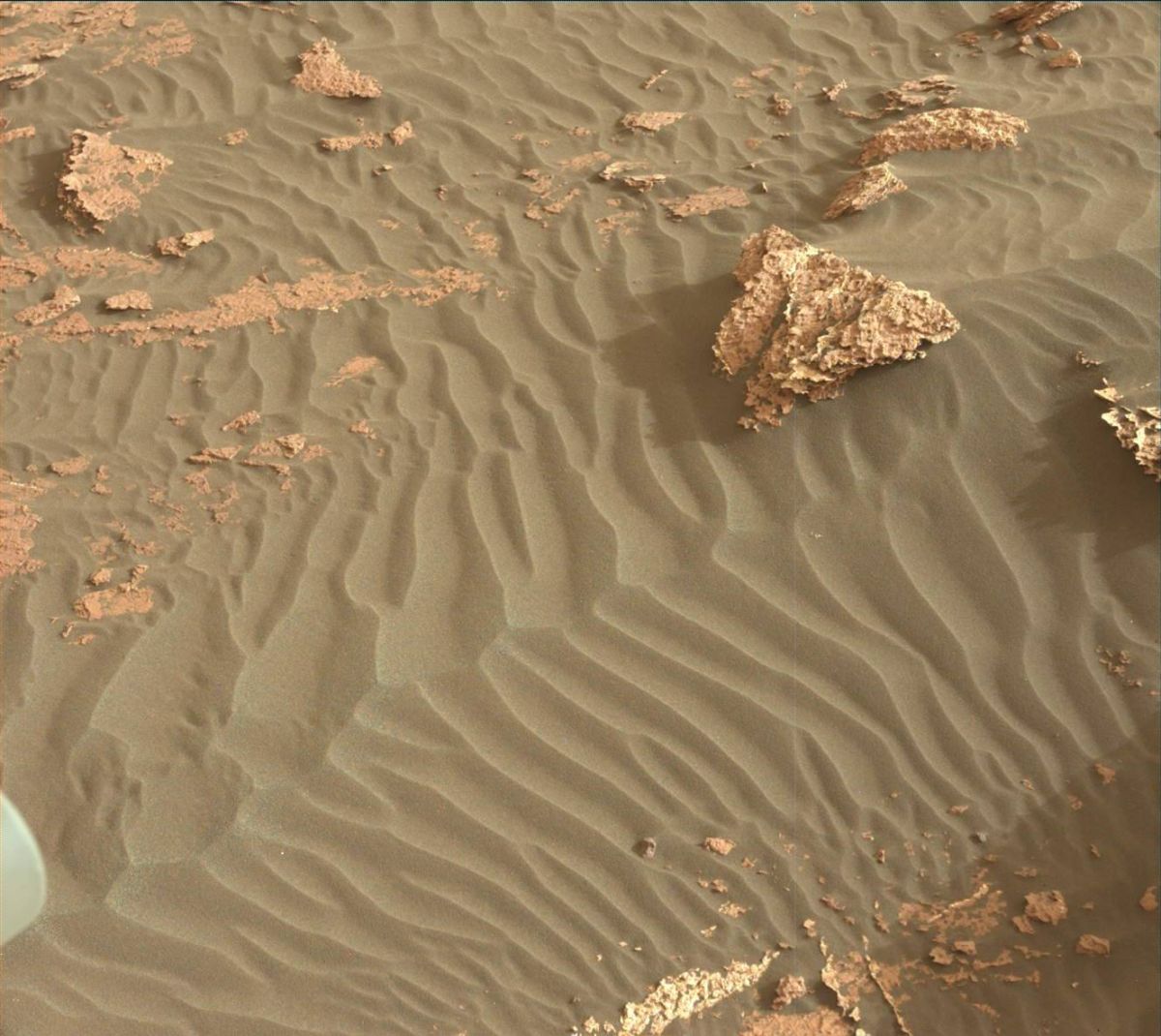
Curiosity Mastcam Left image taken on Sol 1659, April 6, 2017.
Credit: NASA/JPL-Caltech/MSSS
Anderson says that the environmental science group has been working to recover the activities that were lost last weekend because of the Deep Space Network outage, such as the morning imaging suite and 15-frame Navcam dust devil movie, while also continuing the normal cadence of monitoring activities.
Sandy DAN
Earlier in the week, a special Dynamic Albedo of Neutrons (DAN) active measurement was acquired over the sand of “Ogunquit Beach.”
“By turning the rover in place and backing up onto the dune, we placed the field of view of DAN’s active neutron experiment, which is centered between the rear two wheels, right on the dune sand,” Anderson adds. DAN active experiments are performed after each rover position change (usually immediately after a drive), but in this case, the measurement was taken just before the rover departed Ogunquit Beach.
“In a DAN active measurement, neutrons are fired in all directions by the Pulse Neutron Generator, and some neutrons scattered by the soil under the rover return to the DAN detectors. This measurement will allow DAN to compare the amount of hydrogen measured at Namib Dune around sol 1243 to the conditions at Ogunquit Beach,” Anderson concludes.
Dates of planned rover activities are subject to change due to a variety of factors related to the Martian environment, communication relays and rover status.

