Archive for 2015
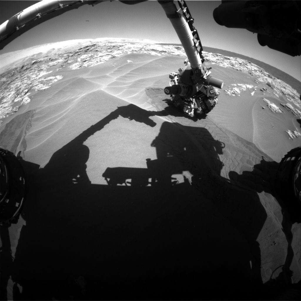
Curiosity Front Hazcam Right B image taken on Sol 1183, December 4, 2015.
Credit: NASA/JPL-Caltech
NASA’s Curiosity rover on Mars has been busy carrying out mobility testing, turning and backing out of Martian sand.
The robot documented its moves while taking multiple Hazcam images, then pausing to take Navcam and Mastcam images of the wheel tracks, reports Ken Herkenhoff of the USGS Astrogeology Science Center in Flagstaff, Arizona.
Images were taken to look for changes in a trench wall, and image the spots where the Alpha Particle X-Ray Spectrometer (APXS) was placed on the sand. APXS measures the abundance of chemical elements in rocks and soils.
Curiosity Navcam Left B image taken on Sol 1183, December 4, 2015
Credit: NASA/JPL-Caltech
Dark dune sand
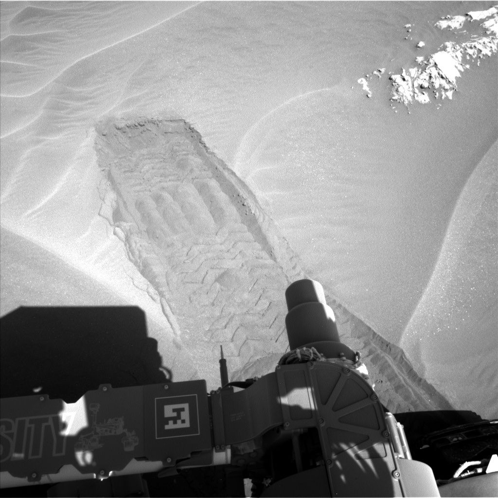
Rover operators were on task to drive the Mars machinery close enough to “High Dune” to allow contact science on the dark dune sand.
This weekend, the plan called for another drive of Curiosity.
Last week, the rover drove a little ways into a sand patch and then backed out, leaving trenches where the wheels were.
Curiosity Navcam Left B image taken on Sol 1181 December 2, 2015.
Credit: NASA/JPL-Caltech
Making trenches
“Yes, we’re disturbing some of the very photogenic sand ripples that we have been seeing, but it’s for a good cause,” reports Ryan Anderson, a planetary scientist at the USGS Astrogeology Science Center. “It teaches us more about how well we can drive in that sand, and by using the wheels to make trenches like this, we can get a better idea of the internal structure of the sand ripples,” he added.
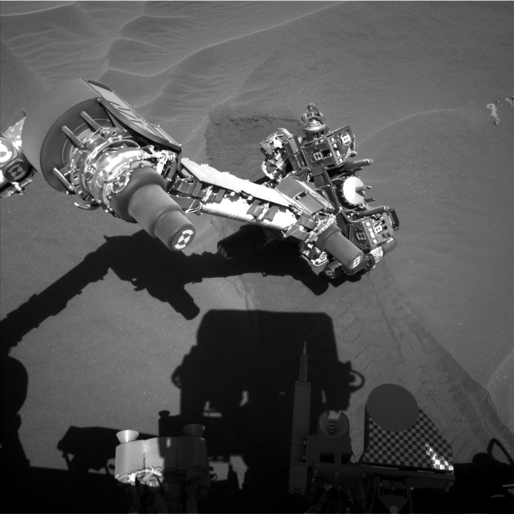
Imaging undisturbed sand
Work last week involved contact science on the sand, with images taken by the robot’s Mars Hand Lens Imager (MAHLI) of the undisturbed sand, the walls of the wheel track, and the interior of the track, Anderson said.

NASA’s Mars rover Curiosity acquired this image using its Mars Hand Lens Imager (MAHLI), located on the turret at the end of the rover’s robotic arm, on December 3, 2015, Sol 1182 of the Mars Science Laboratory Mission.
Credit: NASA/JPL-Caltech/MSSS
Dates of planned rover activities are always subject to change due to a variety of factors related to the Martian environment, communication relays and rover status.

LauncherOne hauls satellites into orbit.
Credit: Virgin Galactic
Sir Richard Branson’s Virgin Galactic has introduced an addition to its fleet of vehicles as part of a technical update on its LauncherOne small satellite launch service.
A 747-400 commercial jet aircraft — previously operated by Virgin Atlantic under the nickname “Cosmic Girl” — will provide a dedicated launch platform for the LauncherOne orbital vehicle.

Virgin Galactic pilot, Kelly Latimer, explains use of a 747-400 commercial jet aircraft — previously operated by Virgin Atlantic under the nickname “Cosmic Girl” — to provide a dedicated launch platform for the LauncherOne orbital vehicle.
Credit: Virgin Galactic
Cosmic Girl went into service in 2001 and will spend her new life as an aerial platform for LauncherOne.
The acquisition of a 747-400 carrier to be the “dedicated air launch” vehicle for LauncherOne is intended to free up WhiteKnightTwo for Virgin Galactic’s human space flight program. That suborbital launch system for paying passengers makes use of the WhiteKnightTwo carrier craft and the SpaceShipTwo rocketship.
Commercial suborbital spaceflight services for ticket holders are to be carried out of Spaceport America in New Mexico.
Rapid service
“Air launch enables us to provide rapid, responsive service to our satellite customers on a schedule set by their business and operational needs, rather than the constraints of national launch ranges,” said George Whitesides, Virgin Galactic CEO in a press statement.
“Selecting the 747 airframe provides a dedicated platform that gives us the capacity to substantially increase our payload to orbit without increasing our prices,” Whitesides added.
Wing modification
The LauncherOne rocket will be mounted to the carrier aircraft under the left wing, adjacent to the position that has been used by other 747s to ferry a fifth engine.
Initial inspections and tests of Cosmic Girl have already been completed and, prior to the start of the wing modification.
A regularly scheduled maintenance check will be conducted by VT San Antonio Aerospace – a maintenance, repair and operations organization.

Sir Richard Branson and Kelly Latimer, a pilot for Virgin Galactic.
Launch prices
In September, Virgin Galactic announced it had doubled LauncherOne’s performance to 440 pounds (200 kilograms) into the standard Sun-Synchronous Orbit for a price below $10 million, with the option to purchase further increases in performance to the same orbit and for launches that reach other altitudes or inclinations.
The launch system is capable of launching over 880 pounds (400 kilograms) of payload to other orbits.
Initial inspections
The LauncherOne rocket will be mounted to the carrier aircraft under the left wing, adjacent to the position that has been used by other 747s to ferry a fifth engine.
Initial inspections and tests of Cosmic Girl have already been completed and, prior to the start of the wing modification, a regularly scheduled maintenance check will be conducted by VT San Antonio Aerospace. A maintenance, repair and operations (MRO) organization, VT San Antonio Aerospace has over the years re-delivered more than 3,000 aircraft.
Game-changing customers
According to Virgin Galactic President, Steve Isakowitz: “Our LauncherOne team moved into a 150,000 square foot facility for design and manufacturing, grew to more than 150 dedicated staff, completed multiple long-duration hot fires of our liquid rocket engines, doubled the L1[LauncherOne] payload capacity, and welcomed two game-changing customers from both new space and government, OneWeb and NASA.”
For more information, visit this special video on LauncherOne’s new mothership:
https://www.youtube.com/watch?v=L2OT8Fvo1zw&feature=youtu.be
New Update:
https://youtu.be/bLUXO_YdTDc

This artist’s concept depicts NASA’s InSight Mars lander fully deployed for studying the deep interior of Mars. InSight — short for Interior Exploration using Seismic Investigations, Geodesy and Heat Transport — will investigate processes that formed and shaped Mars.
Credit: NASA/JPL-Caltech
NASA’s next Mars lander has completed assembly and testing at Lockheed Martin Space Systems in Colorado – but one problem. A key science instrument to be carried on the mission is experiencing a problem.
The Interior Exploration Using Seismic Investigations, Geodesy and Heat Transport (InSight) spacecraft is to investigate processes that formed and shaped Mars.
But one major piece of hardware is experiencing a leak in the vacuum container carrying its main sensors. The sensors are part of an instrument called the Seismic Experiment for Interior Structure (SEIS), which is provided by the French Space Agency (CNES).
Ticking countdown clock
The seismometer is the prime science payload that will help answer questions about the interior structure and processes within the deep Martian interior.
The countdown clock is ticking for a slated blastoff to Mars in March of next year of the lander from Vandenberg Air Force Base, California.
The plan calls for the mission to launch during the period March 4 to March 30, 2016, and land on Mars Sept. 28, 2016.

Robot arm would deploy sensitive Seismic Experiment for Interior Structure (SEIS) (white object in foreground).
Credit: NASA/JPL
Bad news
According to a Jet Propulsion Laboratory InSight status report: “The SEIS instrument has three high-sensitivity seismometers enclosed in a sealed sphere. The seismometers need to operate in a vacuum in order to provide exquisite sensitivity to ground motions as small as the width of an atom. After the final sealing of the sphere, a small leak was detected, that would have prevented meeting the science requirements once delivered to the surface of Mars.”
Promising news
A CNES/JPL team is currently working to repair the leak, prior to instrument integration and final environmental tests in France before shipping to the United States for installation into the spacecraft and launch.
The Heat Flow and Physical Properties Package (HP3) from Germany and the rest of the scientific payload for InSight are already installed.
NASA and CNES managers are committed to launching InSight in March and are currently assessing the launch window timeline.
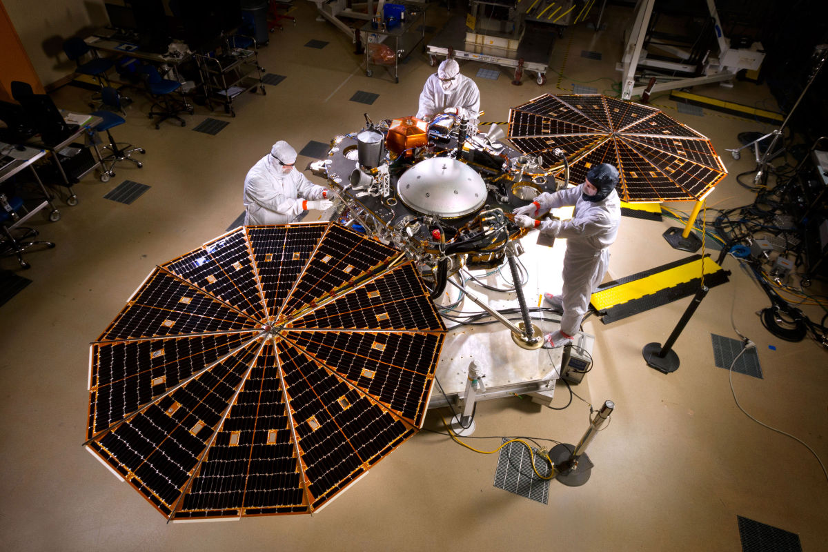
NASA’s InSight Mars lander spacecraft in a Lockheed Martin clean room near Denver. As part of a series of deployment tests, the spacecraft was commanded to deploy its solar arrays in the clean room to test and verify the exact process that it will use on the surface of Mars.
Credit: Lockheed Martin Space Systems
Meanwhile, Lockheed Martin Space Systems is prepared to ship InSight to the Vandenberg AFB launch site. Installation of the seismometer is planned for early January.
The InSight Project is managed by NASA’s Jet Propulsion Laboratory, Pasadena, California. The InSight mission is led by Bruce Banerdt of JPL.
Focus on mission success
In a statement provided to Inside Outer Space from InSight’s builder, Lockheed Martin:
“Lockheed Martin designed and built the InSight Mars lander for NASA on schedule and has recently completed the rigorous environmental testing phase. The spacecraft is now being readied for shipment to the launch site to begin the launch campaign. We understand the importance of this Mars mission and are doing everything possible to accommodate a late delivery of the French Space Agency’s SEIS instrument while still maintaining a focus on mission success.”

Sketch of the ExoMars 2018 surface platform.
Credit: Roscosmos/Lavochkin/IKI
The European Space Agency is pressing forward on its 2018 mission to Mars, selecting payloads for the ExoMars surface platform.
That surface platform — which is the responsibility of Roscosmos and the Space Research Institute of Russian Academy of Sciences (IKI) — will remain stationary on the surface of Mars.
Once on Mars in 2019, the ExoMars rover will descend from the platform via a ramp. Then both the rover and platform will begin their scientific operations.
Science priorities
The main science priorities for the surface platform are context imaging of the landing site, long-term climate monitoring, and atmospheric investigations.

ESA’s ExoMars Rover
Credit: ESA
Expected to operate for at least one Earth year, the platform will enable imaging of the landing site, monitor the climate of Mars, investigate the atmosphere and analyze the radiation environment. It will also study the distribution of any subsurface water at the landing site, and perform geophysical investigations of the internal structure of Mars.
Landing site prospects
A Landing Site Selection Working Group has recommended the Oxia Planum region for further detailed evaluation for consideration as the primary landing site for the 2018 mission.
A further recommendation was made to also consider Oxia Planum as one of the two candidate landing sites for the backup launch opportunity in 2020, with a second to be selected from Aram Dorsum and Mawrth Vallis.
All three sites bear evidence of having been influenced by water in the past, and are likely representative of global processes operating in the Red Planet’s early history.
First up! ExoMars 2016
The first of the two ExoMars mission is in final preparation for launch next March atop a Russian Proton booster.

Artist’s impression depicting the separation of the ExoMars 2016 entry, descent and landing demonstrator module, named Schiaparelli, from the Trace Gas Orbiter, and heading for Mars.
Credit: ESA/ATG medialab
ExoMars 2016 consists of the Trace Gas Orbiter that will investigate the possible biological or geological origins of important trace gases in the Martian atmosphere.
Also onboard is Schiaparelli that will be deployed as an entry, descent and landing demonstrator module.

Image from Curiosity’s Front Hazcam Left B November 30, 2015, Sol 1179
Credit: NASA/JPL-Caltech
NASA’s Curiosity Mars rover has entered Sol 1180, reconnoitering sand dunes and studying ripples.
Mars Hand Lens Imager (MAHLI) has evaluated the rover’s wheels for damage. An initial assessment showed no broken grousers, explains Ken Herkenhoff of the USGS Astrogeology Science Center in Flagstaff, Arizona.

Taking a look at wheel damage using the Mars Hand Lens Imager (MAHLI), located on the turret at the end of the rover’s robotic arm, on November 30, 2015, Sol 1179
Credit: NASA/JPL-Caltech/MSSS
“The rover is now poised to begin testing mobility in the dark sand in front of the vehicle, but first a table used onboard to determine when heating is needed must be updated,” Herkenhoff adds. “No heating is allowed this sol after the update, which limits the activities that can be planned.”
Recently, making use of Curiosity’s Navcam, a search for clouds was made. Also, there were Chemistry & Camera (ChemCam)/Mastcam observations of a sandy ripple named “Khumib” and an outcrop dubbed “Abenab,” Herkenhoff notes.

Laser zapping of Mars sand dune via ChemCam. Taken by Curiosity Mastcam Right on November 28, 2015, Sol 1177.
Credit: NASA/JPL-Caltech/MSSS
ChemCam looks at rocks and soils from a distance, firing a laser that allows analysis of the elemental composition of vaporized materials from tiny areas on the surface of Martian rocks and soils. An on-board spectrograph provides detail about minerals and microstructures in rocks by measuring the composition of the resulting plasma — an extremely hot gas made of free-floating ions and electrons.

CuriosityNavcam Left B image taken on November 30, 2015, Sol 1179
Credit: NASA/JPL-Caltech

Former Soviet Union’s historic Luna 9 lander that in 1966 relayed the first images from the Moon’s bleak surface.
Credit: S.P. Korolev RSC “Energia”
Earth’s crater-dotted moon is a graveyard of space probes, hurled there by a number of nations. The search is on for pinpointing the whereabouts of the former Soviet Union’s Luna 9 probe. It was the first survivable landing of a human-made object on another celestial body.
The USSR’s Luna 9 made it to the moon on February 3, 1966. The lander was spherical in shape, less than 2-feet (0.6 meters) in diameter, and weighed around 220 pounds (100 kilograms).
Once coming to full-stop, the vehicle cranked out the first images taken from the moon’s bleak landscape. When pieced together, those pictures offered a panoramic view of the moon’s terrain and the horizon less than a mile away.
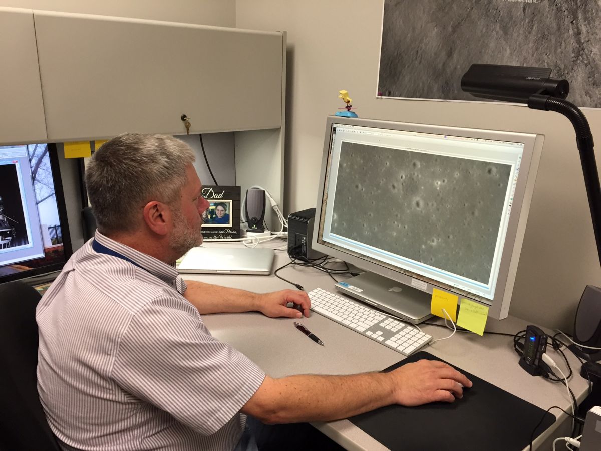
On the lunar lookout. Jeff Plescia of The Johns Hopkins University’s Applied Physics Laboratory is sifting through Lunar Reconnaissance Orbiter imagery to pinpoint the former Soviet Union’s Luna 9 spacecraft.
Credit: Jeff Plescia/APL
Decades later, and thanks to the sharp-eyed NASA Lunar Reconnaissance Orbiter (LRO) now circling the moon, researchers are trying to locate the true, final resting location of the historic Luna 9.
For more details, go to my new Space.com story at:
Long-Lost Lander: Researchers Hunting for Soviet Moon Probe Luna 9
By Leonard David, Space.com’s Space Insider Columnist |
November 30, 2015 07:00am ET
http://www.space.com/31213-luna-9-soviet-moon-probe-search.html

NOAA 16 satellite.
Credit: NOAA
The Joint Space Operations Center (JSpOC) at Vandenberg Air Force Base in California has served notice of a breakup of the National Oceanic and Atmospheric Administration’s NOAA-16 spacecraft.
Orbital debris related to the breakup is being cataloged. Potential close approaches to other satellites are being assessed.
Although pinpointing the cause of the breakup is under investigation, there is no indication that a collision caused the NOAA-16 breakup. SpaceTrackOrg has noted that, at this time, there is no danger to any other satellite as result of NOAA 16 breakup.

JSpOC detects, tracks, and identifies all artificial objects in Earth orbit.
2014 decommissioning
NOAA-16 Polar-Orbiting Environmental Satellite (POES) was also tagged as NOAA-L and was built by Lockheed Martin Space Systems Co., Sunnyvale, Calif.
Pre-launch image of NOAA-16.
Credit: NASA/KSC
NOAA-16 was launched on September 21, 2000 under technical guidance and project management by NASA’s Goddard Space Flight Center. The spacecraft was placed into a 470- nautical mile afternoon orbit.
The spacecraft was decommissioned after it suffered a serious anomaly on June 6, 2014.
NOAA announced on June 9, 2014 that the spacecraft was turned off.
DMSP break-up
In early February, a Defense Meteorological Satellite Program Flight 13 was involved in a debris-causing event. It too was built by Lockheed Martin.

DMSP satellite also suffered a debris-creating event earlier this year.
Credit: US Air Force
A subsequent review of the incident determined there were no actions that could have been taken to prevent the incident. The mission was operated by NOAA on behalf of the U.S. Air Force.
The review into the unexpected loss of this satellite determined a failure of the battery charger as the likely cause.
Analysis indicated that one of the wiring harnesses lost functionality due to compression over a long period of time in the battery charge assembly.
Once the harness was compromised, the exposed wires potentially caused a short in the battery power, leading to an overcharge situation with eventual rupture of the batteries.

LROC system on the NASA Lunar Reconnaissance Orbiter captures crash spot of
Apollo 16’s SIVB rocket stage – dead center in image.
Credit: NASA/GSFC/Arizona State University
The crash site of Apollo 16’s S-IVB stage has been pinpointed after a dedicated search for its impact location on the Moon.
As the third stage on the Saturn V booster, the S-IVB stages were purposely smashed into the Moon to perform seismic measurements used for characterizing the lunar interior.
However, on the Apollo 16 flight, a malfunction resulted in premature loss of tracking data for that mission’s SIVB. There was uncertainty in the stage’s impact location.
Position poorly defined
“I did finally find the Apollo 16 SIVB crater,” reports Jeff Plescia of The Johns Hopkins University’s Applied Physics Laboratory in Laurel, Maryland.

Leader in lunar lost and found hardware: Jeff Plescia of The Johns Hopkins University’s Applied Physics Laboratory in Laurel, Maryland.
“It looks like the others, but its position was much more poorly defined since the tracking was lost prior to impact,” Plescia told Inside Outer Space.
The Apollo 16’s SIVB struck the Moon on April 19, 1972.
Plescia made use of super-powerful images produced by the LROC system on the NASA Lunar Reconnaissance Orbiter to identify the crash site.
Fifth human mission
Lifting off from Earth on April 16, 1972, Apollo 16 was the fifth mission to land humans on the Moon and return them to Earth.

April 16, 1972 liftoff of Apollo 16.
Credit: NASA
The crew members for this expedition were John Young, Commander, Thomas Mattingly II, Command Module Pilot, and Charles Duke, Jr., Lunar Module Pilot,
Onboard their lunar lander – Orion — Young and Duke touched down in the Descartes Highlands of the Moon.

Curiosity Navcam Left B camera image taken on November 25, 2015, Sol 1174.
Credit: NASA/JPL-Caltech
NASA’s Curiosity rover on Mars drove some 92 feet (28 meters) on Sol 1174 and is now parked in front of a beautiful sand sheet and sand dune!
That’s the word from Lauren Edgar, a research geologist at the USGS Astrogeology Science Center in Flagstaff, Arizona and a member of the Mars Science Laboratory (MSL) research team.
Three sol plan
“Today science and engineering teams cooked up a full 3-Sol plan, to account for the second half of the Thanksgiving holiday weekend,” Edgar reports.
The Mars rover team, Edgar adds, started with equal parts Mastcam and ChemCam to analyze the sand and bedrock, and to monitor the movement of sand across the rover deck and in nearby ripples.
This image was taken by Curiosity’s Mastcam Right on November 24, 2015, Sol 1173.
Credit: NASA/JPL-Caltech/MSSS
“The meat of the plan consists of SAM [Sample Analysis at Mars Instrument Suite] preconditioning, drop off of the “Greenhorn” drill sample to SAM, and an EGA (evolved gas analysis). Essentially that means that we’ll heat the sample up in an oven and measure the major gases that are released,” Edgar adds.
Wheel inspection
On the third Sol planning, use of the Mars Hand Lens Imager (MAHLI) is on tap that is dedicated to imaging and monitoring Curiosity’s wheel wear and tear.
Additionally, Edgar notes, there’s a Mastcam change detection experiment to monitor the ripples on the third Sol.
“Add in a dash of excitement about the opportunity to study active dunes on another planet, and it’s sure to be a great weekend on Mars,” Edgar concludes.
As is always the case, dates of planned rover activities are subject to change due to a variety of factors related to the Martian environment, communication relays and rover status.
Europe’s ExoMars 2016 spacecraft – ready for shipment to
Baikonur, Kazakhstan.
Credit: Thales Alenia Space France
The voyage of Europe’s ExoMars 2016 spacecraft is moving closer to the Red Planet – departing the clean rooms of Thales Alenia Space in Cannes for shipment to Baikonur, Kazakhstan.
This ExoMars spacecraft is headed for a March 2016 liftoff atop a Proton booster.
ExoMars is a joint endeavor between the European Space Agency (ESA) and the Russian Space Agency (Roscosmos), with the Italian Space Agency (ASI) as a major contributor.
Two separate missions
As the first mission in ESA’s Aurora exploration program, the ExoMars effort is made up of two separate missions.
The first mission in 2016 will study Mars’ atmosphere and demonstrate the feasibility of several critical technologies for atmospheric entry, descent and landing.
The second mission in this program — in 2018 — will include an autonomous European rover, capable of taking soil samples down to a depth of two meters, and analyzing their chemical, physical and biological properties.
Modules for Mars
For the 2016 mission, the Entry, Descent and landing Demonstration module (EDM) has been developed by Thales Alenia Space Italy.
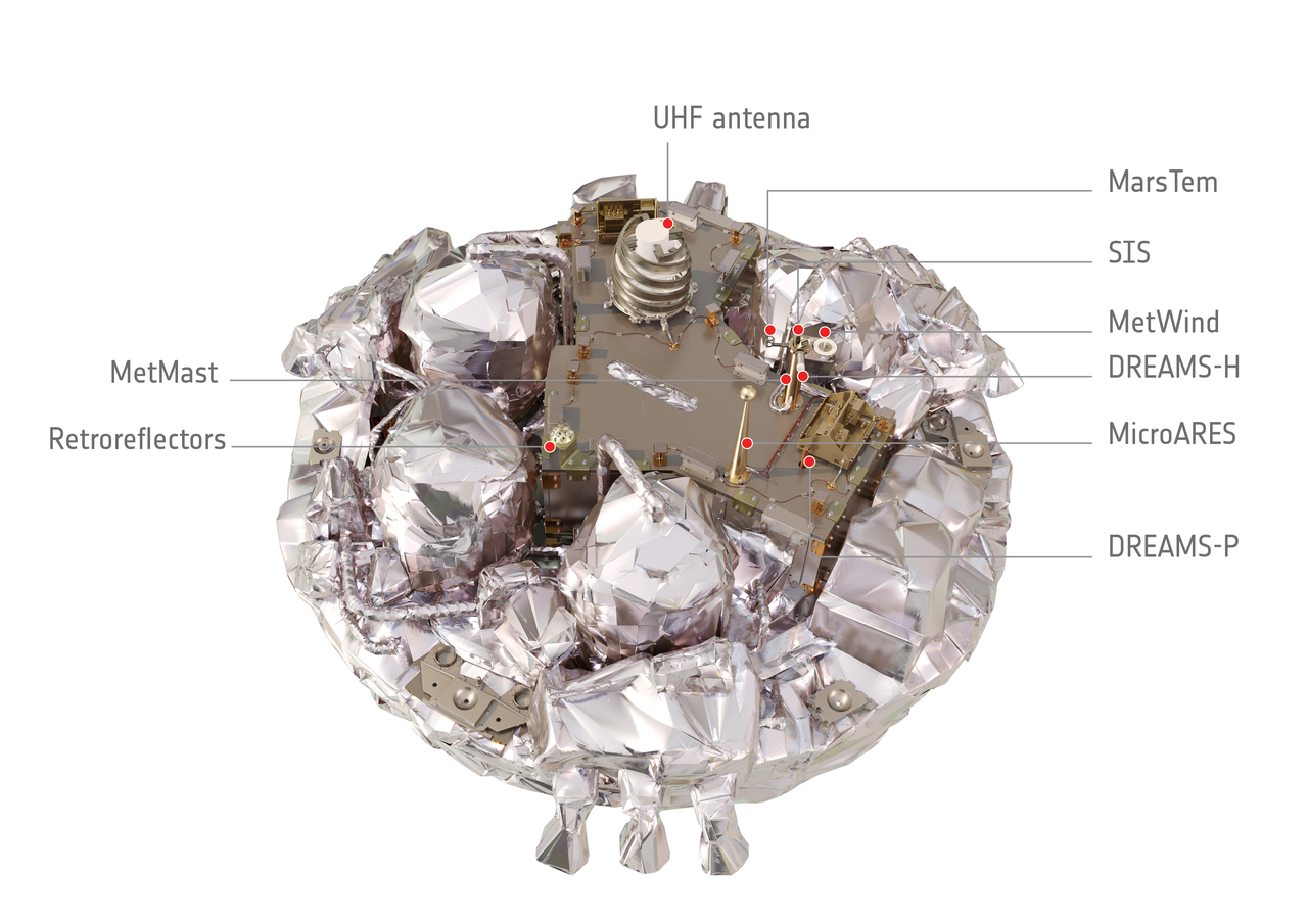
Interior of the Schiaparelli entry, descent and landing demonstrator module.
Schiaparelli carries a small science payload, called DREAMS (Dust Characterisation, Risk Assessment, and Environment Analyser on the Martian Surface), to study the environment.
DREAMS consists of a suite of sensors to measure the local wind speed and direction (MetWind), humidity (DREAMS-H), pressure (DREAMS-P), atmospheric temperature close to the surface (MarsTem), the transparency of the atmosphere (Solar Irradiance Sensor, SIS), and atmospheric electric fields (Atmospheric Radiation and Electricity Sensor; MicroARES) at Mars. The payload will operate on the surface of Mars for 2–8 sols.
In addition, there is an investigation known as AMELIA, for entry and descent science data collection using the spacecraft engineering sensors. A separate instrumentation package, COMARS+, will monitor the heat flux on the back cover of Schiaparelli as it passes through the atmosphere.
A compact array of laser retroreflectors is attached to the zenith-facing surface of Schiaparelli. This can be used as a target for Mars orbiters to laser-locate the module.
A UHF antenna is used for communicating with the Trace Gas Orbiter.
Credit: ESA/ATG medialab
Thales Alenia Space France is responsible for the design and integration of the 2016 orbital module, or TGO (Trace Gas Orbiter).
The ExoMars spacecraft will reach the Red Planet in October 2016 and consists of the TGO and EDM modules.
2016 mission aims
The aims of the ExoMars 2016 mission are to:
- Validate landing on the planet Mars with a demonstration capsule weighing about 600 kg, using a control system based on a radar altimeter, and with a carbon fiber shock absorber to attenuate the hard contact with the surface.
- Gather as much information as possible during entry into the Martian atmosphere.
- Carry out scientific sampling on the surface for a short period.
- Observe the Martian atmosphere and surface for two years from the orbiter at an altitude of 400 kilometers.
- Provide the telecommunication support needed by the rover for the 2018 mission.
The EDM for ExoMars 2016 is named “Schiaparelli” in honor of the Italian astronomer Giovanni Virginio Schiaparelli – considered one of the leading figures in 19th century Italian astronomy, and also a leading scholar of ancient astronomy science and history.
Patrice Caine, Thales Chairman & CEO noted: “This program, which also involves 134 other space companies from ESA countries, is a key first step for an unprecedented European scientific mission on Mars.”

