Archive for September, 2018
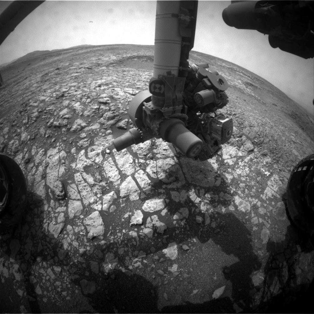
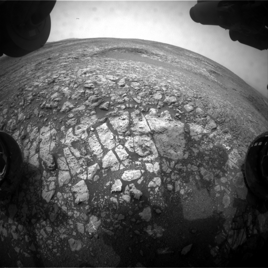
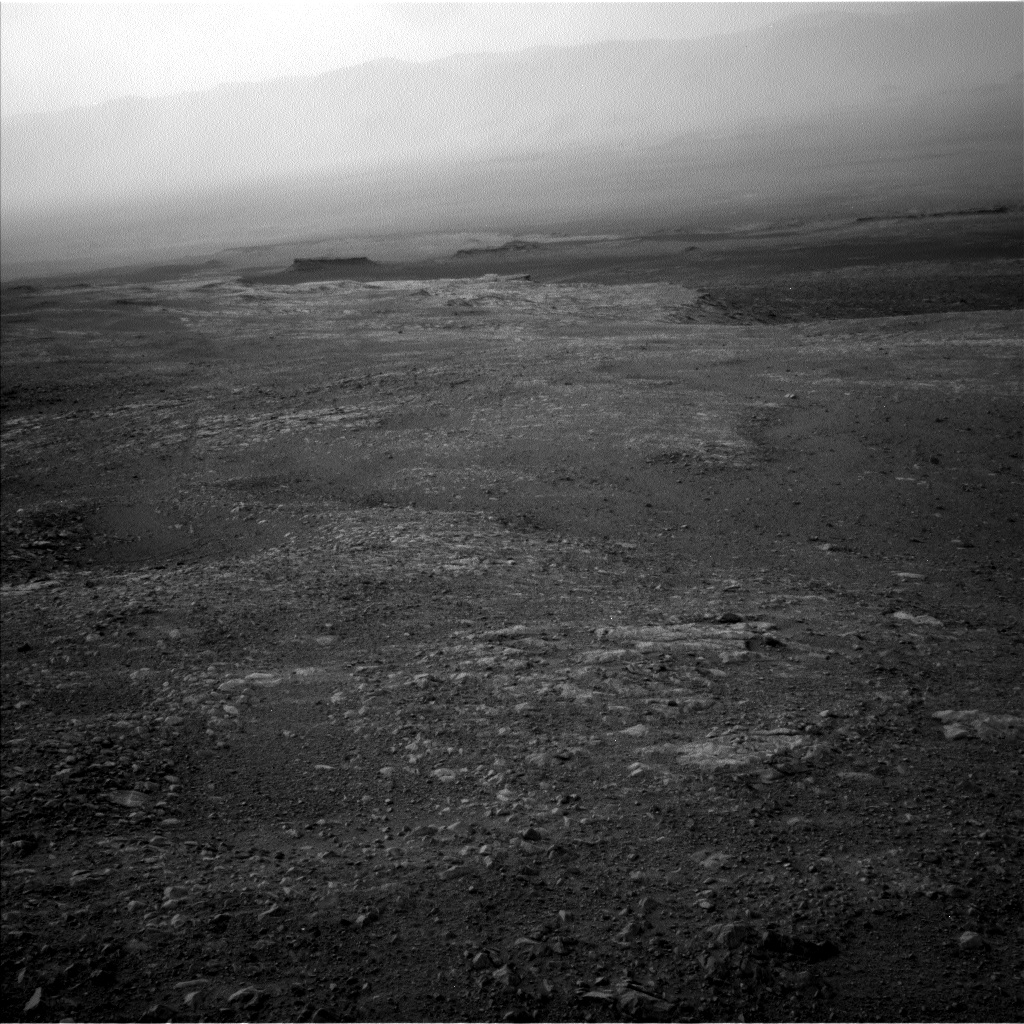
Curiosity Front Hazcam Right B image acquired on Sol 2166, September 9, 2018.
Credit: NASA/JPL-Caltech
NASA’s Curiosity rover is now performing Sol 2167 duties.
The plan called for the rover to make a “bump” – that is, a drive of roughly 50 feet (15 meters) reports Lucy Thompson, a planetary geologist at the University of New Brunswick; Fredericton, New Brunswick, Canada.
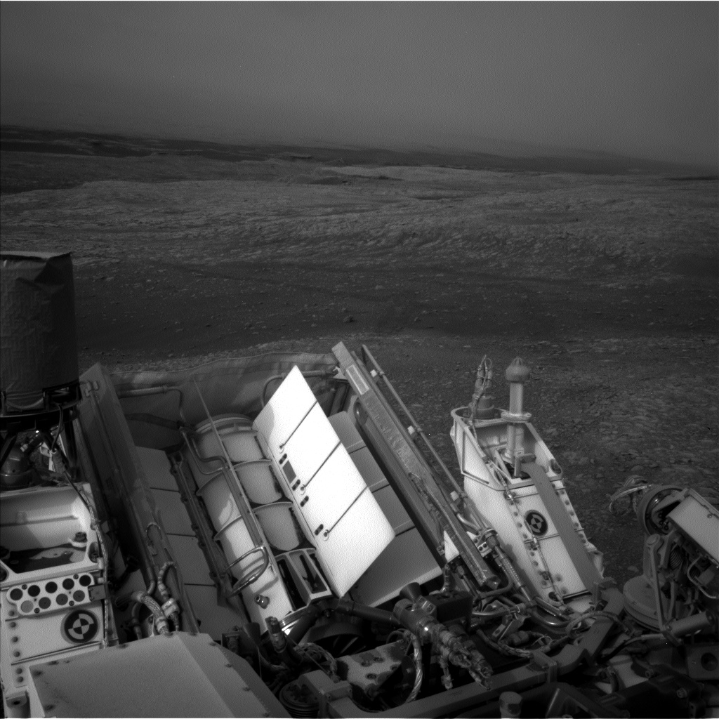
Curiosity Rear Hazcam Right B photo taken on Sol 2166, September 9, 2018.
Credit: NASA/JPL-Caltech
That drive was to place the robot, Thompson explains, “for an attempt at drilling an interesting grey colored patch of bedrock,” identified from orbit within the Jura member of the Murray formation on the Vera Rubin Ridge, referred to as “Loch Eriboll.”
“We want to figure out how these patches of bedrock differ from the surrounding tan colored rocks, more typical of what we see from orbit,” Thompson adds.
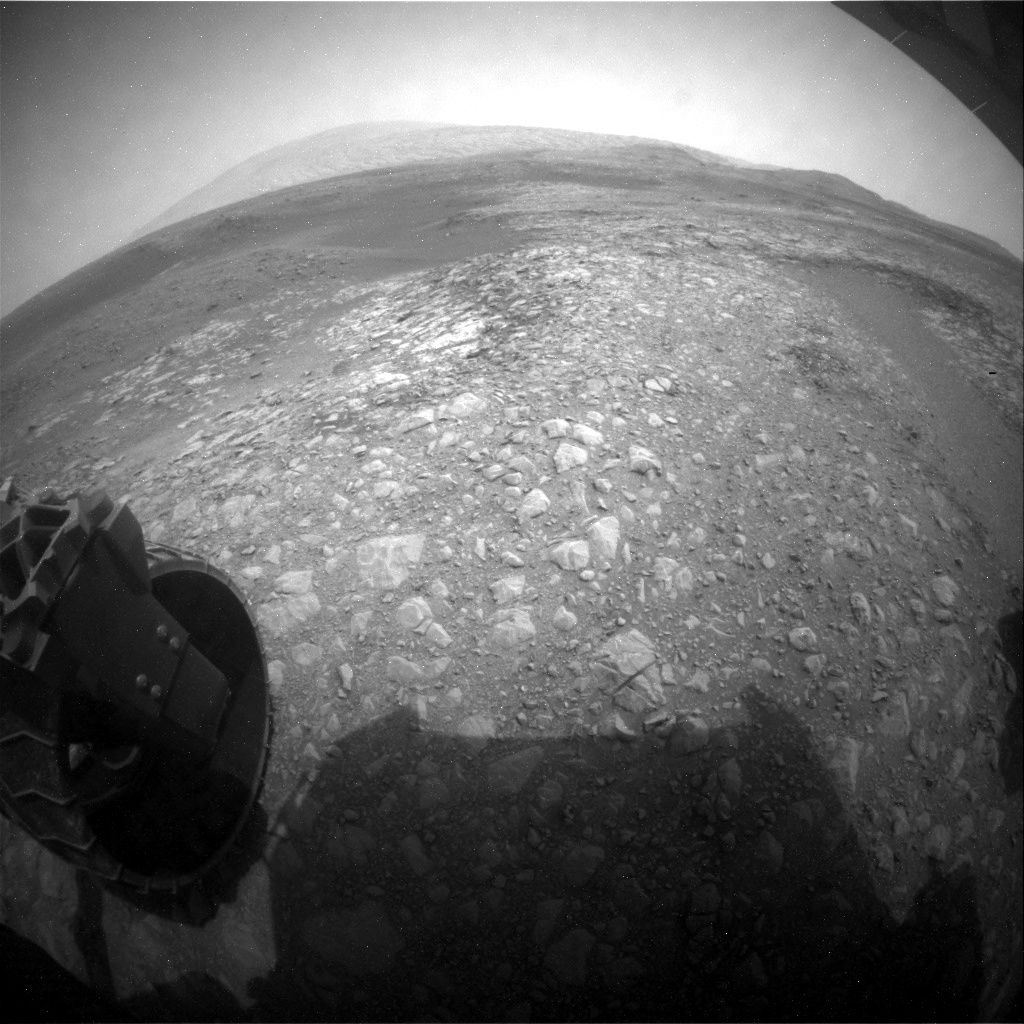
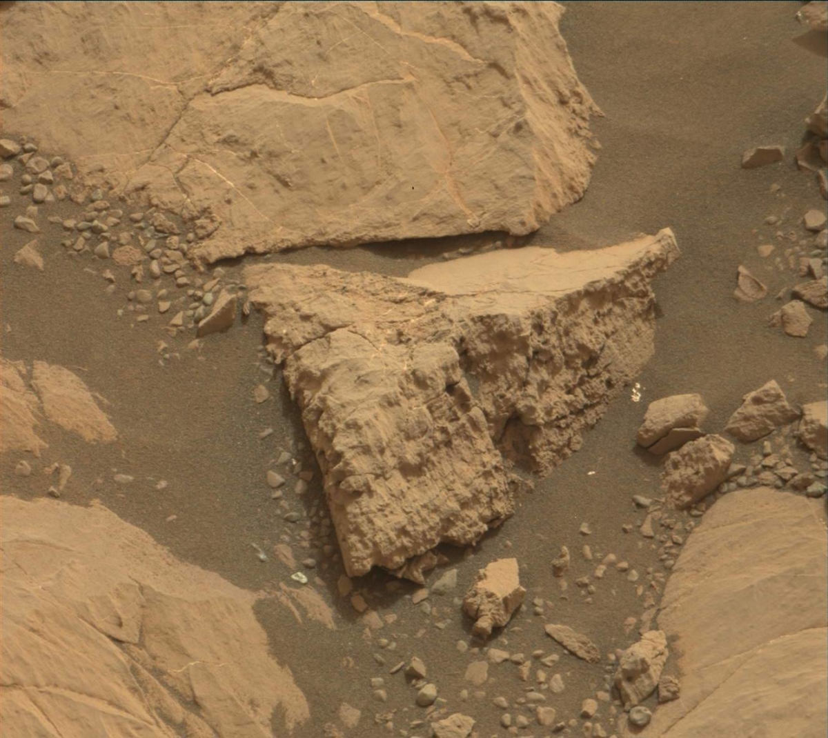
Curiosity Navcam Left B image taken on Sol 2166, September 9, 2018.
Credit: NASA/JPL-Caltech
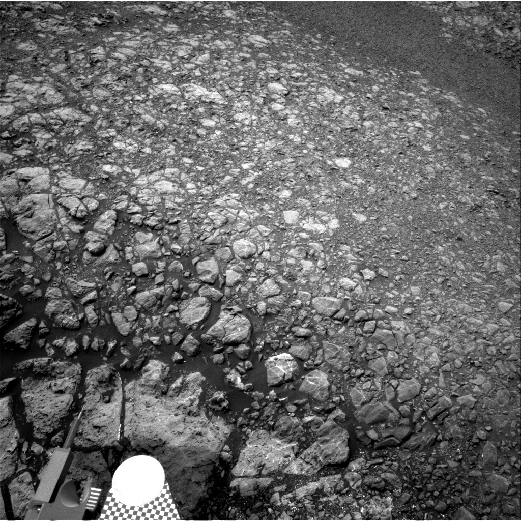
Broken up, smaller pieces of rock
Curiosity had the potential to do a “touch and go” in the plan, whereby it would unstow its robotic arm and use the Alpha Particle X-Ray Spectrometer (APXS) and Mars Hand Lens Imager (MAHLI) instruments to examine the chemistry and texture of a target close-up, before driving away.
Curiosity Navcam Left B image taken on Sol 2166, September 9, 2018.
Credit: NASA/JPL-Caltech
“However, the workspace consists of a lot of broken up, smaller pieces of rock and we already have a lot of compositional and textural information of similar rocks,” Thompson adds. The ability to use the arm is instead being utilized to acquire MAHLI close-up imaging of the Rover Environmental Monitoring Station (REMS) ultra-violet sensor.
Curiosity Navcam Right B photo acquired on Sol 2166, September 9, 2018.
Credit: NASA/JPL-Caltech
This is requested periodically to check for dust and the general health of the sensor.
Targets for investigation
“We decided to concentrate our efforts on the bump and some remote science observations using instruments situated on the rover’s mast. We selected 4 bedrock targets for investigation with ChemCam (“The Law,” “Eathie,” “The Minch” and “Windy Hills”), to monitor compositional variation, accompanied by Mastcam documentation of those targets,” Thompson explains.
Mastcam mosaics are being acquired of the “Laithach” area where scientists observe a potential contact between the grey and tan rocks, and the “Loch Eriboll” area, which will include multiple filters to look at the spectral properties of the different rocks.
New workspace
“We then bump to our potential drill location,” Thompson notes, followed by imaging of the new workspace and a 20 minute Dynamic Albedo of Neutrons (DAN) Active measurement.

Curiosity Mastcam Right image acquired on Sol 2165, September 8, 2018.
Credit: NASA/JPL-Caltech/MSSS
Post-drive, there are two untargeted Chemistry and Camera (ChemCam) Autonomous Exploration for Gathering Increased Science (AEGIS) software activities to look at bedrock composition, standard REMS and DAN passive, Navcam imaging. Also on the plan is use of the Chemistry & Mineralogy X-Ray Diffraction/X-Ray Fluorescence Instrument (CheMin) vibe and dump sample (after X-ray diffraction on the previously drilled “Stoer” material), Mars Descent Imager (MARDI) (used to document the ground immediately beneath the rover wheels) and SAM Electrical Baseline Test (to periodically monitor SAM’s electrical functions).
Thompson concludes that it’s a busy 2-sol plan to hopefully set up Curiosity’s drilling duties.
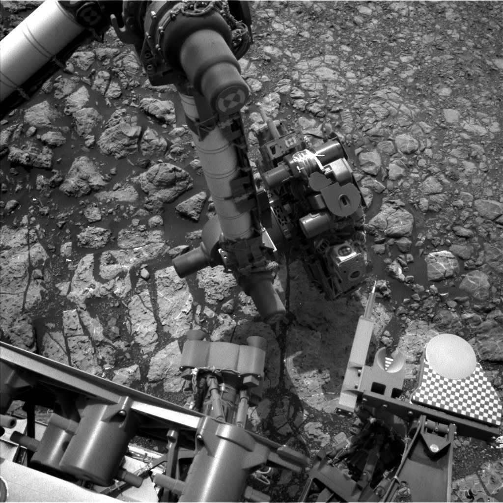
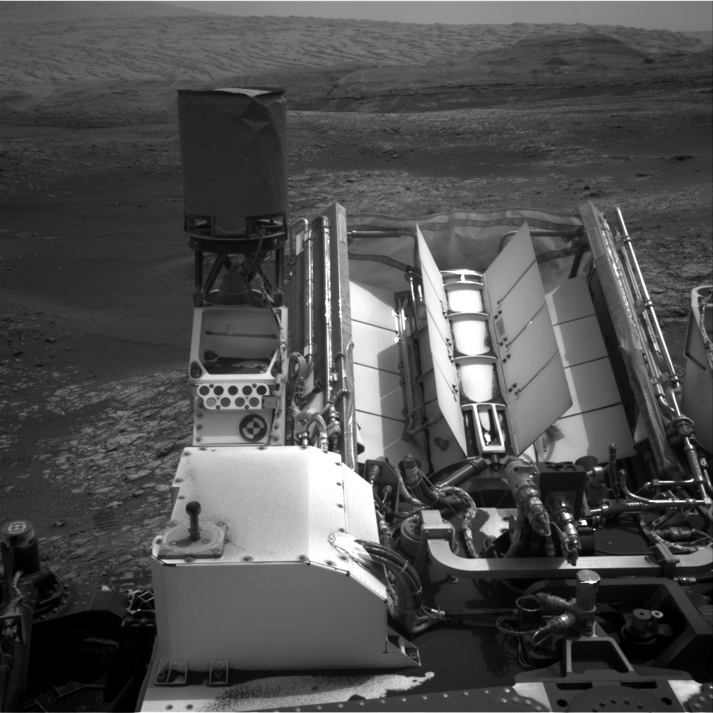
Curiosity Mars Hand Lens Imager (MAHLI) Sol 2166 September 9, 2018. MAHLI is located on the turret at the end of the rover’s robotic arm.
Credit: NASA/JPL-Caltech/MSSSling duties.
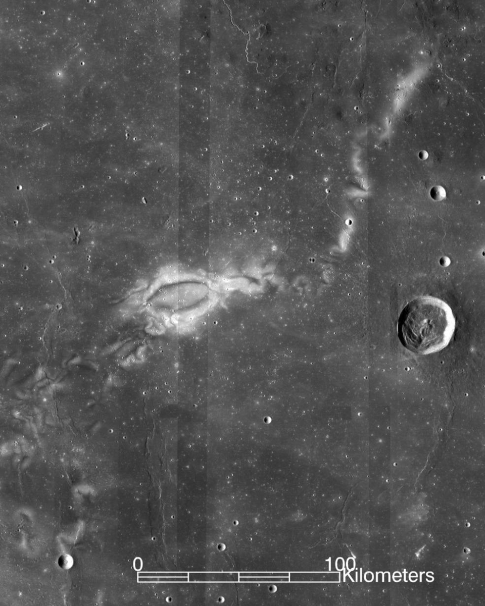
Image of the Reiner Gamma lunar swirl from NASA’s Lunar Reconnaissance Orbiter.
Credits: NASA LRO WAC science team
They have been characterized as tattoos on the Moon.
Better known as lunar swirls, they resemble bright, snaky clouds painted on the Moon’s dark surface. The most famous, called Reiner Gamma, is about 40 miles long.
Most lunar swirls share their locations with powerful, localized magnetic fields. The bright-and-dark patterns may result when those magnetic fields deflect particles from the solar wind and cause some parts of the lunar surface to weather more slowly.
But the cause of those magnetic fields, and swirls themselves, is a puzzler.
Near‐surface magnetic fields
New research on what kind of geological feature could produce these magnetic fields has been done by Douglas Hemingway of the Department of Earth and Planetary Science, University of California, Berkeley. Co-author of the work is Sonia Tikoo of the Department of Earth and Planetary Sciences, State University of New Jersey, Rutgers. The work is published in the Journal of Geophysical Research – Planets, a journal of the American Geophysical Union.
“The length scales of swirls are effectively telling us about the structure of near‐surface magnetic fields on scales that are finer than what can be measured from lunar orbit,” the research team reports.

Sonia Tikoo, an assistant professor in Rutgers-New Brunswick’s Department of Earth and Planetary Sciences, looks at lunar rock samples in a Petri dish.
Credit: Nick Romanenko/Rutgers University
New constraints on the underlying magnetized rocks show that they must be shallow, narrow, and strongly magnetized.
Lava tubes
“This result helps us to better understand the origin of these magnetized rocks and the history of lunar magnetism more generally,” the scientists explain. “In particular, we suggest that these rocks were likely injected into the crust in the form of dikes or subsurface channels of flowing lava and that they cooled slowly, leading to enhancement of their metal content and enabling the rocks to capture a stable record of the Moon’s ancient global magnetic field.”
How could lava tubes and dikes be so strongly magnetic? The answer lies in a reaction that may be unique to the Moon’s environment at the time of those ancient eruptions, over 3 billion years ago, according to a Rutger’s statement.
High iron content
The creation of high iron content lava tubes or dikes would have become strongly magnetic as they cooled.
“No one had thought about this reaction in terms of explaining these unusually strong magnetic features on the Moon,” Tikoo explains. “This was the final piece in the puzzle of understanding the magnetism that underlies these lunar swirls.”
The research article – “Lunar Swirl Morphology Constrains the Geometry, Magnetization, and Origins of Lunar Magnetic Anomalies” – can be found here:
https://agupubs.onlinelibrary.wiley.com/doi/pdf/10.1029/2018JE005604
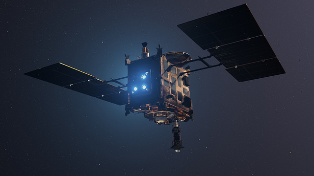
Japan Aerospace Exploration Agency’s (JAXA) Hayabusa2 ,spacecraft.
Credit: DLR (CC-BY 3.0)
The Japan Aerospace Exploration Agency’s (JAXA) Hayabusa2 asteroid mission is busy at work, in position at asteroid Ryugu.
Imagery shows the temperature differences on asteroid Ryugu’s surface during one rotation, with red indicating regions with a high temperature.
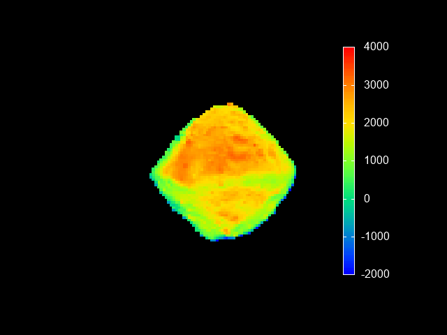
Credit: JAXA, Ashikaga University, Rikkyo University, Chiba Institute of Technology, University of Aizu, Hokkaido University of Education, Hokkaido Kitami Hokuto High School, AIST, National Institute for Environmental Studies, University of Tokyo, German Aerospace Center (DLR), Max Planck Society for the Advancement of Science, Stirling University.
Distinct regions at different temperatures are captured by the Thermal InfraRed Imager (TIR). Features in a thermal image can be seen even if they are in a shaded location in the visible photograph. This lets us confirm that the overall shape of the asteroid is well understood, and also the characteristic topography such as craters and large boulders that show up as a difference in temperature.
Credit: JAXA
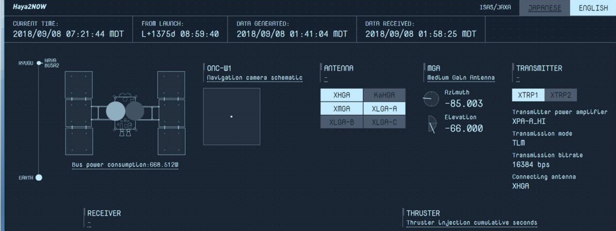
Haya2 now!
Curious about what Japan’s Hayabusa2 asteroid mission is doing right now?
Go to the Haya2 Now website in English!
Just rollover each panel to find out more.
Go to this link:

Credit: NASA/JPL-Caltech/Univ. of Arizona
NASA’s Curiosity rover is now in Sol 2165.
A new road map has been issued showing the robot’s wheeling about Mars since landing in August 2012.
The map shows the route driven by NASA’s Mars rover Curiosity through the 2163 Martian day, or sol, of the rover’s mission on Mars (September 07, 2018).
Numbering of the dots along the line indicate the sol number of each drive. North is up.
Curiosity Front Hazcam Right B photo acquired on Sol 2164, September 7, 2018.
Credit: NASA/JPL-Caltech
Curiosity Navcam Right B image taken on Sol 2164, September 7, 2018.
Credit: NASA/JPL-Caltech

Curiosity Mastcam Right image acquired on Sol 2163, September 6, 2018.
Credit: NASA/JPL-Caltech/MSSS

Curiosity Mastcam Left photo taken on Sol 2163, September 6, 2018.
Credit: NASA/JPL-Caltech/MSSS
From Sol 2161 to Sol 2163, Curiosity had driven a straight line distance of about 50.69 feet (15.45 meters).
Curiosity Mastcam Left photo taken on Sol 2163, September 6, 2018.
Credit: NASA/JPL-Caltech/MSSS
Since touching down in Bradbury Landing in August 2012, Curiosity has driven 12.26 miles (19.74 kilometers).
The base image from the map is from the High Resolution Imaging Science Experiment Camera (HiRISE) in NASA’s Mars Reconnaissance Orbiter.
Red planet scenes
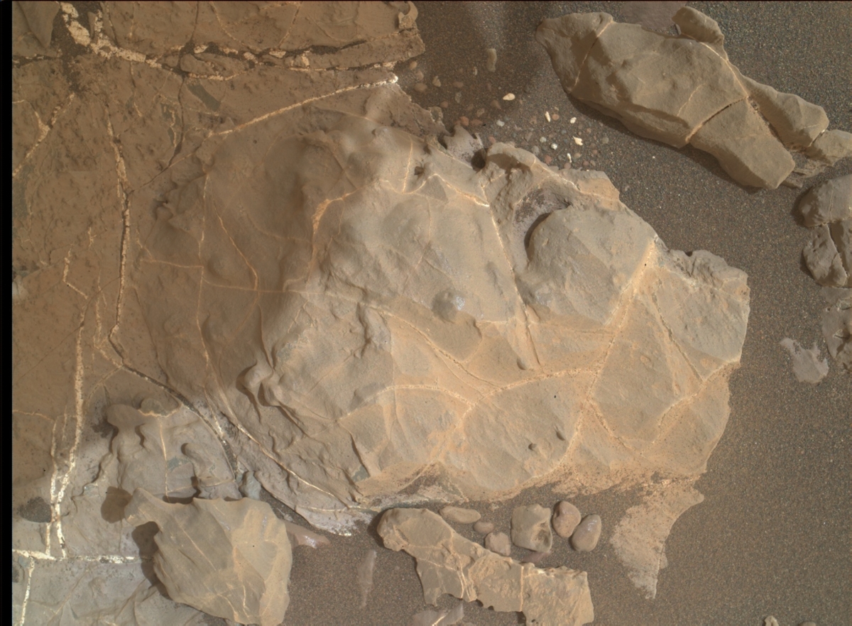
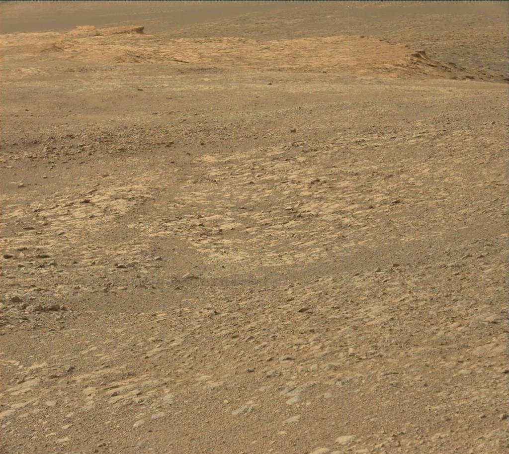
Meanwhile, new color imagery from the rover show its continuing exploration of Vera Rubin Ridge:

Credit: NAS
To answer significant questions about planetary systems, such as whether our solar system is a rare phenomenon or if life exists on planets other than Earth, NASA should lead a large direct imaging mission – an advanced space telescope – capable of studying Earth-like exoplanets orbiting stars similar to the sun, says a new congressionally mandated report by the National Academies of Sciences, Engineering, and Medicine.

Starshade concept.
Credit: NASA/JPL/Caltech
Starshade
The new report — Exoplanet Science Strategy – has made a number of findings and recommendations.
One of those recommendations is using instruments that enable direct imaging of an exoplanet by blocking the light emitted by the parent stars – such as a coronagraph or starshade.
The shade would be positioned between a telescope and a target star system. The shade is used to block the light coming from the star in order to enable the detection of light from an exoplanet.
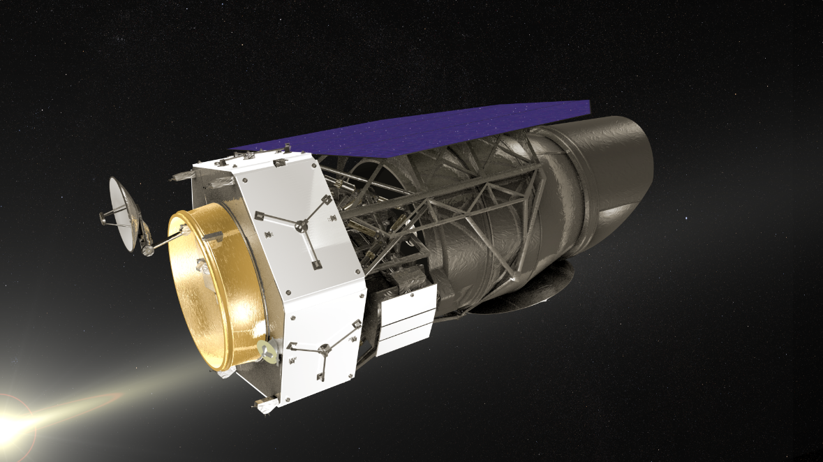
Wide-Field Infrared Survey Telescope (WFIRST).
Credit: NASA/GSFC
WFIRST support
Another recommendation is that NASA should launch the Wide-Field Infrared Survey Telescope (WFIRST) mission and to demonstrate the technique of coronagraphic spectroscopy on exoplanet targets.
The study was sponsored by NASA.
To download a free PDF of the report, go to:
https://www.nap.edu/catalog/25187/exoplanet-science-strategy
A highlights document can be read here:
https://www.nap.edu/resource/25187/RH-exoplanets.pdf
Also, take a view of this video that details the report:

A longing look at one space elevator design.
Credit: Obayashi Corporation of Tokyo, Japan.
A novel trial-run to help design a space elevator is headed for the International Space Station, an investigation that’s onboard Japan’s H-IIB Vehicle No. 7. That cargo resupply ship is scheduled for launch from the Tanegashima Space Center in Kagoshima Prefecture on September 11th.
The test equipment has been produced by researchers at Shizuoka University in Japan. Japanese construction firm, Obayashi, is collaborating on the initiative.
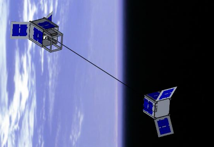
Japanese STARS-Me (Space Tethered Autonomous Robotic Satellite-Mini Elevator)
Credit: Shizuoka University
Stretched tight
Once free in space, the test involves a small box that will move along a cable some 30 feet (10 meters) long, suspended between two cubesats to keep the cable stretched tight.
Cameras on the mini-satellites are to monitor the movement of the motorized box.

Climber makes it way up lengthy space elevator.
Credit: Frank Chase/Chase Design Studios
Elevator cable
Obayashi engineers have been working on space elevator concepts for many years.
The construction firm has plans to put in place a space elevator by 2050 with a capacity to carry 100-ton “climbers.”
In conceptual terms, Obayashi engineers envision the space elevator composed of a 60,000 mile (96,000 kilometer) carbon nanotube cable, attached to a floating Earth Port, along with a 12,500-ton counter-weight.
Critical testing
The upcoming experiment reminds us that testing in space is critical to progress in major projects, said Pete Swan, President of the International Space Elevator Consortium (ISEC).
The ISEC published a study report in 2015 that laid out the architectural process for development of the Space Elevator. In the report, the authors dealt with the tether climber testing – in space:
“….. each segment (of space elevator) must ‘demonstrate’ that the Climber Segment holds the necessary mature technologies and validated engineering approaches for the design and development activity within the planning phase. Over the course of time, leading to the culminating demonstrations, the Space Elevator team will show that the Climber can do what it needs to do while buttressed by the test data gathered along the way.”

Courtesy: Sky Line
‘The upcoming tether satellite and climber demonstration by the researchers at Shizuoka University and other institutions will fulfill a necessary engineering test along the way to space elevator operations, even this early in the mega-project called the Space Elevator,” Swan told Inside Outer Space.
For more information on the International Space Elevator Consortium, go to:
To stretch your mind a bit take a look at this Obayashi video on the space elevator:
https://www.obayashi.co.jp/en/news/detail/the_space_elevator_construction_concept.html
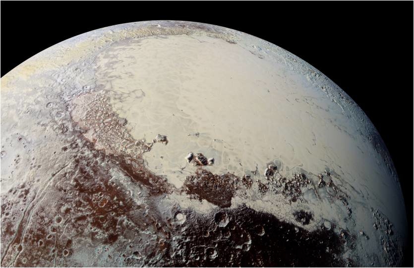
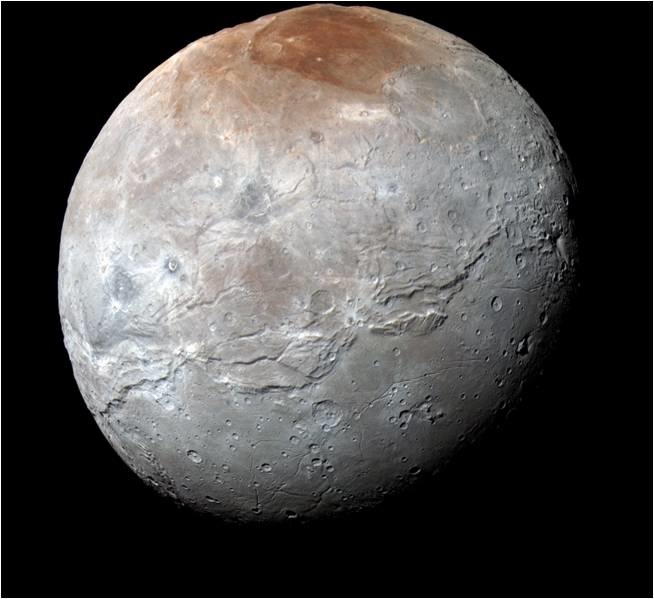
Pluto in enhanced color showing the vast Sputnik Planitia (SP) N2-dominated
glacier and surrounding mountain ranges.
Credit: NASA/Johns Hopkins University Applied Physics Laboratory/Southwest Research Institute
Continued exploration of Pluto is advocated in a community White Paper on the case for Pluto follow on missions, and most particularly a Pluto orbiter.
Now being circulated is “A White Paper on Pluto Follow on Missions: Background, Rationale, and New Mission Recommendations.”

Credit: Johns Hopkins University Applied Physics Laboratory/Southwest Research Institute (JHUAPL/SwRI)
An executive summary explains:
“The exploration of the binary Pluto-Charon and its small satellites during the
New Horizons flyby in 2015 revealed not only widespread geologic and compositional diversity across Pluto, but surprising complexity, a wide range of surface unit ages, evidence for widespread activity stretching across billion of years to the near-present, as well as numerous atmospheric puzzles, and strong atmospheric coupling with its surface.”
Charon as seen by New Horizons, featuring its red polar stain, ancient
terrains, and clear signs of massive tectonics.
Credit: NASA/Johns Hopkins University Applied Physics Laboratory/Southwest Research Institute
Diversity of landforms
NASA’s New Horizons spacecraft also found an unexpected diversity of landforms on its binary companion, Charon. “Pluto’s four small satellites yielded surprises as well, including their unexpected rapid and high obliquity rotation states, high albedos, and diverse densities,” the paper notes.
Those findings made by New Horizons helps build the case for a follow up mission to investigate the Pluto system in more detail.

The spectacular Pluto-Charon binary in montage
from the New Horizons color imager.
Credit: NASA/Johns Hopkins University Applied Physics Laboratory/Southwest Research Institute
Next step
“As the next step in the exploration of this spectacular planet-satellite system, we recommend an orbiter to study it in considerably more detail, with new types of instrumentation, and to observe its changes with time,” the paper recommends, and calls for the in-depth study of Pluto orbiter missions as a precursor to the 2023 Planetary Science Decadal Survey.
The White Paper explains that an orbiter is the best next step.
“However, many aspects of such a mission remain open and require study in order to properly compare a Pluto orbiter to other choices that the next Planetary Decadal Survey must evaluate,” the paper points out. “Accordingly, we recommend that in advance of the 2023 Decadal Survey, NASA fund one or more Pluto orbiter studies.”
Pluto remains a puzzle.
Credit: My Science Shop
Open scientific questions
The White Paper adds that there are numerous, compelling, open scientific issues surrounding Pluto itself and the Pluto system in general, and the relationship of the Pluto system to the Kuiper Belt.
That being the case, there is strong motivation for follow on Pluto system exploration, the White Paper concludes. “Among the various options for that exploration is a second flyby, an orbiter, or a lander.”
To read the entire White Paper, go to:
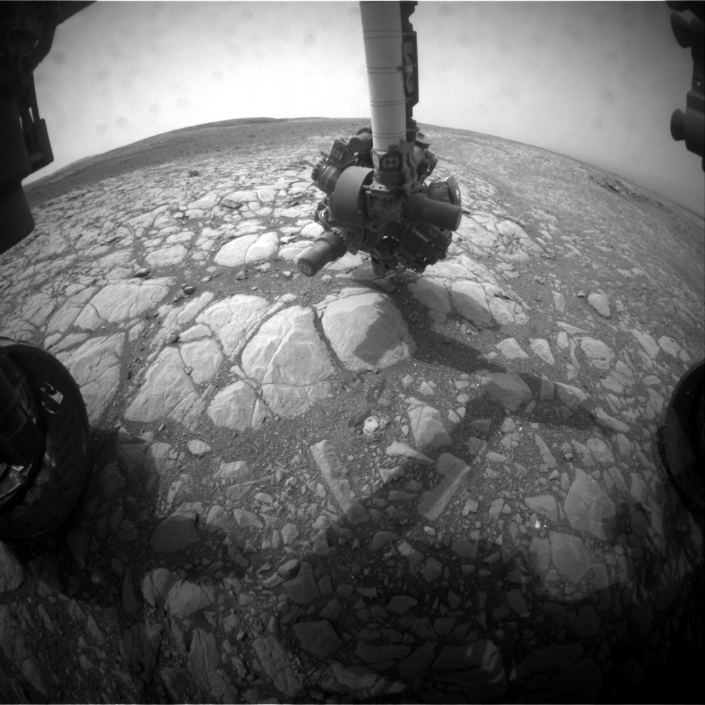
Curiosity Front Hazcam Left B image taken on Sol 2161, September 4, 2018.
Credit: NASA/JPL-Caltech
NASA’s Curiosity Mars rover is now performing Sol 2162 duties.
Mars researchers have recently been handling gobs of data from Curiosity thanks to extra downlink from two orbiters, reports Dawn Sumner, a planetary geologist from the University of California Davis in Davis, California. “We planned 4 sols due to the Labor Day weekend.”
Curiosity Navcam Right B image acquired on Sol 2161, September 4, 2018.
Credit: NASA/JPL-Caltech
“Usually, we use the Mars Reconnaissance Orbiter (MRO) and Mars Odyssey (ODY) to transmit our data, and we get an average of 500 megabits of data per sol,” Sumner reports. “Note that 8 bits = 1 byte, so our average bandwidth is about 60 megabytes of data per sol. In contrast, DSL bandwidths are roughly10 megabytes per second, so we get about 6 seconds worth of internet per sol!”
Curiosity Navcam Left B photo taken on Sol 2161, September 4, 2018.
Credit: NASA/JPL-Caltech
Extra downlink
Mars scientists have been getting lots of extra downlink.
NASA’s InSight mission will land in November, and MRO will be dedicated to relaying InSight data for its prime mission, Sumner adds. Curiosity will shift to downlinking data through NASA’s Mars Atmosphere and Volatile Evolution (MAVEN) orbiter and the European Space Agency’s Trace Gas Orbiter (TGO).
Curiosity Navcam Left B photo taken on Sol 2161, September 4, 2018.
Credit: NASA/JPL-Caltech
“In preparation, we have been downlinking extra data using MAVEN and TGO. This has allowed us to downlink a backlog of images,” Sumner explains. In a new plan, “we were able to take some large multispectral mosaics to fill an extra roughly 2 gigabits of downlink…an extra 4 sols worth of bits!”
Three sols
The plan called for recharging the rover batteries on sol 2159. That was to be followed over the next three sols by use of Mastcam to take multispectral mosaics of “Tayvallich,” “Rosie,” “Rhinns of Galloway,” and “Ben Haint” plus an image of “Ben Vorlich.”

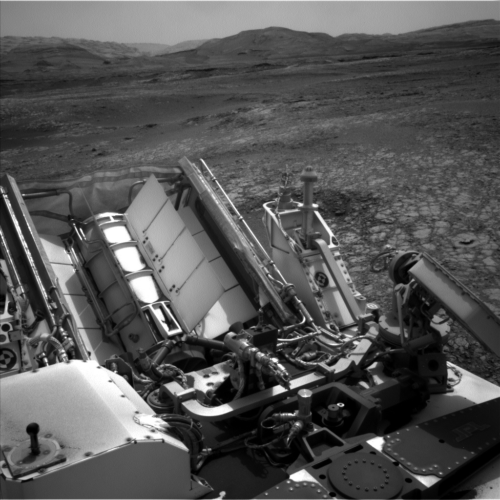
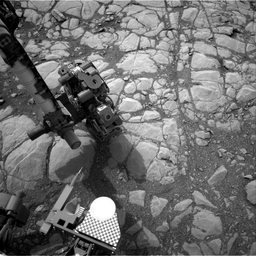
Part of the calibration target for Curiosity Mars Hand Lens Imager (MAHLI), a photo produced on Sol 2161, September 4, 2018. MAHLI is located on the turret at the end of the rover’s robotic arm. The MAHLI calibration target includes color chips, a metric standardized bar graphic, a penny, and a stair-step pattern for depth calibration.
Credit: NASA/JPL-Caltech/MSSS
The robot’s Chemistry and Camera (ChemCam) was slated to analyze “Ben Vorlich” with the Laser Induced Breakdown Spectroscopy (LIBS) device, and ChemCam, Alpha Particle X-Ray Spectrometer (APXS), and Mars Hand Lens Imager (MAHLI) will analyze “Tayvallich.”
“It’s time to check our instrument calibrations, and APXS will integrate overnight on its calibration target to better constrain dust that settled during the recent dust storm,” Sumner points out. MAHLI was slated to image both the MAHLI and APXS calibration targets on sol 2161. ChemCam then takes its turn for characterizing dust by observing the passive spectrum of the white part of the Mastcam calibration target with a magnet under it, followed by passively observing the sky.
Next drill location
“After all of this imaging, Curiosity will drive toward our next drill location, and we hope to end within 15 meters [nearly 50 feet] of our next drill site. Mastcam will take multispectral images of that area to help us choose the exact spot,” Sumner notes.
Sol 2162 is set to focus on collecting environmental data, including a sky survey and an image of the crater rim to compare dust levels in Gale Crater with those in the atmosphere as a whole. Coming out of the long weekend, planning doesn’t resume again until today, Sumner concludes.
New road map
Meanwhile a new Curiosity traverse map through Sol 2161 has been issued.
The map shows the route driven by NASA’s Mars rover Curiosity through the 2161 Martian day, or sol, of the rover’s mission on Mars (September 04, 2018).

Credit: NASA/JPL-Caltech/Univ. of Arizona
Numbering of the dots along the line indicate the sol number of each drive. North is up. The scale bar is 1 kilometer (~0.62 mile).
From Sol 2157 to Sol 2161, Curiosity had driven a straight line distance of about 102.49 feet (31.24 meters), bringing the rover’s total odometry for the mission to 12.25 miles (19.72 kilometers).
The base image from the map is from the High Resolution Imaging Science Experiment Camera (HiRISE) in NASA’s Mars Reconnaissance Orbiter.

Artist’s illustration of asteroid ISRU showing astronauts at an asteroid as well as other mining and transportation vehicles operating in space.
Credit: TransAstra Corporation & Anthony Longman
The U.S. Geological Survey (USGS) is starting to earnestly evaluate space resources.
Since the 1870’s they’ve dealt with the Earth, but now attention is being paid to assay what benefits may or may not exist in tapping extraterrestrial water, minerals and metals.
Some asteroid resource advocates, for example, trot out pie-in-the-sky estimates of trillions of dollars in return for the investment.

Business plan for asteroid mining.
Credit: Joel Sercel/ICS Associates Inc. and TransAstra
Making the grade
A no-nonsense approach is being espoused by the USGS to accurately portray what truly “makes the grade” in terms of profitably exploiting off-Earth assets.
Check out my new Space.com story posted today:
The US Geological Survey Is Getting Serious About Space Resources and Mining
September 4, 2018 07:00am ET
https://www.space.com/41707-space-mining-usgs-resource-survey.html

Credit: China Central Television (CCTV)/Screengrab
China’s commercial space group, LandSpace Technology Corporation (蓝箭, Blue Arrow), is getting ready to launch its first rocket ZQ-1 (朱雀一号, ZhuQue-1).
The company’s headquarter is located in Huzhou City, Zhejiang Province, east China, with the final assembly of the rocket taking place in Xi’an City, Shaanxi Province, northwest China.

Credit: China Central Television (CCTV)/Screengrab
According to Zhang Changwu (CEO/LandSpace), the private rocket can carry a 440 pound (200 kilograms) payload at a 500-kilometer sun-synchronous orbit and 400 kilograms at low-earth orbit.

Credit: China Central Television (CCTV)/Screengrab
The first launch is scheduled at China’s Jiuquan Satellite Launch Center in the next two months and the booster’s payload is a small satellite called “Future” (Weilai-1).

